Deprecated: WP_Translation_Controller::load_file(): Implicitly marking parameter $locale as nullable is deprecated, the explicit nullable type must be used instead in /homepages/4/d577990729/htdocs/blog/wp-includes/l10n/class-wp-translation-controller.php on line 101
Deprecated: WP_Translation_Controller::unload_file(): Implicitly marking parameter $locale as nullable is deprecated, the explicit nullable type must be used instead in /homepages/4/d577990729/htdocs/blog/wp-includes/l10n/class-wp-translation-controller.php on line 156
Deprecated: WP_Translation_Controller::unload_textdomain(): Implicitly marking parameter $locale as nullable is deprecated, the explicit nullable type must be used instead in /homepages/4/d577990729/htdocs/blog/wp-includes/l10n/class-wp-translation-controller.php on line 201
Deprecated: WP_Translation_Controller::is_textdomain_loaded(): Implicitly marking parameter $locale as nullable is deprecated, the explicit nullable type must be used instead in /homepages/4/d577990729/htdocs/blog/wp-includes/l10n/class-wp-translation-controller.php on line 243
Deprecated: WP_Translation_Controller::translate(): Implicitly marking parameter $locale as nullable is deprecated, the explicit nullable type must be used instead in /homepages/4/d577990729/htdocs/blog/wp-includes/l10n/class-wp-translation-controller.php on line 263
Deprecated: WP_Translation_Controller::translate_plural(): Implicitly marking parameter $locale as nullable is deprecated, the explicit nullable type must be used instead in /homepages/4/d577990729/htdocs/blog/wp-includes/l10n/class-wp-translation-controller.php on line 297
Deprecated: WP_Translation_Controller::locate_translation(): Implicitly marking parameter $locale as nullable is deprecated, the explicit nullable type must be used instead in /homepages/4/d577990729/htdocs/blog/wp-includes/l10n/class-wp-translation-controller.php on line 397
Deprecated: WP_Translation_Controller::get_files(): Implicitly marking parameter $locale as nullable is deprecated, the explicit nullable type must be used instead in /homepages/4/d577990729/htdocs/blog/wp-includes/l10n/class-wp-translation-controller.php on line 430
Deprecated: WP_Translation_File::create(): Implicitly marking parameter $filetype as nullable is deprecated, the explicit nullable type must be used instead in /homepages/4/d577990729/htdocs/blog/wp-includes/l10n/class-wp-translation-file.php on line 84
Deprecated: wp_getimagesize(): Implicitly marking parameter $image_info as nullable is deprecated, the explicit nullable type must be used instead in /homepages/4/d577990729/htdocs/blog/wp-includes/media.php on line 5502 June | 2015 | NABS Blog
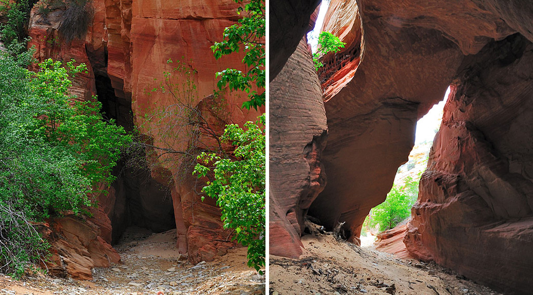
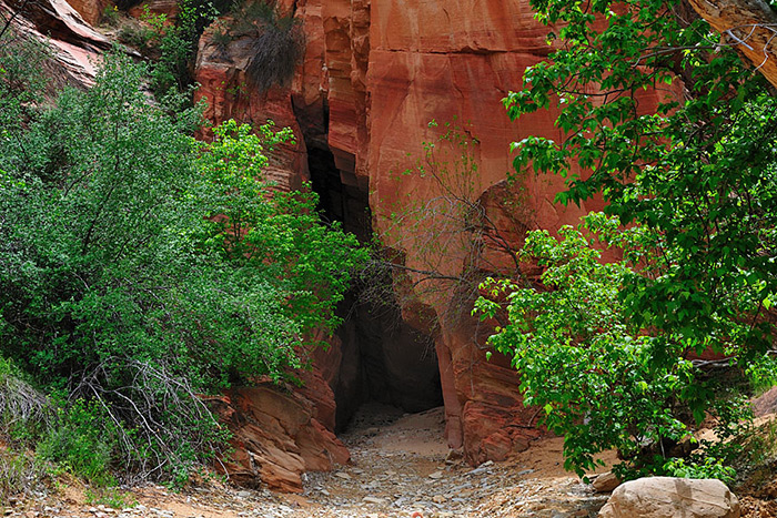
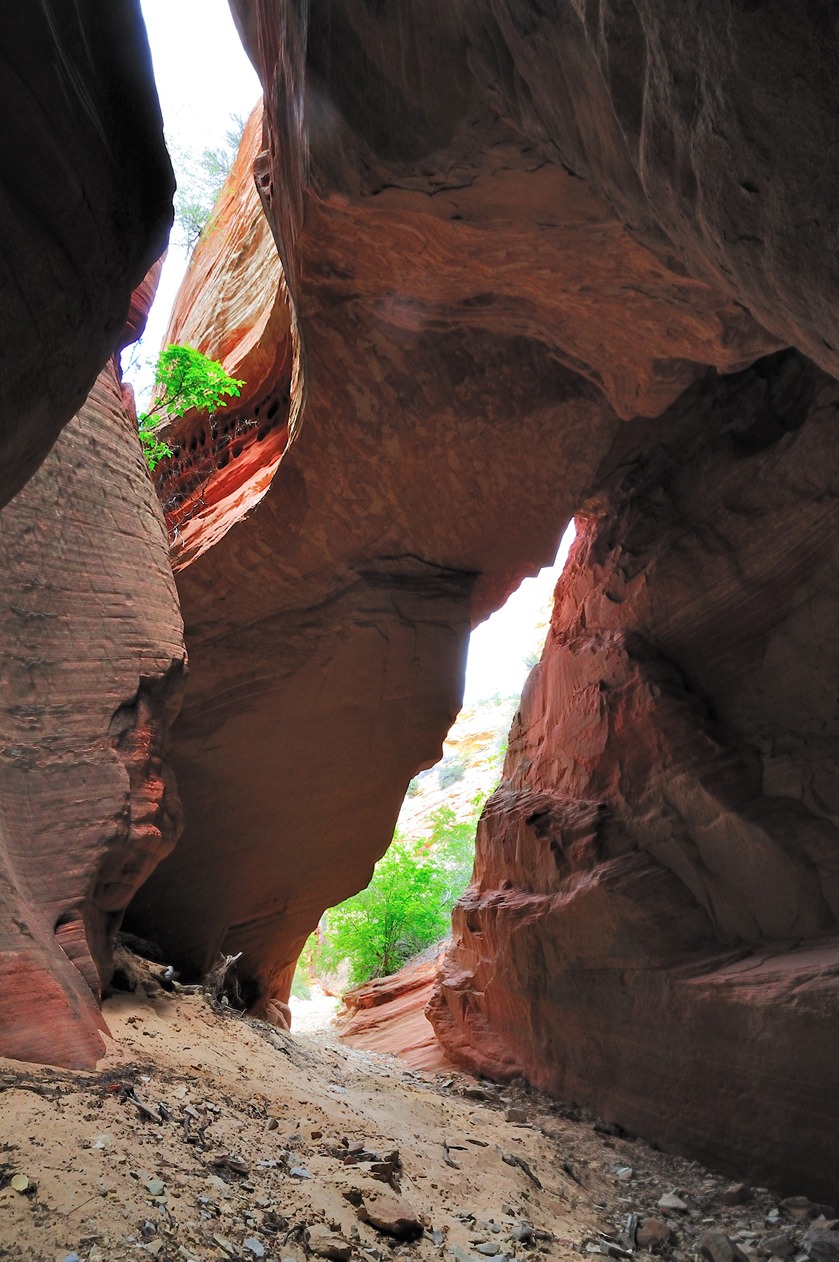
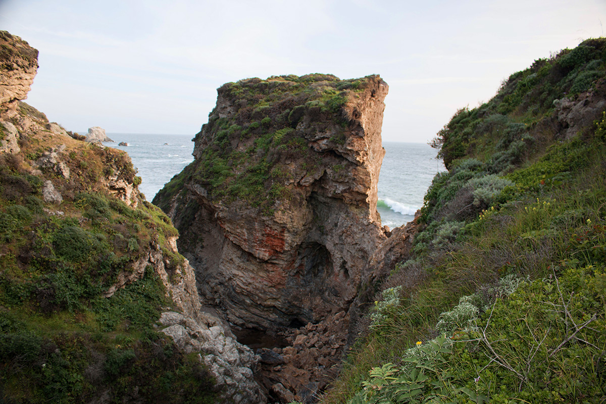
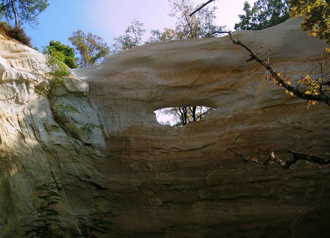
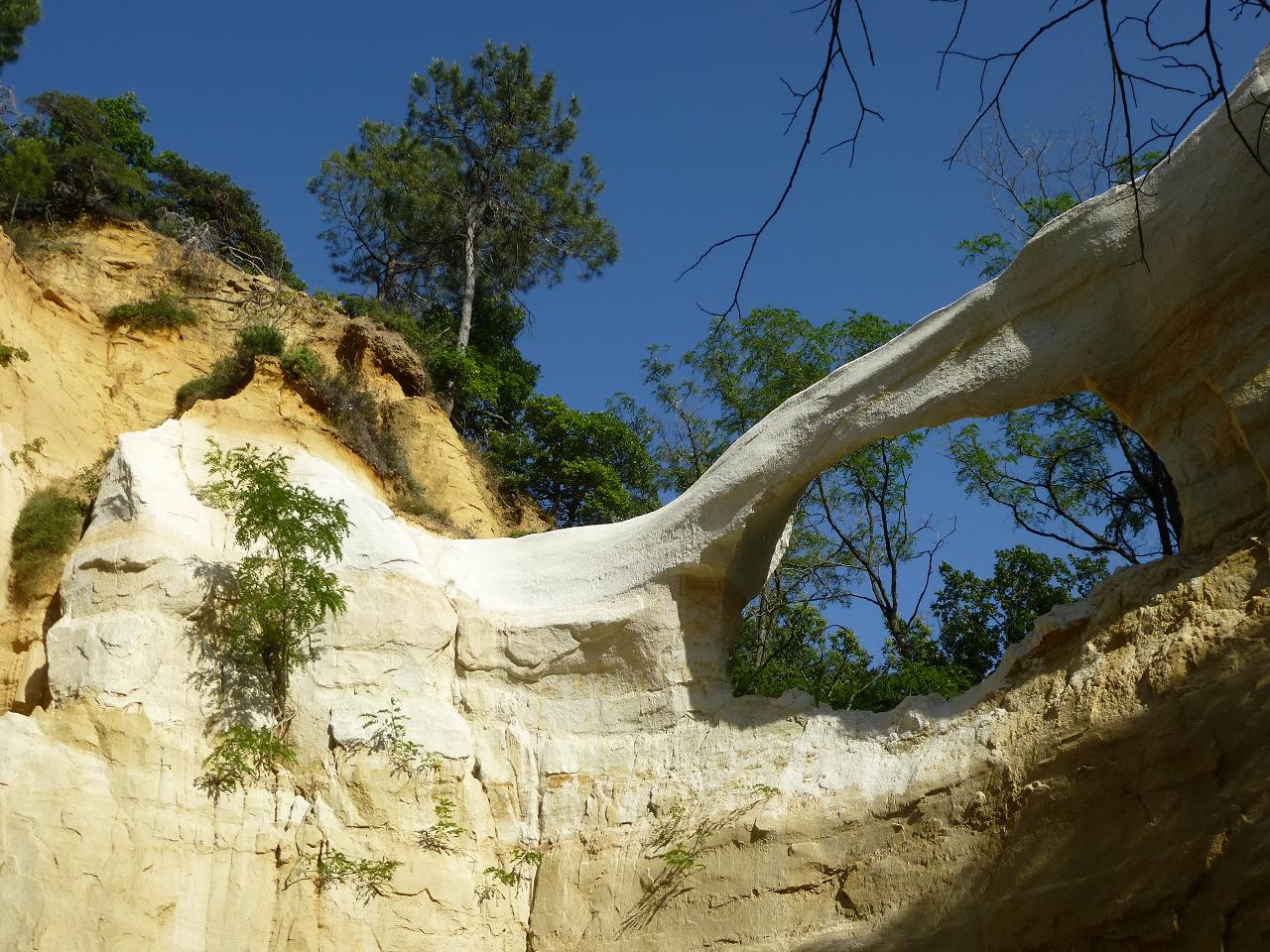
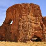
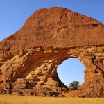
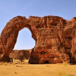
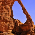
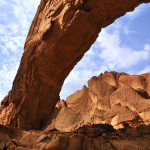
Merwin Canyon Arch is on BLM land in Kane County, Utah, east of Zion National Park. Merwin Canyon is a side canyon of Bay Bill Canyon which itself is a side canyon of Parunuweap Canyon, the canyon of the east fork of the Virgin River. While the lower part of Merwin Canyon is just a sandy wash, 0.6 miles upcanyon it becomes a beautiful and easy to explore non-technical slot canyon. The arch is right at the entrance of the slot.
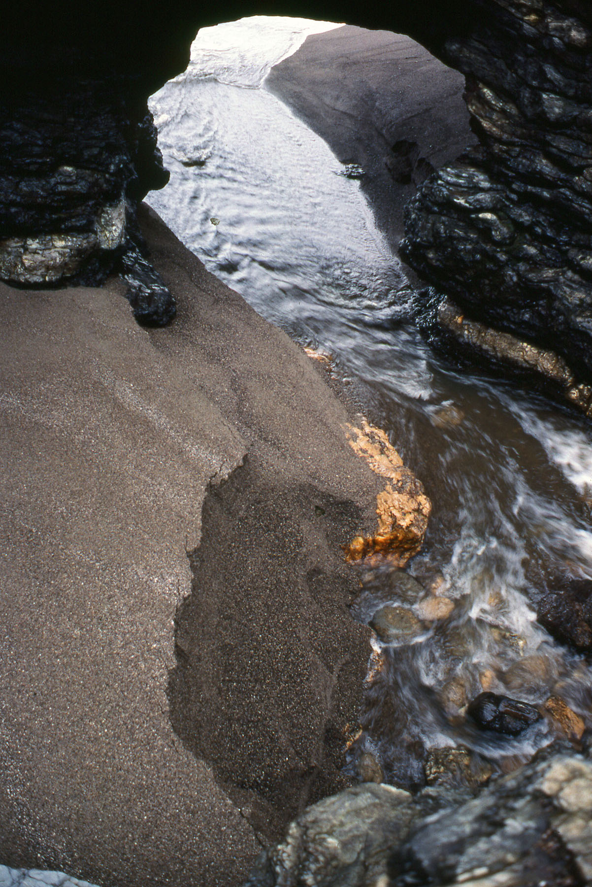
Merwin Canyon Slot Entrance
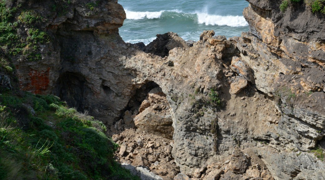
Merwin Canyon Arch
The opening has a width of approximately 40 feet and a height of approximately 25 feet. To take a better photo than mine, bring a tripod and a wide angle lens; take several photos with different exposures and then at home you can create an HDR photo on your computer.
Taking a GPS reading at the arch was not possible for me but it should be close to 12S 346250 4114530.
Directions: Less than a mile south of Mt. Carmel Junction turn west on a dirt road and drive on it about one mile to a fence with a cattle guard. Park there and walk down Parunuweap Canyon on a public road through private land for about 5 miles to the confluence with Bay Bill Canyon. If you have a 4 x 4 you can drive here if you don’t mind crossing the ankle deep river many times. Hike up the sandy wash of Bay Bill Canyon for 1 mile. Then turn left and walk up colorful Merwin Canyon for 0.6 miles to the arch and the slot.
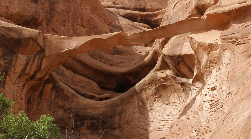
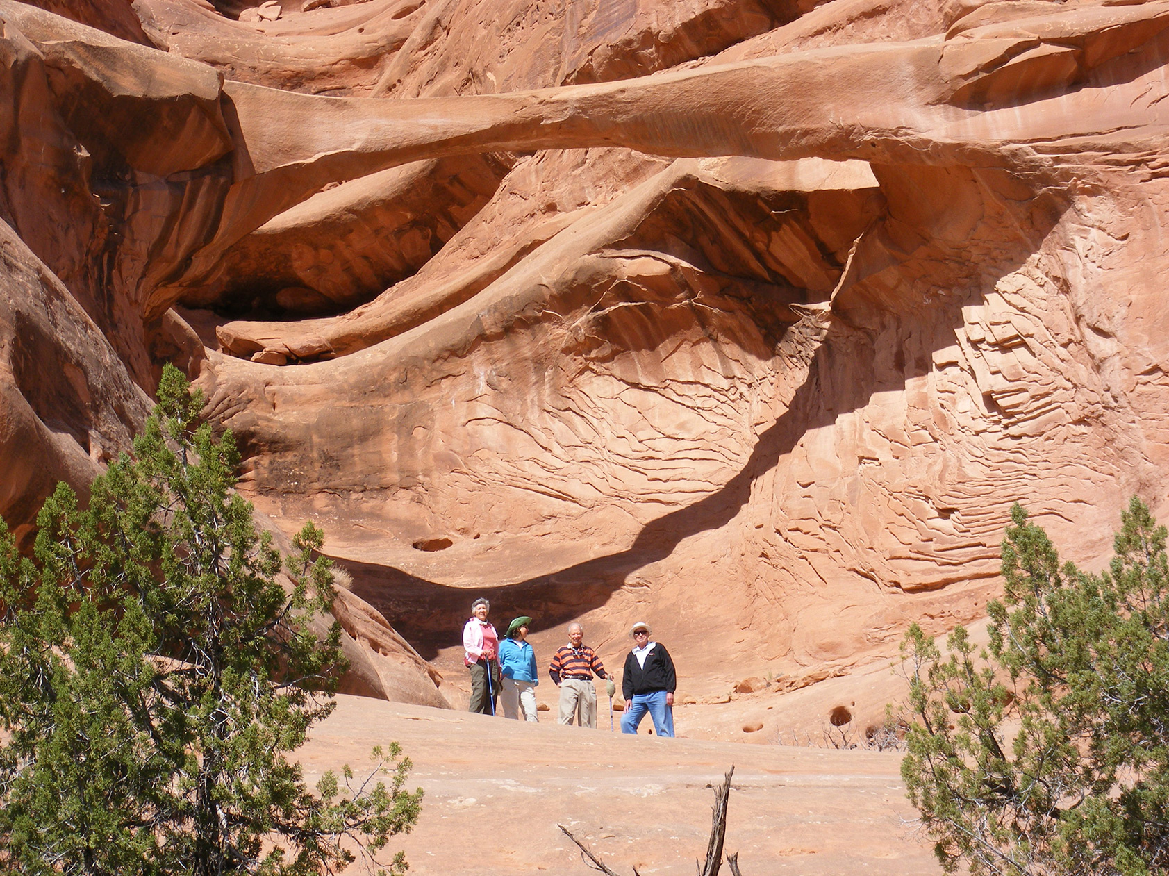
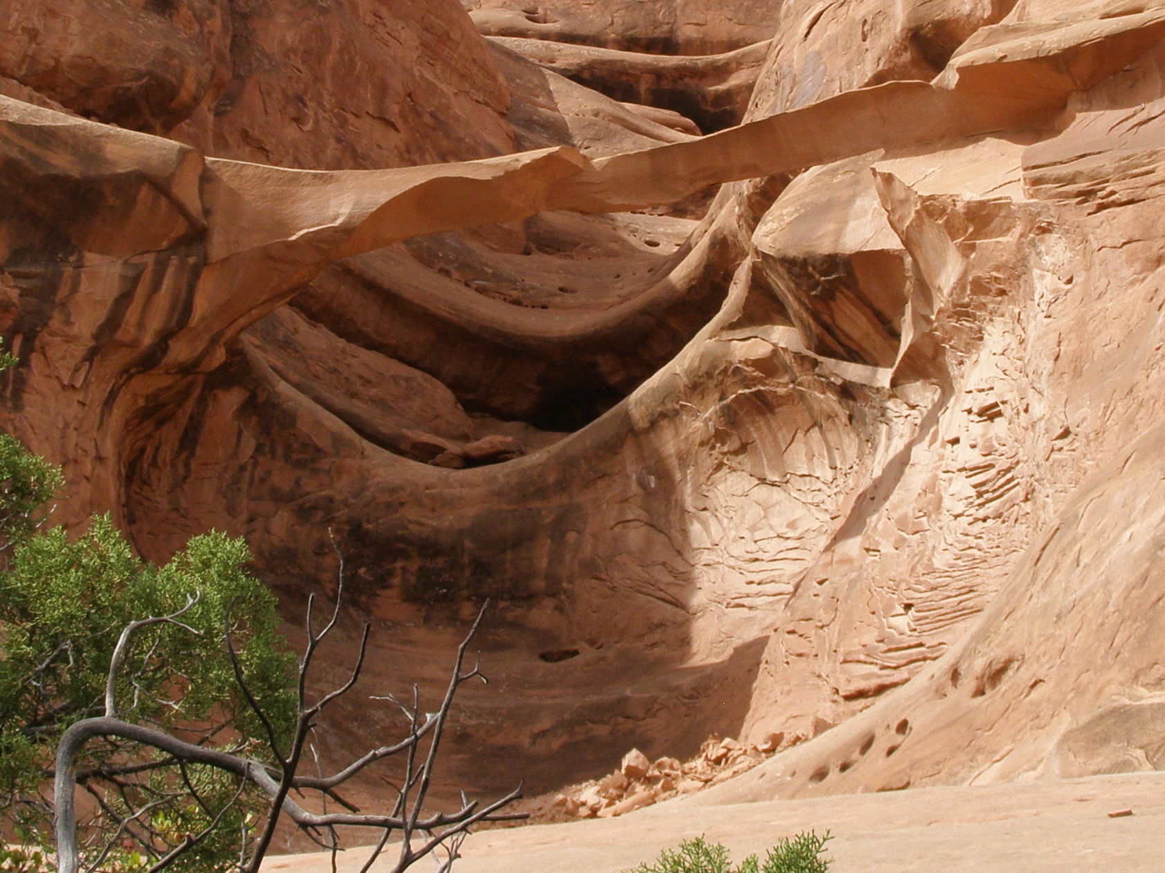
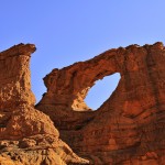
These photos show a dramatic change in the appearance of Ring Arch in Courthouse Wash in Arches National Park. Sometime between April 29 and October 7, 2014, a significant portion of the arch collapsed, leaving the arch very much thinner and looking quite delicate.
Ring Arch Spring 2014. From left to right: Sandra Scott, Susan McDowell, Gus Scott, and John Slivka. Photo by Larry Beck taken during NABS Spring Arch Rally.Ring Arch Fall 2014. Photo by Susan McDowell taken during NABS Fall Arch Rally.
As the photos show, the left abutment remains intact, but shortly beyond, a large amount of rock including a portion of the right abutment has fallen. The arc of rock that remains shows no fractures in the photos, but it showed no fractures in the earlier photos either. Standing under the arch, it appears as though much of the lower right front of the span has fallen.
Ring Arch may be seen almost directly west from the park road from a long pullout on the west side of the road (NABSQNO 12S-621729-4278463) about 0.15 miles southwest of the center of the Courthouse Wash Bridge. Binoculars will help, as the arch is about 1.3 miles from the road and the arch location is not obvious.
There is no established trail to Ring Arch. Walking directly to it from the park road view is not recommended since it is difficult to avoid disturbing sensitive desert soils. It’s also unpleasant to deal with the stickers in dense patches of Russian thistle and several tumbleweed-filled drainages. A better route starts on a use trail at the parking area on the northwest side of Courthouse Wash (12-622006- 4278791).
Ring Arch is tucked in a northeastward facing alcove and has morning sun. Courthouse Wash can have standing water, serious mud, and voracious seasonal biting insects. Walks taken after a dry spell and when insect populations are low are recommended. If you are good at finding use trails and return the way you came, your round-trip walk will be about 4.0 miles. This is a wonderfully pristine area, so stay in drainages when possible and do your best to insure there is only one narrow footpath leading to the arch.
Ring Arch is a very old pothole type natural arch, which has formed in the Slick Rock Member of Entrada Sandstone. The Slick Rock Member was deposited in tidal mudflats, beaches, and sand dunes during the Middle Jurassic period between 180 and 140 million years ago.
Sources agree that Harry Reed, a Moab photographer and custodian of what was then Arches National Monument, first reported Ring Arch in 1940. Slim Mabery, a former district ranger at the monument, named the arch in 1961. The name comes from the shape of the arch. According to the World Arch Database, Ring Arch’s span is 45’ with a height of 39’. After the recent rockfall, the arch may be marginally taller.
No, the Natural Arch and Bridge Society does not make money from arches.
But some governments do.
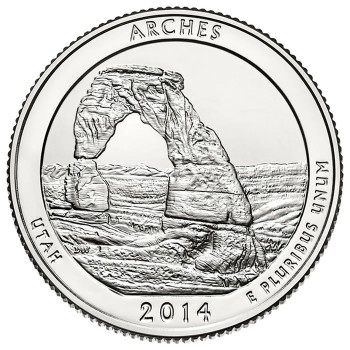
The United States Mint released an Arches National Park quarter in 2014 as part of its America the Beautiful Quarters Program, featuring Delicate Arch. You can buy a 100-coin bag of these from the U. S. Mint ($25 face value) but it will set you back $40 with shipping. [UPDATE 2016: Not any more, but you can get a pack of 3 for $9.95 + $4.95 shipping.]
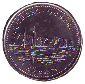
NABS member Daniel Putelat has the following coins in his collection. Quebec released a coin featuring Le Rocher Percé:
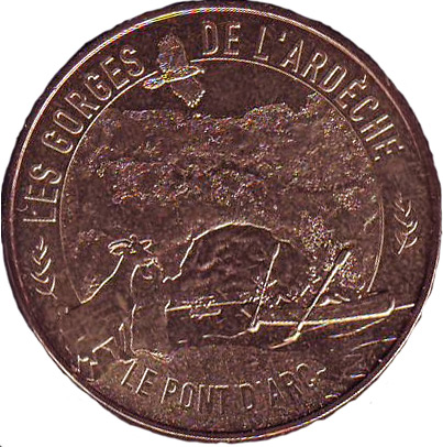
He also has in his collection this 2015 Monnaie de Paris (Money of Paris) featuring Pont d’Arc:
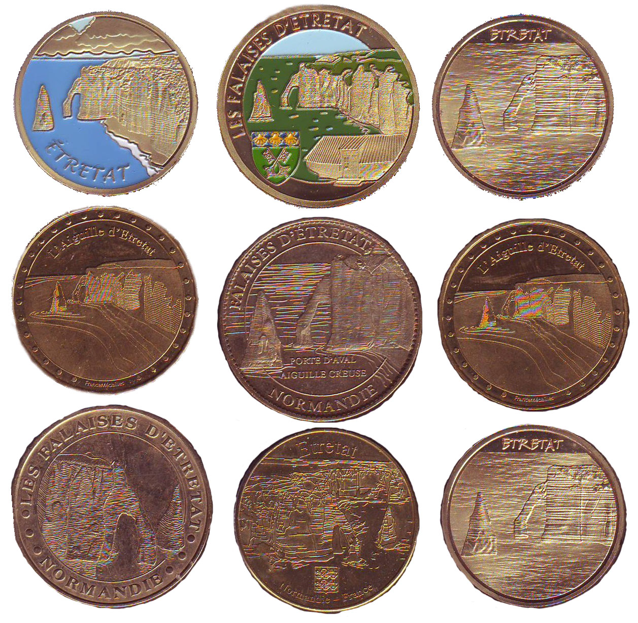
Daniel also has in his collection these Monnaie de Paris featuring Etretat:
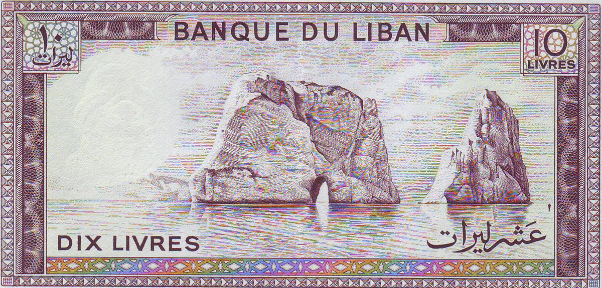
Paper bank notes have also been produced. Below is Pigeon Rock in Lebanon.
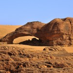
Arch Rock before collapse. Photo by Robert Robinson.
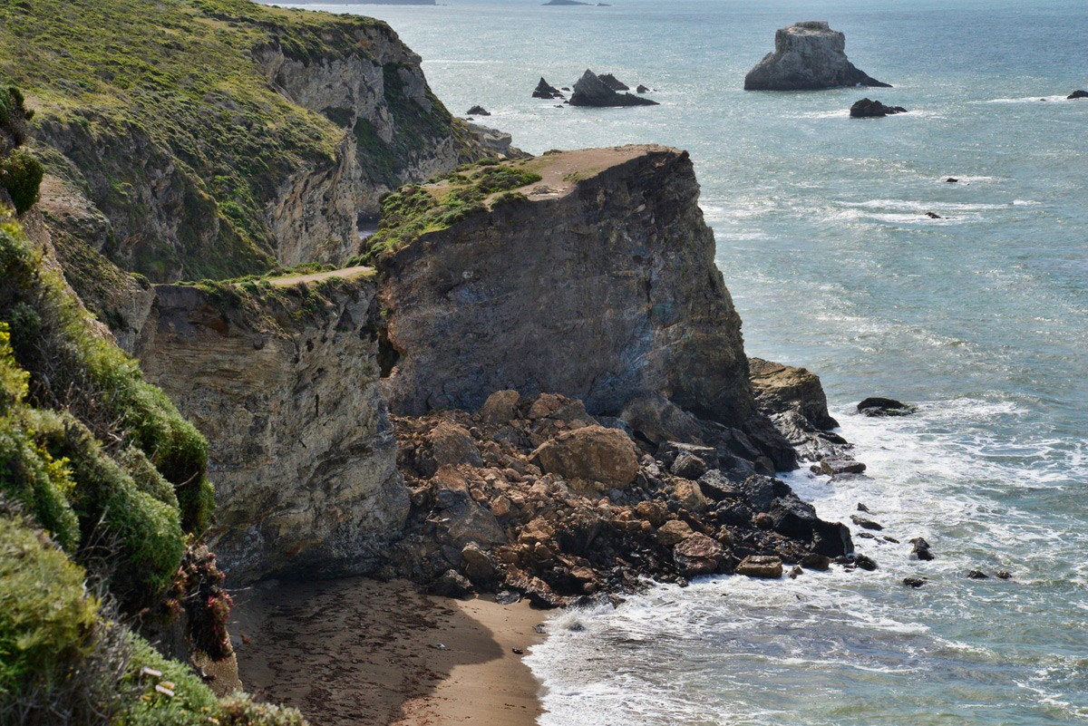
One person died and another was critically injured just before 6 p.m. on Saturday, March 21 when the bluff above Arch Rock (V21-12, NABSQNO 10S-516381-4204424) collapsed when the two hikers were standing on it. The arch is at the end of the Bear Valley Trail in Point Reyes National Seashore, California. The pair fell about 70 feet and were covered by the falling rocks and debris. The collapse of the bluff came about two days after the National Park Service had posted warning signs about the cliff becoming weak from cracks and partial collapses.
Arch rock is a meander type natural bridge where Clear Creek had cut through the narrow peninsula which had connected Miller Point to the mainland as shown in the photo below, looking back from Miller Point across the top of the arch before the collapse.
Trail across the top of Arch Rock looking back from Miller Point before the collapse. Photo by Robert Robinson.
The photo below taken after the collapse shows that Miller Point is now an isolated butte no longer accessible by the trail that used to go across the top of the arch.
After the collapse, Miller Point is now an isolated butte no longer accessible by trail. Photo by Robert Robinson.
The photo below shows the large pile of rubble after the collapse.
Large pile of rubble after collapse of the bluff above Arch Rock. National Park Service photo.
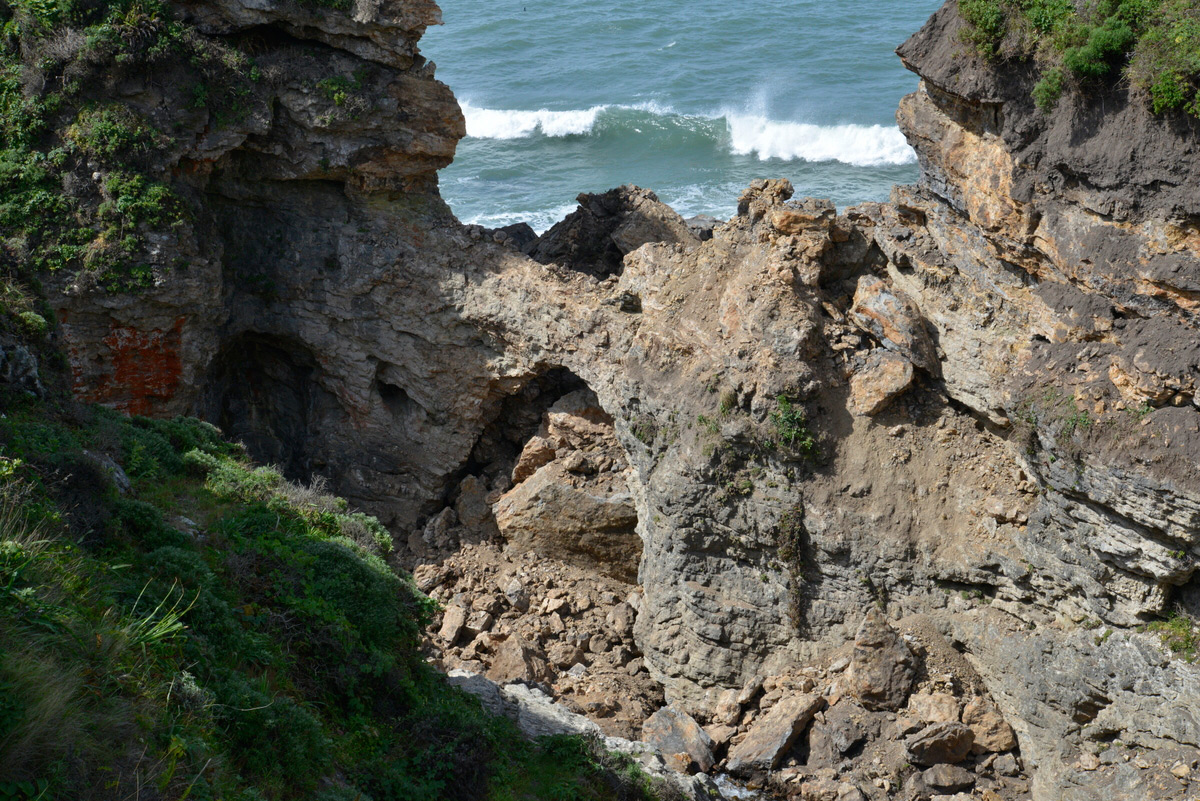
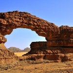
The post-collapse photo below shows that the arch actually survived the collapse of the bluff above it, a testament to the structural strength that the arch form provides.
This photo shows that the arch itself actually survived the collapse of the bluff above it. National Park Service photo.
The photo below shows more clearly that the arch survived the collapse but changed it shape and now the opening has a greater height. Clear Creek still flows under the arch but disappears under the new rubble pile.
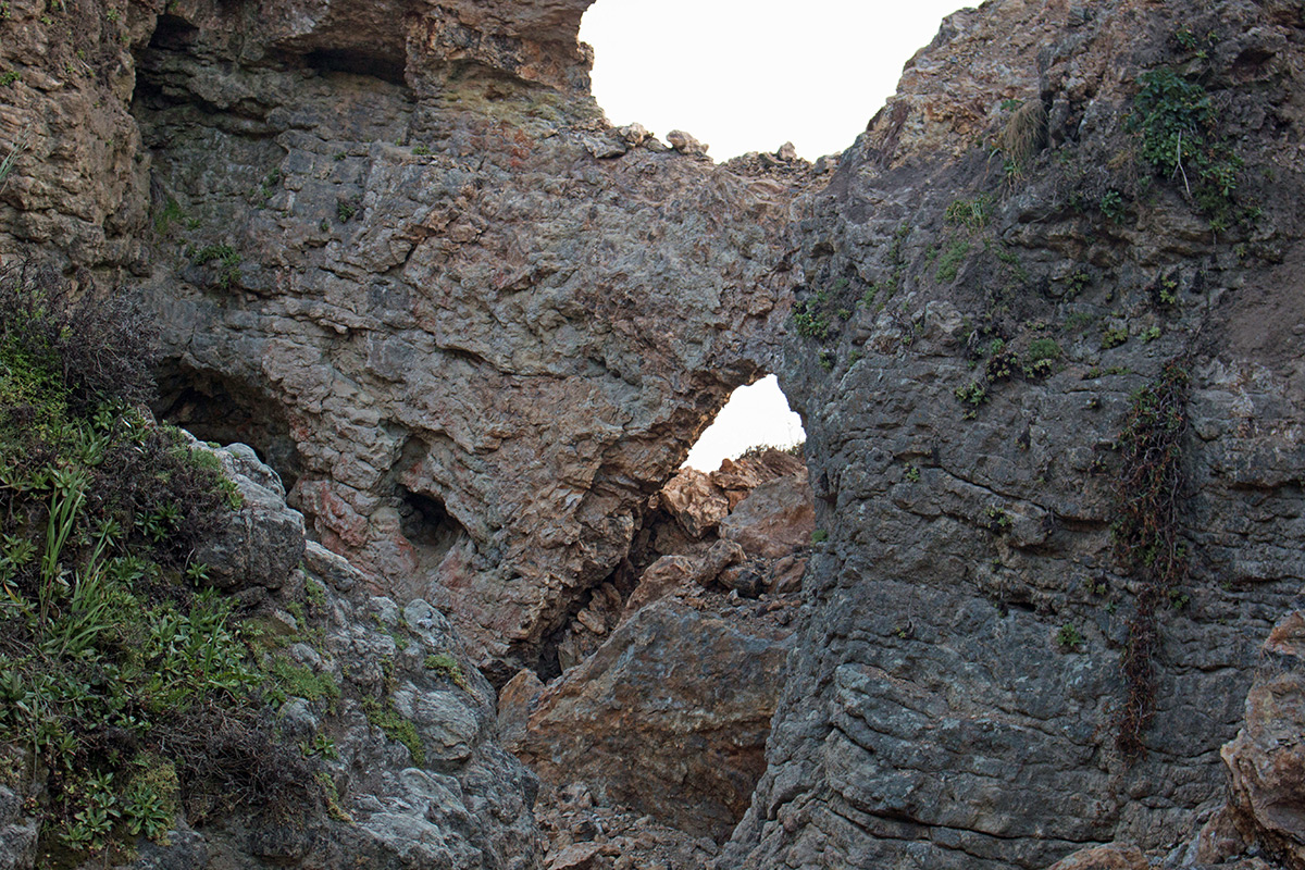
Arch Rock itself survived the collapse, but changed its shape. Photo by Robert Robinson.
The Park Service considers the formation to still be unstable and dangerous and has closed the trail to Arch Rock.
The three very short videos below by Robert Robinson were taken on April 23. The first video shows the approach on the trail that formerly went across the top of the arch. You can see fissures in the ground indicating the possibility of another collapse. The second video shows views of the collapse from the Coast Trail above the opposite side of the creek. The third video shows the still-existing arch from Coast Creek itself.
A special thanks to Robert Robertson and Jeff Moore for supplying material for this article.
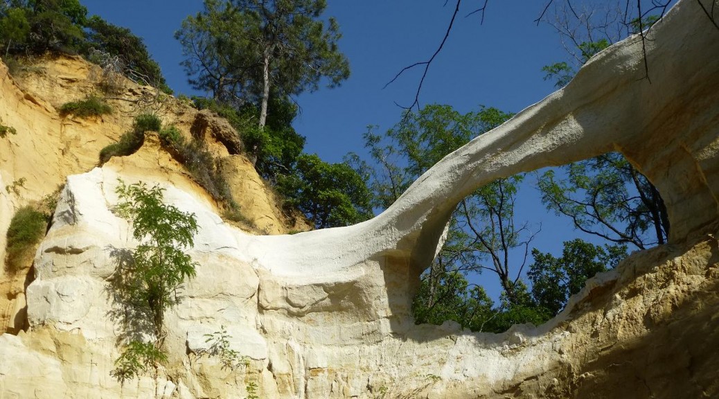
Arch evolution can occur over thousands of years, but La Dame Blanche (The White Lady) in France consisted of a crumbly clay-like rock and evolved from youth to maturity to collapse in the course of just a few years.
The photo below taken by Albert Zwinkels in 2009 shows a small, young opening.
The photo below by NABS member Guilain Debossens taken in June 2014 shows a mature span of 20 feet.
The photo below by Raphael Rodon was taken in April 2015, showing that the arch had collapsed.
La Dame Blanche (NABSQNO 31T-663186-4933509) was located in the vicinity of Dieulefit village in the Drôme department of France, about 100 miles south of Lyon and 120 miles north of Marseille.
Since the first reports of the early Africa explorers of the 19th century it was known that the Sahara is really not the safest place on Earth. But it was always possible to visit at least some of the magic places in the central Sahara with limited risk. Unfortunately the situation has become a lot worse in the last couple of years. Nowadays you have not only to handle the “normal” criminals, kidnappers, smugglers and corrupt officials, but also the terrorists of Al-Qaeda and the so-called Islamic State. Chad has received the financial and military help of France to assist with such problems.
Chad Ennedi Gallery: Click on any image for slide show, ESC to return.
Chad NABSQNO-34Q-612439-1840692
Chad NABSQNO-34Q-590654-1853740
Chad NABSQNO-34Q-590535-1853812
Chad NABSQNO-34Q-589676-1855430
Chad NABSQNO-34Q-589356-1854055
Chad NABSQNO-34Q-589344-1854076
Chad NABSQNO-34Q-589250-1854180
Chad NABSQNO-34Q-589164-1855576
Chad NABSQNO-34Q-589045-1854882
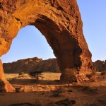
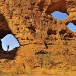
Chad NABSQNO-34Q-588596-1854326 The Eye of Tokou
Chad NABSQNO-34Q-587313-1854533
Chad NABSQNO-34Q-587224-1854016
Chad NABSQNO-34Q-558792-1865077
Chad NABSQNO-34Q-558601-1865075
Chad NABSQNO-34Q-552964-1869022
Chad NABSQNO-34Q-546321-1865937
Chad NABSQNO-34Q-546290-1865041
In 2011 and 2012 my wife and I visited Chad for three weeks each time. In 2011 the traverse of Emi Kousi attracted us (see SPAN Spring 2013). It is an extinct volcano and actually the highest elevation not only in the Tibesti Mountains but in the whole Sahara. In 2012 it was the Ennedi Plateau, a wonderland of rocks, outstanding rock art, and home of some of the very last desert crocodiles. Both trips had an expedition-like character which definitely needed good preparation and organization. This job was done perfectly by Spazi d’Avventura, an Italian family-based tour operator with decades of experience in Niger and Chad (www.spazidavventura.com).
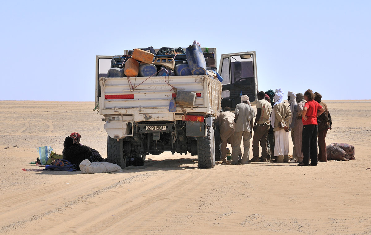
Both trips started in N’Djanema, Chad’s capital, which can be reached by plane via Paris with Air France, or via Addis Abbaba with Ethiopian Airlines, which is also a pretty good and reliable carrier. Spazi picked us up directly at the airport and helped with the paperwork for entering the country. We soon found out that the people on the tour all came from different European countries with different languages, but fortunately everyone was happy with English. Our Toyota Land Cruisers (two for Tibesti and three for Ennedi) were soon loaded and off we went!
In many African countries the Chinese are building new roads and this is the case in Chad too. Nevertheless we reached the end of the pavement in a few hours. From there on it was off road driving, sometimes easy, sometimes difficult. It took us three full days to reach the Ennedi and two more to get to the border of the Tibesti.
This part of the trip was a bit boring because there is not much to see in the Sahel zone most of the time. The big excitement was whenever we reached a water reservoir or a well. It was absolutely fascinating to see the nomads come and go with all their different type of cattle, goats, sheep, horses and camels. But it was also very sad to find long stretches of land with almost no vegetation, the result of grazing too many cows here. The more north and east we came, the fewer people we saw. Then all of a sudden we found ourselves in the world’s biggest desert, the Sahara.
Safe driving in the Sahara needs some precautions: at least two cars, lots of spare parts, and someone who can fix a lot more than just a flat tire, and without a garage. If you can’t take enough fuel with you in canisters, then a private gas depot somewhere is necessary. Spazi had all of this.
The importance of safety precautions became obvious to us when we met a group of people (men, women and children) right in the middle of nowhere, hundreds of miles from the next little village and water source. The previous day their truck had suddenly stopped and they were not able to repair it, and they had no satellite phone to call for help. It was just a lucky chance that we came along. It took our car mechanic about 20 minutes to find out that the injection pump was out of order and the battery was dead. We gave these unlucky fellows as much water as possible and then had to leave.
Water is of course rare in the desert. Whenever we came close to a well, we took the opportunity to fill up our stock of water. Normally lots of nomads were already there waiting to take their turn. In situations like this our local guide Muhammad was of inestimable value. This was not only the case in the Ennedi but in particular in the Tibesti which is even more wild and untouched.
Muhammad arranged for an additional guide for the drive through a field of land mines, and also for a couple of locals with pack camels for the traverse of Emi Koussi on the first trip. Muhammad was respected a lot because of his status as a “mustati”—a man who has finished the hajj (pilgrimage) to Mecca. In spite of the knife in his sleeve and the Kalashnikov assault rifle on his back, he was a nice guy.
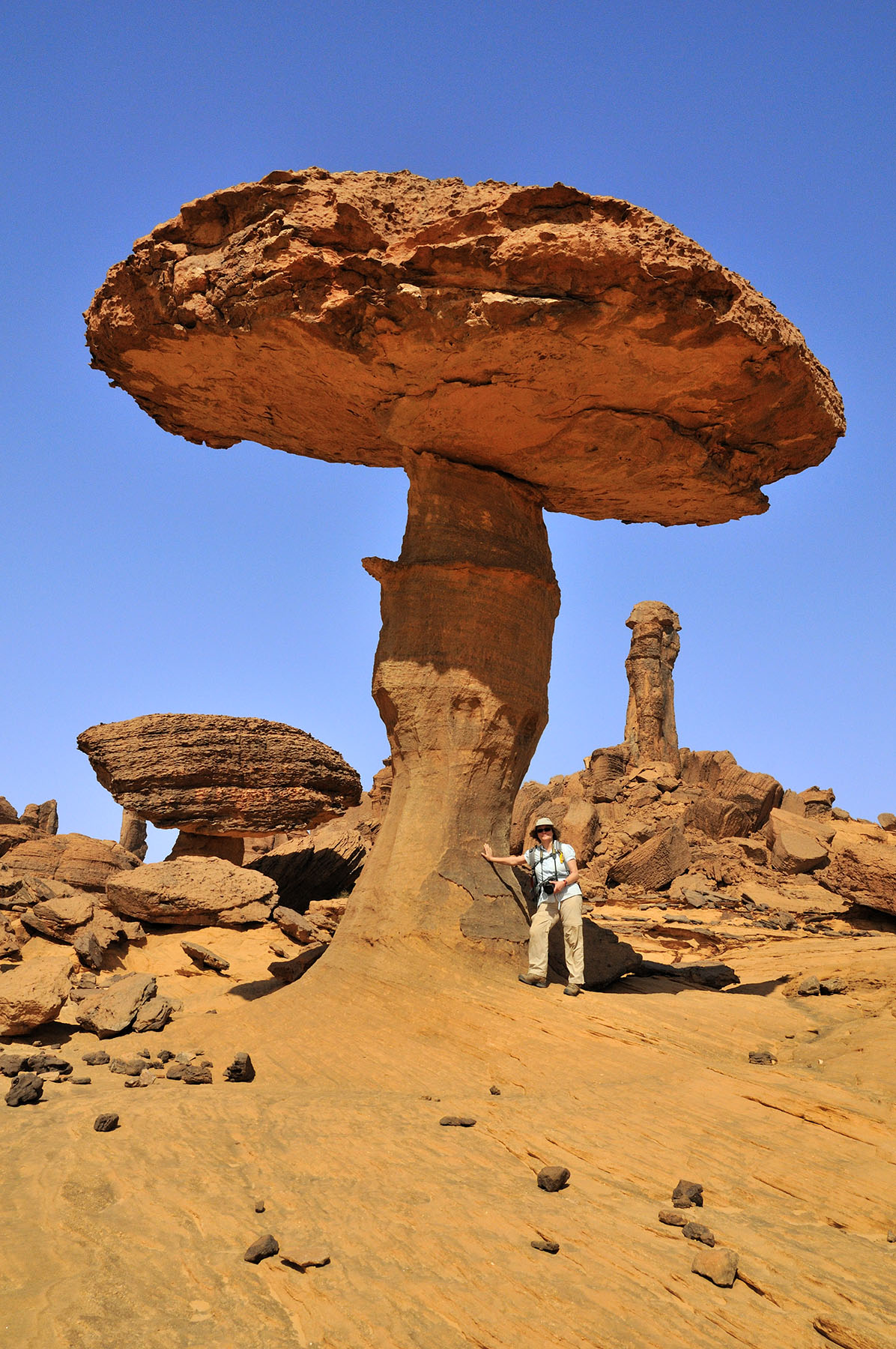
Hiking the Ennedi was most often nothing less than spectacular, at least for an inveterate desert lover like me. It was not too tough because we always had a long lunch break at a place with nice shade.
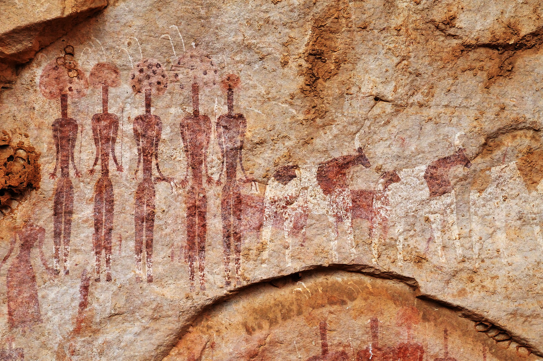
We reached the campsite normally in the late afternoon, erected Spazi’s excellent desert tents, had tea or explored alcoves close by for rock art (the Ennedi has ubiquitous rock art from the last five millennia).
Dinner was great Italian cuisine. When it was not too windy we slept outside the tent and enjoyed the night sky full of stars.
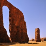
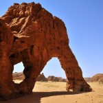
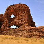
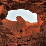
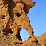
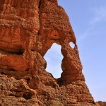
With the exception of the huge Aloba Arch we never looked for arches on purpose, but ran into them more or less accidentally. In the Tibesti we found just a handful of them, but in the Ennedi on every hike we saw several really big, beautiful and most remarkable arches. Some of them have been known to us for years from the pioneering work of my friend Gunter Welz (www.archhunter.de), others were known only from aerial photos, and many were completely new.
On both trips we just had one night in a hotel, the last night. On the Tibesti trip it was a hotel a bit outside the capital city situated very nicely along a river that flows into Lake Chad. It was run by a French guy at that time. Having the first cold beer after many days and looking out onto the river was great. On the Ennedi trip we had a really good hotel in town and were invited by Spazi for dinner in a nice restaurant. The next day they brought us to the airport and waited until we all went through security. Very good and conscientious work on the part of Spazi.
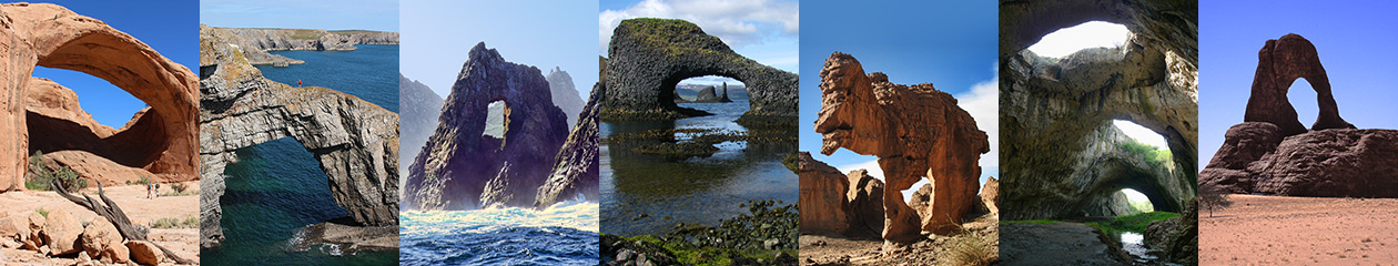
As you know, there are arches spread out all over the world. But they are not equally distributed over the Earth’s surface; some places have large clusters of them. The best places for arch-hunting I have seen so far are Arches National Park in the U.S., Kukenan Tepui in Venezuela, Tassili n’Ajjer in Algeria and…you guessed it, the Ennedi Plateau in Chad!
If you are interested in more photos, please visit my website www.hike-wild.de. If you have questions, don’t hesitate to email me (Peter-Felix-Schaefer@t-online.de).
Organization of a tailor-made trip for arch hunters to the Ennedi is easy, but to get a good price at least five to six people are necessary. The best time of the year for a trip is from November to February, with the very best month being November. It might become one of the most memorable trips of your life!
Travel Warnings (added by editor): Although NABS members have traveled in Chad without incident, readers need to be aware of travel warnings issued:
Norman L. Self, 80, formerly of El Centro, CA, passed away in Tucson, AZ, on Sunday, April 19, 2015, from complications of cancer.
Norm was born in Salinas, CA, on October 23, 1934. He moved to El Centro with his mother, Laura, at the age of three. He attended Harding and McKinley Elementary Schools, Wilson Junior High and Central Union High. He continued to live in El Centro until he and his wife, Linda, moved to Tucson in 2011 to enjoy their retirement years together.
He was a printer by trade. Beginning in 1953 he advanced from apprentice to journeyman printer with the Imperial Valley Press eventually becoming composing room foreman of the Brawley News, also owned by the IV Press, and later, foreman of the El Centro plant.
Norm at 18
In 1963, Norm took a position as typesetter operating a Linotype machine at Imperial Printers in El Centro. In 1977 the owner, long-time Valley master printer Marvin (Barney) Wieben, Sr., retired and the company’s ownership was reorganized with Norm assuming the presidency of the corporation.
Norm was a member of the El Centro Rotary Club and an avid supporter of the El Centro Chamber of Commerce. He served about 13 years on the Chamber board of directors and was instrumental in computerizing the chamber office.
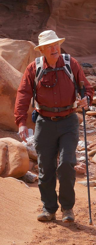
In addition to his love of music, he enjoyed sharing his knowledge of the night sky whenever he camped out under the stars. He was passionate about the marvels of the southwest desert areas and loved nothing more than introducing others to the history and natural wonders of that environment.
Norm on the trail
Through his interest in photography combined with his appreciation of beautiful natural areas, he became an avid hiker and joined the Natural Arch and Bridge Society (NABS). Soon thereafter he volunteered to publish SPAN, the newsletter of NABS. Norm cherished the many friends he made through NABS and encouraged others to learn about and join this group.
His first wife Patsy preceded Norman in death. He is survived by his loving wife Linda of Tucson, AZ; son John of San Diego, CA; stepdaughter, Jennifer and her husband, Kevin Murphy, of Amsterdam, NL.
Should anyone wish to honor Norm’s memory, the family suggests the following: Peppi’s House, TMC Hospice, Tucson, AZ; Pioneers’ Park Museum, Imperial, CA; Imperial Valley Desert Museum, Ocotillo, CA.
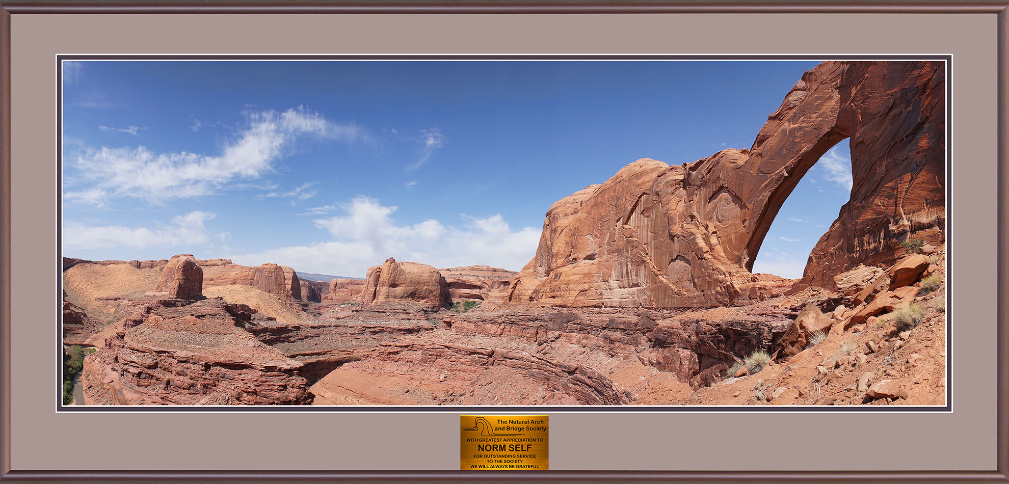
Norm used professional publishing software to transform NABS’ original xeroxed newsletter into a thing of beauty for 54 issues over a period of 13.5 years.
To honor and express appreciation to Norm, NABS made a three-foot-wide tribute photo/plaque, shown below, featuring Craig Shelley’s panoramic photo of Stevens Arch, which was Norm’s favorite arch hike.