Deprecated: WP_Translation_Controller::load_file(): Implicitly marking parameter $locale as nullable is deprecated, the explicit nullable type must be used instead in /homepages/4/d577990729/htdocs/blog/wp-includes/l10n/class-wp-translation-controller.php on line 101
Deprecated: WP_Translation_Controller::unload_file(): Implicitly marking parameter $locale as nullable is deprecated, the explicit nullable type must be used instead in /homepages/4/d577990729/htdocs/blog/wp-includes/l10n/class-wp-translation-controller.php on line 156
Deprecated: WP_Translation_Controller::unload_textdomain(): Implicitly marking parameter $locale as nullable is deprecated, the explicit nullable type must be used instead in /homepages/4/d577990729/htdocs/blog/wp-includes/l10n/class-wp-translation-controller.php on line 201
Deprecated: WP_Translation_Controller::is_textdomain_loaded(): Implicitly marking parameter $locale as nullable is deprecated, the explicit nullable type must be used instead in /homepages/4/d577990729/htdocs/blog/wp-includes/l10n/class-wp-translation-controller.php on line 243
Deprecated: WP_Translation_Controller::translate(): Implicitly marking parameter $locale as nullable is deprecated, the explicit nullable type must be used instead in /homepages/4/d577990729/htdocs/blog/wp-includes/l10n/class-wp-translation-controller.php on line 263
Deprecated: WP_Translation_Controller::translate_plural(): Implicitly marking parameter $locale as nullable is deprecated, the explicit nullable type must be used instead in /homepages/4/d577990729/htdocs/blog/wp-includes/l10n/class-wp-translation-controller.php on line 297
Deprecated: WP_Translation_Controller::locate_translation(): Implicitly marking parameter $locale as nullable is deprecated, the explicit nullable type must be used instead in /homepages/4/d577990729/htdocs/blog/wp-includes/l10n/class-wp-translation-controller.php on line 397
Deprecated: WP_Translation_Controller::get_files(): Implicitly marking parameter $locale as nullable is deprecated, the explicit nullable type must be used instead in /homepages/4/d577990729/htdocs/blog/wp-includes/l10n/class-wp-translation-controller.php on line 430
Deprecated: WP_Translation_File::create(): Implicitly marking parameter $filetype as nullable is deprecated, the explicit nullable type must be used instead in /homepages/4/d577990729/htdocs/blog/wp-includes/l10n/class-wp-translation-file.php on line 84
Deprecated: wp_getimagesize(): Implicitly marking parameter $image_info as nullable is deprecated, the explicit nullable type must be used instead in /homepages/4/d577990729/htdocs/blog/wp-includes/media.php on line 5502 France | NABS Blog
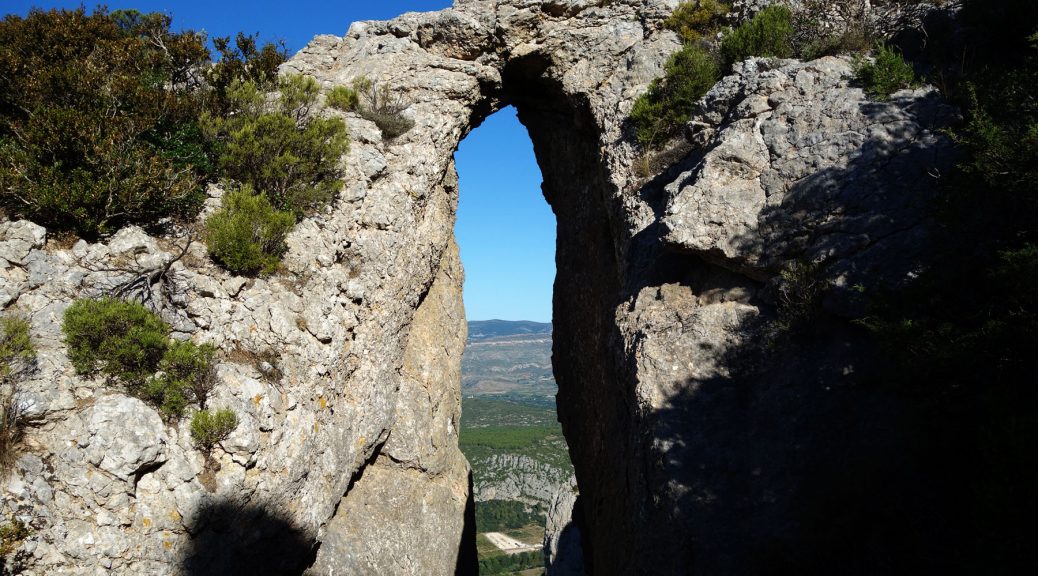
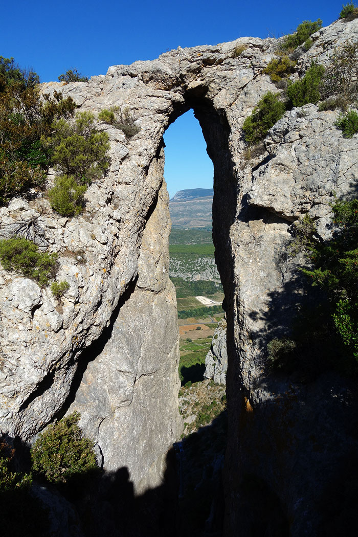
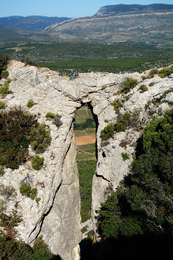
Our intrepid arch hunter Guilain Debossens reports the 1300th arch that he has documented in France, located on the crest of Serrat de la Nereda Mountain near the village of Tautavel in Pyrénées-Orientales department of France. The opening has a measured height of about 30 feet.
Pascal Sombardier, French author and mountaineer, lead a team of reporters for the French National TV Network FRANCE 3 to Double Arch of Jalliffier on Vercors Mountain. In this segment of the show (4 minute video below), views of rappelling down through the arch are enhanced with the use of a drone.
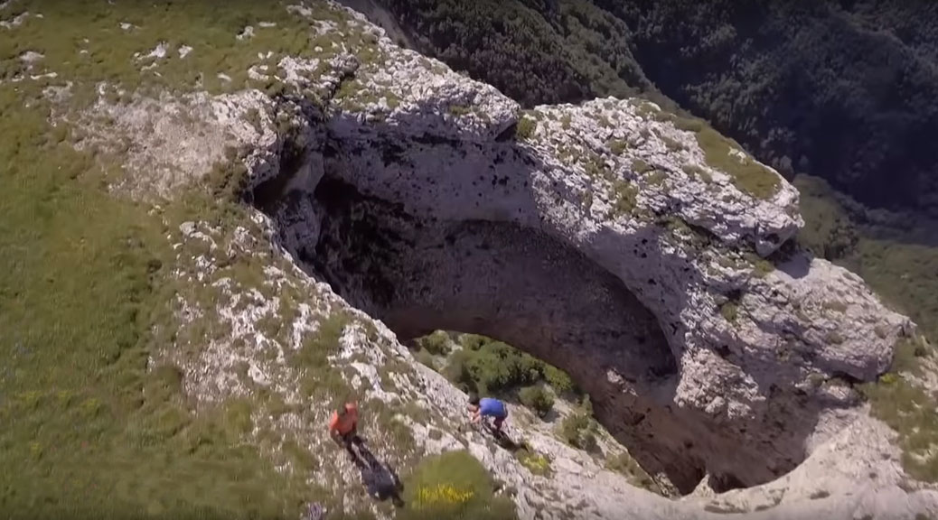
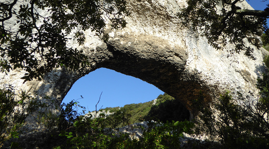
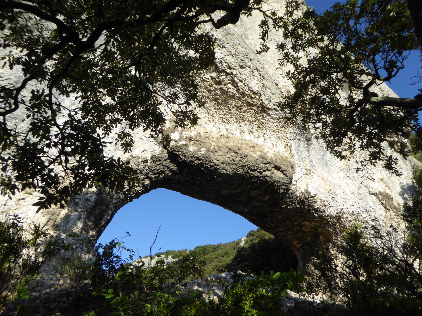
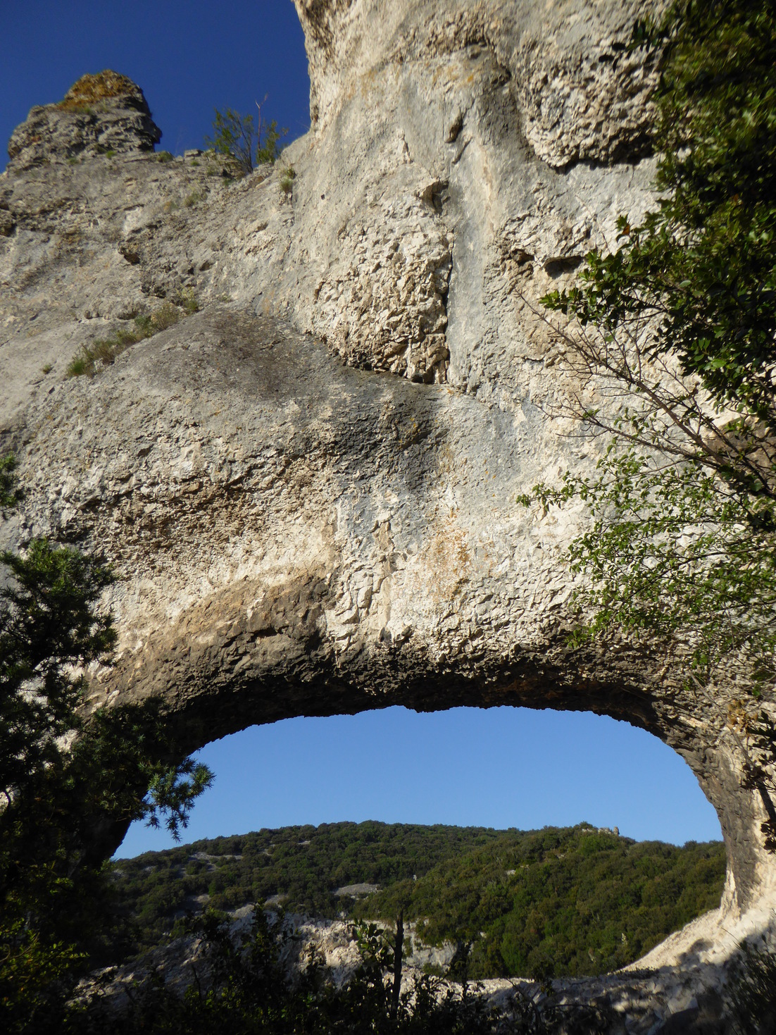
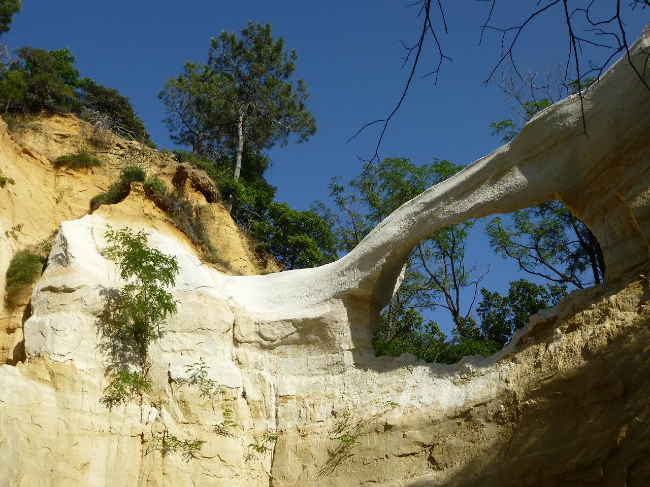
Our intrepid arch hunter Guilain Debossens reports the 900th arch that he has documented in France: Barri Troué.
This natural arch is located on the lower section of the canyon of Rimouren near the village of Saint-Montant in the Ardèche department of France. The opening has a measured span of 18 feet. Barri is an old Provençal name for a rocky ledge. Barri Troué is named (but not precisely located) on the IGN topographic map Top 25 number 2939 West Gorges de l’Ardèche (pleat B9).
Below are three photos of Barri Troué. About 95% of the arches Guilain has documented in France are on his website.
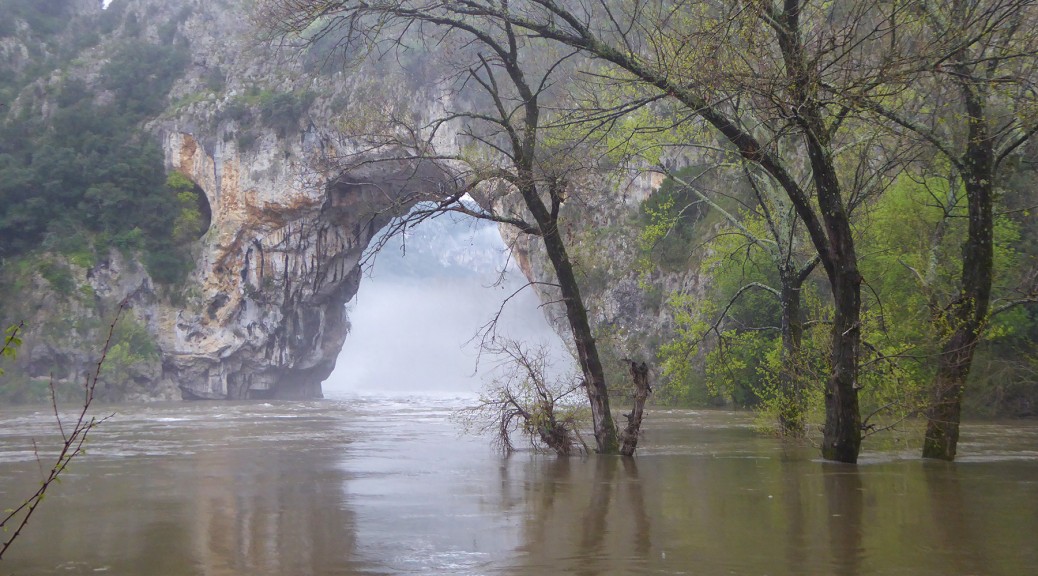
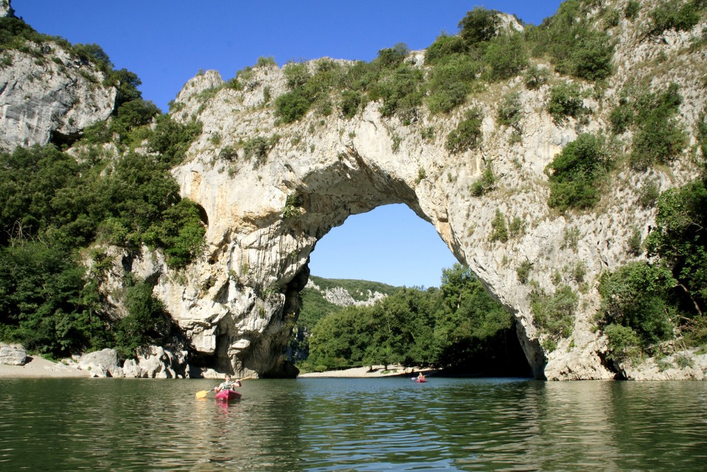
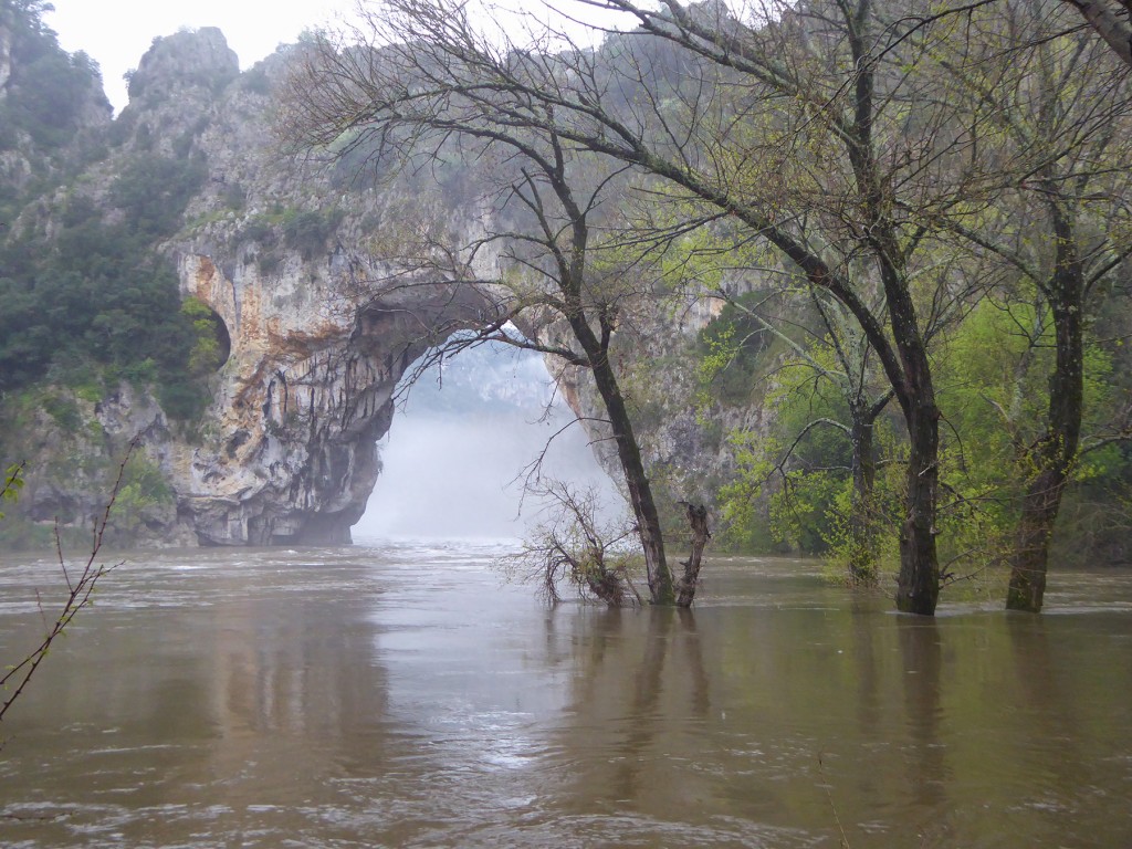
Pont d’Arc in France experienced flooding on April 4, 2016, as can be seen in the two photos below showing the Ardeche River at normal flow followed by a photo on April 4.
Pont d’Arc at normal flow.
Pont d’Arc on April 4, 2016. Photo courtesy Guilain Debossens.
A much larger flood occurred on September 19, 2014, as can be seen in the first 30 seconds of the video below.
Guilain Debossens reports that there is an historic plaque fixed on the cliff two meters above the road at the entrance of the Gorges de l’Ardèche. The plaque indicates that the Ardèche River reached the level of the plaque, 55 feet above normal flow, during the historic flood of September 22, 1890. It was the most severe flood since man developed photography, but not of all time of course.
Guilain found the photo below taken during this historic flood. The text written on the back said the flood was so huge that the Ardeche River retook the abandoned meander during this event.
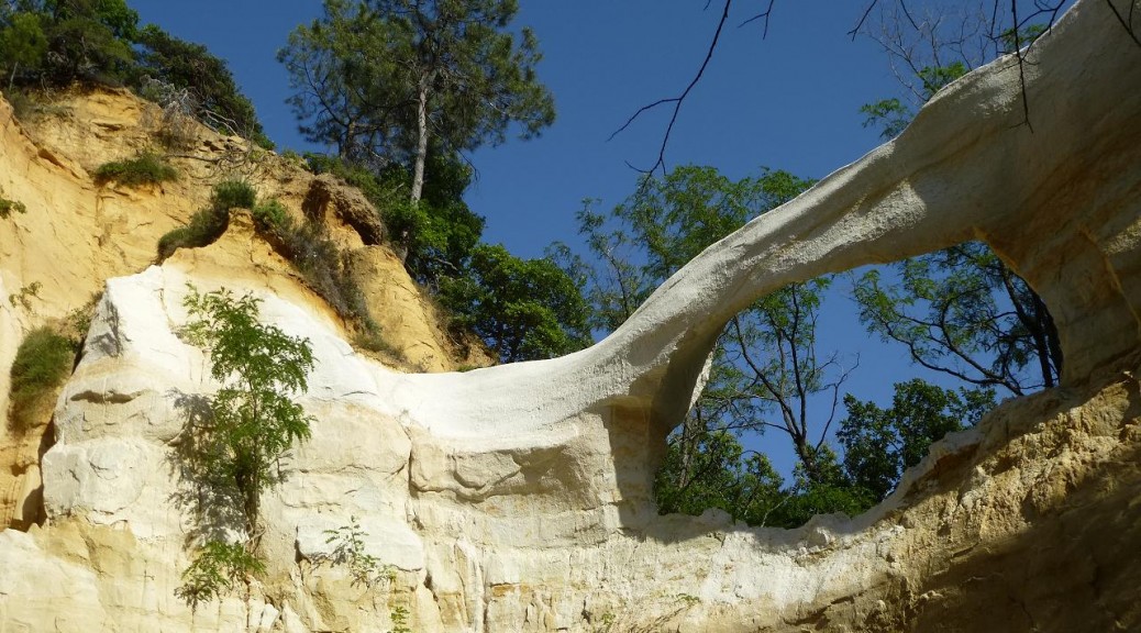
Arch evolution can occur over thousands of years, but La Dame Blanche (The White Lady) in France consisted of a crumbly clay-like rock and evolved from youth to maturity to collapse in the course of just a few years.
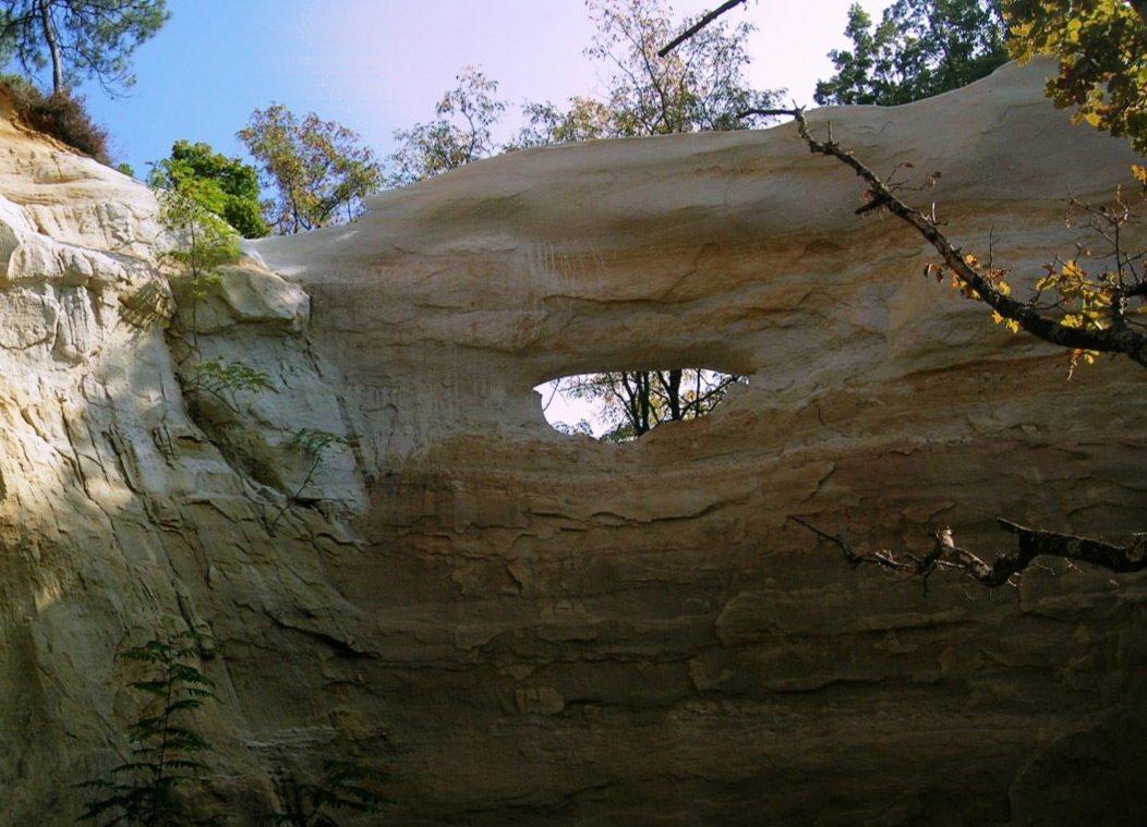
The photo below taken by Albert Zwinkels in 2009 shows a small, young opening.
The photo below by NABS member Guilain Debossens taken in June 2014 shows a mature span of 20 feet.
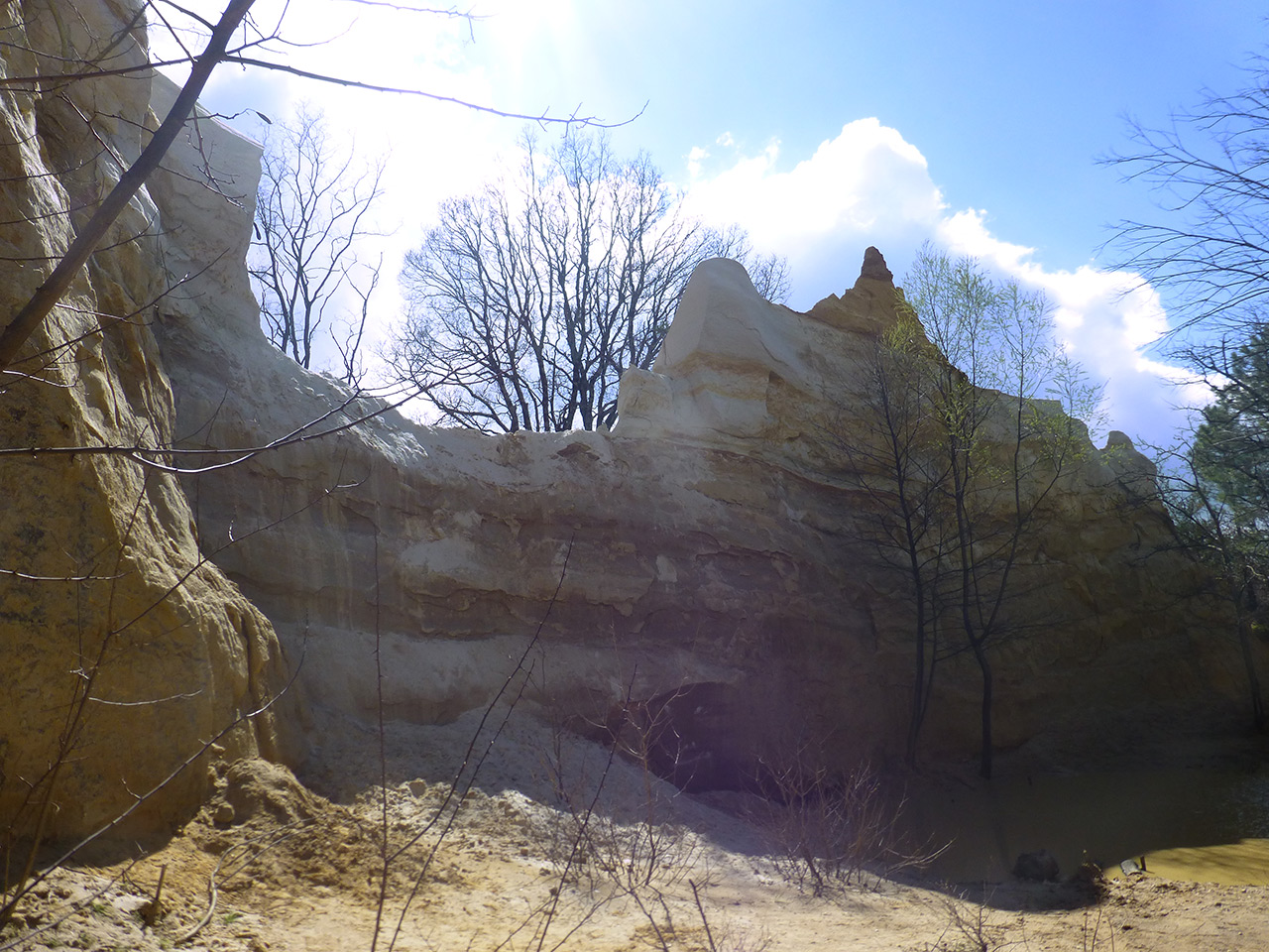
The photo below by Raphael Rodon was taken in April 2015, showing that the arch had collapsed.
La Dame Blanche (NABSQNO 31T-663186-4933509) was located in the vicinity of Dieulefit village in the Drôme department of France, about 100 miles south of Lyon and 120 miles north of Marseille.