One person died and another was critically injured just before 6 p.m. on Saturday, March 21 when the bluff above Arch Rock (V21-12, NABSQNO 10S-516381-4204424) collapsed when the two hikers were standing on it. The arch is at the end of the Bear Valley Trail in Point Reyes National Seashore, California. The pair fell about 70 feet and were covered by the falling rocks and debris. The collapse of the bluff came about two days after the National Park Service had posted warning signs about the cliff becoming weak from cracks and partial collapses.
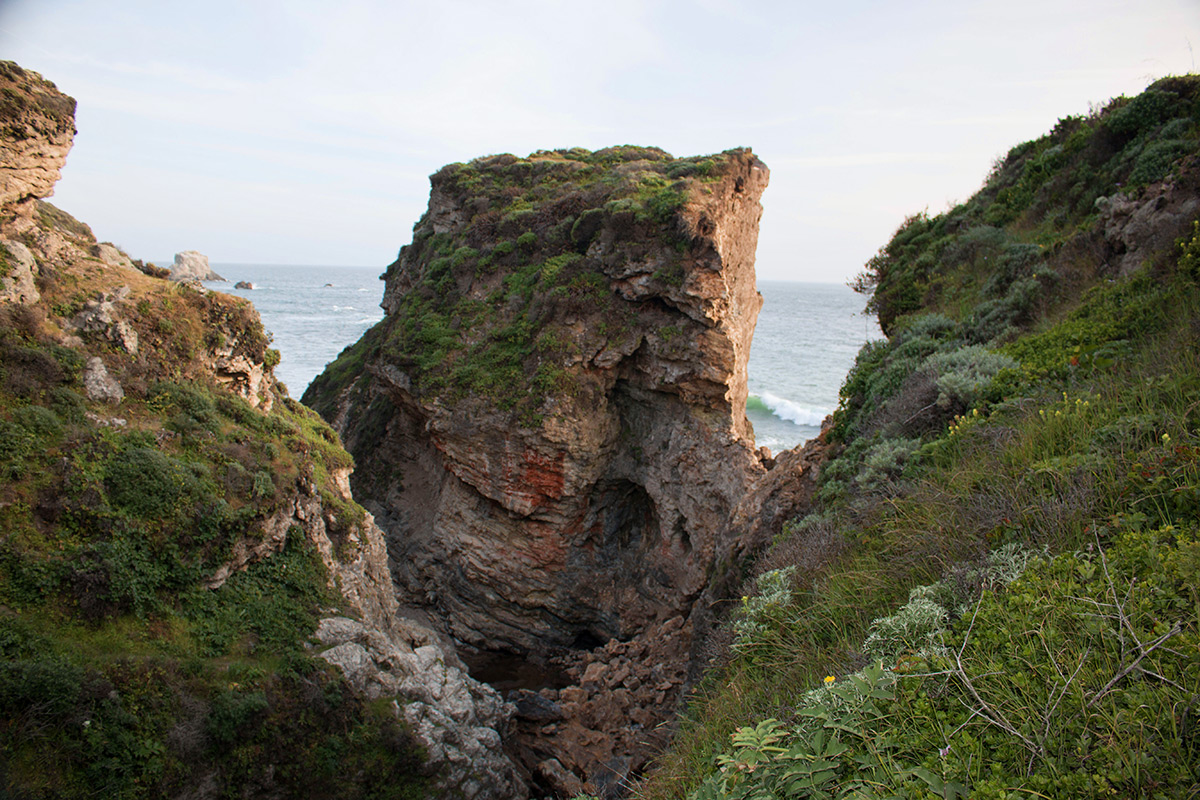
Arch rock is a meander type natural bridge where Clear Creek had cut through the narrow peninsula which had connected Miller Point to the mainland as shown in the photo below, looking back from Miller Point across the top of the arch before the collapse.
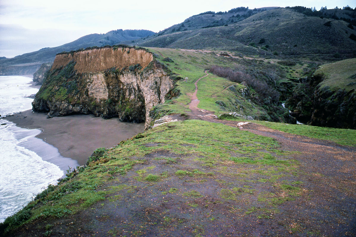
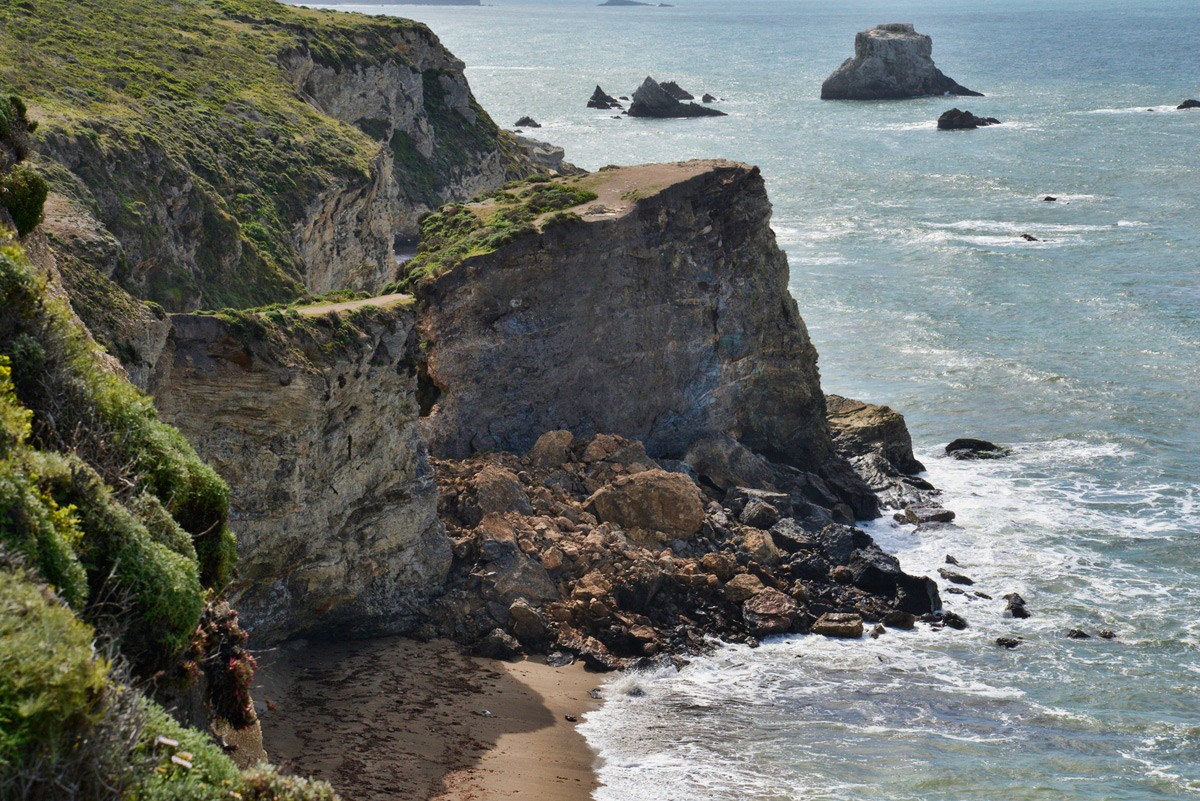
The photo below taken after the collapse shows that Miller Point is now an isolated butte no longer accessible by the trail that used to go across the top of the arch.
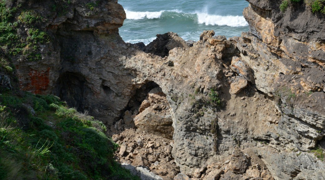
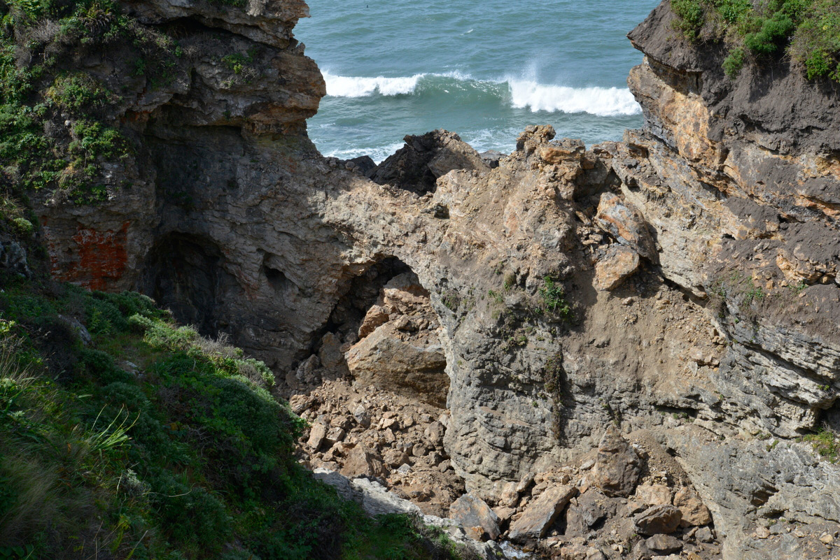
The photo below shows the large pile of rubble after the collapse.
The post-collapse photo below shows that the arch actually survived the collapse of the bluff above it, a testament to the structural strength that the arch form provides.
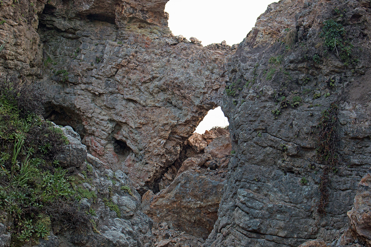
The photo below shows more clearly that the arch survived the collapse but changed it shape and now the opening has a greater height. Clear Creek still flows under the arch but disappears under the new rubble pile.
The Park Service considers the formation to still be unstable and dangerous and has closed the trail to Arch Rock.
The three very short videos below by Robert Robinson were taken on April 23. The first video shows the approach on the trail that formerly went across the top of the arch. You can see fissures in the ground indicating the possibility of another collapse. The second video shows views of the collapse from the Coast Trail above the opposite side of the creek. The third video shows the still-existing arch from Coast Creek itself.
A special thanks to Robert Robertson and Jeff Moore for supplying material for this article.
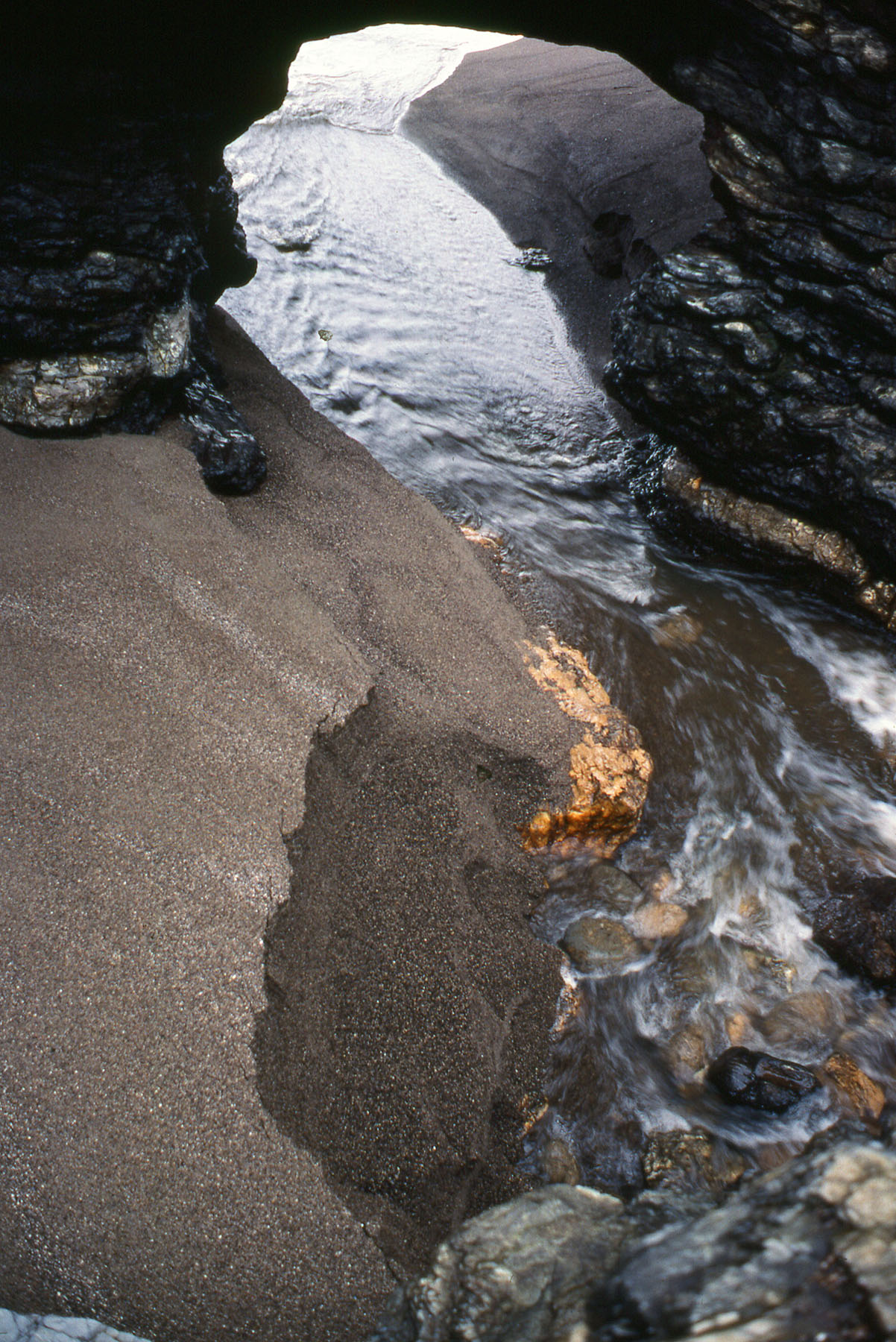
As of December 24, 2019, the arch is no more. There is still the remnants of the southern portion of the arch but it is completely open to the sky now as the creek now flows around the south end of Miller Point. (It has carved a new tunnel, but it is too small to walk through.)