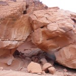
Natural Arch and Bridge Society member Ray Millar visited Libya in 2008 and offers this 9-minute video slide show of his trip, which includes a bunch of natural arches on the Akakus Plateau.
Sea Arches of Japan
By Toru Moriyasu
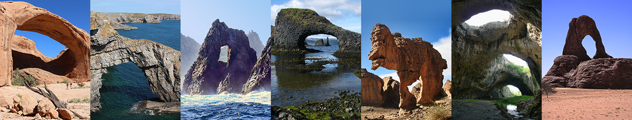
I am a NABS member from Japan and I greatly enjoyed meeting other NABS members at the 2015 NABS Rally in Escalante. Japan is an island country, so there are many sea arches here, and I would like to share some of them. Generally, they are not very large.
![]()
NABSQNO 54S-392039-3885693 is an arch rock near Ukishima in Chiba Prefecture. There is a shrine on the Ukishima island next to the arch rock, and we can land there once in a year when a sacred festival is held.
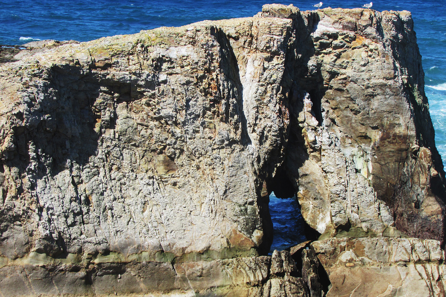
NABSQNO 54S-374119-3888470 is Umanosedoumon in Kanagawa Prefecture. This area is a bathing beach and in summer many people visit here to enjoy swimming. The photo below is the top of this arch. It is prohibited to walk on it.
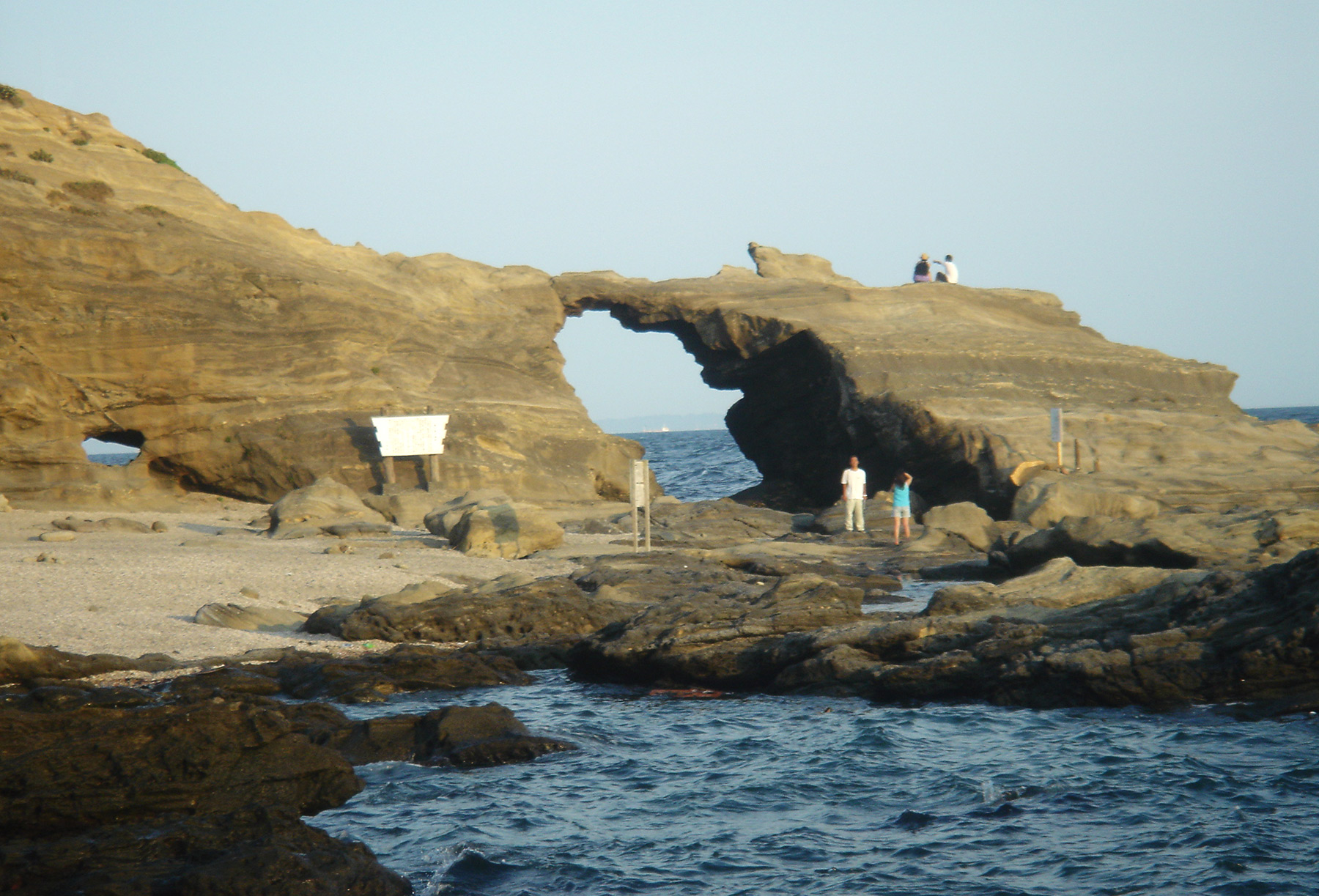
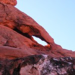
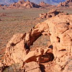
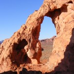
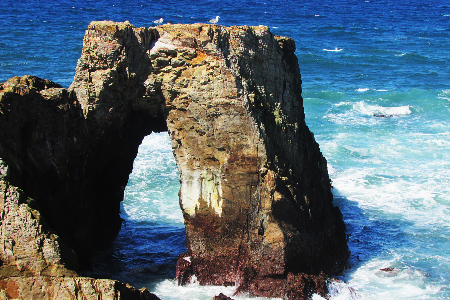
NABSQNO 54S-295596-3854128 is Meganeccho in Shizuoka Prefecture. It looks like a magnifying glass, or like Godzilla! In the same area there is a famous sea cave, Tensoudou (see below).
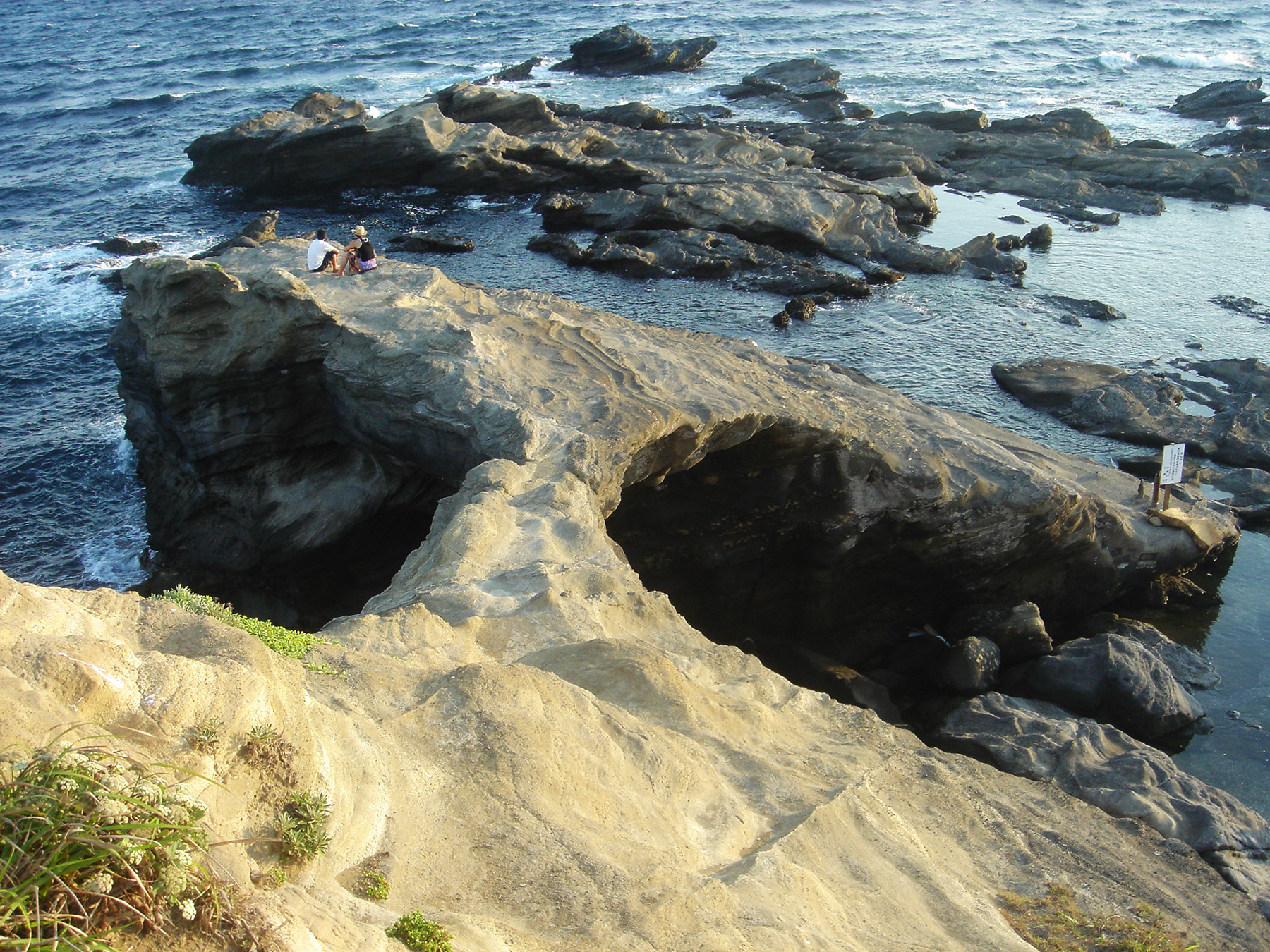
NABSQNO 54S-294833-3852422 is another sea arch near Meganeccho and Tensoudou, with me in the foreground.
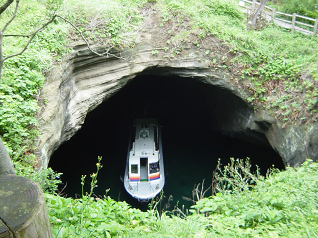
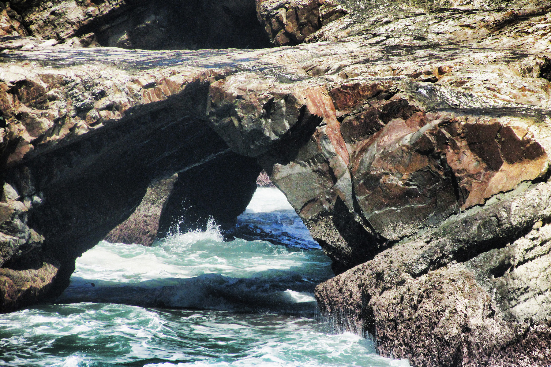
NABSQNO 54S-295596-3851220 is the sea cave Tensoudou, with a tour boat going under the arch.

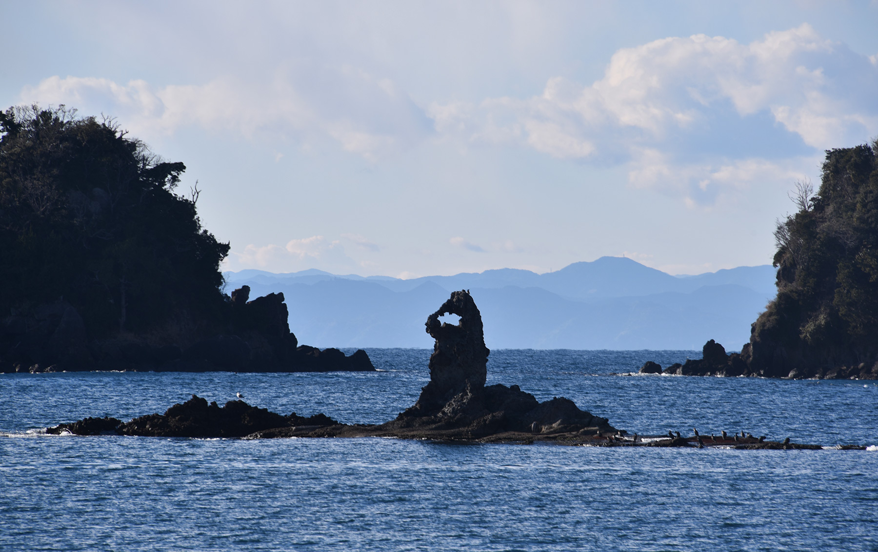
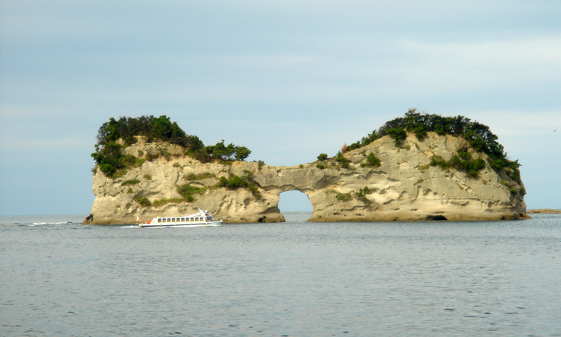
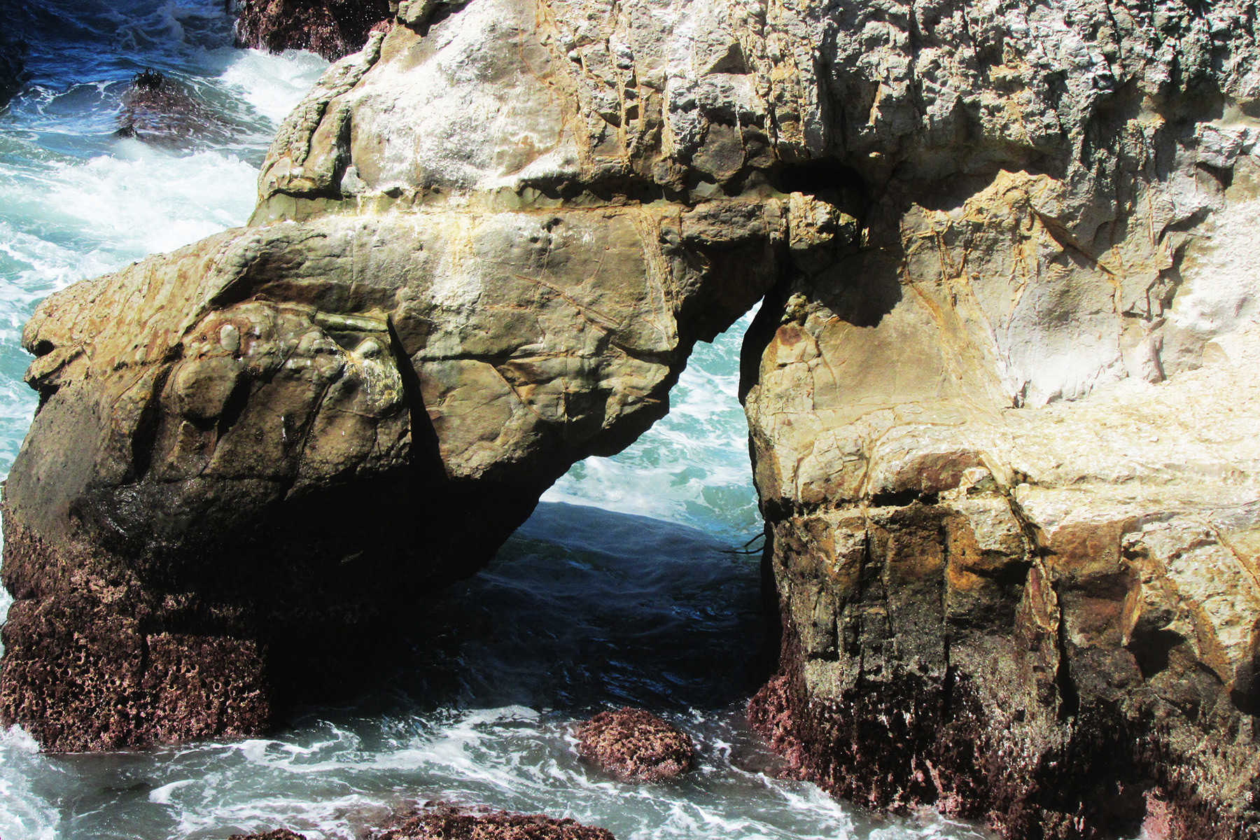
NABSQNO 54S-293168-3844185 is Senganmon in Shizuoka Prefecture, in the same area as Meganeccho and Tensoudou. A tour boat goes through this arch.

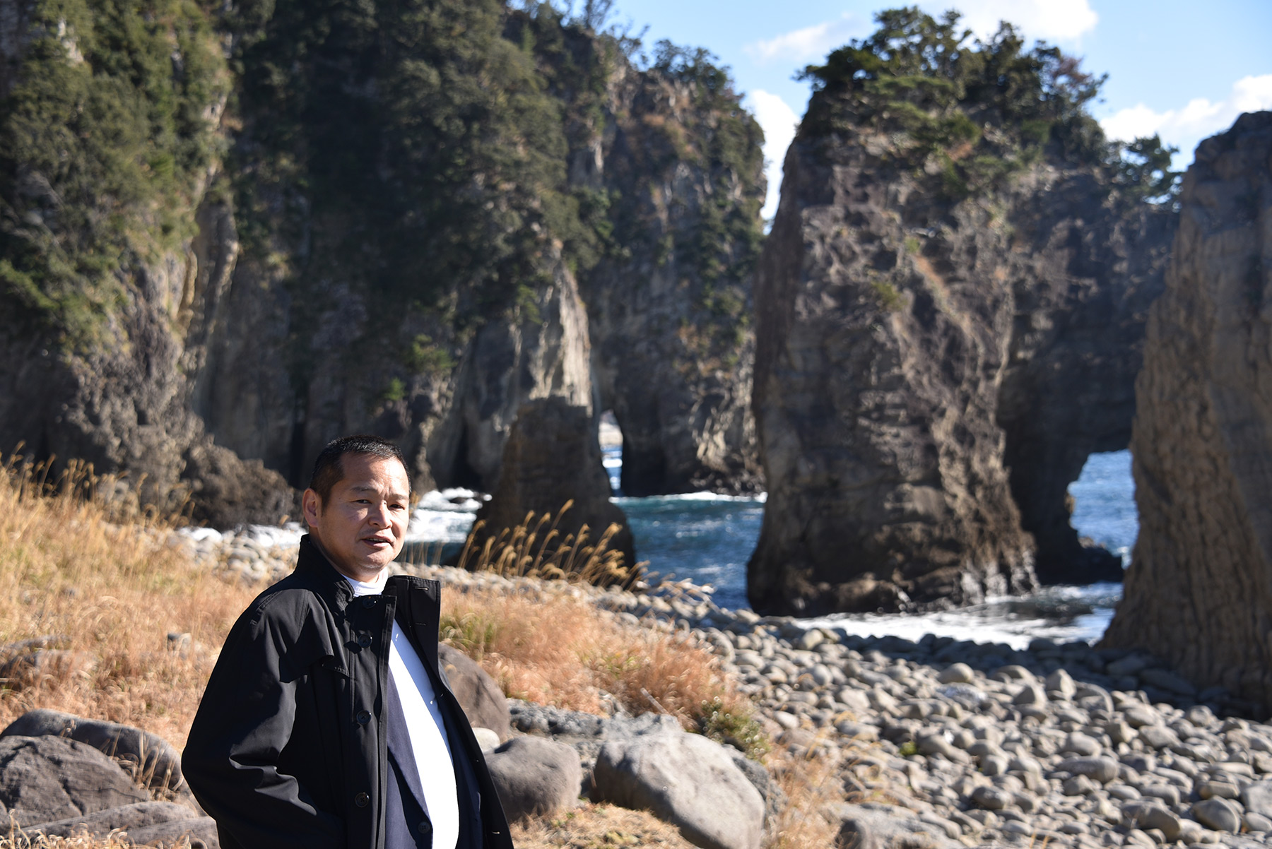
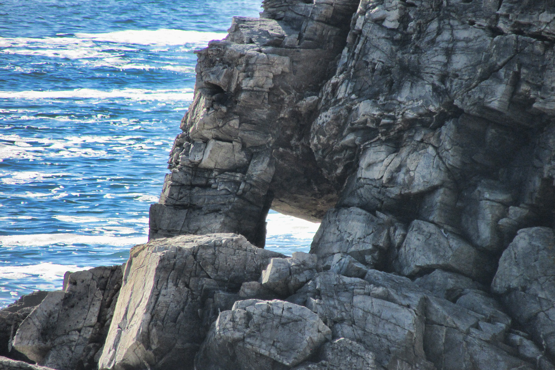
NABSQNO 53S-686992-3828085 is Hiinosekimon in Aichi Prefecture. It is made of sedimentary rock.
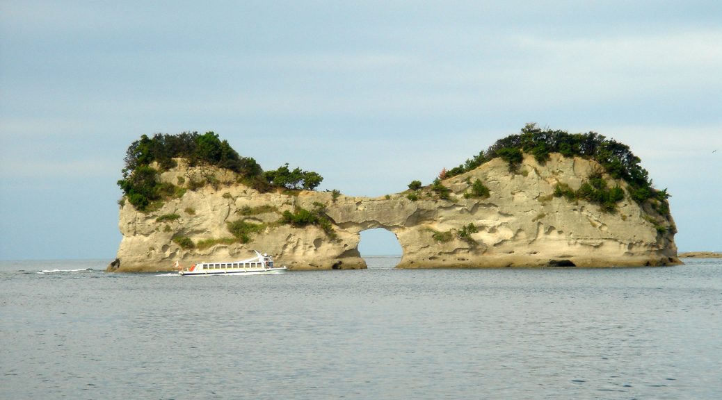
NABSQNO 53S-531185-3727842 is Engetsuto in Wakayama Prefecture. The span of the opening is about 9 meters and the height of the entire rock is 25 meters. This area is a famous tourist resort, with many tourists in high season.

NABSQNO 52S-628231-3736269 is Hanagurise in Fukuoka Prefecture. The height of opening is about 10 meters. The arch is made of basalt.
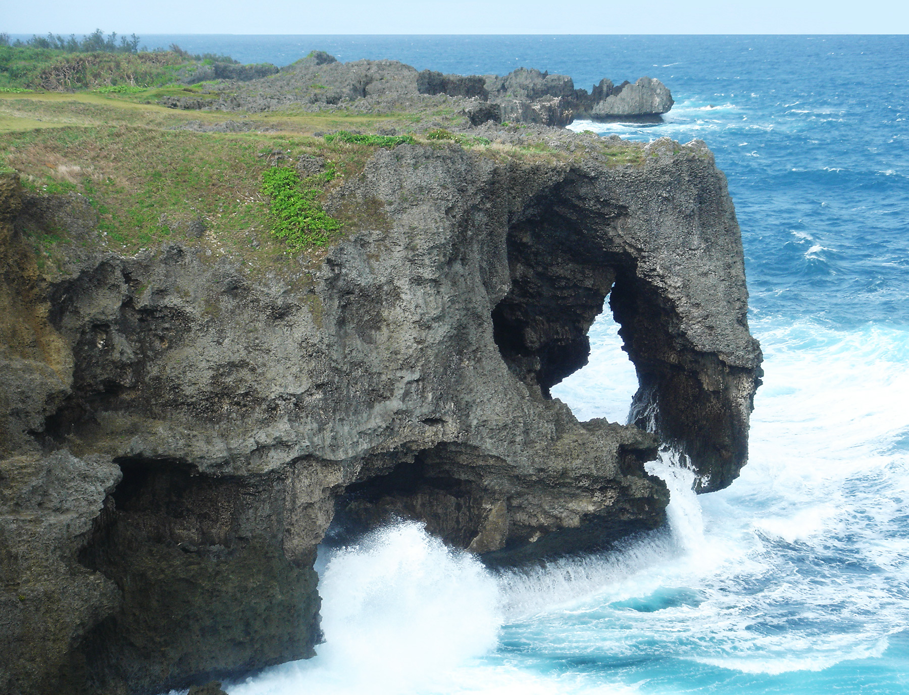
NABSQNO 52R-385422-2932167 is Manzamou in Okinawa Prefecture. The height of the cliff is about 20 meters.
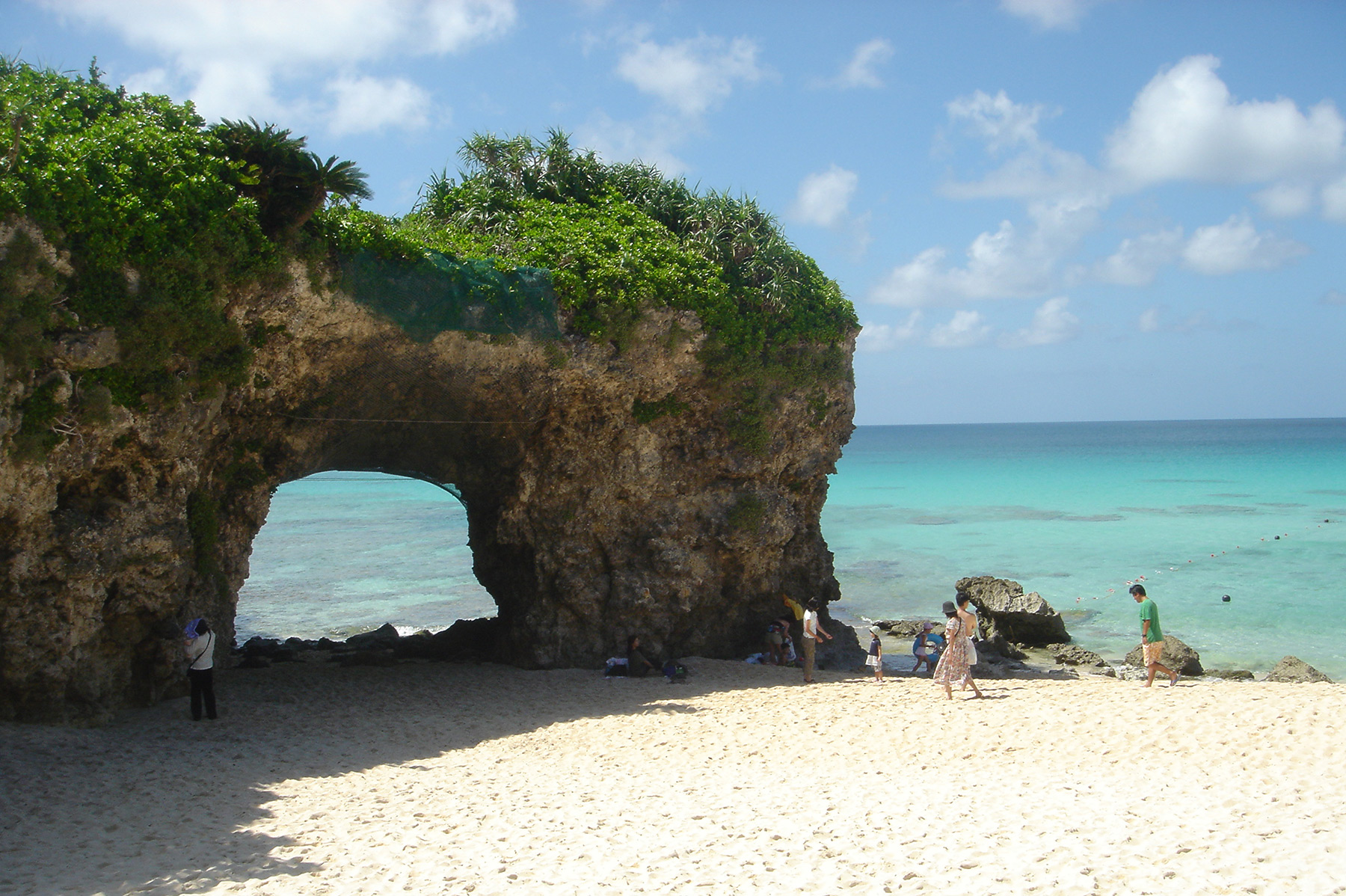
NABSQNO 51R-730446-2749088 is the arch on Sunayama Beach on Miyakojima Island in Okinawa Prefecture. The sea in this area is especially beautiful.
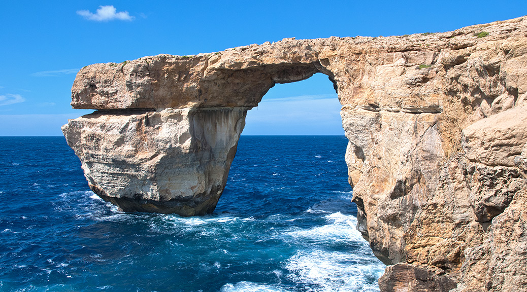
Azure Window Collapses
Famous Azure Window in Malta collapsed during a storm on March 8, 2017. Not only did the lintel itself collapse, but the entire outer column fell into the sea.
The arch was considered at risk of collapse and walking across the arch was prohibited only last December. And in January, a slab of rock fell off a lateral face of the outer column during high seas.
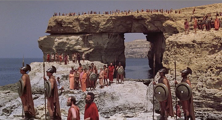
The spectacular arch was featured in many movies, including Game of Thrones. Some history of partial collapse can be seen in these movies. In the scene below from the 1981 movie Clash of the Titans, the underside of the arch is flat.
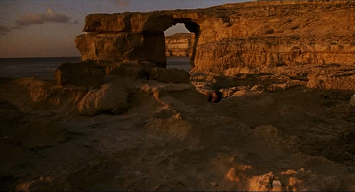
In the scene below from the 2002 movie The Count of Monte Christo, it can be seen that the underside of the lintel has fallen to create a more arced shape.
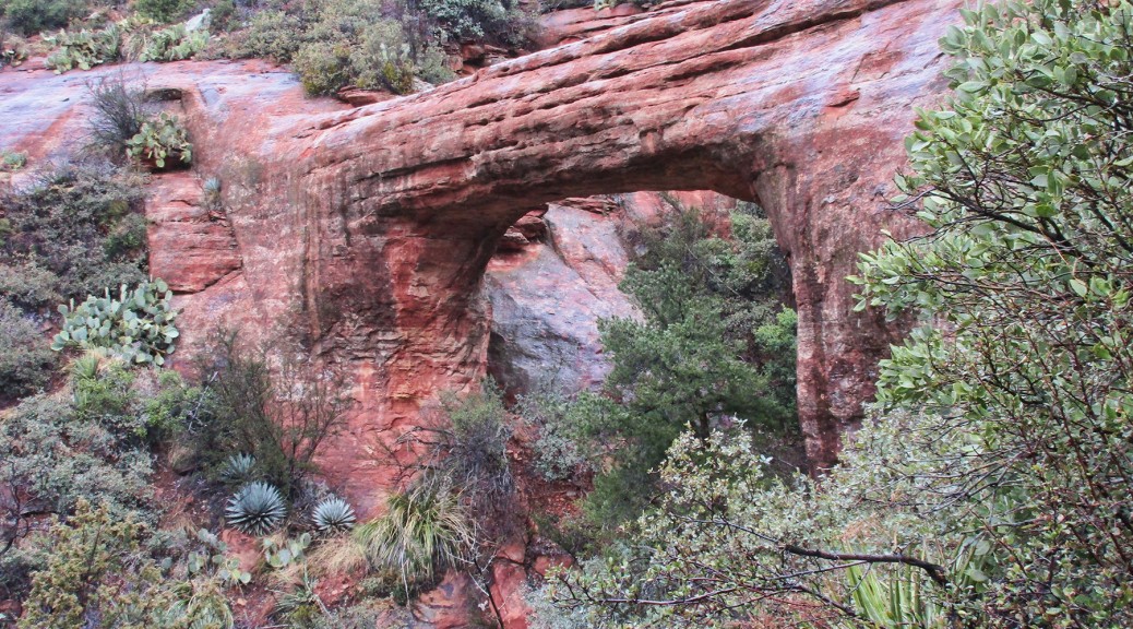
Vultee Arch Update
David Kennedy reports that some NABS website information about Vultee Arch near Sedona in Yavapai County, AZ, was out of date [it was updated accordingly today]. The website had reported that the trail went only to a viewpoint (shown below) and that to access the arch itself required significant bushwhacking.
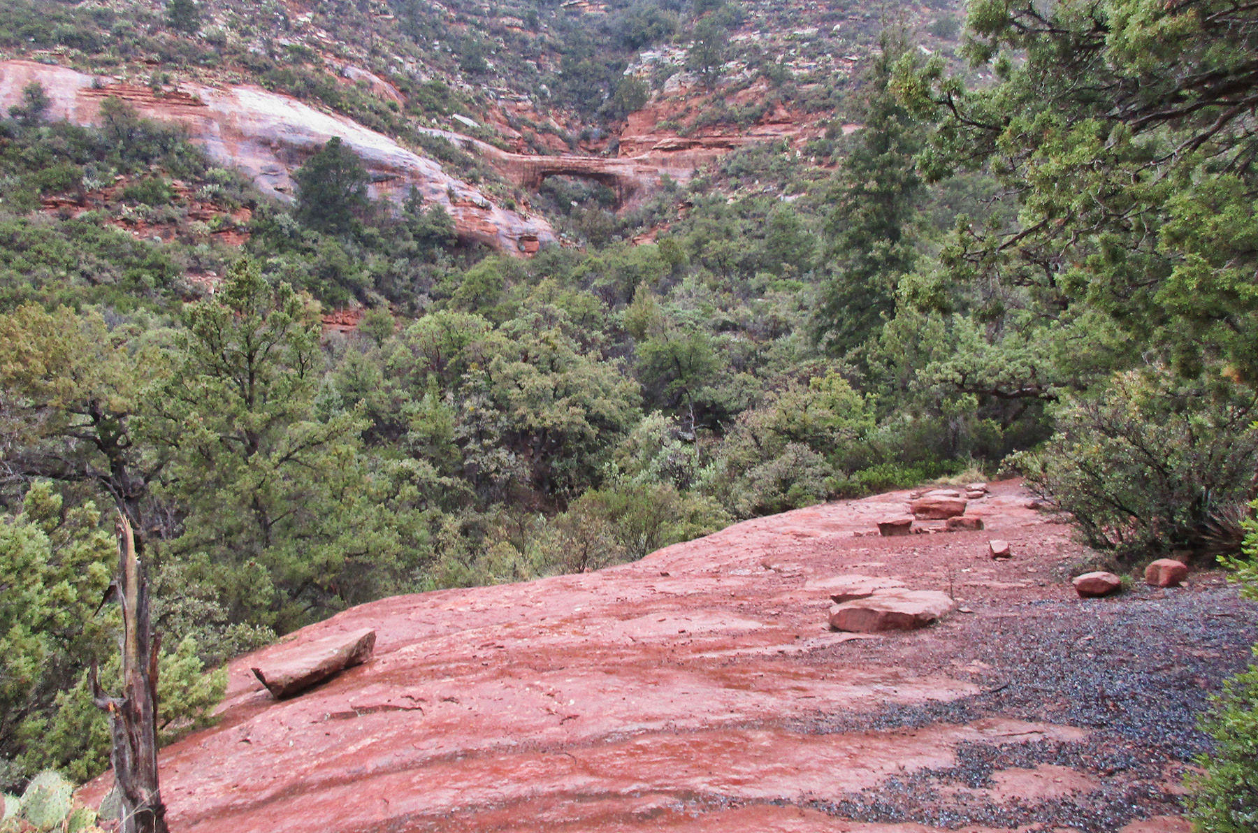
A hike there Feb. 7, 2017, revealed that a trail now goes up to a point next to the lintel of the arch, where the photo below was taken, so there is no longer any bushwhacking involved. From that point one can get onto the lintel and/or go down behind the arch to get beneath it. It is a steep descent to the lintel which Dave declined to take because the rock was wet at the time.
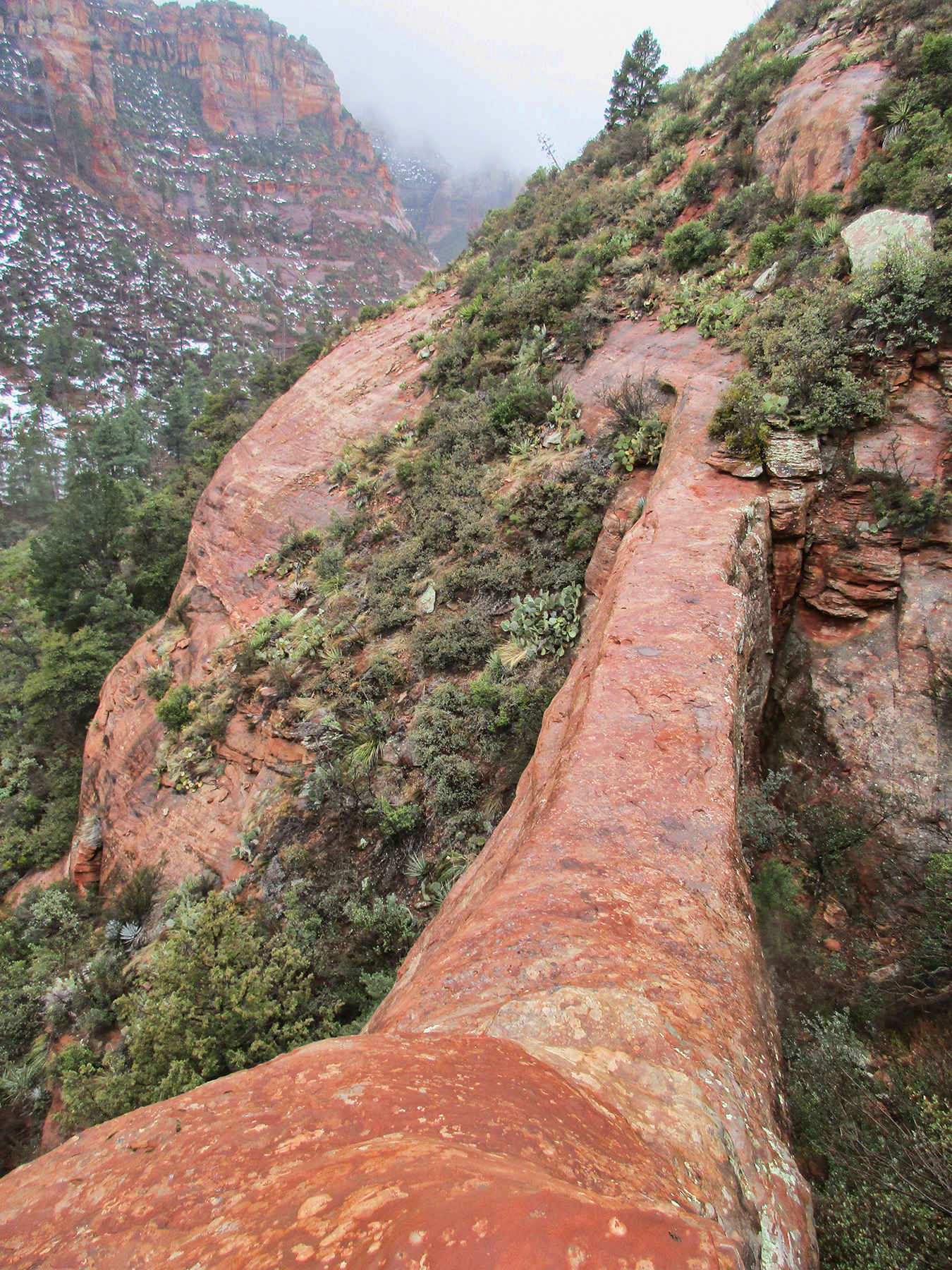
A GPS reading at the photo vantage point was 12S 429812.28 E 3866826.42 N, very close to that reported on the website.
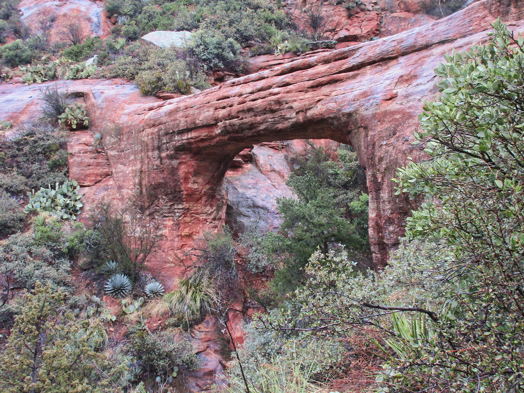
Vultee Arch from below. All photos courtesy Dave Kennedy.
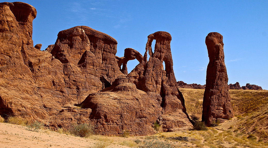
Chad: The Country and Its Arches
Here is a 16-minute video slide show by Ray Millar:
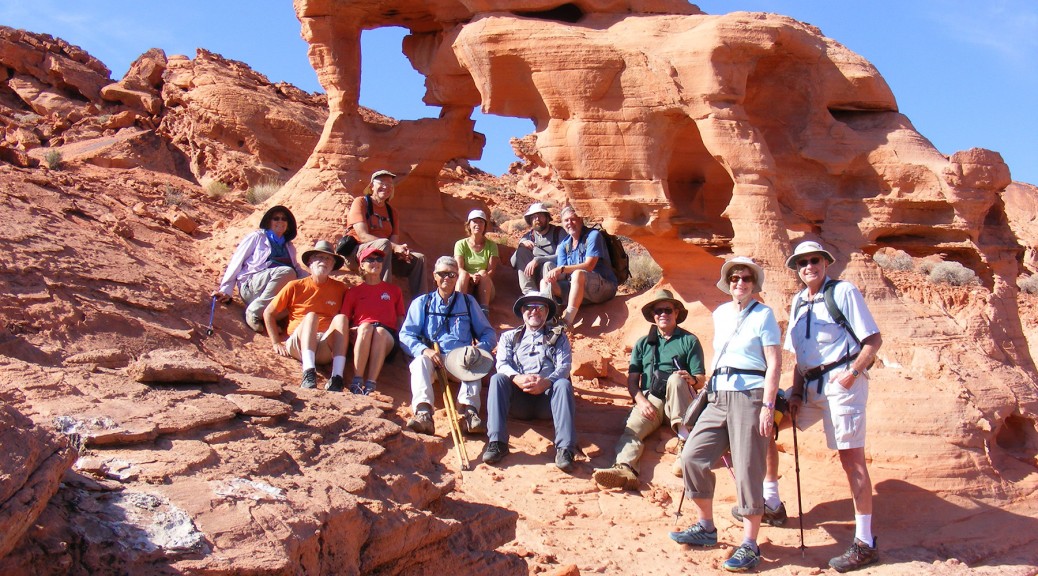
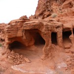
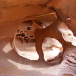
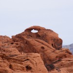
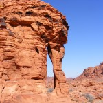
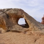
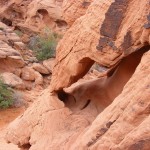
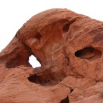
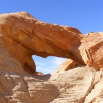
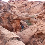
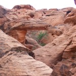
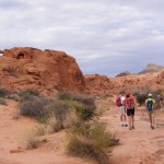
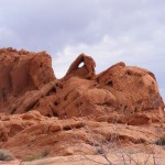
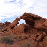
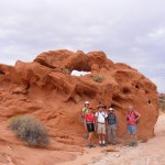
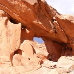
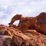
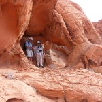
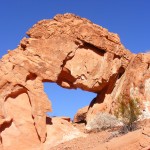
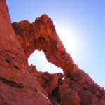
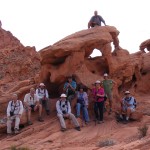
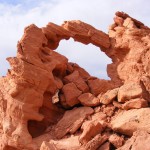
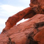
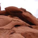
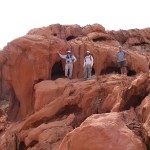
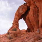
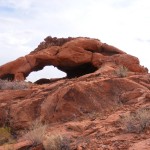
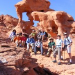
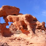
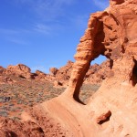
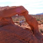
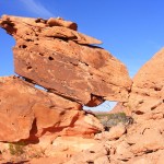
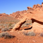
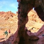
Valley of Fire Arch Rally
The October 2016 NABS Valley of Fire Arch Rally in Nevada was, as usual, filled with fun and camaraderie. Presented here is a slide show of photos taken by NABS President Larry Beck. Click on any image to start the slide show. The title of each image in the slide show provides the UTM WGS84 coordinates (the NABSQNO number) in zone 11S, and where present the name and catalog number of the arch. Catalog numbers refer to the Arch Hunter Books Valley of Fire series (available to NABS members).
Portland Head Lighthouse Arch, Maine
By Nick Terzakis
Maine is not known for natural arches but there were four small ones reported in the Journal of Natural Arch Discoveries.
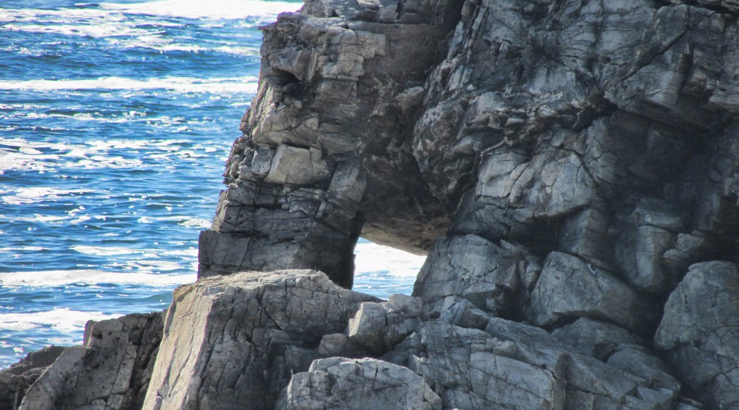
This October, Pat and I drove up the Maine coast stopping at some nice lighthouses. At the Portland Head Lighthouse in South Portland, ME you can see Portland Head Lighthouse Arch (ME-4), which is just south of the lighthouse.

Directions: In Portland, drive State Street south across the bridge into South Portland and turn left onto Cottage Road. Turn left into Ft. Williams State park and head to the lighthouse parking lot. You can see the arch to the south. Walk the trail south along the fence then go uphill to the top of the cliffs. Go left on a faint trail which goes on a pebble beach, and go right around the rocks to see the arch (only if it is low tide). The arch has a span of three feet.
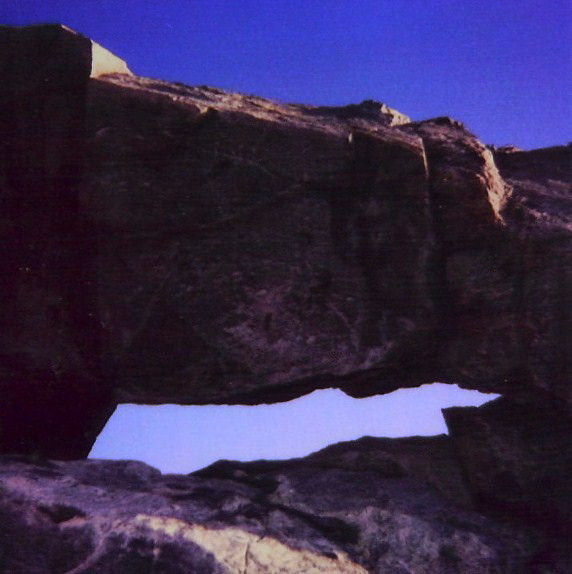
Unfortunately nearby Portland Head Arch (ME-2) has fallen. It had a span of four feet. A scan of my old Polaroid photo is below.
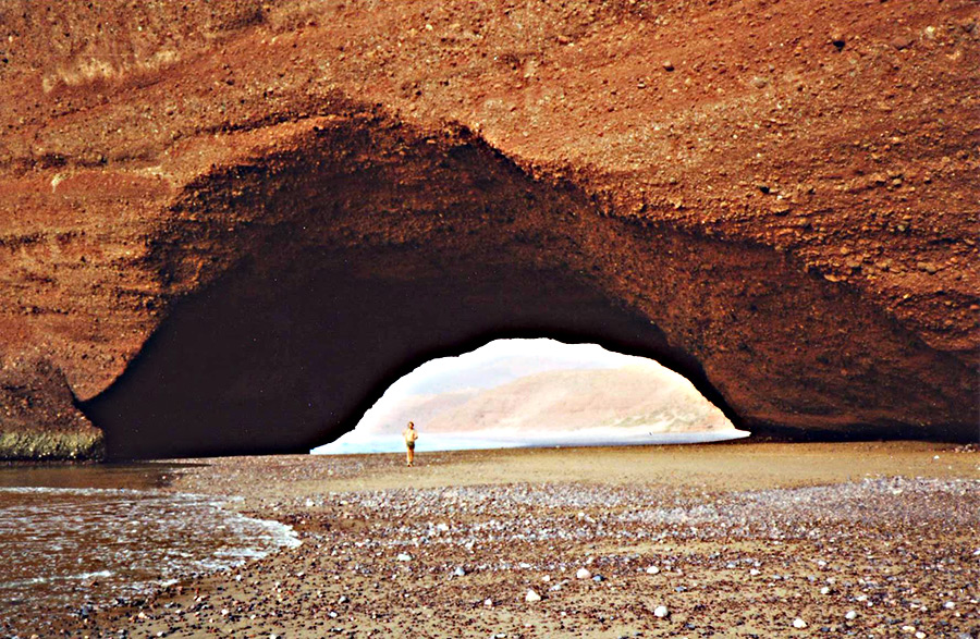
Arch collapse at Legzira Beach, Morocco
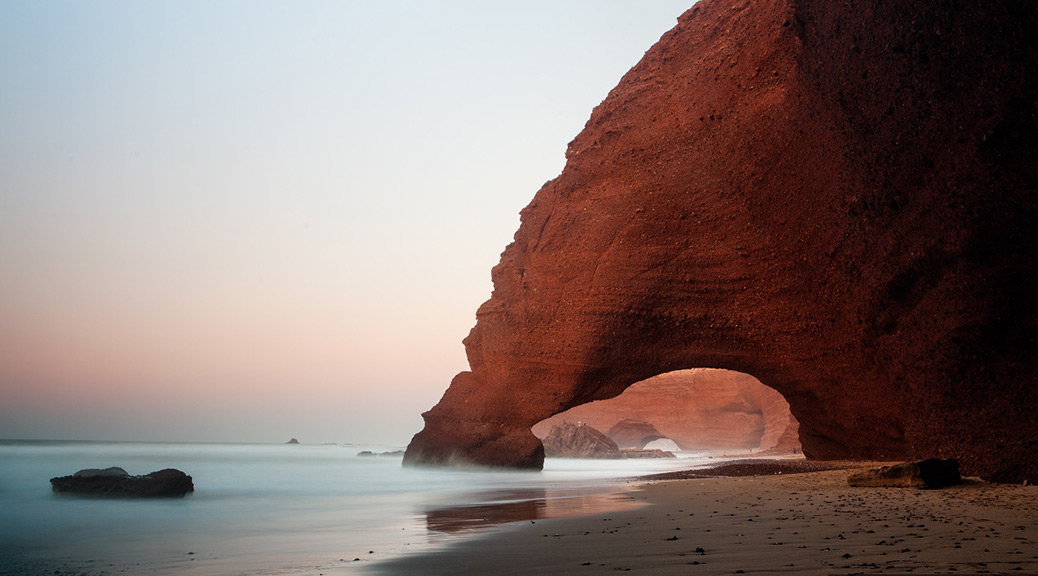
The photo below shows two large natural arches at Legzira Beach, Morocco, in the Province D’Agadir about 10 kilometers north of Sidi Infi.
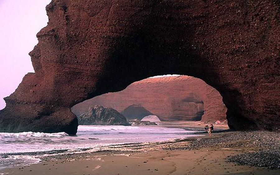
The arch in the foreground, NABSQNO 29R 391178 3257234 with an estimated span of 60 feet, collapsed on September 23, 2016. The remains are shown in the photo below.
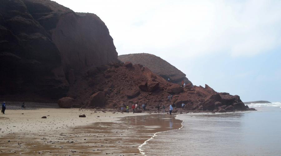
The remaining arch, with an estimated span of 90 feet, still stands. Our own Guilain Debossens stands by the arch in the photo below.
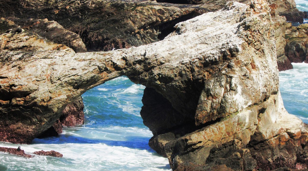
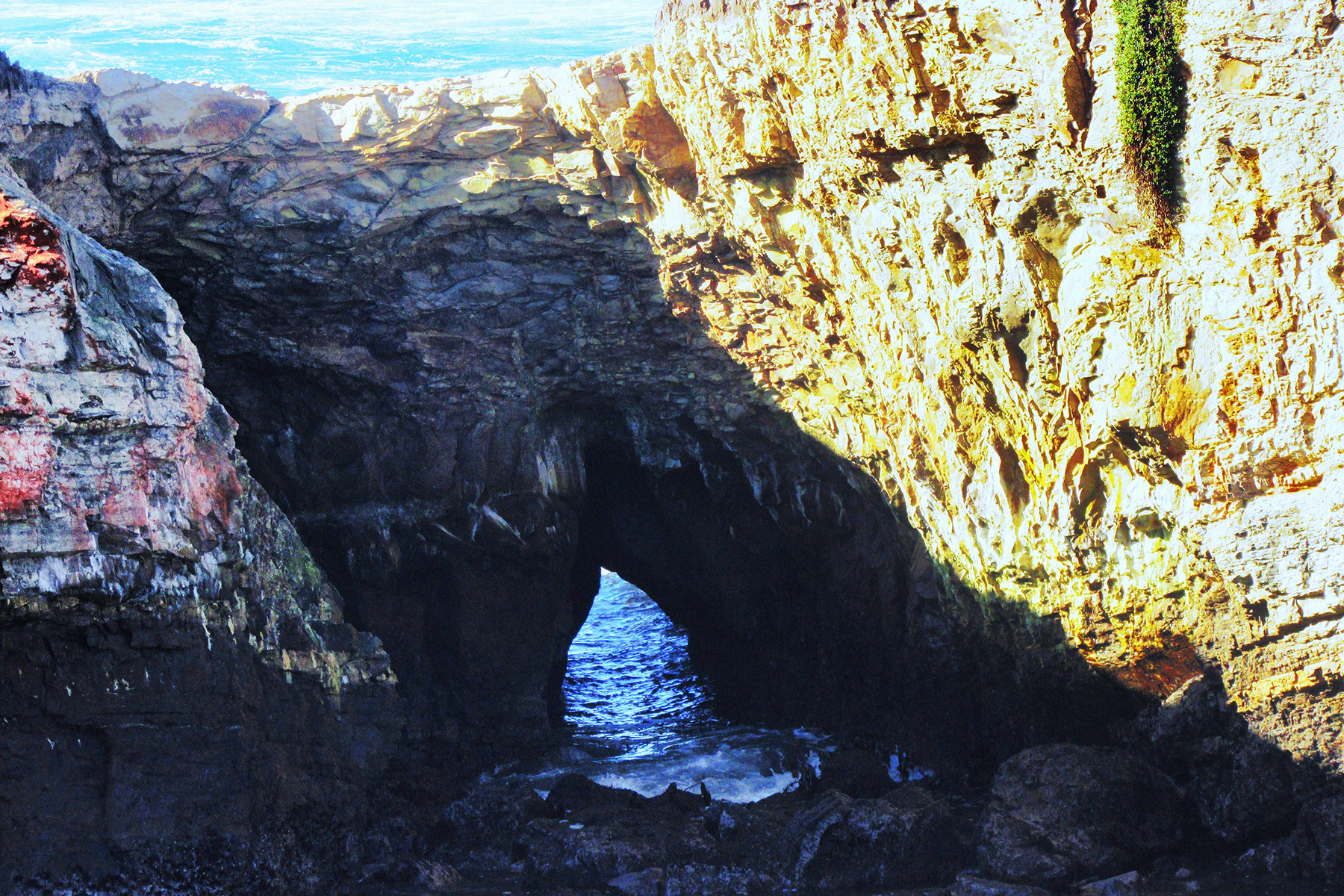
Stornetta Public Lands
By Nick Terzakis
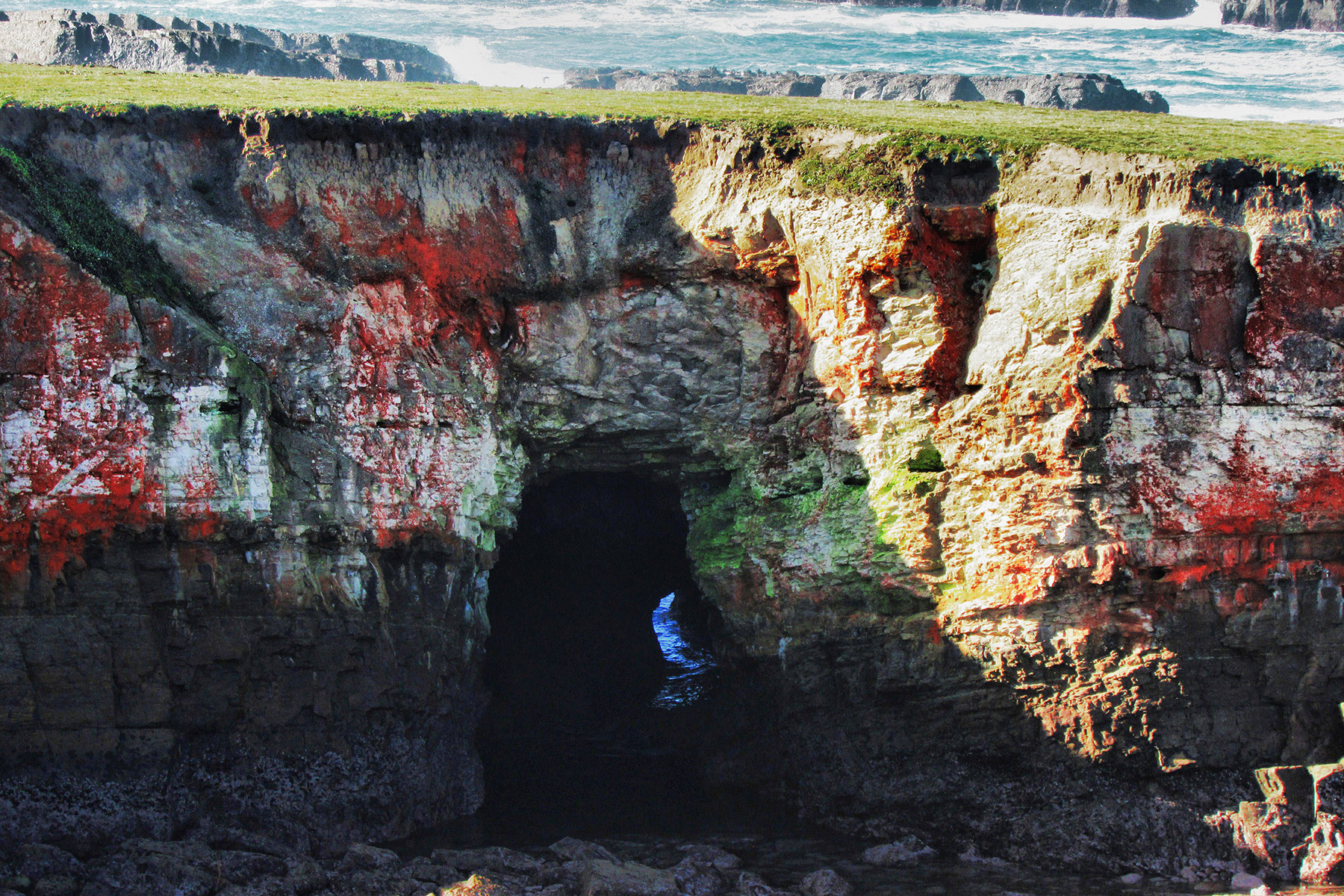
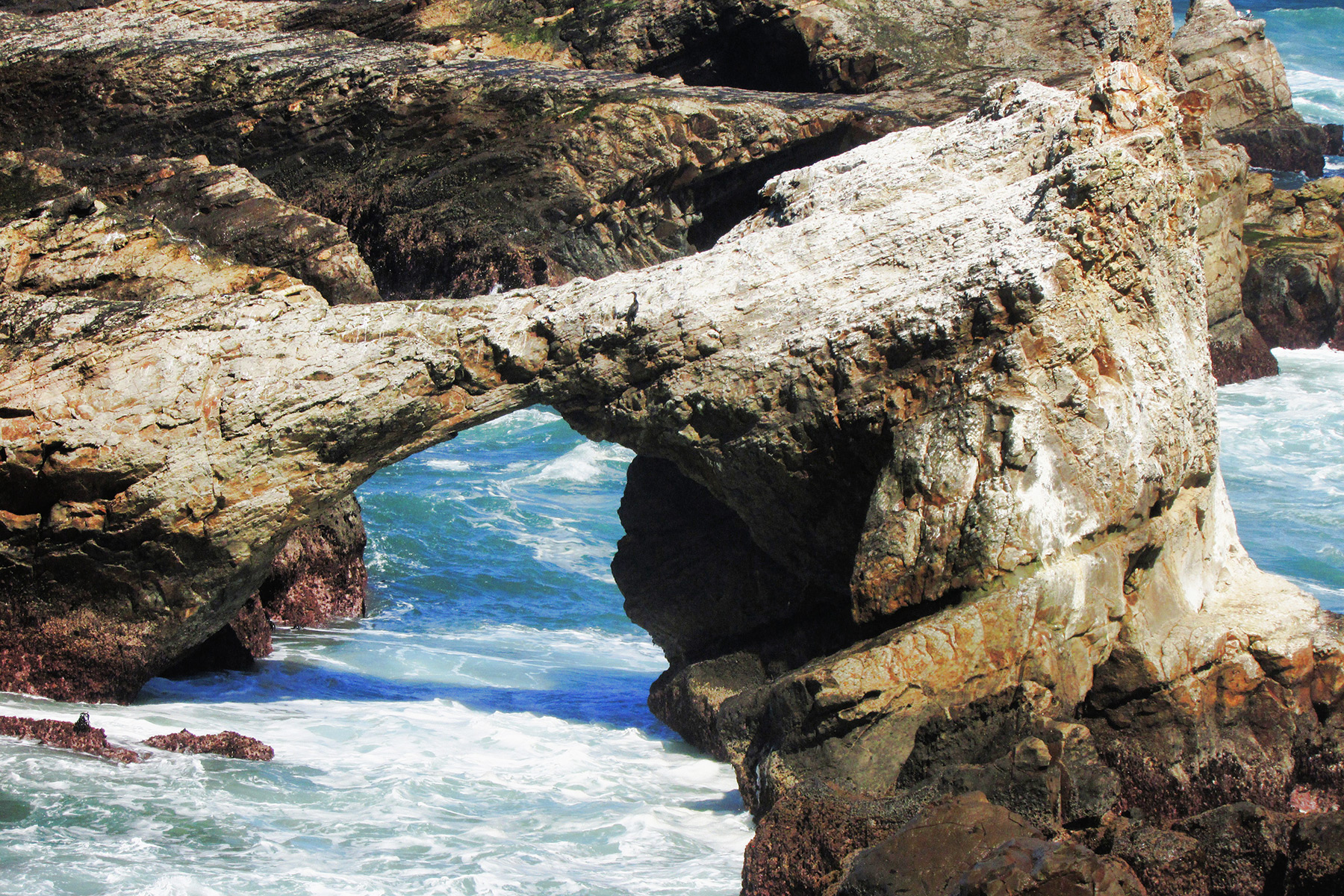
SPAN Editor Dave Kennedy gave me a tip about an area up the Northern California Coast called Storenetta Public Lands that has some sea arches. This area was once a dairy farm owned by Clover Creames based in Petaluma, CA. So I drove up to the area near the Pt. Arena lighthouse, parked at the Stornetta Public Lands trailhead, and walked the trail along the bluffs. It was quite windy. Coordinates given are from Jay Wilbur’s GIS section of the NABS website; sizes are estimates.
Off shore on a island is CA-85, Pt. Arena Arch, at 10S-43670-4310290, 30×35 feet, Photo 1:

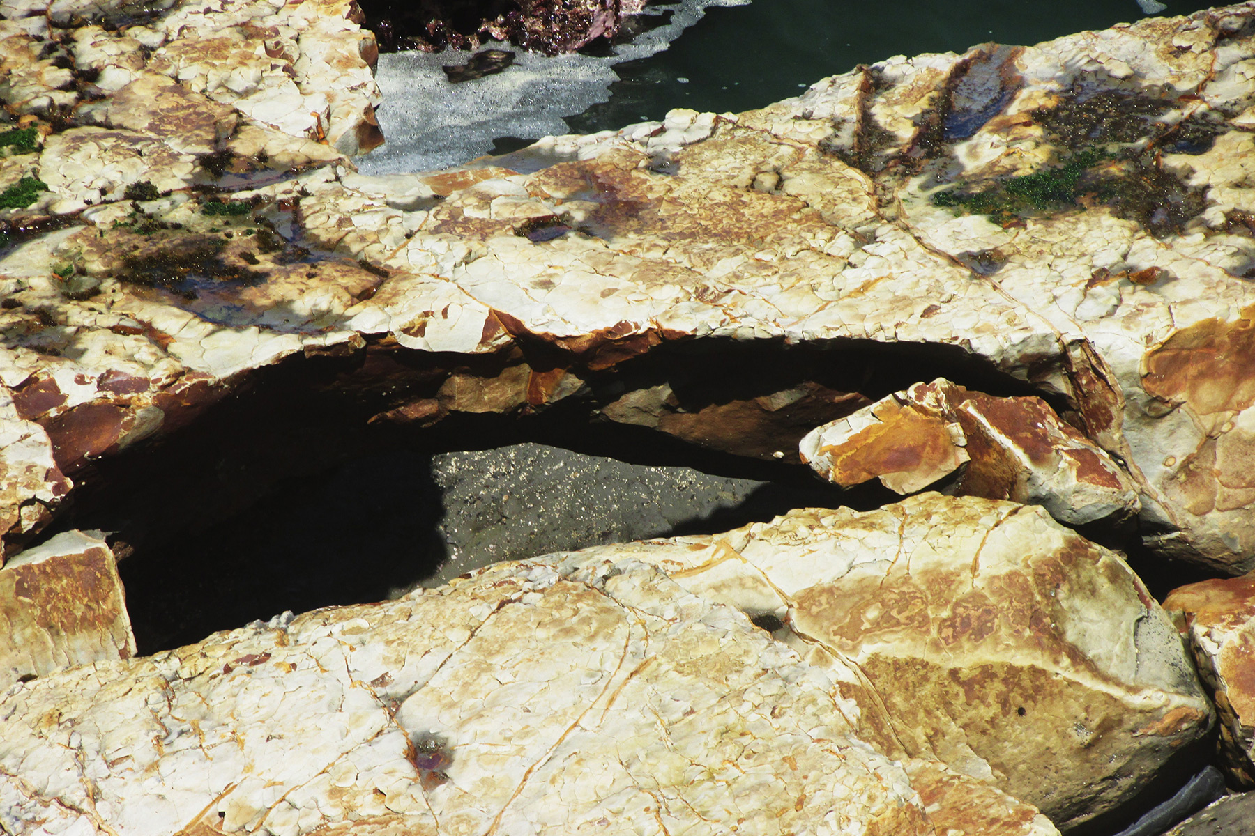
Just east of CA-85 are two other sea arches, 10×8 and 20×15 feet, Photos 2 and 3:
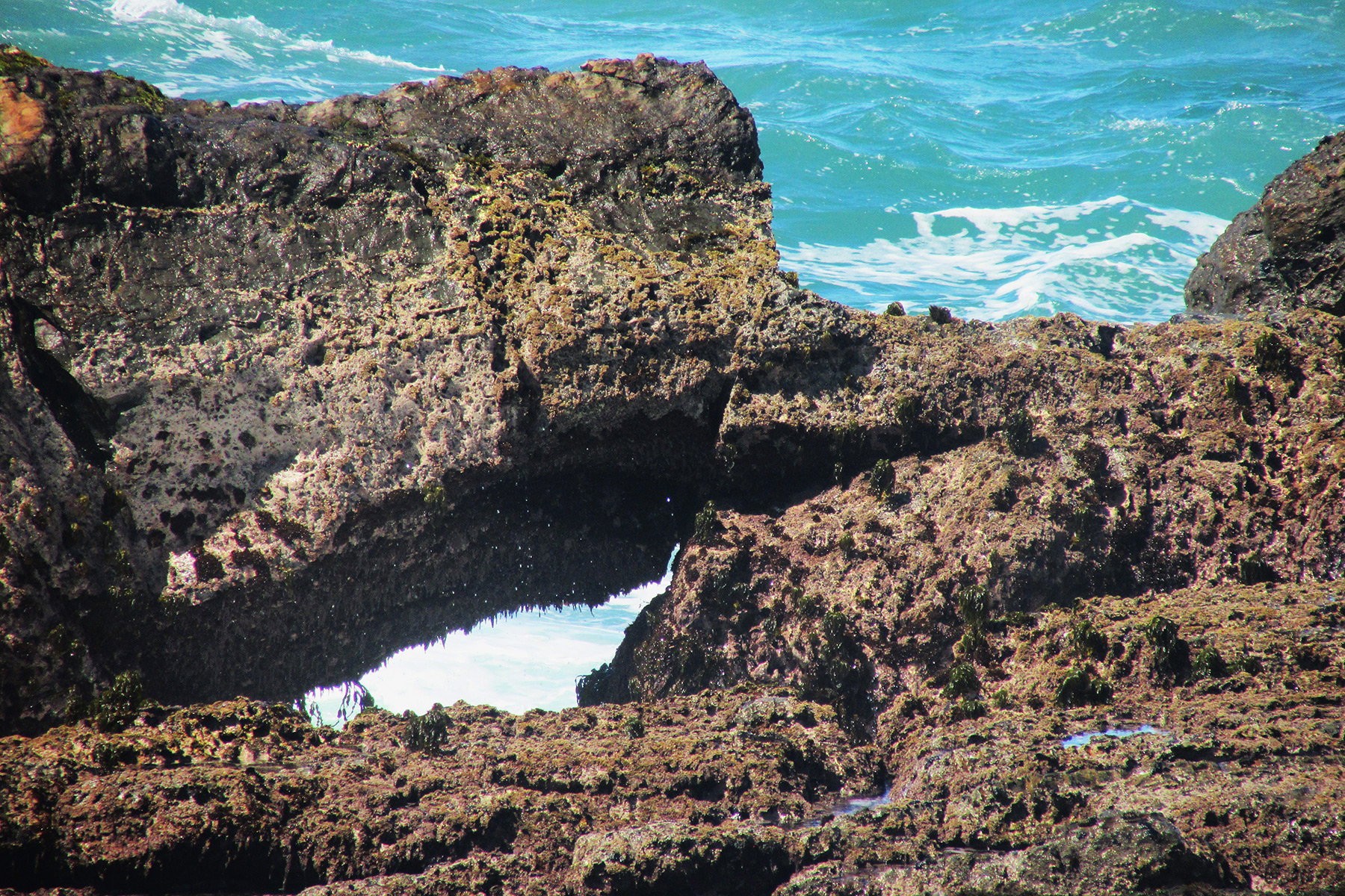
South on the trail can be seen an island called “Sea Lion Rock” which contains two arches, 10S-436670-4310055, 30×20 feet, and 10S-436730-4309980, 20×5 feet, Photos 4 and 5:

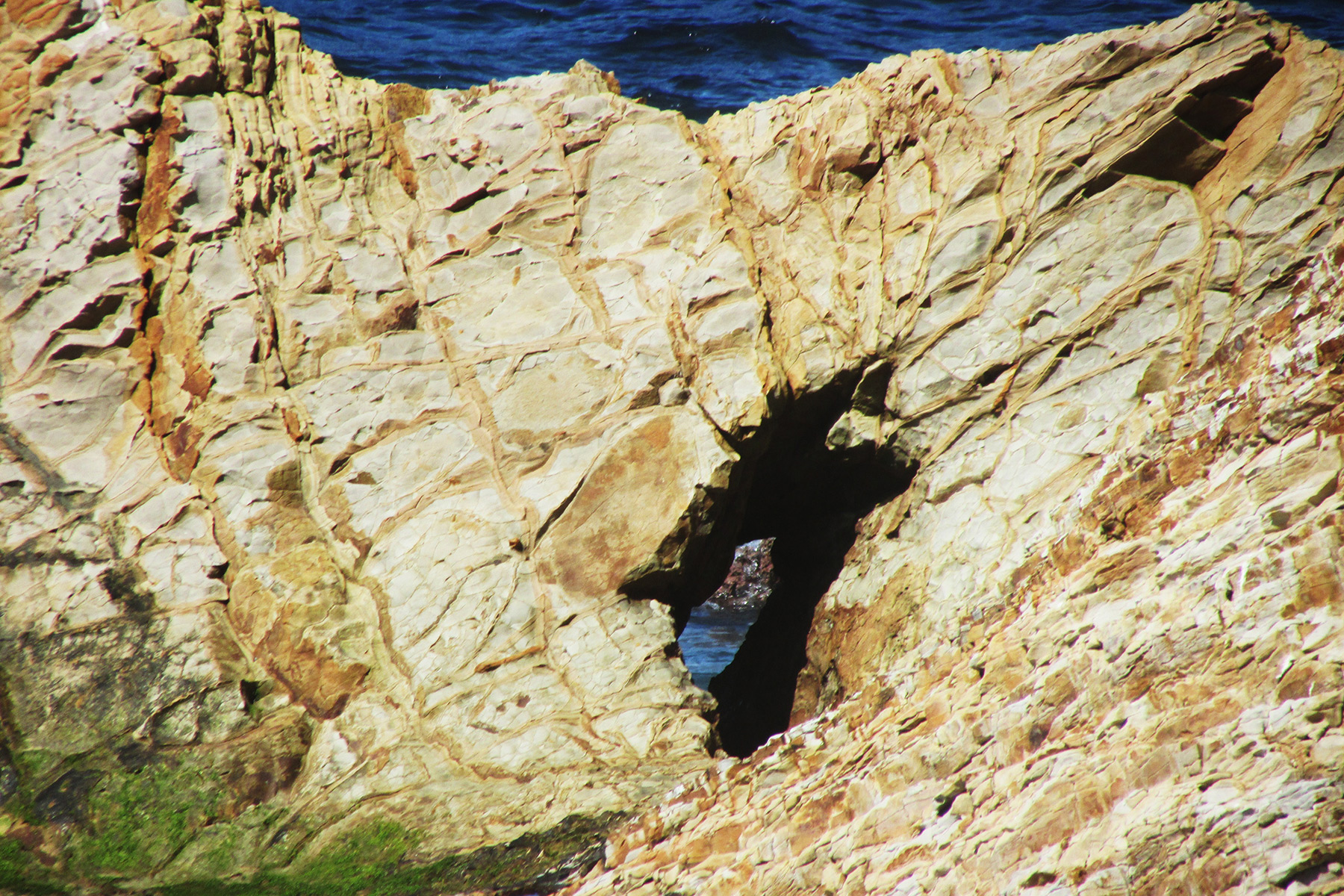
Further south along the trail near some trees is a sinkhole that has a sea arch with a pillar inside it, 10S-437040-4309680, 15×8 feet, Photo 6:
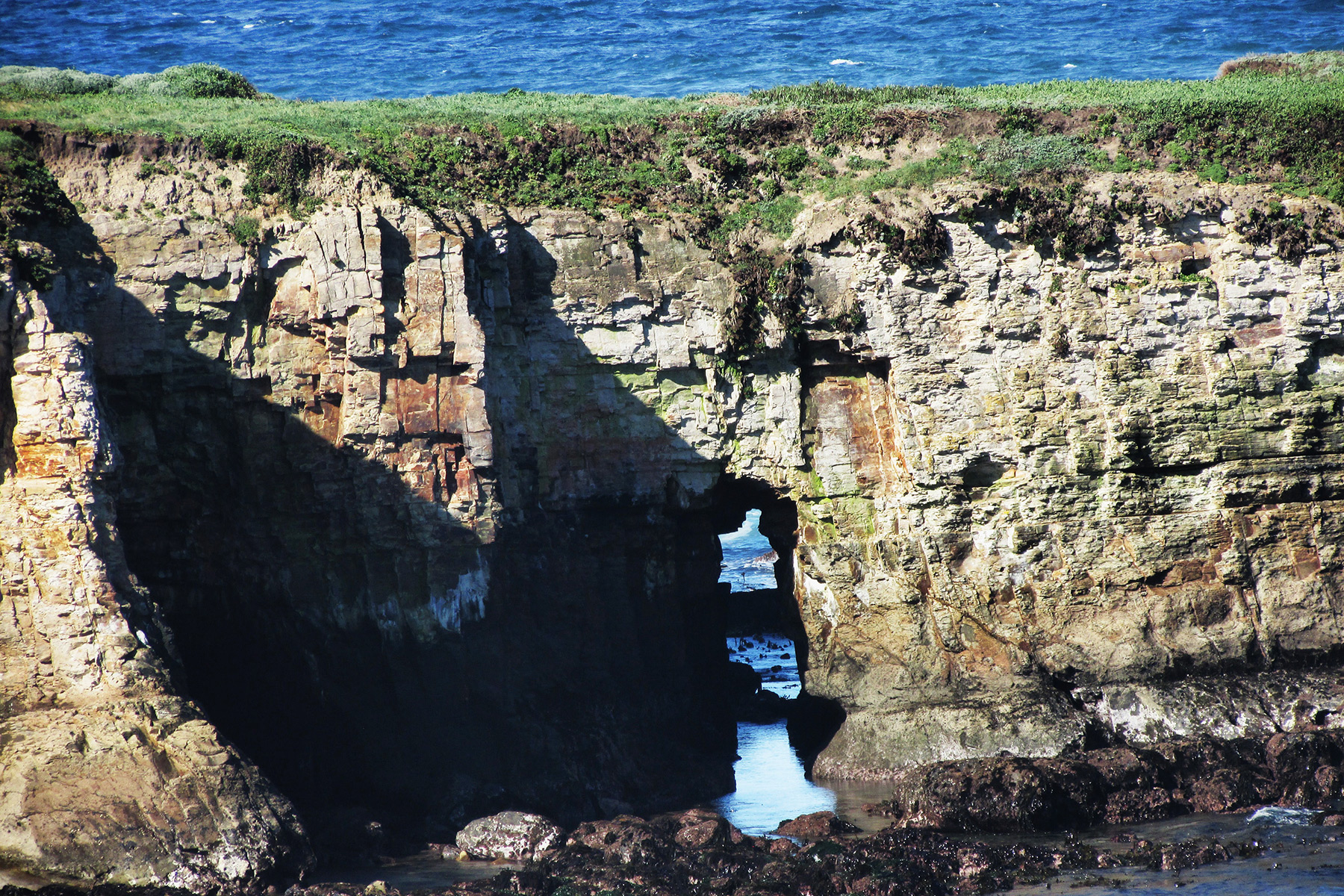
The trail soon crosses a creek, then goes up hill, and then goes around an agricultural conservation easement which is private property. The trail turns left onto a road and then goes right through a gated fence and follows the fence to the bluffs. On the bluffs on the private property side you can see an arch, 10S-436795-4309005, 10×8 feet, Photo 7:
Go south along the bluffs to the first rock outcropping to find a nice arch, 10S-436805-4308560, 30×15 feet, Photo 8:
To the left is another sea arch, 10×5 feet, Photo 9:
The second rock outcropping has 3 sea arches, one of which is a double, 30×15, 15×25, 25×40/30×20 feet, Photos 10-12:

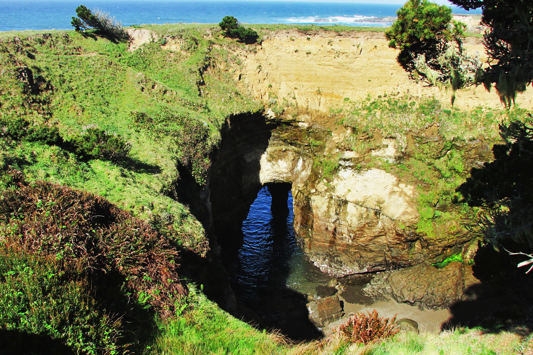
The next rock outcropping is The Hitch’n Post, 10S-436855-4308455, 20×40 feet, Photo 13:
Below the view point of The Hitch’n Post is another sea arch, 10×40 feet, Photo 14:
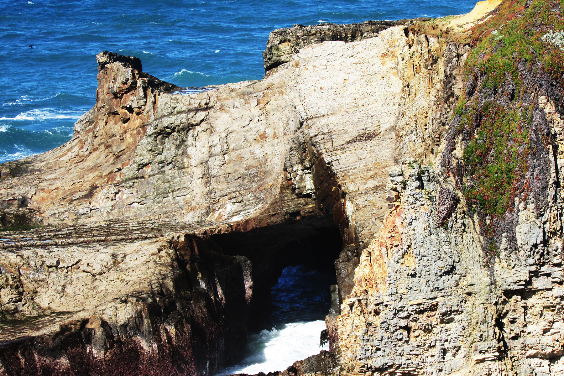
South along the bluffs is a sea arch with seaweed growing inside it, 10×30 feet, Photo 15:
Further south in a cove is sea arch which was the last one I saw, 10×8 feet, Photo 16:
Yellowstone Natural Bridge
By Robert Robinson
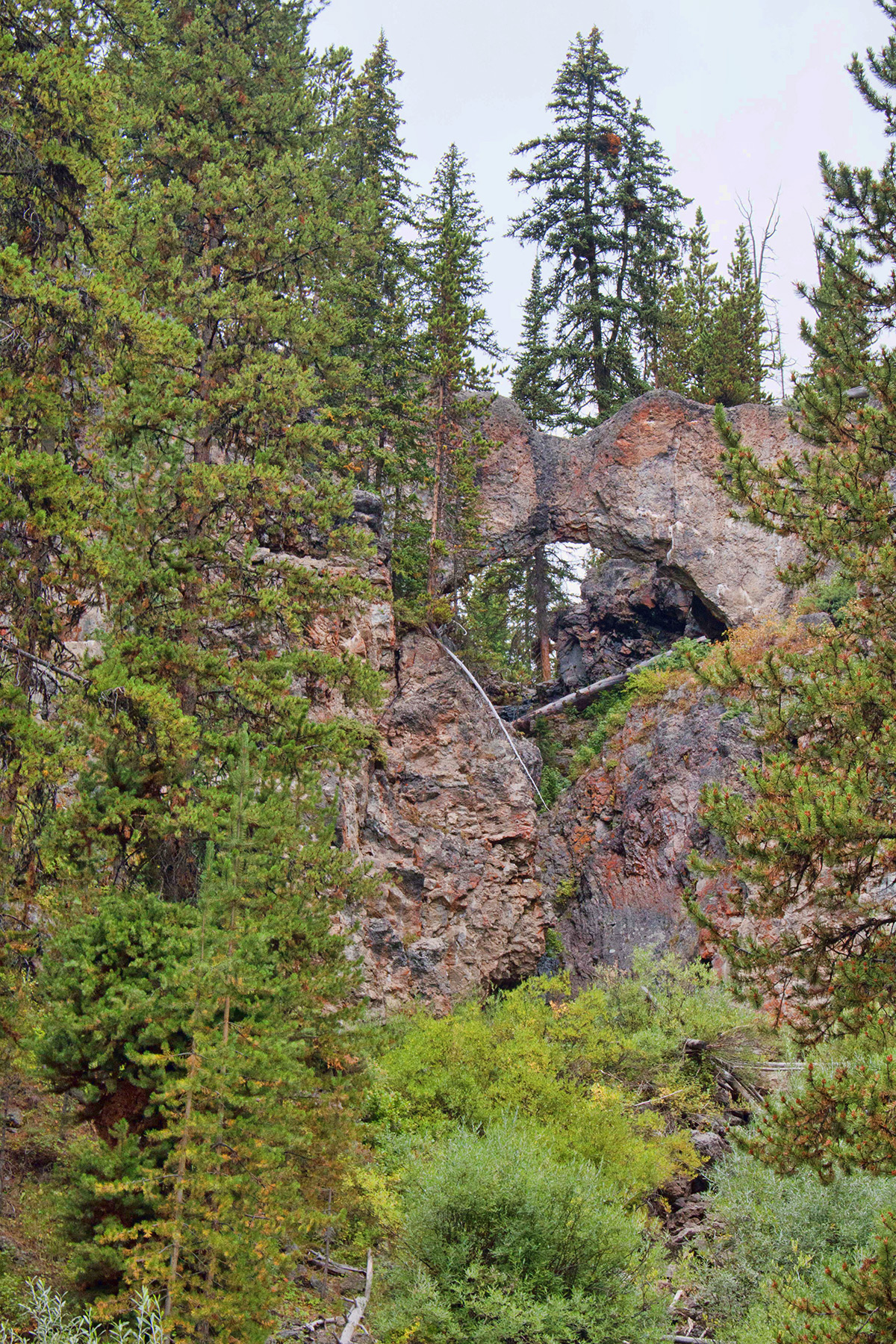
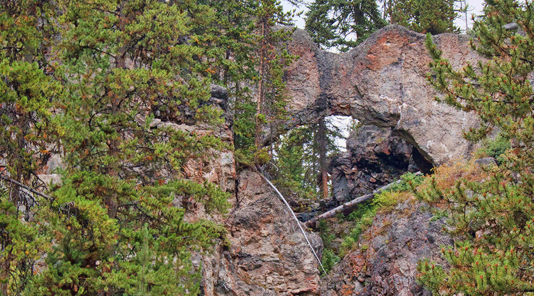
I just got back from a trip to the Tetons and Yellowstone, and, of course, I made a point of hiking to Yellowstone Natural Bridge (NABSQNO 12T-543257-4930475).
A loop trail completely encircles the area where the bridge is, including going to the back side of the bridge from how I first saw it. At one point the trail goes near the top of the bridge and it was while I was standing there looking at the top of the bridge that I made an interesting discovery for myself.
The Natural Bridge of Yellowstone is actually a double bridge. The informational bulletin board down below the bridge mentions its height and span at about 51 feet and 29 feet respectively, but doesn’t say anything about it’s being double.
What I discovered is that behind the span that I first saw when hiking to the bridge there’s a good-sized crack that goes all the way through separating this front span from a second span that has a tree growing on it. As you can see from the first photo below, the front span has a rather narrow width and is almost pointed on top, while the second span is wider and more squared off. To get the photo of the top of the double bridge, I was standing up against the “Keep Off the Bridge” sign that the Park Service placed to one side of the bridge to keep visitors from walking on top or across the spans.
In Vreeland’s Nature’s Bridges and Arches Volume 19 he mentions the double nature of this waterfall-type natural bridge and gives the widths of the two lintels as 2 feet and 5 feet.
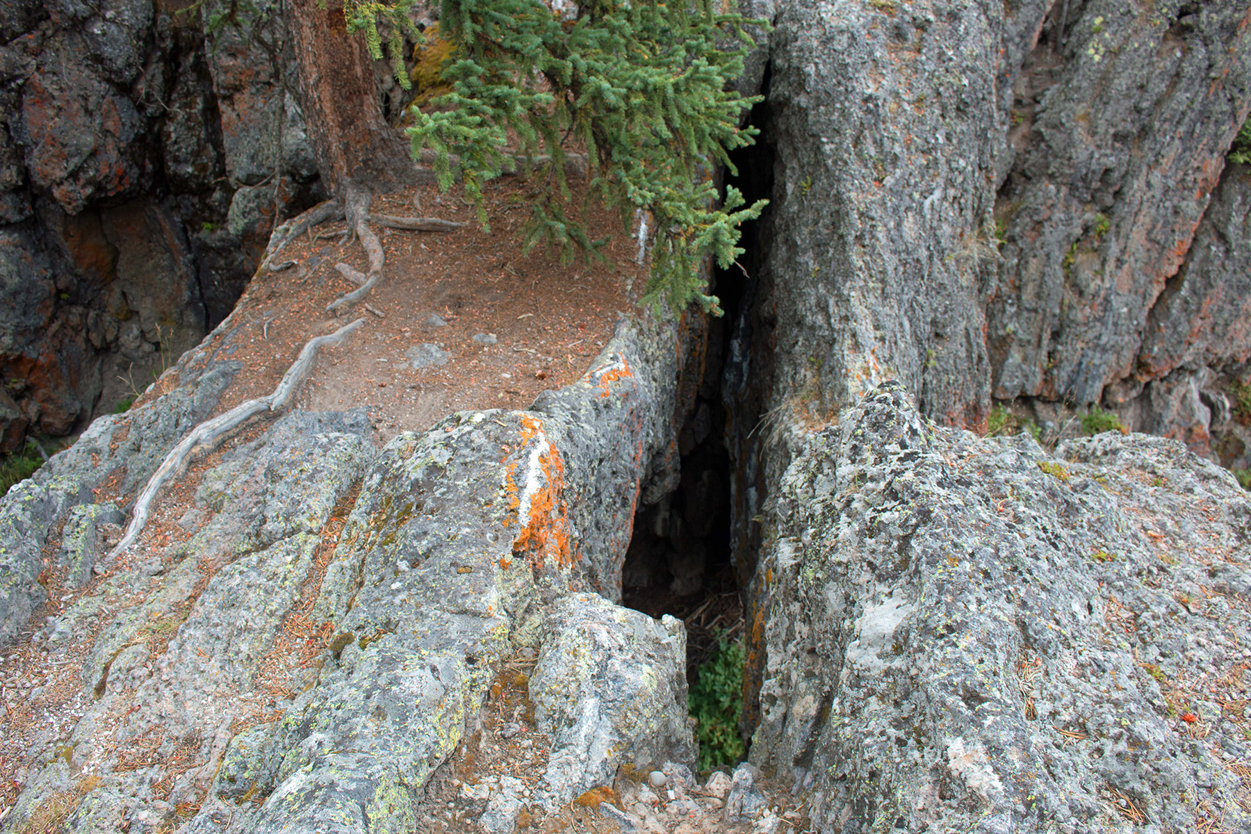 The photo above shows the double nature of the span. The photo below shows the view from the standard approach.