Deprecated: WP_Translation_Controller::load_file(): Implicitly marking parameter $locale as nullable is deprecated, the explicit nullable type must be used instead in /homepages/4/d577990729/htdocs/blog/wp-includes/l10n/class-wp-translation-controller.php on line 101
Deprecated: WP_Translation_Controller::unload_file(): Implicitly marking parameter $locale as nullable is deprecated, the explicit nullable type must be used instead in /homepages/4/d577990729/htdocs/blog/wp-includes/l10n/class-wp-translation-controller.php on line 156
Deprecated: WP_Translation_Controller::unload_textdomain(): Implicitly marking parameter $locale as nullable is deprecated, the explicit nullable type must be used instead in /homepages/4/d577990729/htdocs/blog/wp-includes/l10n/class-wp-translation-controller.php on line 201
Deprecated: WP_Translation_Controller::is_textdomain_loaded(): Implicitly marking parameter $locale as nullable is deprecated, the explicit nullable type must be used instead in /homepages/4/d577990729/htdocs/blog/wp-includes/l10n/class-wp-translation-controller.php on line 243
Deprecated: WP_Translation_Controller::translate(): Implicitly marking parameter $locale as nullable is deprecated, the explicit nullable type must be used instead in /homepages/4/d577990729/htdocs/blog/wp-includes/l10n/class-wp-translation-controller.php on line 263
Deprecated: WP_Translation_Controller::translate_plural(): Implicitly marking parameter $locale as nullable is deprecated, the explicit nullable type must be used instead in /homepages/4/d577990729/htdocs/blog/wp-includes/l10n/class-wp-translation-controller.php on line 297
Deprecated: WP_Translation_Controller::locate_translation(): Implicitly marking parameter $locale as nullable is deprecated, the explicit nullable type must be used instead in /homepages/4/d577990729/htdocs/blog/wp-includes/l10n/class-wp-translation-controller.php on line 397
Deprecated: WP_Translation_Controller::get_files(): Implicitly marking parameter $locale as nullable is deprecated, the explicit nullable type must be used instead in /homepages/4/d577990729/htdocs/blog/wp-includes/l10n/class-wp-translation-controller.php on line 430
Deprecated: WP_Translation_File::create(): Implicitly marking parameter $filetype as nullable is deprecated, the explicit nullable type must be used instead in /homepages/4/d577990729/htdocs/blog/wp-includes/l10n/class-wp-translation-file.php on line 84
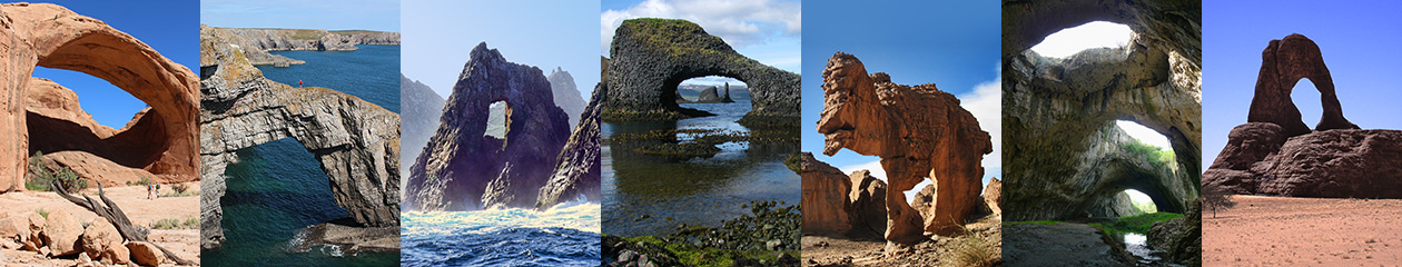
Deprecated: wp_getimagesize(): Implicitly marking parameter $image_info as nullable is deprecated, the explicit nullable type must be used instead in /homepages/4/d577990729/htdocs/blog/wp-includes/media.php on line 5502 NABS Blog | Natural Arch and Bridge Society | Page 2
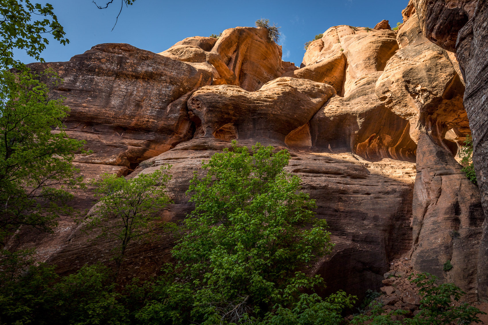
Red Butte Wilderness is adjacent to and south of the Kolob Section of Zion National Park. Red Butte Wilderness was created in 2009, contains 1,537 acres, and gets little visitation. There are no trails in the area and it’s very brushy.
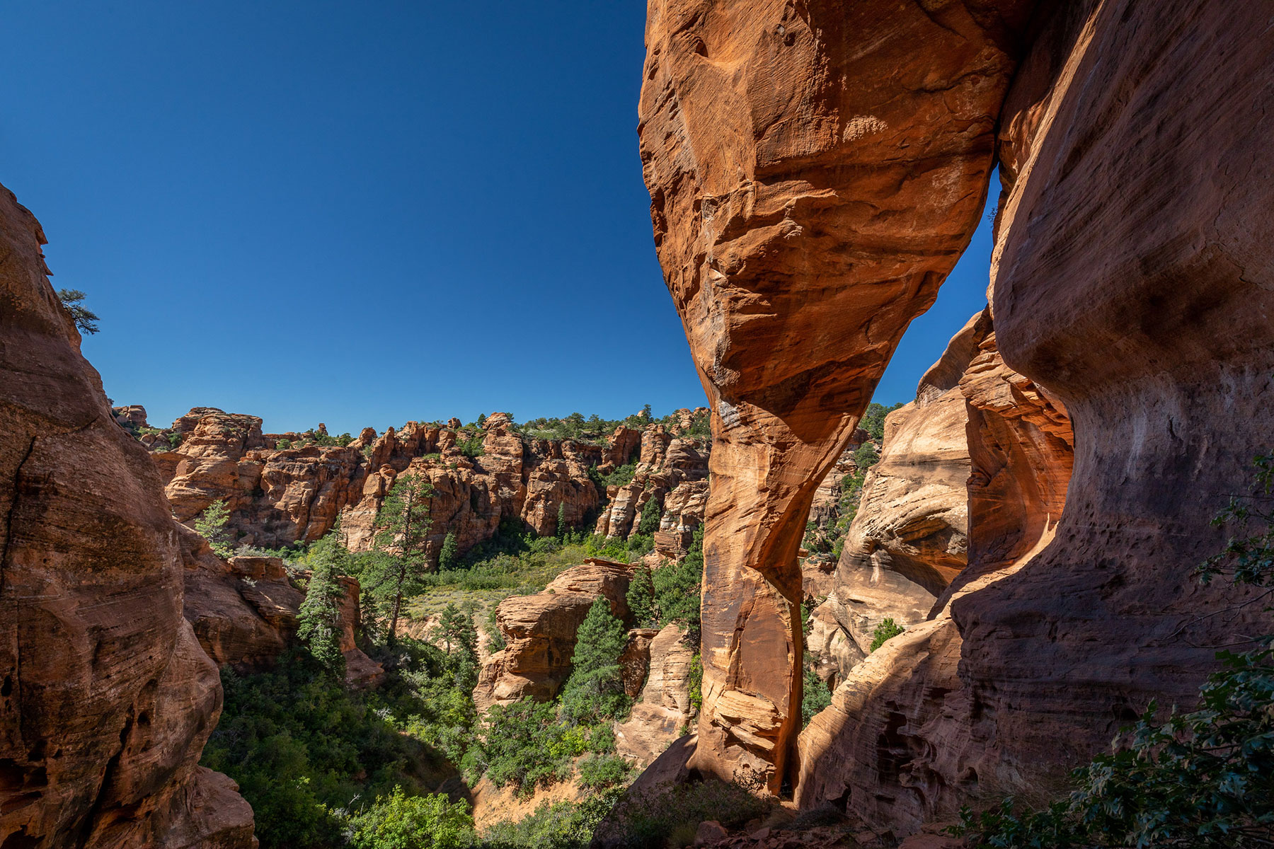
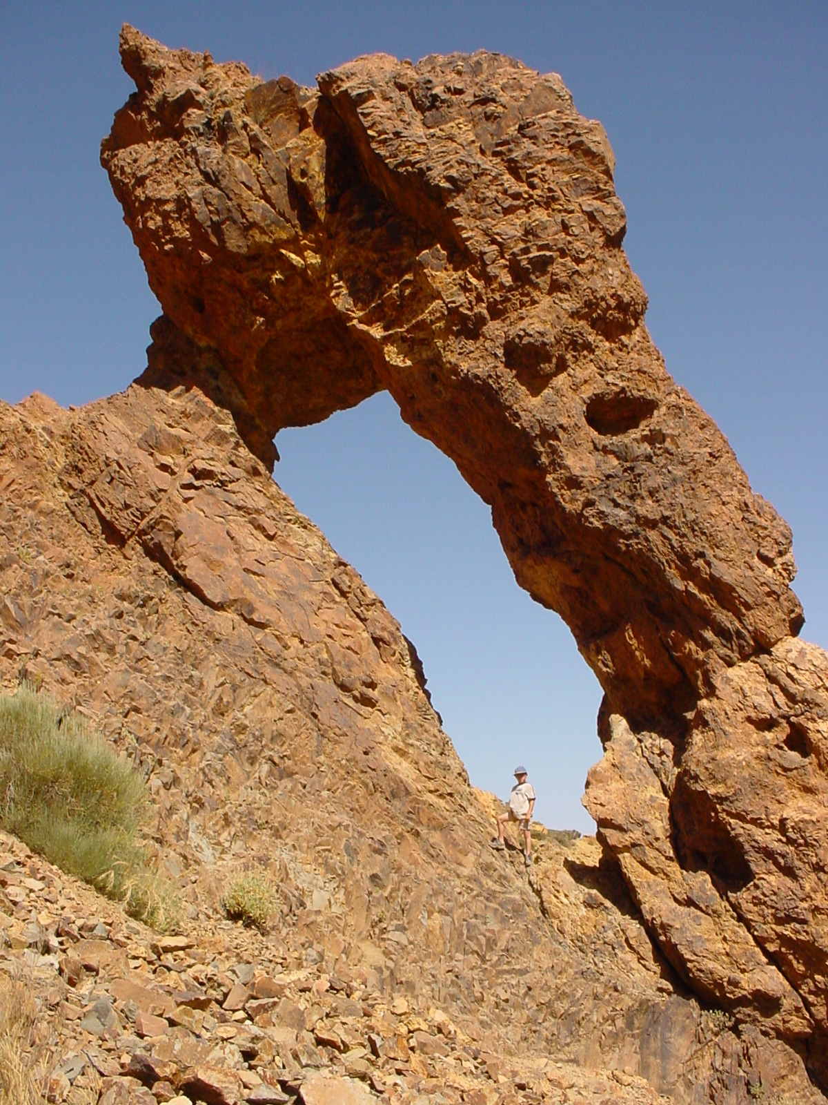
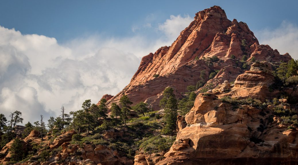
Red Butte itself contains an arch (top and next two photos). The Butte has an elevation of 7,420 feet and rises 1,800 feet above the Kolob Reservoir road about 10 miles north of the Virgin River. The coordinates for the Butte are 12S-309870-4137310. It’s a technical climb to actually attain the arch.
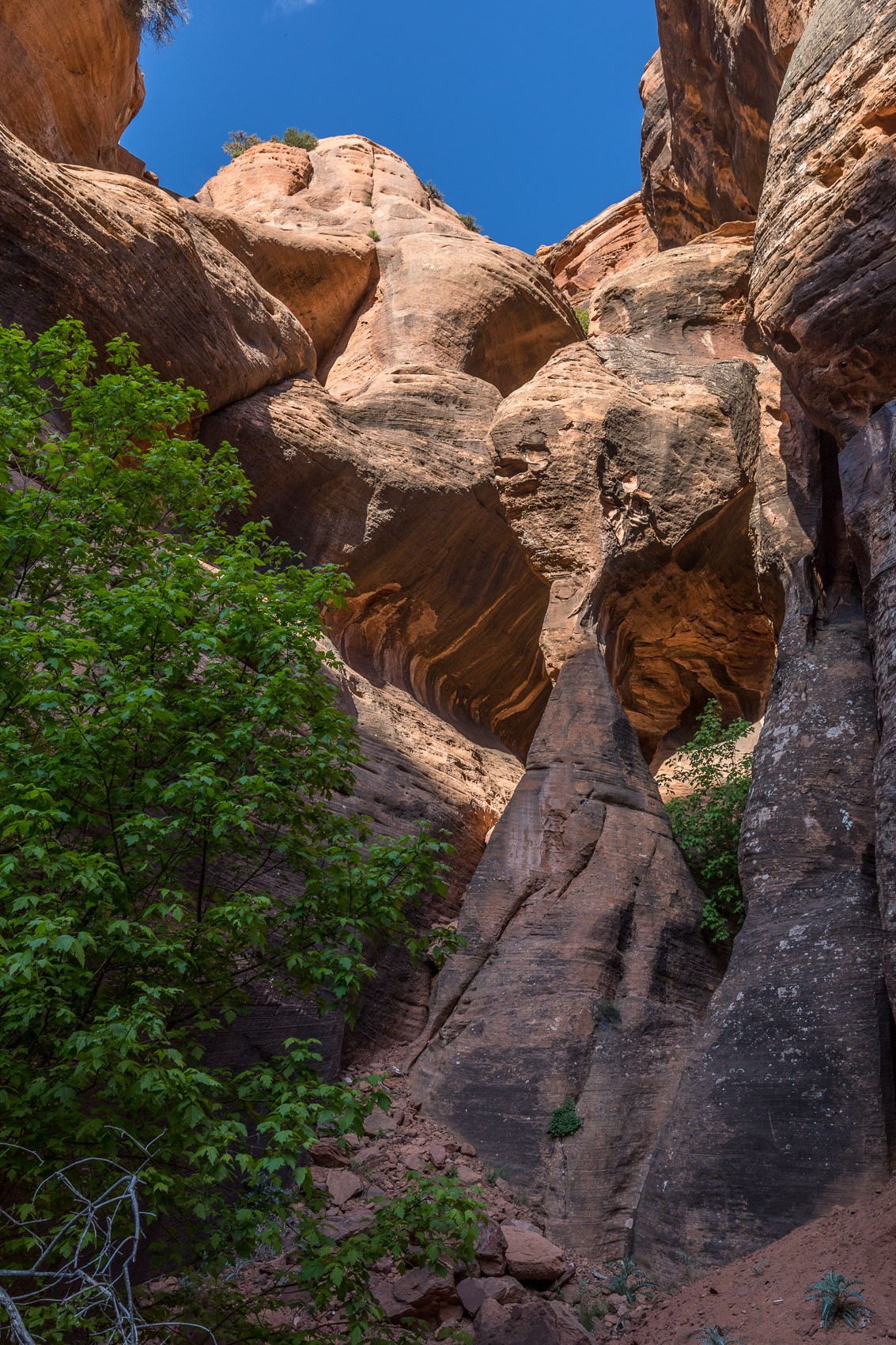
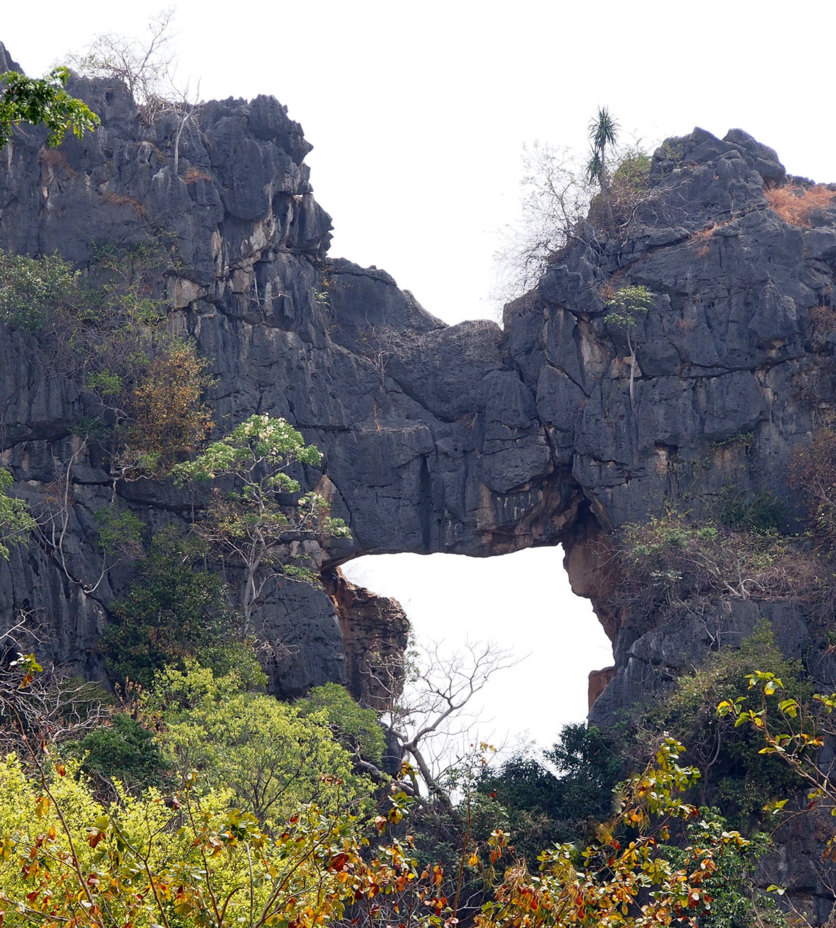
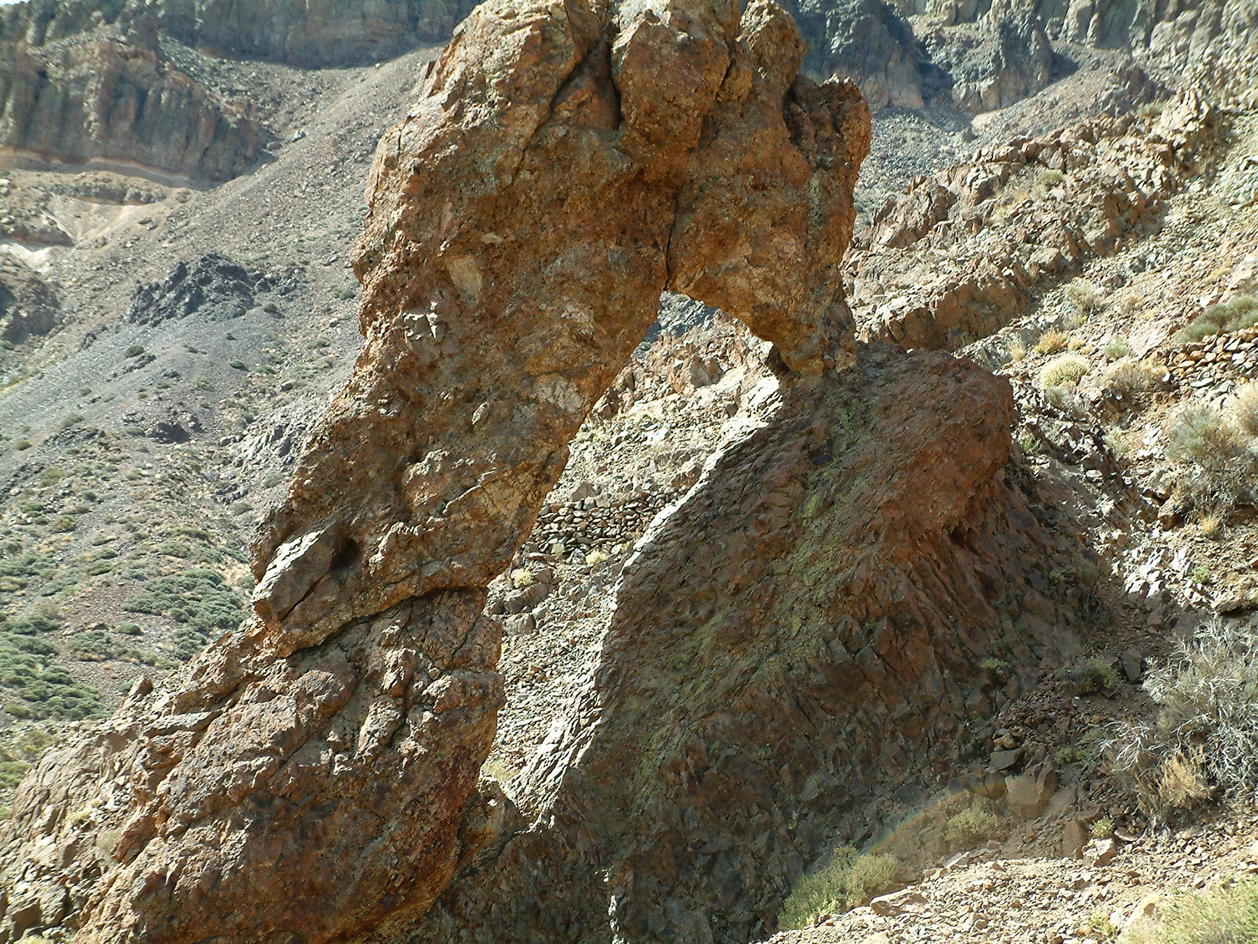
I have (so far) found three other arches in Red Butte Wilderness. The first arch, which I’m referring to as Fisher Arch, is high above the canyon floor and is situated in a position where it doesn’t get sunlight for much of the day. Despite being a very large arch it blends in with the background and as a result is not easily noticed. The first time I saw it I was far away and only had a wide angle lens. Even looking at the pictures later, zoomed up on my computer, I could not tell for sure if it was an arch. So it nagged at me for almost a year before I went back to check it out and take the photos below.
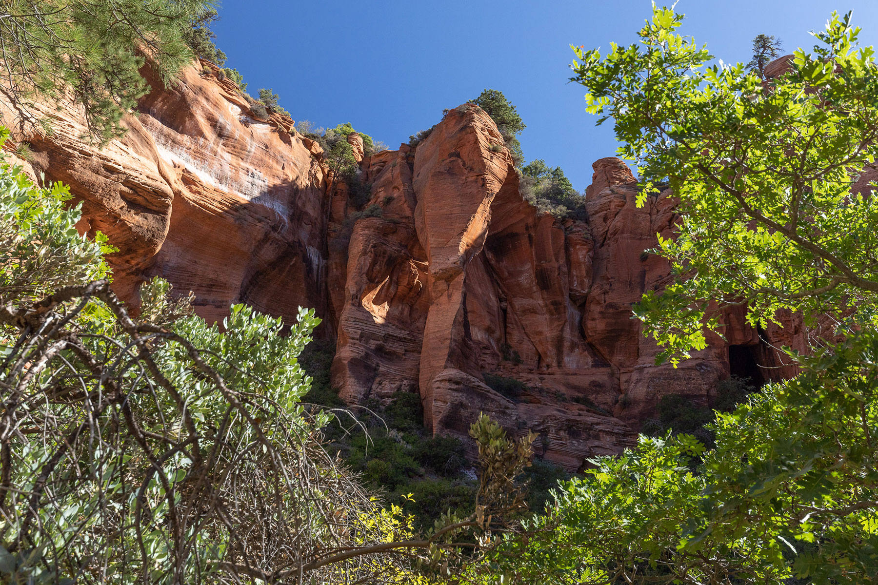
Approaching Fisher Arch.
Closer view of Fisher Arch.
I recorded the coordinates with Gaia GPS on my phone (12S-309643-4136684) and took measurements as best I could with a laser meter (it’s approximately 65 feet high and around 30 feet at it’s widest). It’s not easy to move around the arch but it can be reached with a bit of a class 3+ scramble. The view from behind is shown below.
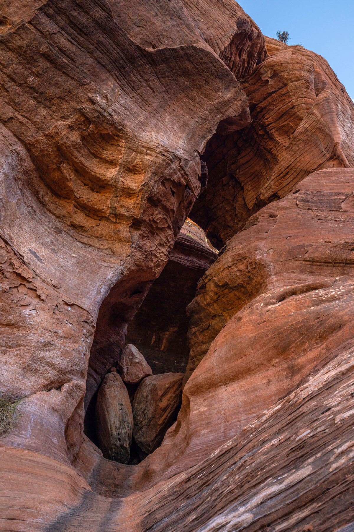
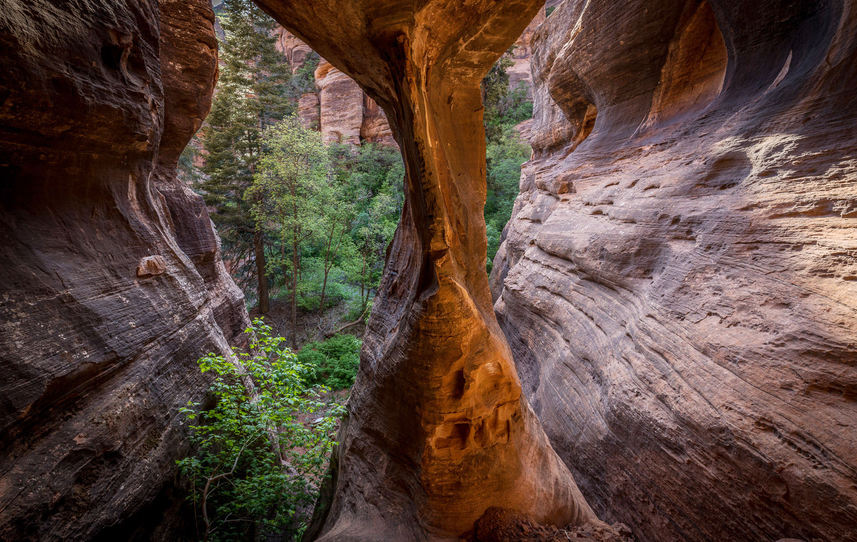
The second arch I thought this was just an interesting hole in the cliff until I got close and noticed it was separated from the wall behind it. I call it Pietila Arch and the coordinates are 12S 309935 4136444. the height is about 44 feet from below the boulders, and the span is about 20 feet. I tried to climb up the front entrance but the boulders in the photo below are about 10 feet high and I wasn’t able to get up them.
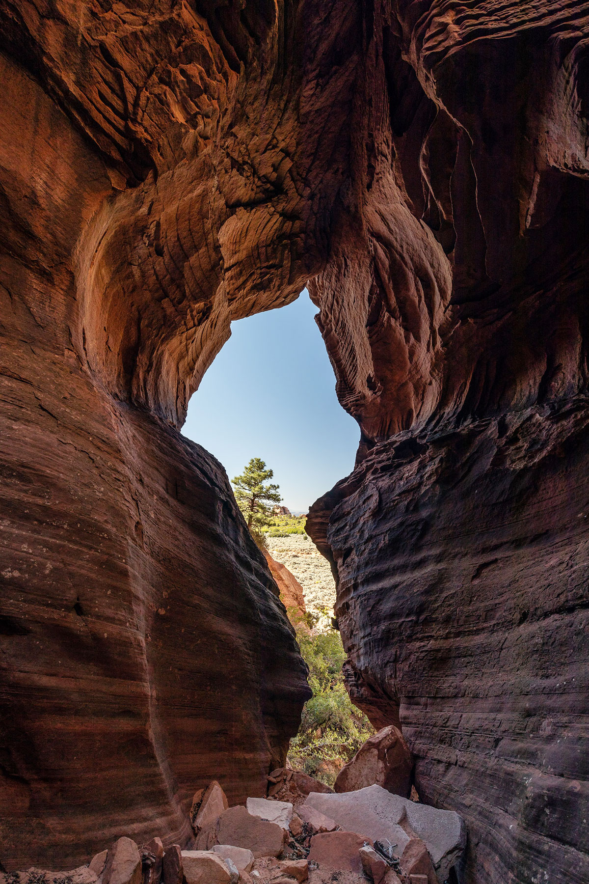
But the back side can be reached via some steep scrambling through brush and sand. Behind is is a nice little slot canyon shaped like a combination of a “V” vertically and a footprint like an “L” so water flows through here in storms. The photo below is looking through the arch from the back side.
In the photo above, you can see the arch in the center going through the rock to the left. The slot canyon goes off to the right. Another view of the arch can be seen below.
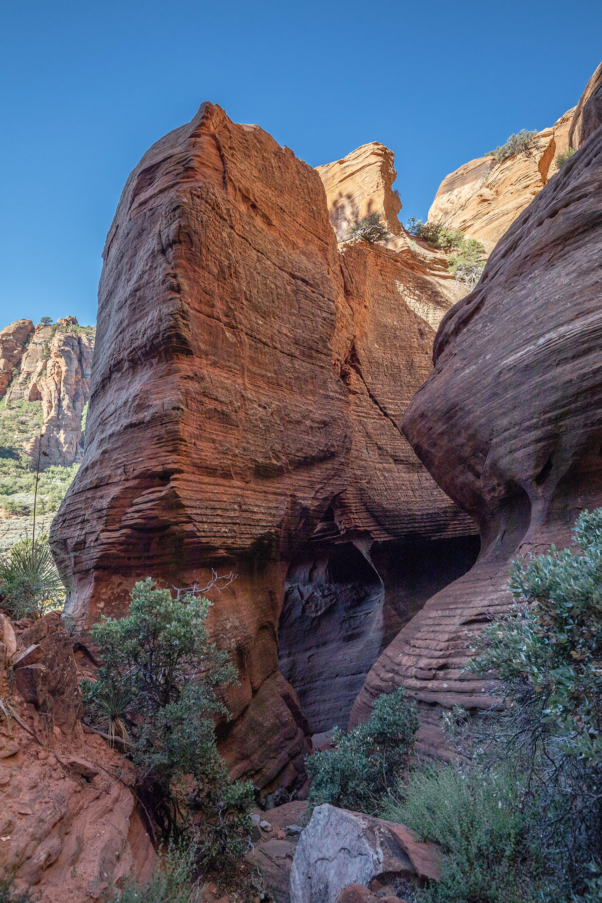
The third arch I call Adams Arch. It is a small one (about 8 feet by 8 feet) but is quite pretty once you are up inside it. It’s up on a wall, again, on the east side of the hidden canyon behind Red Butte. The coordinates are 12S-309584-4136809. In the approach photo below it is on the very far right.
By Roderick Wayland Bates
Associate Professor, Nanyang Technological University, Singapore
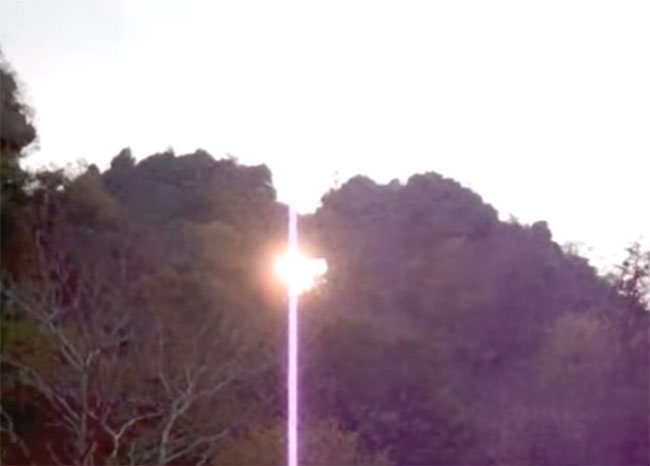
Ratchaburi is a large, mostly agricultural province to the West of Bangkok, Thailand. It is dotted with highly eroded limestone hills, many of which contain caves, and many of which host Buddhist temples. One of these hills is at Wat Tham Mongkut, surrounded by fields of sugar cane. The hill here has a small cave (tham = cave) used as a Buddhist shrine. Up at the top of the hill, overlooking the temple, is a natural arch, clearly visible driving into the grounds, and even visible if you come along the main road from the North. Although there is no easy access to the arch, Martin Ellis of the UK’s Shepton Mallet Caving Club, who maintains a database of caves in Thailand, gives a span of 10 m (32 feet) and a height of 30 m (98 feet), while giving the hill a height of 100 m (320 feet).
At the right time of year, the rising sun shines directly through the arch. You can see a video of this on YouTube (it is five minutes long and changes very little throughout). A still from the video is below.
Better late than never. Here we present a 12-minute video slide show of a NABS trip to Tassili National Park, Algeria, in 2006. Photos by Ray Millar, who had previously visited the area in 2003 so some photos from that trip are included as well. Music by Oliver Shanti.
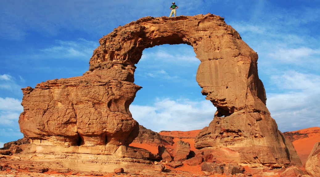
Zapato de La Reina (NABSQNO 28R-337392-3121540) is a natural arch in Teide National Park on the island of Tenerife, the largest of Spain’s Canary Islands. It is located a short walk from a parking area at kilometer 50 of the TF-21 road. It has a span of about 14 feet and a height of about 19 feet.
Teide National Park features the Teide-Pico Viejo stratovolcano that, at 3,718 m, is the highest peak in Spain. Rising 7,500 m above the ocean floor, it is regarded as the world’s third-tallest volcanic structure.
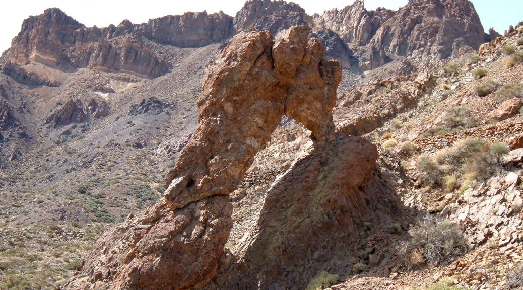
At least two other of the Canary Islands harbor arches as well. Los Arcos de Graziola is found on the island of Graciosa (photo here). There are many more, primarily collapsed lava tubes, around the coast of the island of Lanzarote.
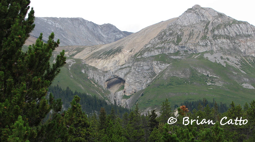
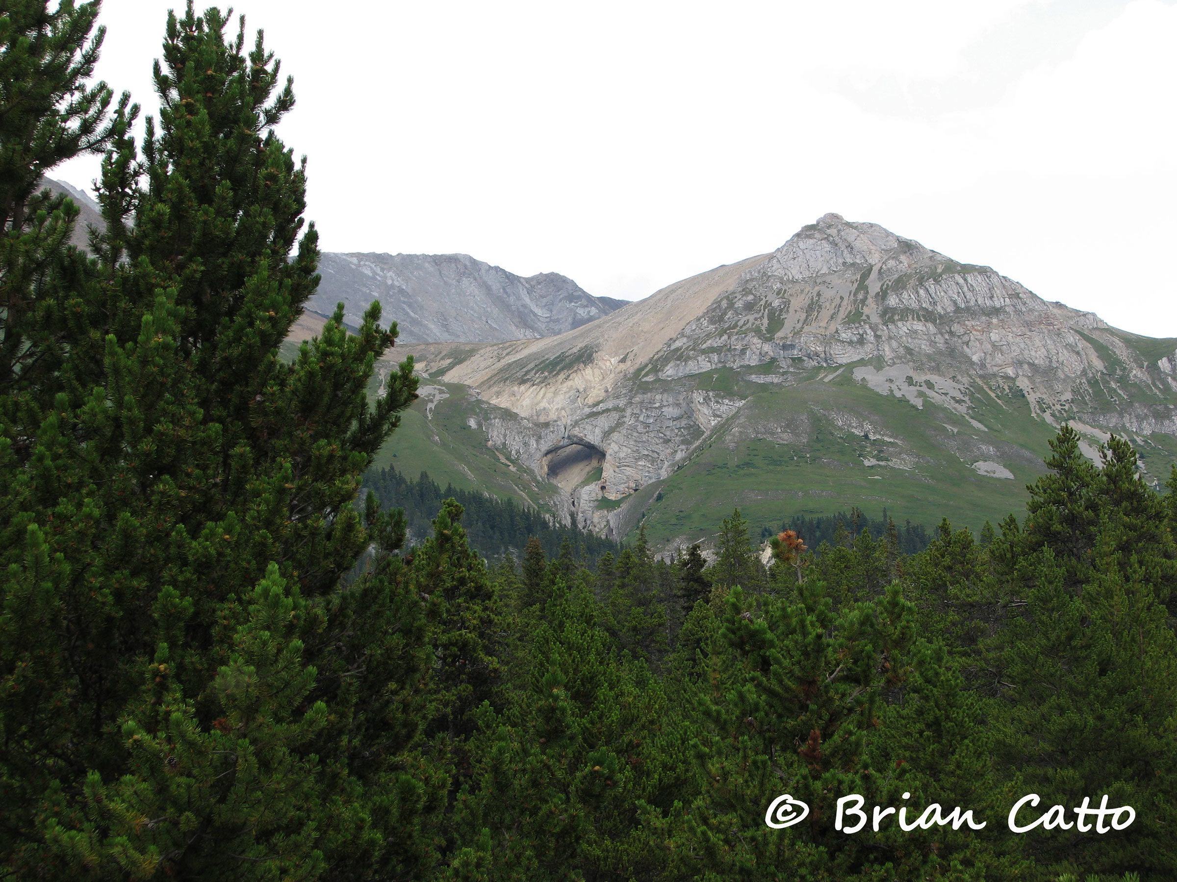
This feature known only as “Natural Arch” is carved out of Palliser limestone on the southwest slope of Mount Perce in the Canadian Rockies. The arch is located along the upper reaches of Blue Creek in northern Jasper National Park. These photos and most of the information is courtesy of Brian Catto.
The coordinates are 11U 375960 5922070 (or at least very close) and our best estimate of the span from analysis of Brian’s photos is 150 plus or minus 15 feet. The photo below is taken near Caribou Inn Hiker Camp, the closest hiker campground to the arch.
Click image for larger version.
There is a horse camp called Natural Arch right at the base of the slope below the arch, but the arch cannot been seen from the horse camp. Brian climbed up near the arch and a closer photo is below. If you click for the larger version you can see two mountain goats on top of the arch (upper right of the opening).
Click image for larger version.
The shortest route to the arch involves 40 miles of trail one-way from Rock Lake using the Willow Creek, North Boundary, and Blue Creek trails. The trails are open to hikers and horseback riders. Brian hiked in but reported that he thought the horse camps were nicer than the hikers camps. A backcountry camping permit is required from the Jasper National Park trail office.
This area of the park is closed to all human use from November through February as part of Parks Canada’s woodland caribou recovery plan. The trail up Blue Creek receives little to no maintenance and a trail bridge washout requires a stream ford which would be difficult before late in the season (late August and September). Brian describes the trip as requiring a lot of “planning, route finding, and determination.”
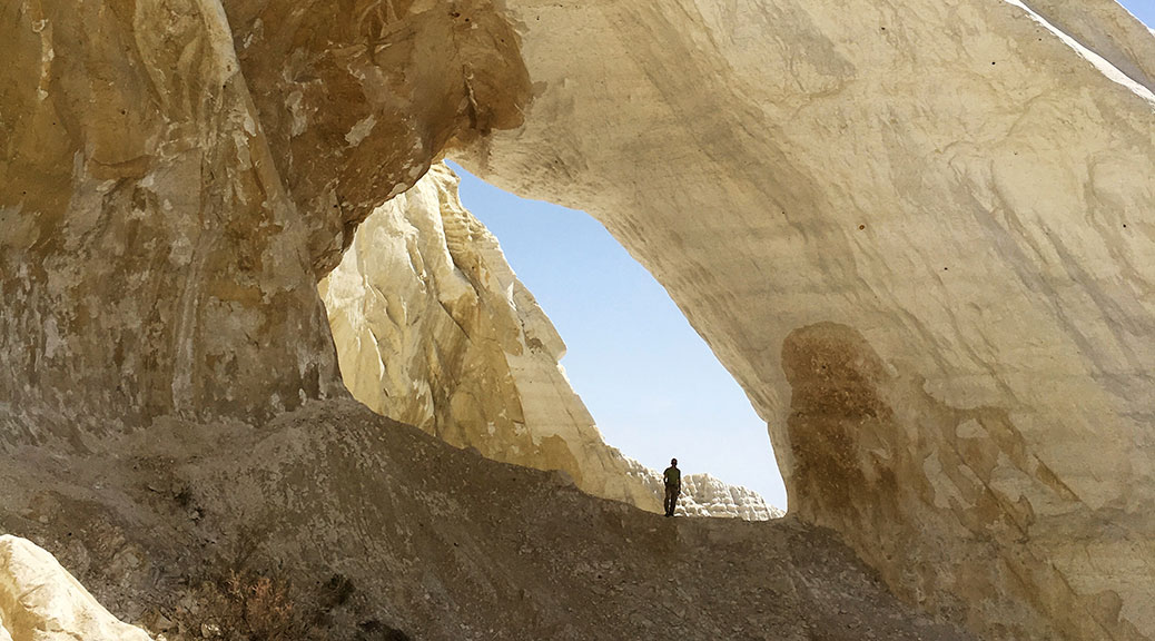
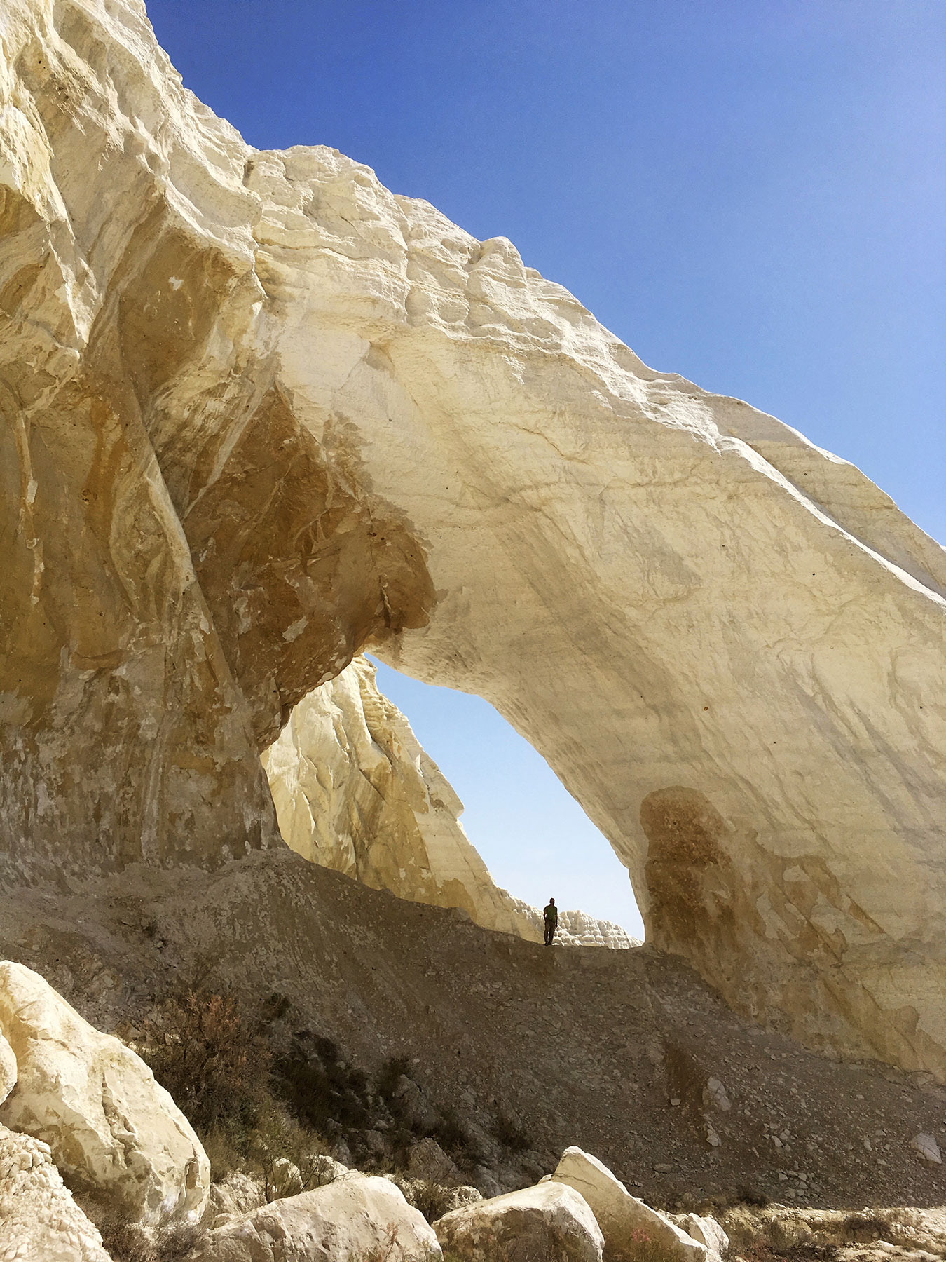
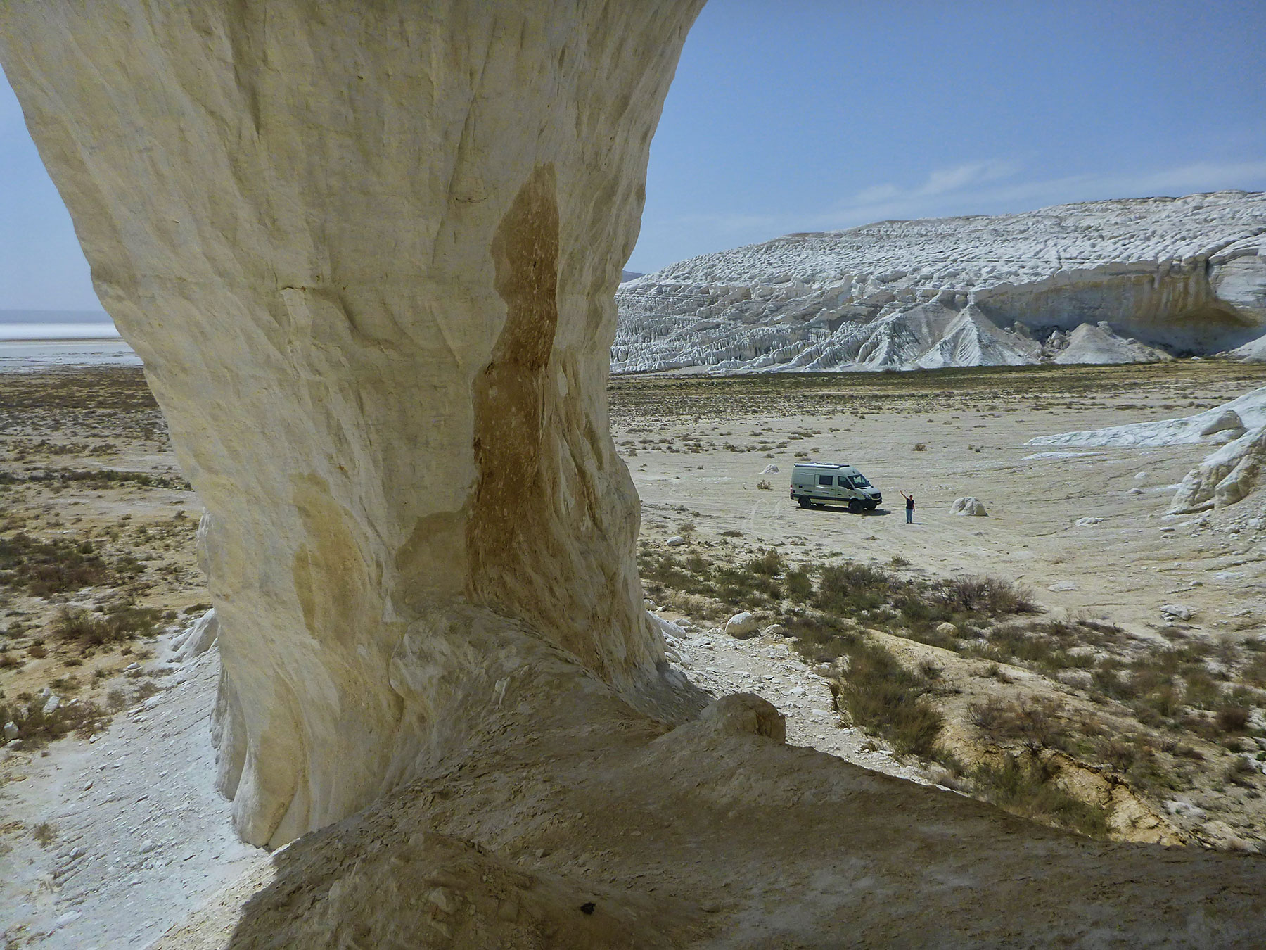
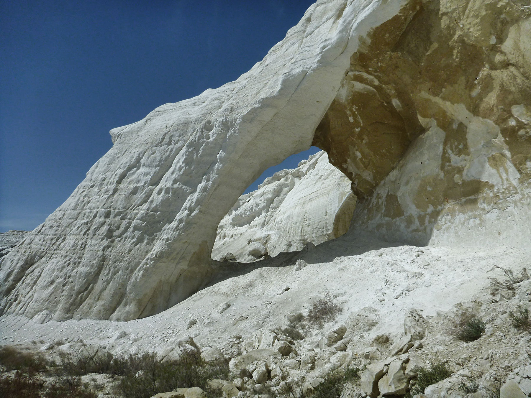
The Natural Arch and Bridge Society is indebted to Niklaus Stöcklin for reporting a natural arch in Kazakhstan. The arch is located at 39T 675930 4878720 and has a span of 40 feet.
The arch is near the city of Aktau, which is located on the east bank of the Caspian Sea. The name means “white mountain” in Kazakh, which may be due to the white cliffs that overlook the Caspian. The arch itself is in white cliffs about 40 km east of Aktau.
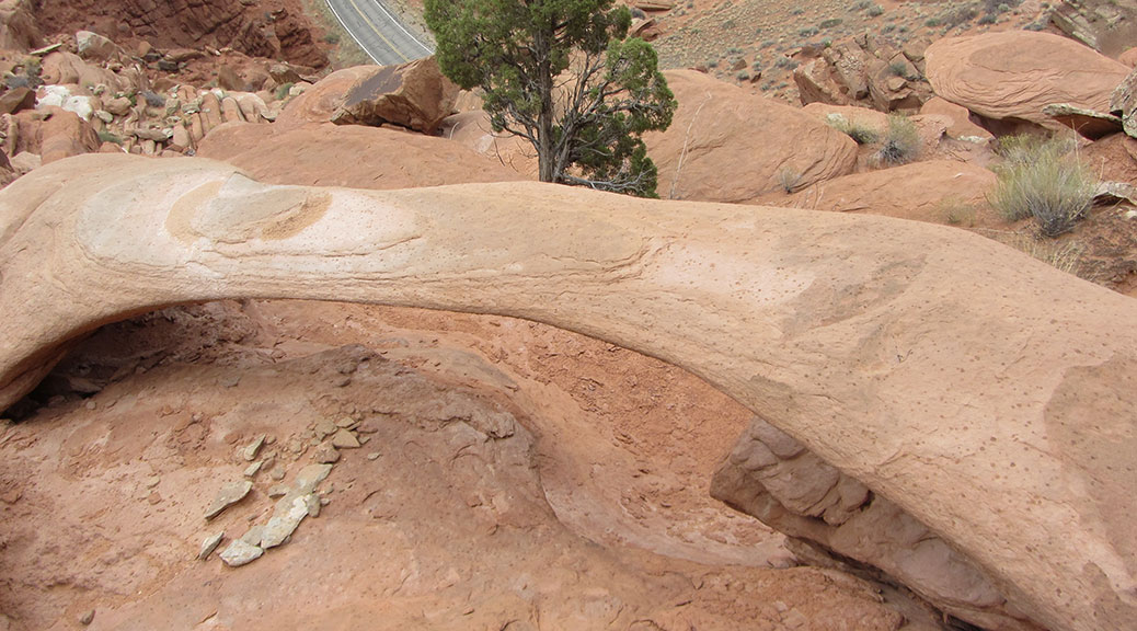
Rainbow Arch, located just above the visitor center in Arches National Park, collapsed sometime this winter. A park ranger noticed it was no longer standing during a hike in February. The arch was cataloged by Stevens and McCarrick as SA-137 and had a reported span of 11.7 feet.
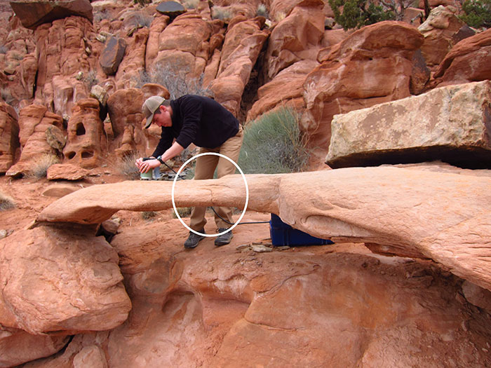
A research team from the University of Utah, including Jeff Moore and Paul Geimer, had actually been studying this arch not long before the collapse. The “before collapse” photos here were taken by Jeff Moore, and the “after collapse” photos were taken by Paul Geimer. The “before-after” comparison below was assembled by Holly Walker.
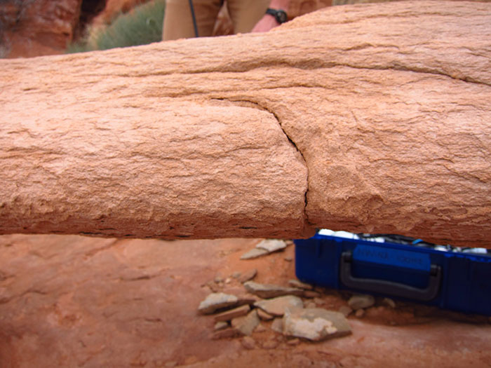
The team made vibration measurements four times at the site in 2017, focusing on a prominent crack working through the center of the span that appeared to be putting the structure in jeopardy. The crack is circled in the photo below.
Close-up photo of the crack before collapse:
However, the team observed no changes in the crack or vibration characteristics over 12 months, and backed off on their monitoring program, believing the arch to be more stable that it appeared.
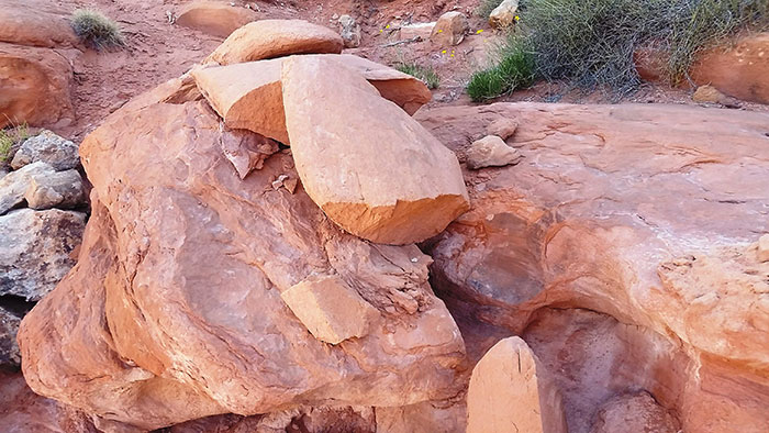
The collapse is bittersweet for the team, as it highlights and validates the fragility of these features, but unfortunately they were unable to record its last few weeks and months and identify accumulating damage.
Below is a photo after collapse.
While they can’t say for certain what caused the collapse, they believe the most likely explanation is that fatigue caused by daily and annual heating cycles finally stressed the tip of the crack enough to cause a runaway failure sometime this past winter.
Rainbow Arch lives on in the virtual world as an interactive 3D model made by the research team that can be found at https://skfb.ly/VMvB.
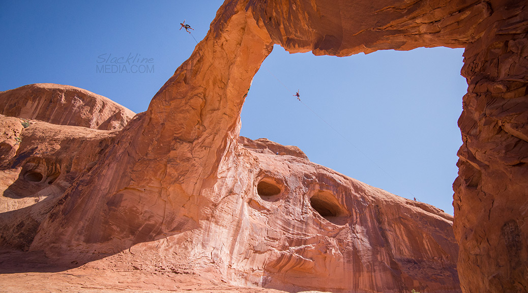
Rope swinging at Corona Arch is now a thing of the past (photo courtesy Brian Mosbaugh at Slacklinemedia.com, Instagram: @Moabmonkeys).
BLM public information officer Lisa Bryant has supplied NABS with the following statement:
BLM-Moab has restricted roped activities, including swinging, for about 37 acres of BLM administered public lands, including Corona Arch (and nearby Bowtie Arch) and Gemini Bridges. The rest of the Moab Field Office area is still open for roped activities and includes several focus areas specifically for climbing and activities such as base jumping and highlining.
Gemini Bridges and Corona Arch are two outstanding geologic formations located northeast of Moab, Utah, in spectacularly scenic settings reached by short hiking trails. Corona Arch was acquired May 8, 2014 through the Utah Recreational Land Exchange, although the hiking trail leading to the arch has always crossed BLM managed lands.
Both features have been very popular destinations for hikers, sightseers and photographers for many years. It is estimated that 40,000 people visit Corona Arch and 50,000 people visit Gemini Bridges each year. Both geological features, but especially Corona Arch, are among the most often photographed sites on BLM lands.
In recent years Gemini Bridges and Corona Arch have become popular areas for a small number of visitors engaging in roped activities, such as highlining and swinging. This had led to a number of complaints from the public about the roped activities diminishing the experience of hikers and sightseers. Recently damage to the arch has also been noted from the rigging structures and ropes. On January 6, 2016 BLM issued a decision to temporarily restrict roped activities for two years, while it looked at appropriate management for the area. Following several public comment periods and environmental reviews, and the federal rule making process, that restriction became permanent on August 17, 2017.
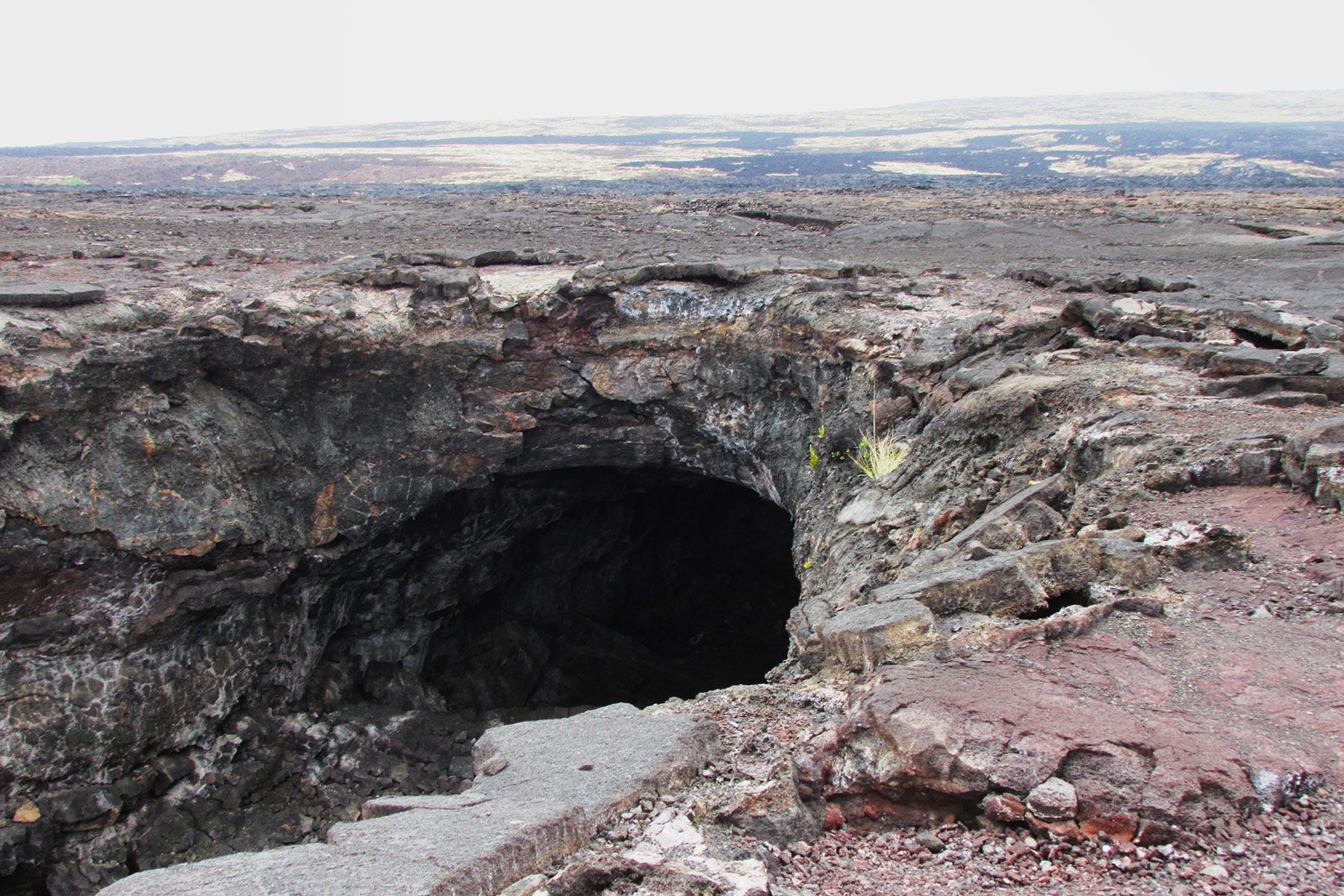
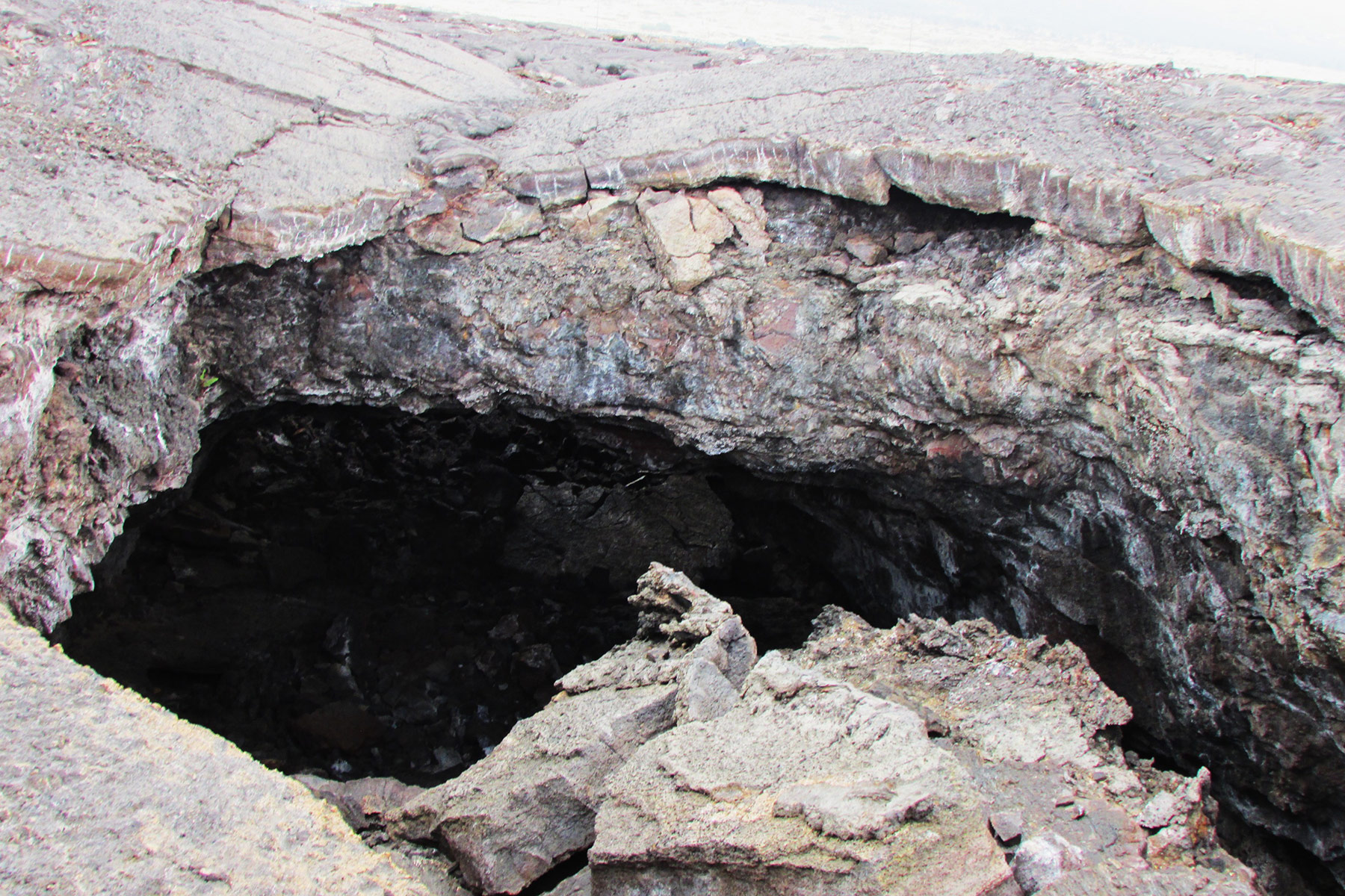
Pat and I visited the Big Island of Hawaii to do some arch hunting and snorkeling. The first day I drove from the Kailua-Kona International Airport: 2.2 miles north on State Hwy 19 there is a lava tube on the right which contains a natural tunnel (4Q-812026-2188066, estimated 50 feet);
and a lava bridge (4Q-811905-2188044, estimated 30 feet);
and another lava bridge (4Q-811901-2188039, estimated 20 feet):
On the way to Hilo we visited some beautiful waterfalls such as Kamaee Falls, Umauma Falls and Akaka Falls.
The second day I drove west to some more beautiful waterfalls such as Rainbow Falls, Peepee Falls and Wailuku Falls. Next, I drove south on State Hwy 11 to Hawaii Volcanoes National Park and then down the Chain of Craters Road to the end of the road and walked to the cliffline to see Holei Arch (5Q-279568-2134773, estimated 50 feet):
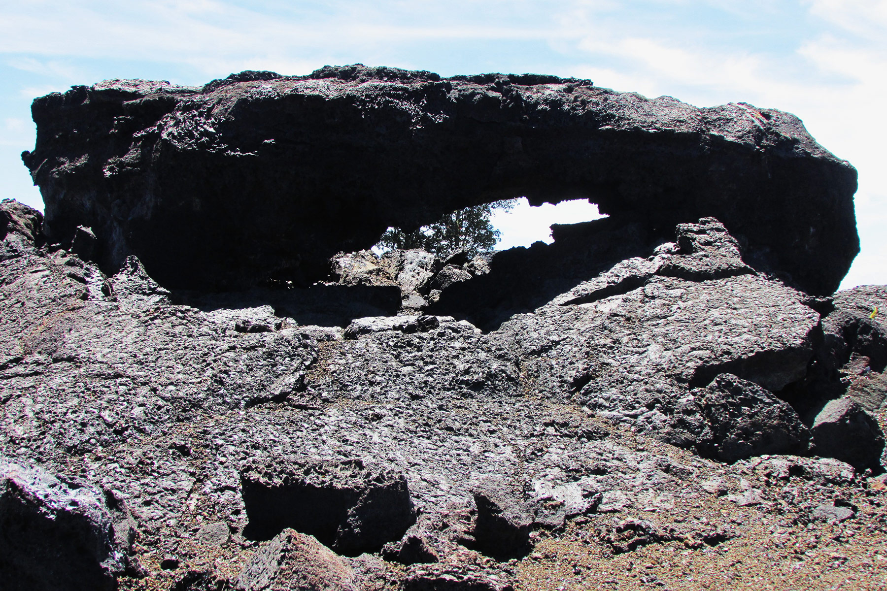
On the way back up on the Chain of Craters Road I found a natural arch at a pullout on the south side of the road and call this “Pele’s Eye” (5Q-266481-2142225, 4 feet). This arch is 14.6 mile from the end of the Chain of Craters Road or 0.4 miles past a road to Mauna Ulu:
We then visited the Kilauea caldera which is amazing.
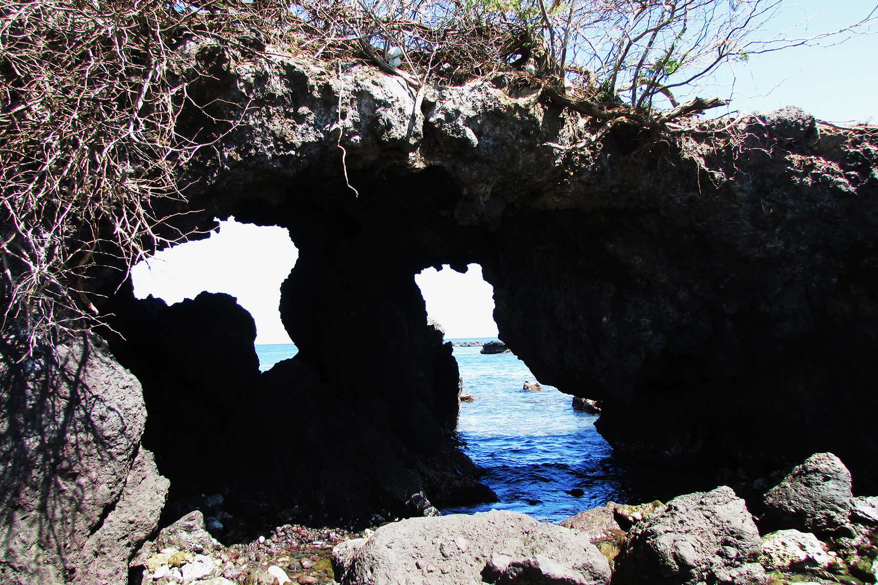
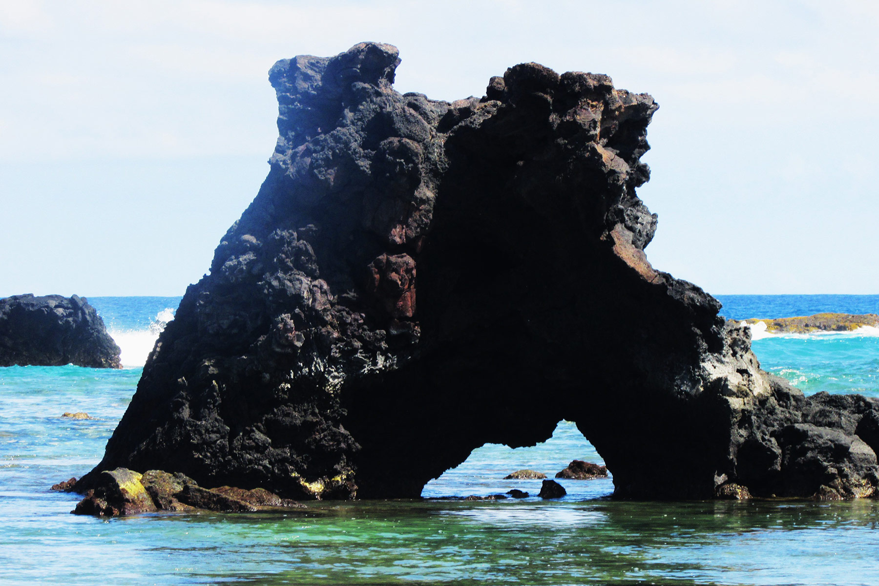
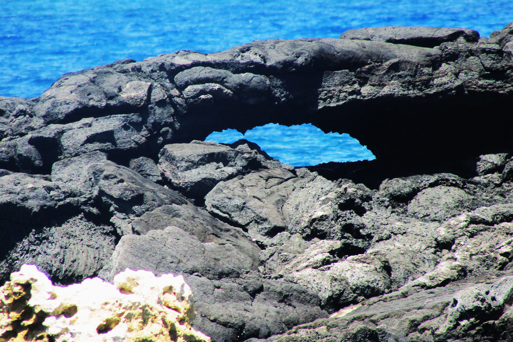
The third day I drove State Hwy 19 to Hapuna Beach and hiked south to M’s Arches (5Q-203756-2212281, estimated 4 feet and 8 feet), a nice double sea arch:
You can also reach this arch from Beach 69 (Waialea Beach) or a 4WD. The next area we visited was Kuki’o Beach which has two sea arches, each 4 feet in size (4Q-814140-2194122):
From State Hwy 19 turn west onto Kaupulehu Road and then turn left on a road (Aina Kaha Pl.), turn right before a gate up ahead and get a visitors pass from a guard. Go back to the gate and show the pass and the road will soon end at a parking area. Walk the trail to the beach. The last area was Noio Point which has two arches (5Q-911379-276932, estimated 5 feet and 20 feet). There are a dozen sea arches near Honaunau Bay that can be seen if you take a snorkel boat tour. Aloha!
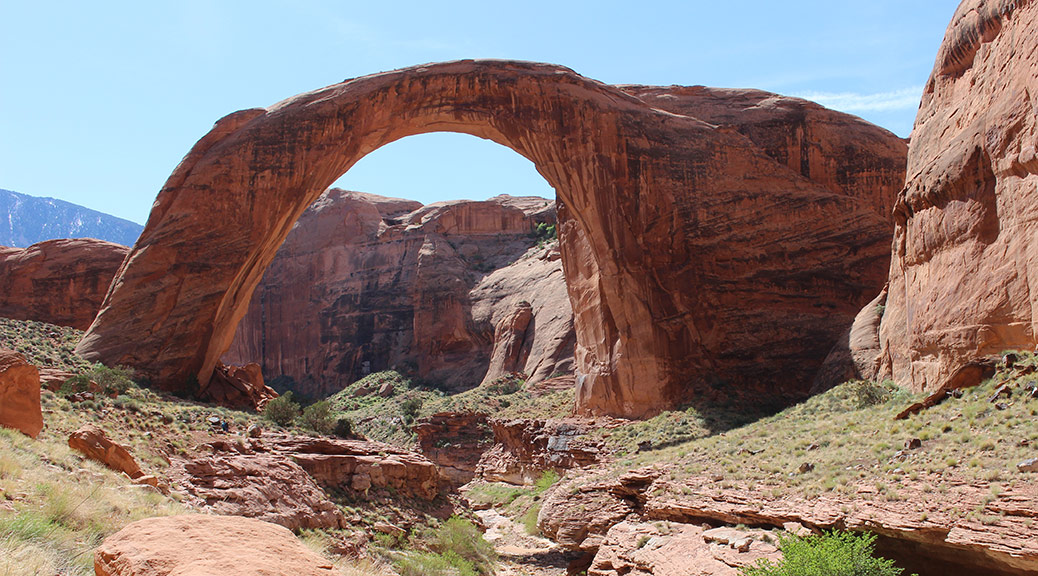
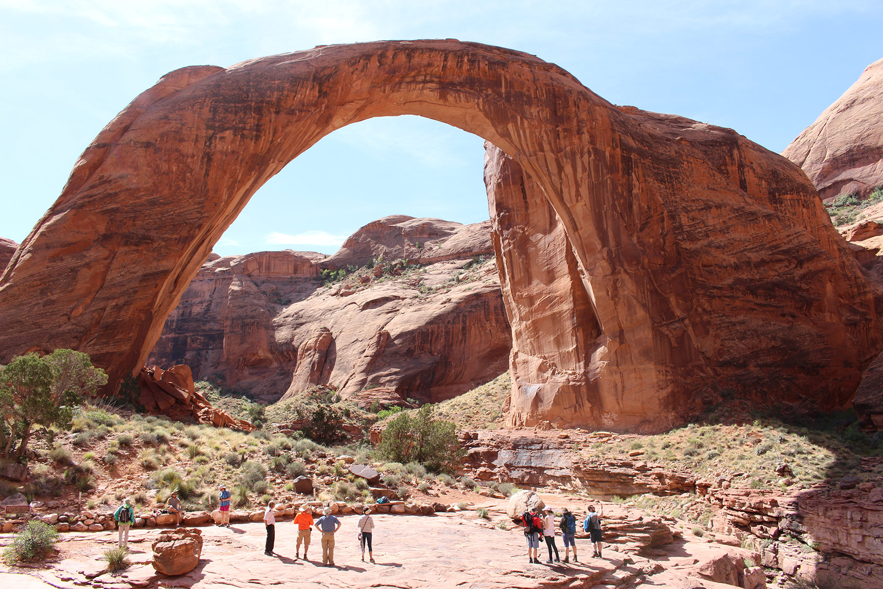
Dave Kennedy, member of the Natural Arch and Bridge Society Board of Directors and former editor of its newsletter, SPAN, wrote this article about his trip to Rainbow Bridge for the publication Our Backyard in Glade Park, Colorado, September 6, 2017.
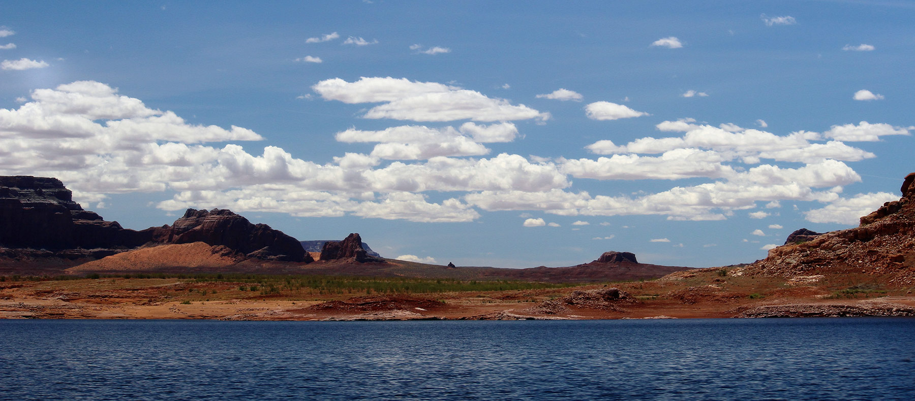
Lake Powell attracts a couple of million visitors to its blue waters and scenic red sandstone surroundings every year and about 100,000 of them make the trip to see Rainbow Bridge. This natural rock span, listed on Google Earth as the world’s largest natural bridge, though it is not, sits in Utah in a branch of Forbidding Canyon about 50 miles up-lake from Glen Canyon Dam.
The boat ride from Wahweap Marina to Forbidding Canyon, home of Rainbow Bridge, crosses Warm Creek Bay and Padre Bay, both offering outstanding photographic opportunities.
The Natural Arch and Bridge Society has a page on their website at naturalarches.org which lists the “Big 19” arches and bridges in the world known to have a span greater than 200 feet. The Society seems to be the only body to set a protocol for measuring arches, which gets to be very technical for lay people. In short, span is defined by NABS as the horizontal extent of unsupported rock and is the organization’s basis for ranking the world’s arches and bridges. The Big 19 shows that Rainbow Bridge, spanning 234 feet, is the 6th longest natural bridge in the world and the 11th longest arch in the world (all natural bridges are arches, but not all natural arches are bridges). Its height is listed at 245 feet, making it also one of the tallest natural arches in the world. The five longest natural bridges listed in the Big 19 are all located in China. Of the Big 19, nine are located in China, nine on the Colorado Plateau and one is in the Sahara Desert of northeastern Chad, Africa.
In the NABS nomenclature, Rainbow Bridge is classified as a meander bridge formed in Navajo sandstone. That geologic stratum dates to the Jurassic Period from about 145 million years ago to about 200 million years ago. The bridge soars in a huge arc over the canyon and its intermittent stream below. The reaches of Bridge Canyon stand sentinel behind it and the entire scene is watched over by 10,000’ Navajo Mountain in the background. This is an outstanding example of the fabulous and fascinating landscapes of the American southwest.
Rainbow Bridge spans 234 feet and towers 245 feet from the ground, making it the sixth longest natural bridge known to exist in the world. About 100,000 people make the trip to Rainbow Bridge National Monument every year, most by boat but many others by backpacking one of two trails from Navajo Mountain.
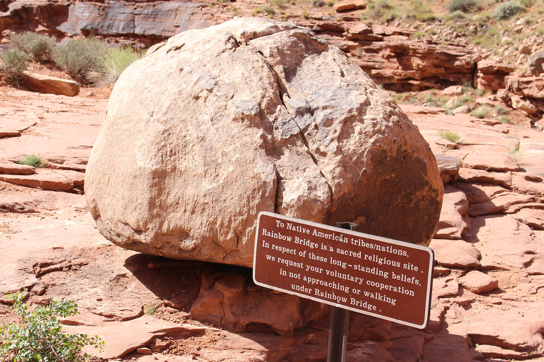
President William Taft designated 160 acres that includes Rainbow Bridge as a National Monument in May 1910, less than a year after it was first documented by Anglos, though it could have been seen earlier by explorers who didn’t bother to record their having seen it. There is evidence of Native American habitation and visitation that dates to ancestral puebloan times and the bridge is held sacred by Navajos, Paiutes and today’s pueblo cultures. The native name for the bridge translates to “rainbow turned to stone.”
The native religious reverence for Rainbow Bridge has generated controversy over the years, which has been resolved to no one’s complete satisfaction by the placement of boulders and signs to discourage visitors from approaching or walking under the bridge. The National Park Service asks visitors to respect the site’s traditional religious nature by not doing so, but a lawsuit in prior years established that the NPS may not ban people from going under the bridge and that the current voluntary request does not constitute a ban.
The National Park Service asks visitors to Rainbow Bridge to voluntarily refrain from approaching or walking under the arch out of respect for Native American religious traditions.
Another controversy surrounding Rainbow Bridge comes from the story of its Anglo discovery. Two parties had been trying for a few years to locate the bridge based on tales told by Native Americans. One was led by Byron Cummings, a dean at the University of Utah and another by John Wetherill, he of the famous Wetherills that discovered Mesa Verde. At length the two parties combined for the trip that led to the finding of the bridge in 1909. Heated arguments ensued as to whether the discoverer should be Cummings or Wetherill. At least one source lists them in an epic weasel-out as co-discoverers.
Other controversies involving this natural bridge include scientific values, access, protection and cultural significance, all of which have shifted over time and are probably still shifting today.
There are two official ways to get to Rainbow Bridge National Monument. You can take a boat or you can hoof it. Private boats are allowed to enter Forbidding Canyon and tie up at the courtesy dock at the trail head for the bridge. The dock has a restroom but no other services are to be had there. Commercial boats are run by the Glen Canyon National Recreation Area concessionaire from Wahweap Marina. Trips take all day and, at the time we went, cost $125 per person.
Commercial and private boats can tie up at the courtesy dock at the trail head for Rainbow Bridge. There are no services at the dock other than a restroom.
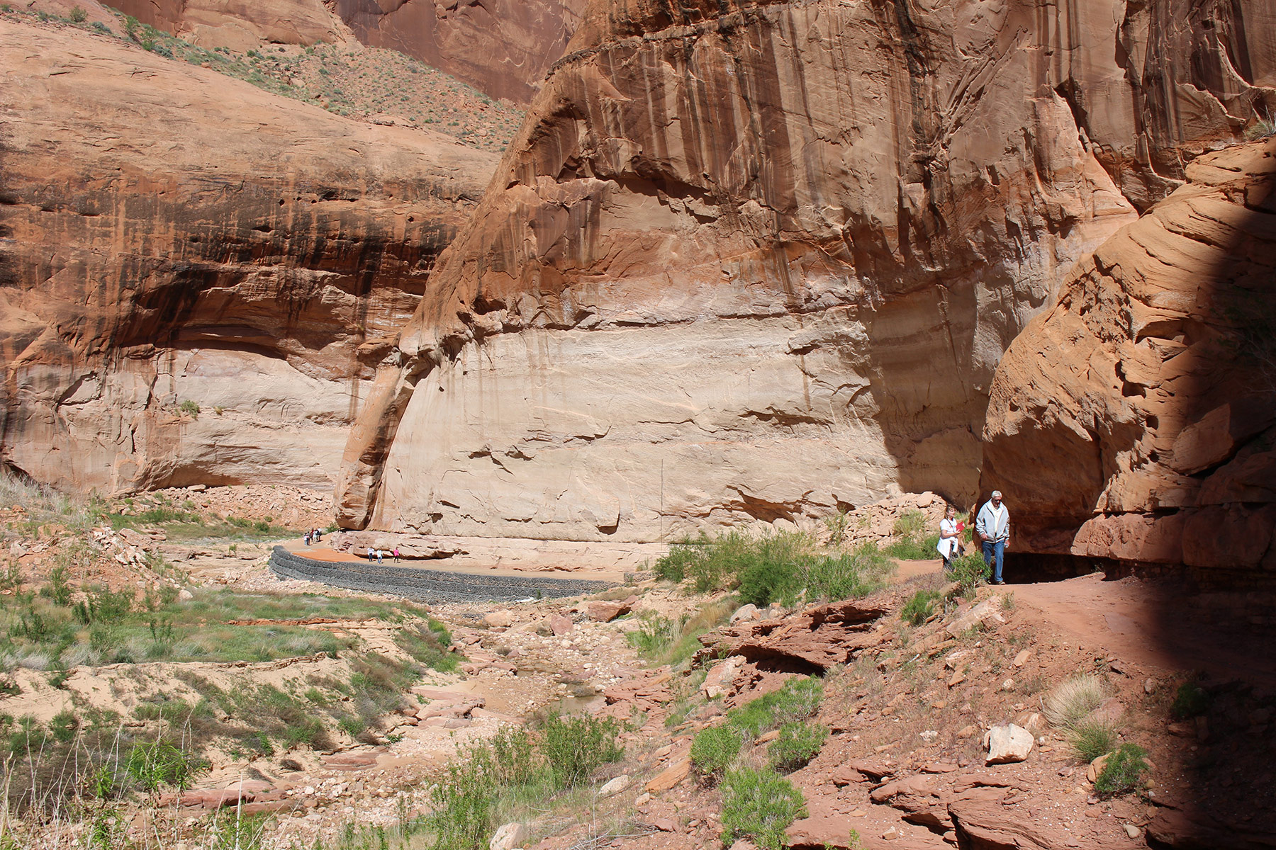
The distance of walk from the dock to Rainbow Bridge depends on the level of Lake Powell. When we went the walk was about 1.25 miles each way. The trail ends at a viewing area near the bridge and there are signs requesting that visitors respect traditional religions and do not approach or walk under it. The concessionaire staffer on our trip yelled at one tourist to return to the viewing area and not go farther.
The hike to Rainbow Bridge from the courtesy dock is about 1.25 miles at the lake level when I was there. The trail brings visitors to many outstanding views of the magnificent natural bridge.
The boat ride is about two hours each way and leaves Wahweap Bay on the way to skirting Antelope Island on the 50-mile trip up-lake. Warm Creek Bay and Padre Bay, Lake Powell’s largest bay, offer up their fantastic scenery along the way.
The boat ride from Wahweap Marina to Forbidding Canyon, home of Rainbow Bridge, crosses Warm Creek Bay and Padre Bay, both offering outstanding photographic opportunities.
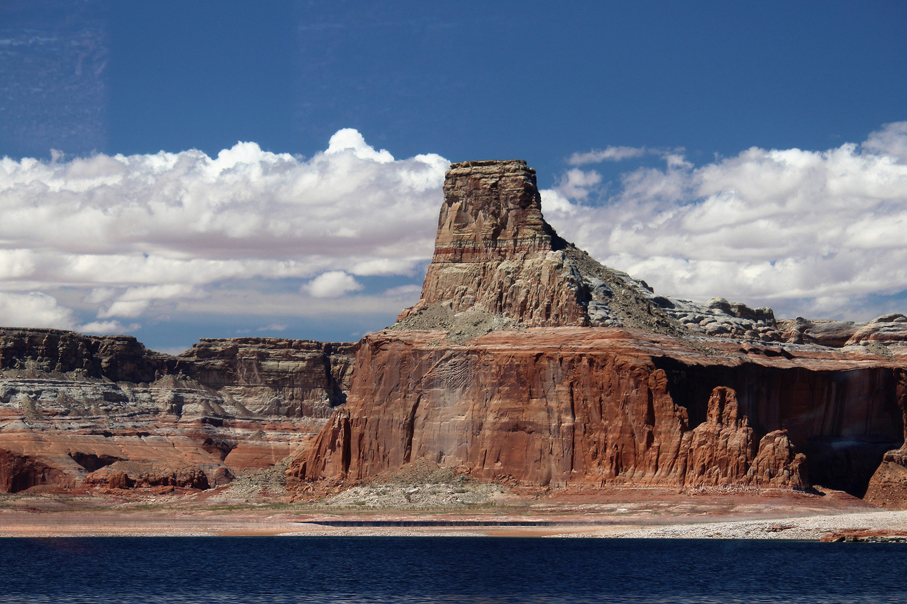
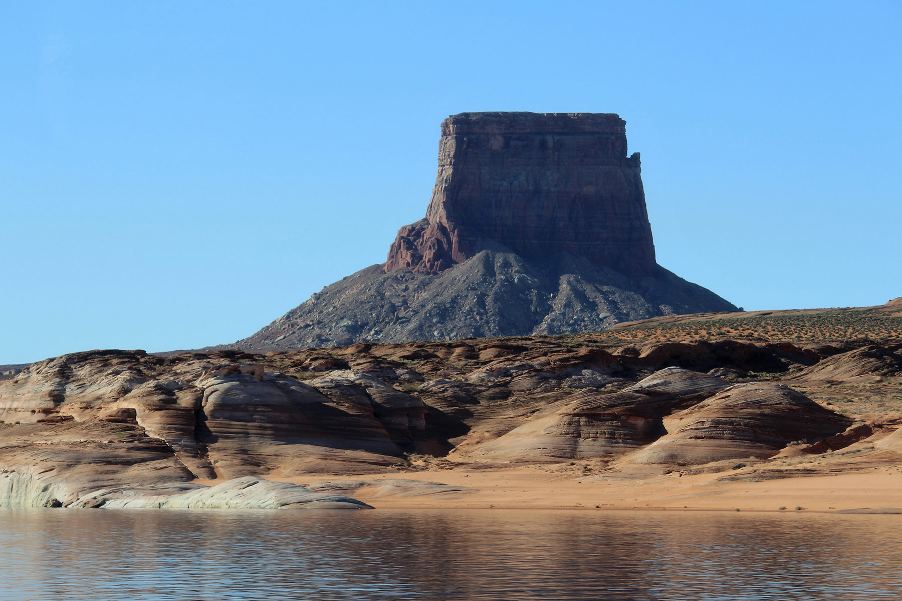
The tour travels by several good viewpoints of Tower Butte which was a landmark for travelers long before the reservoir came into being.
Tower Butte, whose top levels off some 1400 feet above lake level, stood as a landmark for overland travelers long before Lake Powell existed. Many visitors take helicopter tours which land on the butte.
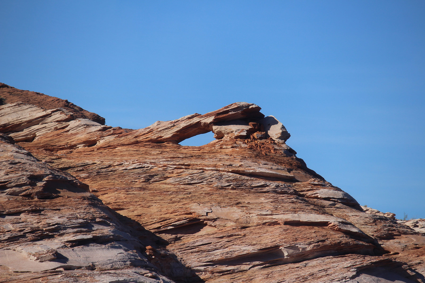
Observant passengers may see other small arches in the sandstone shoreline of the lake and photo opportunities abound.
The picturesque shoreline of Lake Powell enthralls with scenery, such as this small arch seen on a boat tour to Rainbow Bridge.
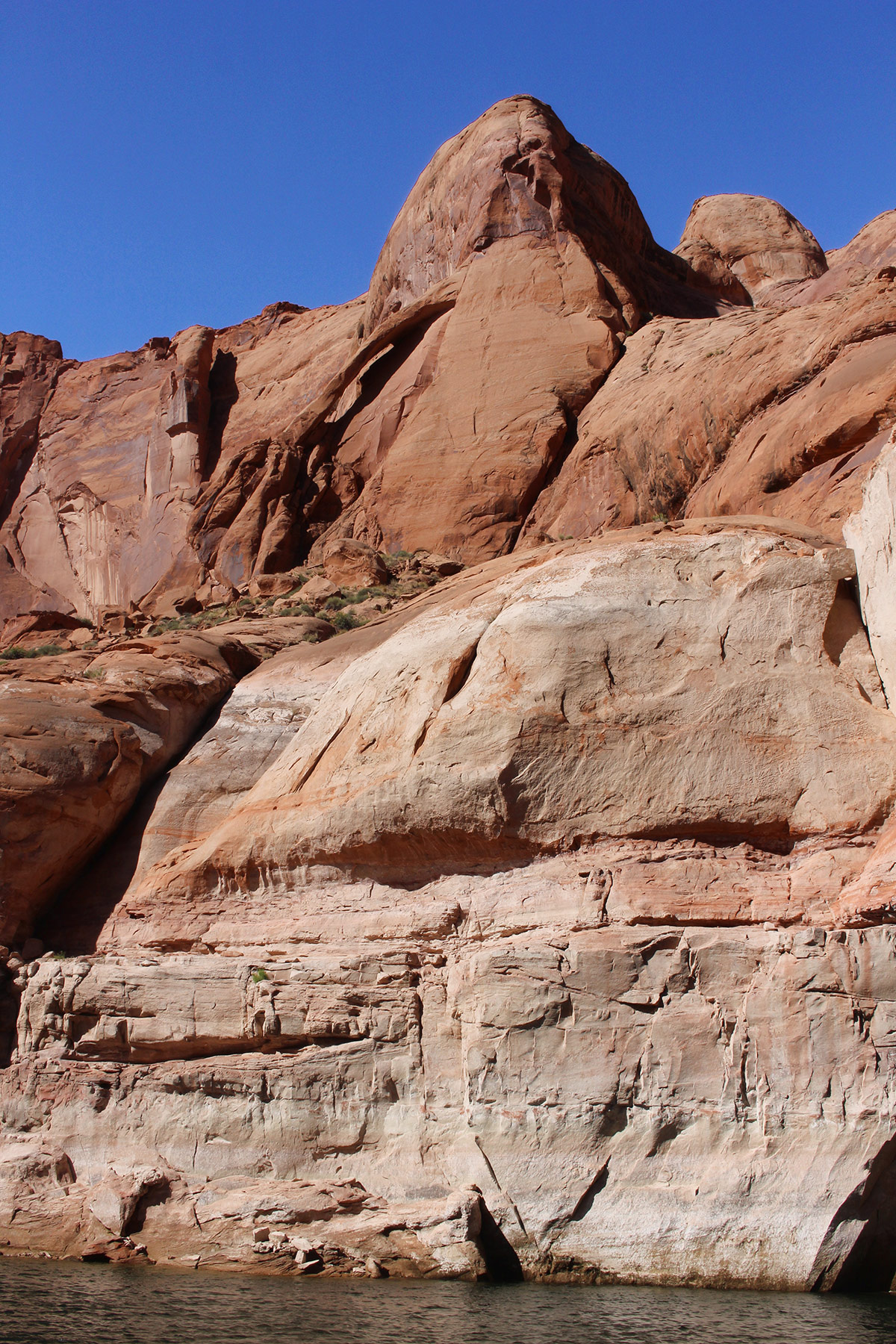
Not long after the boat enters Forbidding Canyon, 25-foot Rainbow Canyon Jughandle arch comes into view high on the right.
Rainbow Canyon Jughandle arch spans 25 feet and can be seen not long after entering Forbidding Canyon by boat on the way to Rainbow Bridge.
The blue water contrasting with the sandstone canyon walls make the entire trip a photographer’s paradise. Online information about the tours and reservations can be found at lakepowell.com.
The other official way to get to Rainbow Bridge is to hike from Navajo Mountain by way of either of two long trails. The northern route is 32.7 miles roundtrip and involves about 7000 feet of elevation change. It has the advantage of being less steep, though harder to get to, and it also goes near lovely Owl Bridge. Its 61-foot span will have you digging your camera out of your backpack.
The southern trail from Navajo Mountain is shorter at 24.5 miles roundtrip but much steeper, with over 8400 feet of elevation change. Distances and elevations for both trails are taken from the alltrails.com website.
Both trails are entirely within the boundaries of the Navajo Nation except for the little distance they are in Rainbow Bridge National Monument. As such, permits from the Navajo are required and can be obtained from the Navajo Nation Parks and Recreation Department in Window Rock, Arizona (928-871-6647) or from their website at navajonationparks.org.
Hikers with shuttle capabilities could walk in on one trail and back the other, and by making prior arrangements with the concessionaire at Wahweap Marina, hikers can ride out on one of the boat tours to the marina.
The trails are not maintained and may be subject to flash flooding, hot, dry conditions in the summer and severe cold and wind in the winter. There are not many trail signs but the trails are mostly marked with small stone cairns. These routes are not recommended for inexperienced or casual hikers.
The Lake Powell area of Utah and Arizona envelops a treasure trove of nature’s wonders for visitors of all interest levels from the casual to the intrepid. Visiting Rainbow Bridge will surely be one of the highlights of anyone’s trip to the area.


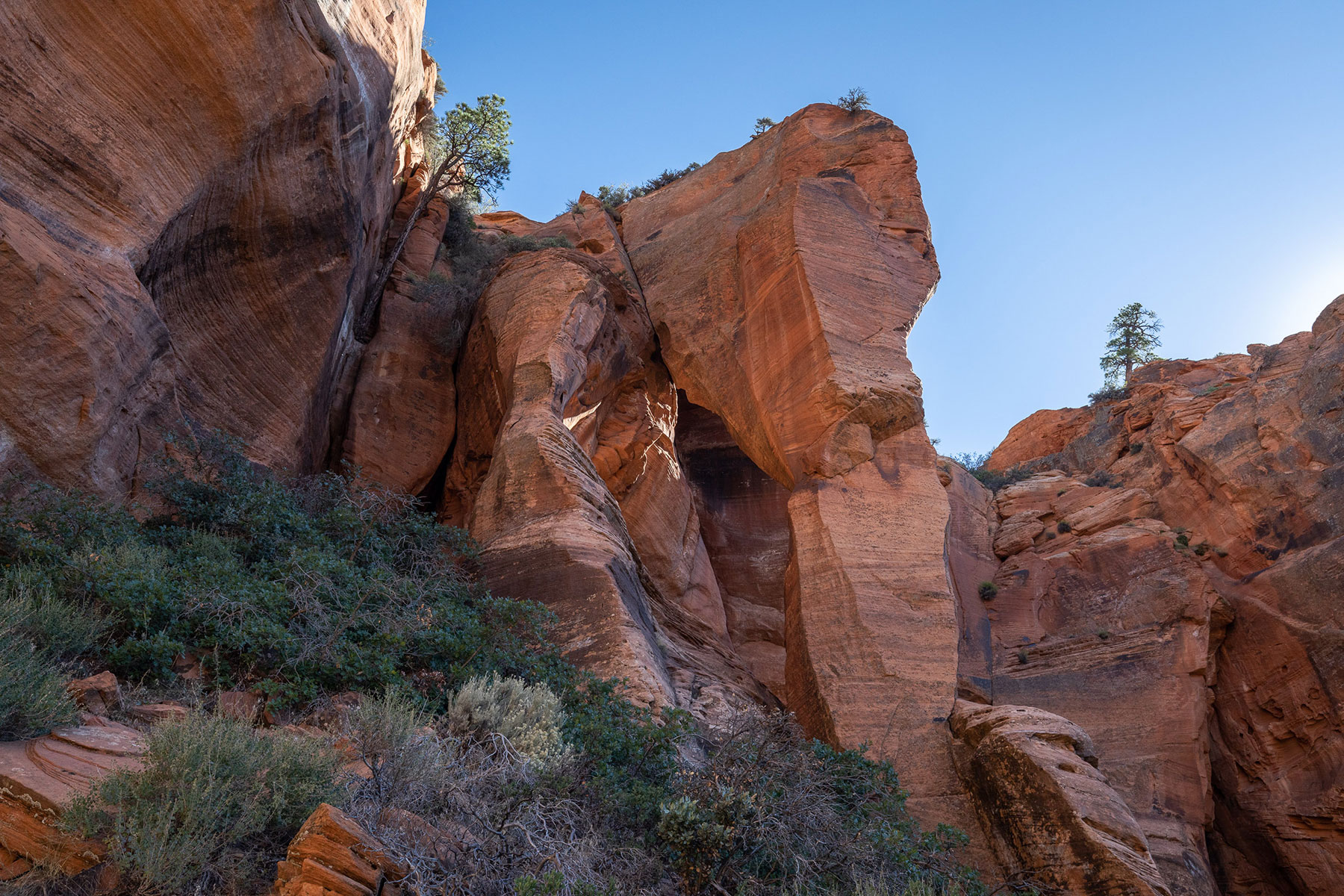 Closer view of Fisher Arch.