Deprecated: WP_Translation_Controller::load_file(): Implicitly marking parameter $locale as nullable is deprecated, the explicit nullable type must be used instead in /homepages/4/d577990729/htdocs/blog/wp-includes/l10n/class-wp-translation-controller.php on line 101
Deprecated: WP_Translation_Controller::unload_file(): Implicitly marking parameter $locale as nullable is deprecated, the explicit nullable type must be used instead in /homepages/4/d577990729/htdocs/blog/wp-includes/l10n/class-wp-translation-controller.php on line 156
Deprecated: WP_Translation_Controller::unload_textdomain(): Implicitly marking parameter $locale as nullable is deprecated, the explicit nullable type must be used instead in /homepages/4/d577990729/htdocs/blog/wp-includes/l10n/class-wp-translation-controller.php on line 201
Deprecated: WP_Translation_Controller::is_textdomain_loaded(): Implicitly marking parameter $locale as nullable is deprecated, the explicit nullable type must be used instead in /homepages/4/d577990729/htdocs/blog/wp-includes/l10n/class-wp-translation-controller.php on line 243
Deprecated: WP_Translation_Controller::translate(): Implicitly marking parameter $locale as nullable is deprecated, the explicit nullable type must be used instead in /homepages/4/d577990729/htdocs/blog/wp-includes/l10n/class-wp-translation-controller.php on line 263
Deprecated: WP_Translation_Controller::translate_plural(): Implicitly marking parameter $locale as nullable is deprecated, the explicit nullable type must be used instead in /homepages/4/d577990729/htdocs/blog/wp-includes/l10n/class-wp-translation-controller.php on line 297
Deprecated: WP_Translation_Controller::locate_translation(): Implicitly marking parameter $locale as nullable is deprecated, the explicit nullable type must be used instead in /homepages/4/d577990729/htdocs/blog/wp-includes/l10n/class-wp-translation-controller.php on line 397
Deprecated: WP_Translation_Controller::get_files(): Implicitly marking parameter $locale as nullable is deprecated, the explicit nullable type must be used instead in /homepages/4/d577990729/htdocs/blog/wp-includes/l10n/class-wp-translation-controller.php on line 430
Deprecated: WP_Translation_File::create(): Implicitly marking parameter $filetype as nullable is deprecated, the explicit nullable type must be used instead in /homepages/4/d577990729/htdocs/blog/wp-includes/l10n/class-wp-translation-file.php on line 84
Deprecated: wp_getimagesize(): Implicitly marking parameter $image_info as nullable is deprecated, the explicit nullable type must be used instead in /homepages/4/d577990729/htdocs/blog/wp-includes/media.php on line 5502 3. COUNTRIES | NABS Blog | Page 2
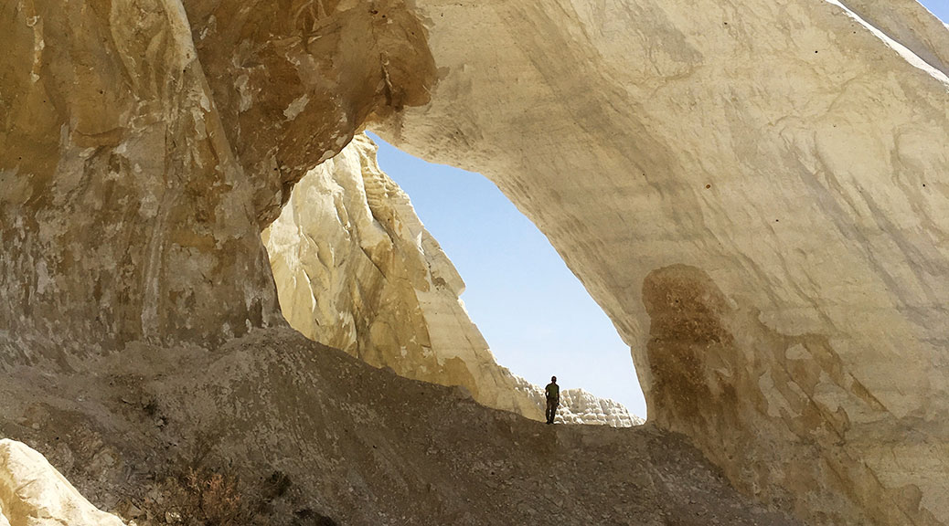
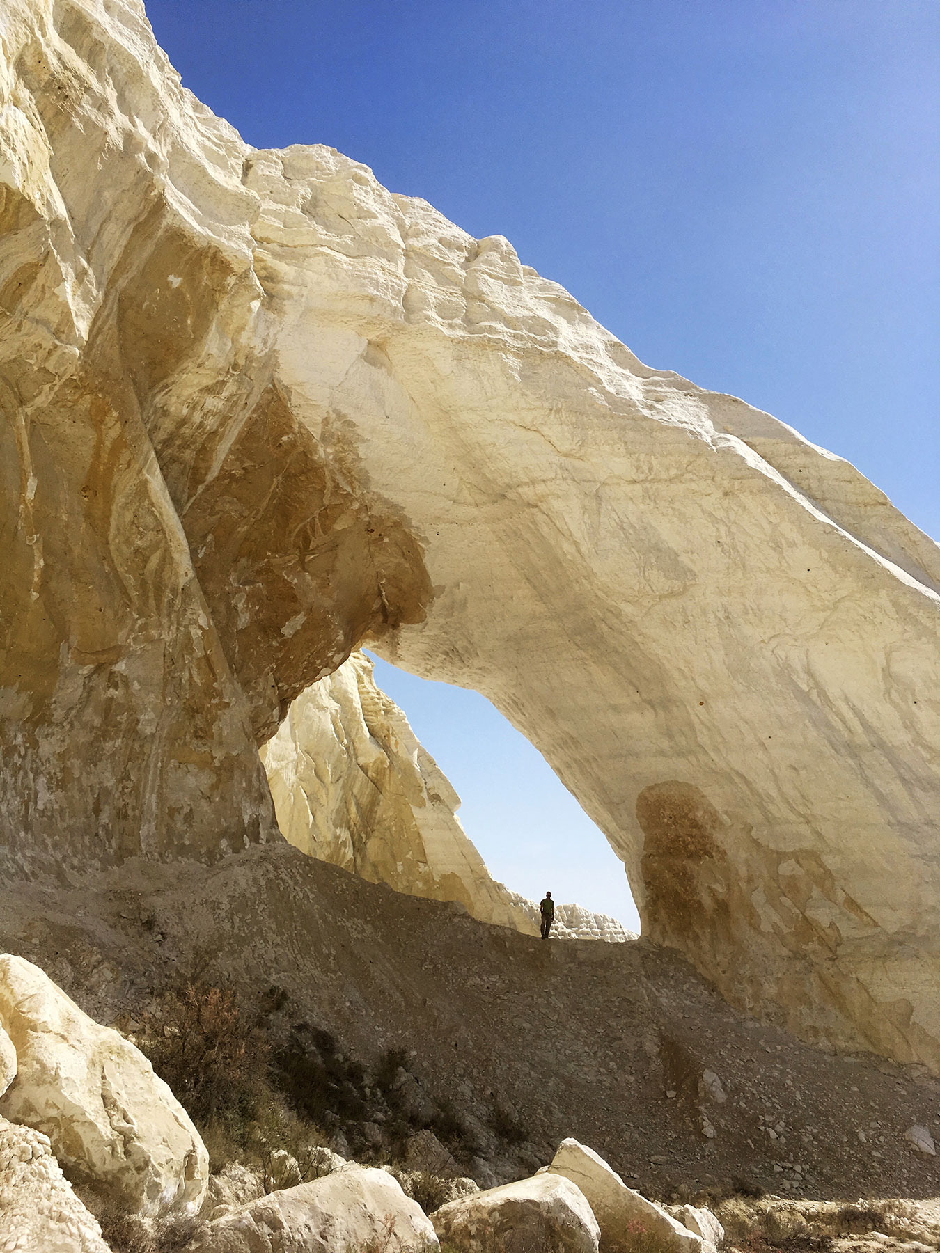
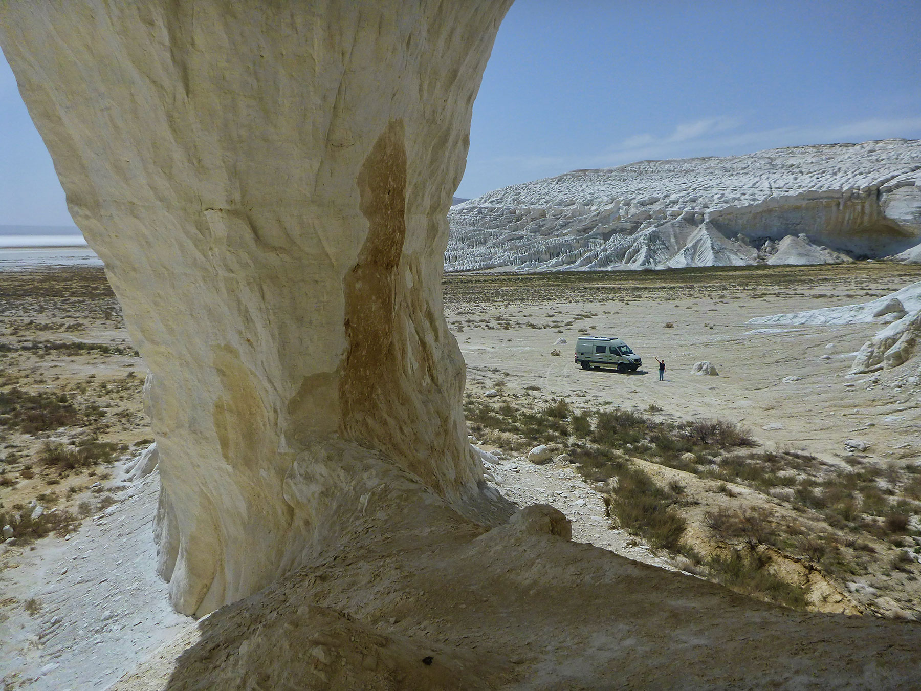
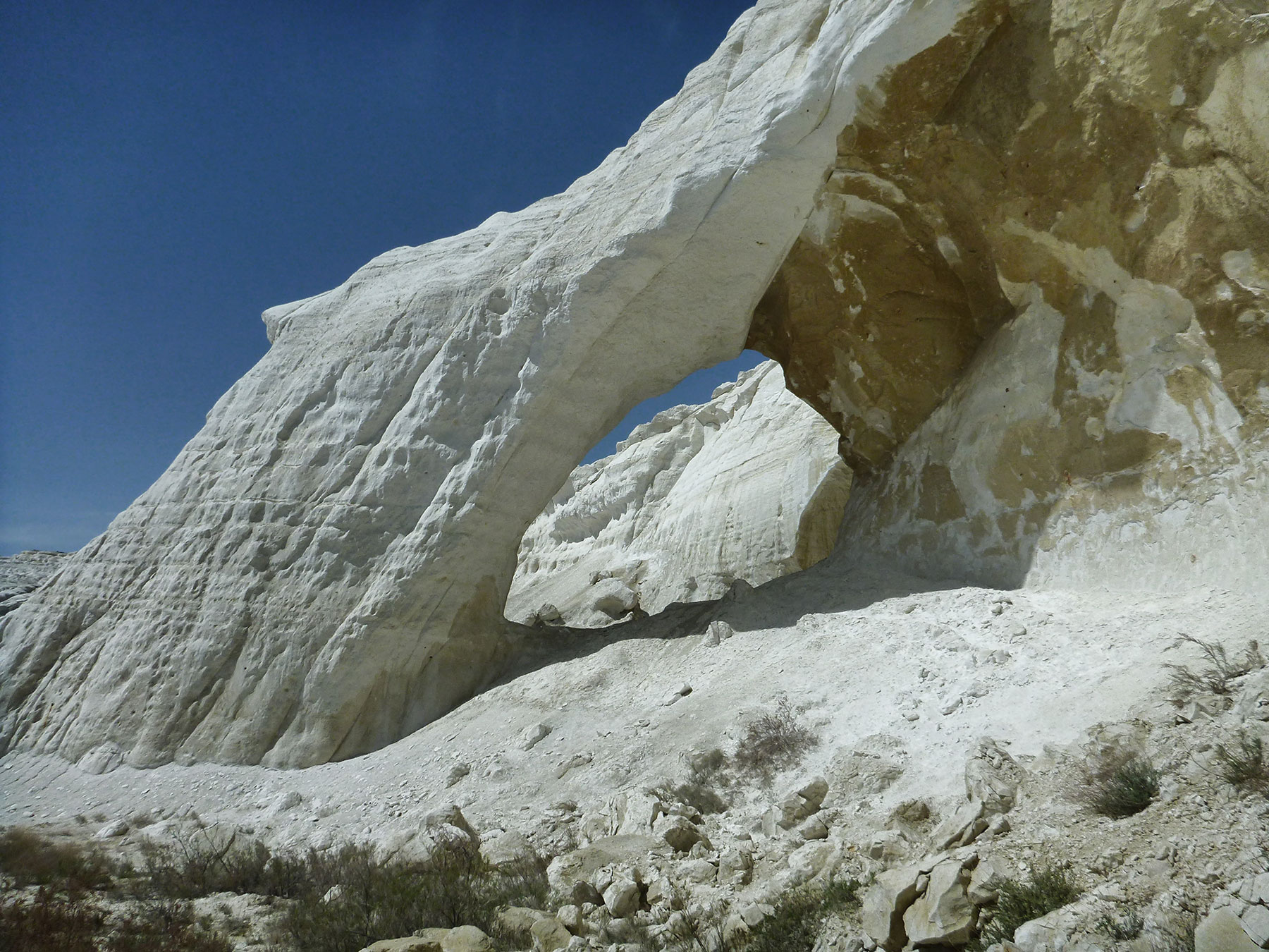
The Natural Arch and Bridge Society is indebted to Niklaus Stöcklin for reporting a natural arch in Kazakhstan. The arch is located at 39T 675930 4878720 and has a span of 40 feet.
The arch is near the city of Aktau, which is located on the east bank of the Caspian Sea. The name means “white mountain” in Kazakh, which may be due to the white cliffs that overlook the Caspian. The arch itself is in white cliffs about 40 km east of Aktau.
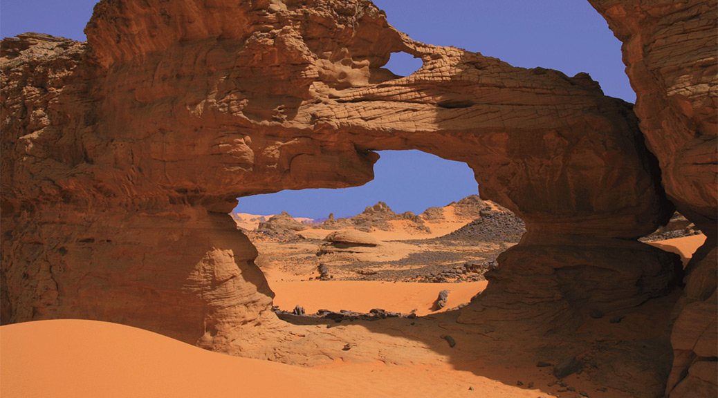
Natural Arch and Bridge Society member Ray Millar visited Libya in 2008 and offers this 9-minute video slide show of his trip, which includes a bunch of natural arches on the Akakus Plateau.
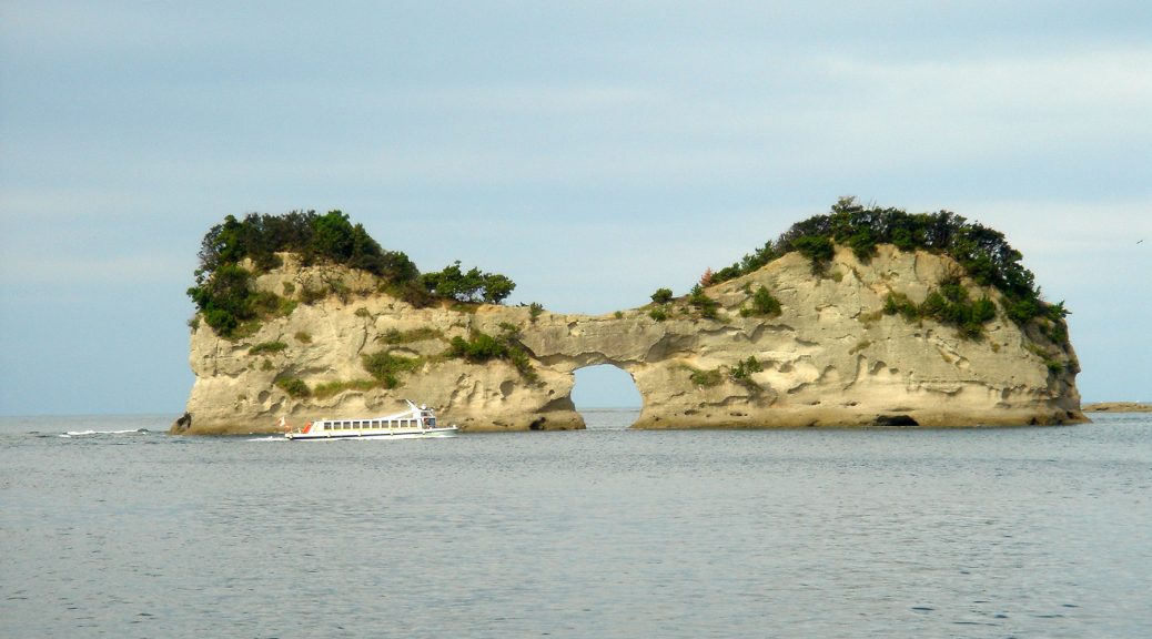
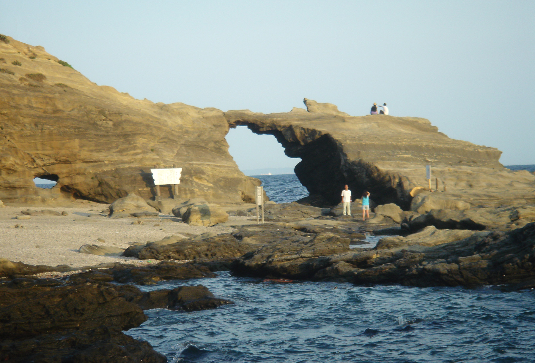
I am a NABS member from Japan and I greatly enjoyed meeting other NABS members at the 2015 NABS Rally in Escalante. Japan is an island country, so there are many sea arches here, and I would like to share some of them. Generally, they are not very large.
NABSQNO 54S-392039-3885693 is an arch rock near Ukishima in Chiba Prefecture. There is a shrine on the Ukishima island next to the arch rock, and we can land there once in a year when a sacred festival is held.
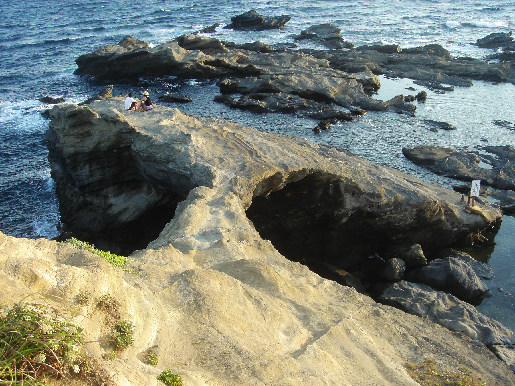
NABSQNO 54S-374119-3888470 is Umanosedoumon in Kanagawa Prefecture. This area is a bathing beach and in summer many people visit here to enjoy swimming. The photo below is the top of this arch. It is prohibited to walk on it.
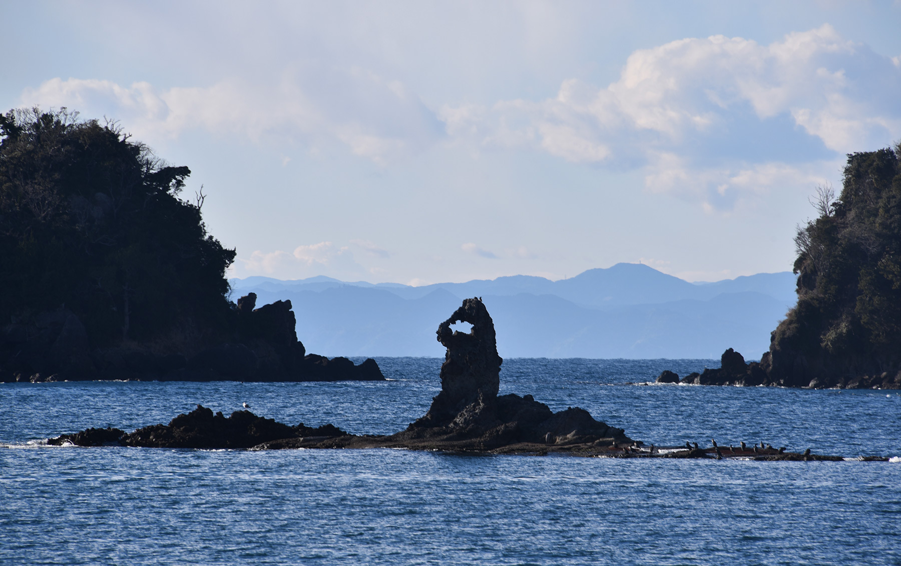
NABSQNO 54S-295596-3854128 is Meganeccho in Shizuoka Prefecture. It looks like a magnifying glass, or like Godzilla! In the same area there is a famous sea cave, Tensoudou (see below).
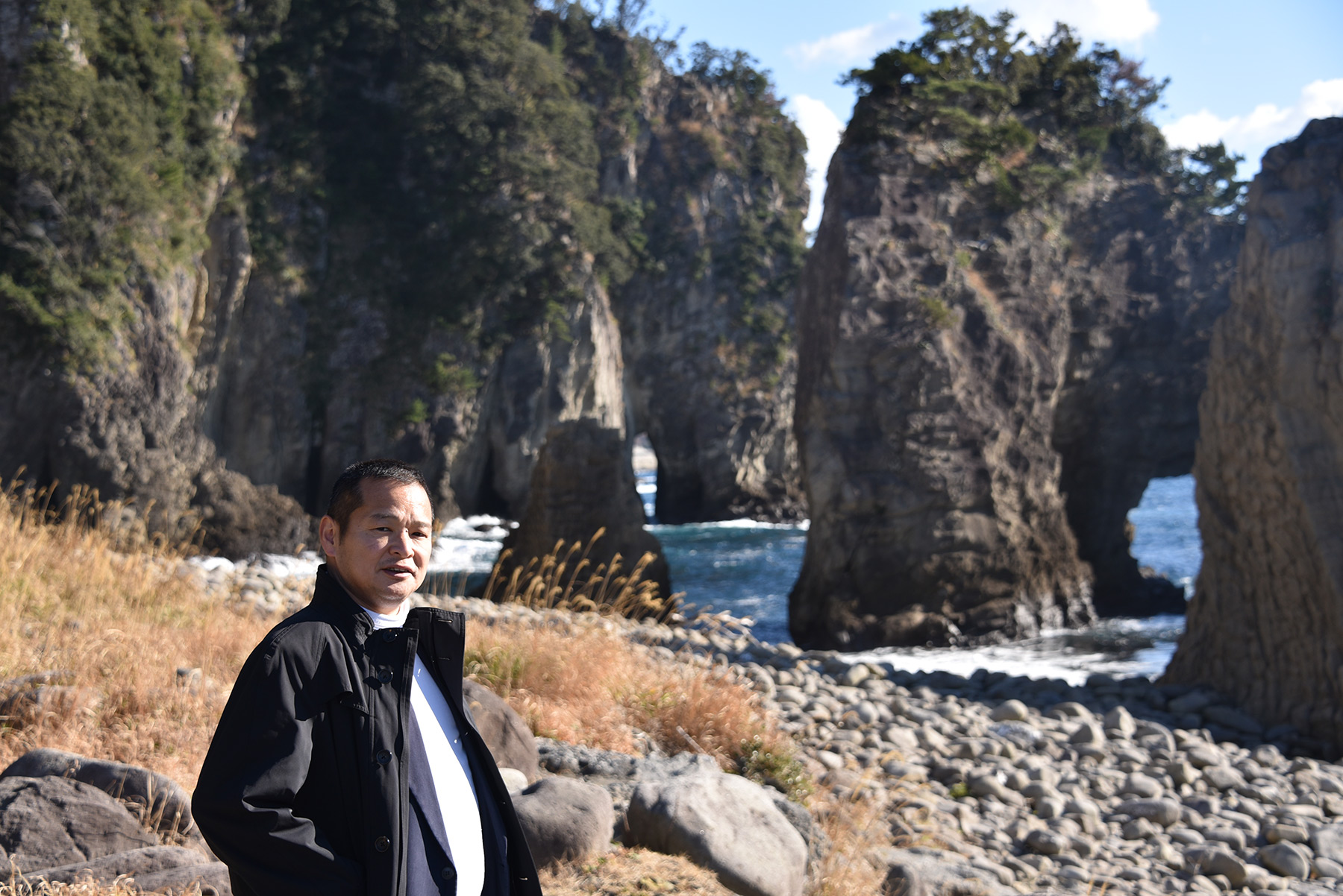
NABSQNO 54S-294833-3852422 is another sea arch near Meganeccho and Tensoudou, with me in the foreground.
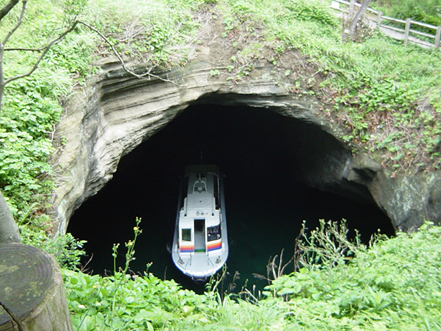
NABSQNO 54S-295596-3851220 is the sea cave Tensoudou, with a tour boat going under the arch.
NABSQNO 54S-293168-3844185 is Senganmon in Shizuoka Prefecture, in the same area as Meganeccho and Tensoudou. A tour boat goes through this arch.
NABSQNO 53S-686992-3828085 is Hiinosekimon in Aichi Prefecture. It is made of sedimentary rock.
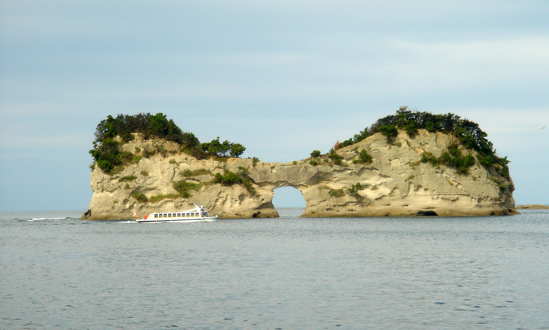
NABSQNO 53S-531185-3727842 is Engetsuto in Wakayama Prefecture. The span of the opening is about 9 meters and the height of the entire rock is 25 meters. This area is a famous tourist resort, with many tourists in high season.
NABSQNO 52S-628231-3736269 is Hanagurise in Fukuoka Prefecture. The height of opening is about 10 meters. The arch is made of basalt.
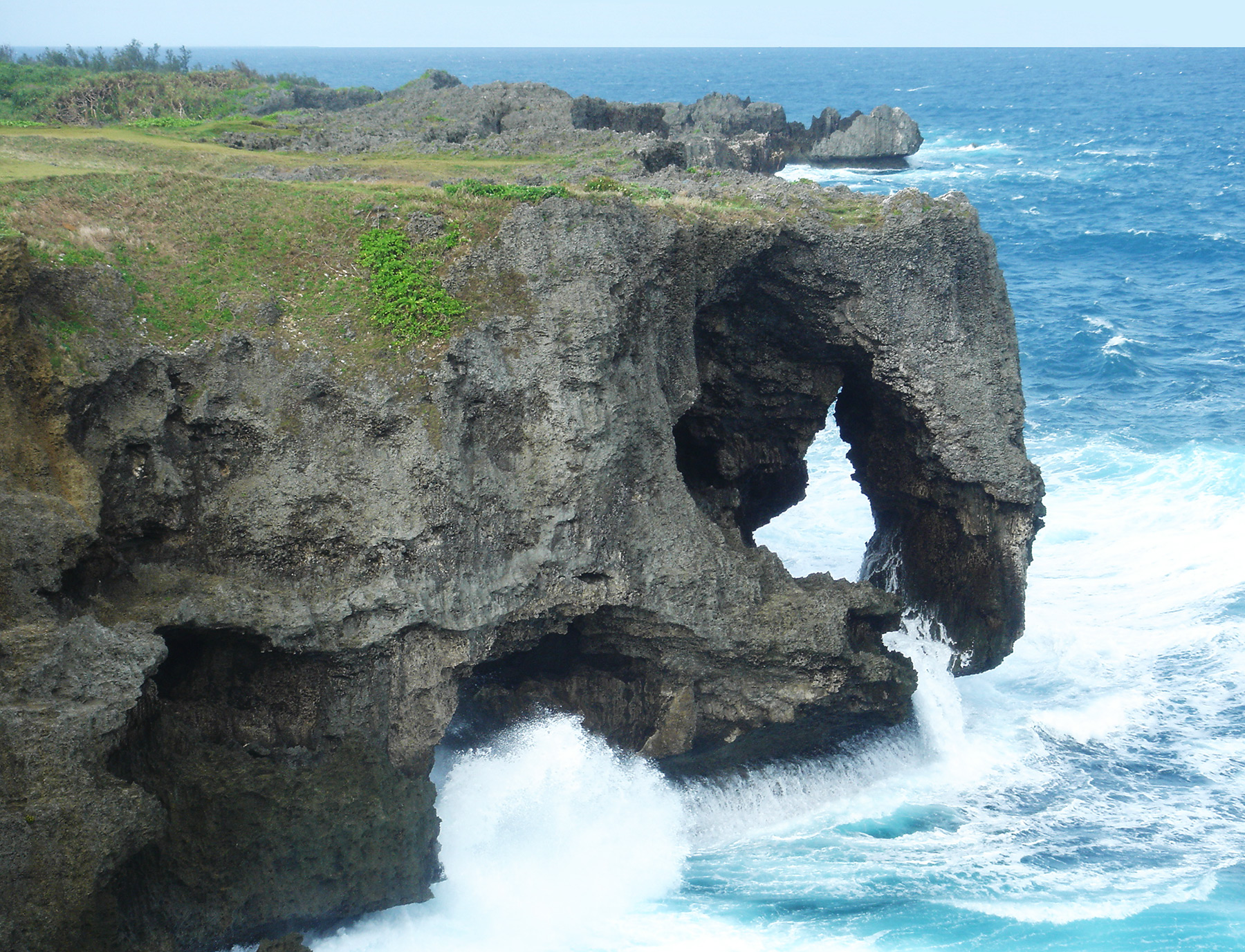
NABSQNO 52R-385422-2932167 is Manzamou in Okinawa Prefecture. The height of the cliff is about 20 meters.
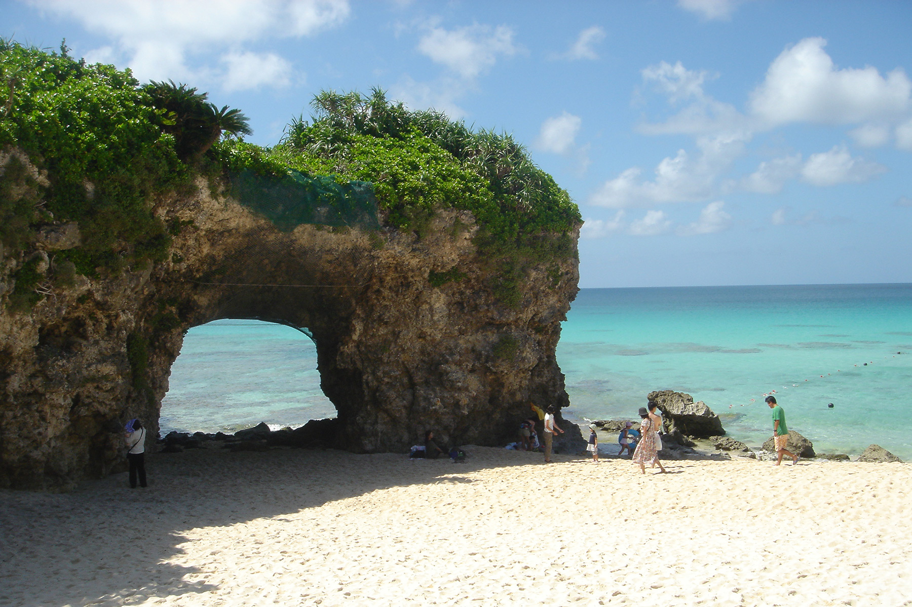
NABSQNO 51R-730446-2749088 is the arch on Sunayama Beach on Miyakojima Island in Okinawa Prefecture. The sea in this area is especially beautiful.
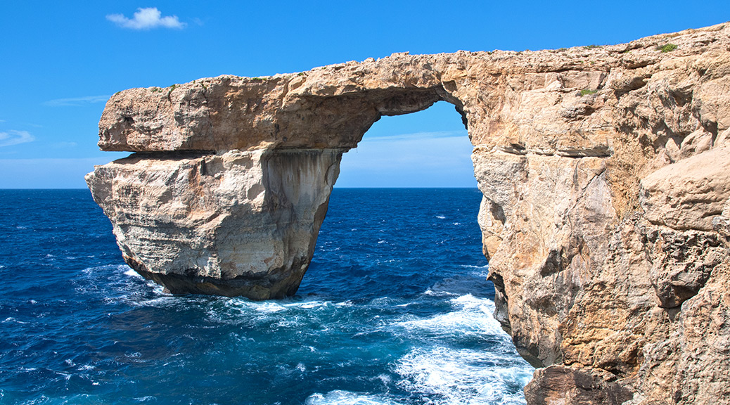
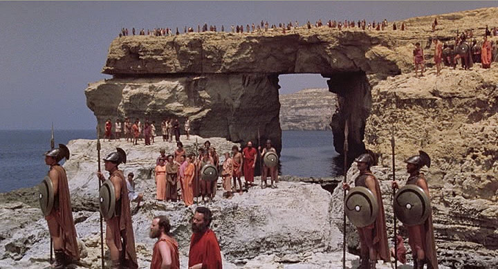
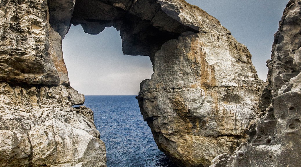
Famous Azure Window in Malta collapsed during a storm on March 8, 2017. Not only did the lintel itself collapse, but the entire outer column fell into the sea.
The arch was considered at risk of collapse and walking across the arch was prohibited only last December. And in January, a slab of rock fell off a lateral face of the outer column during high seas.
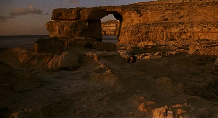
The spectacular arch was featured in many movies, including Game of Thrones. Some history of partial collapse can be seen in these movies. In the scene below from the 1981 movie Clash of the Titans, the underside of the arch is flat.
In the scene below from the 2002 movie The Count of Monte Christo, it can be seen that the underside of the lintel has fallen to create a more arced shape.
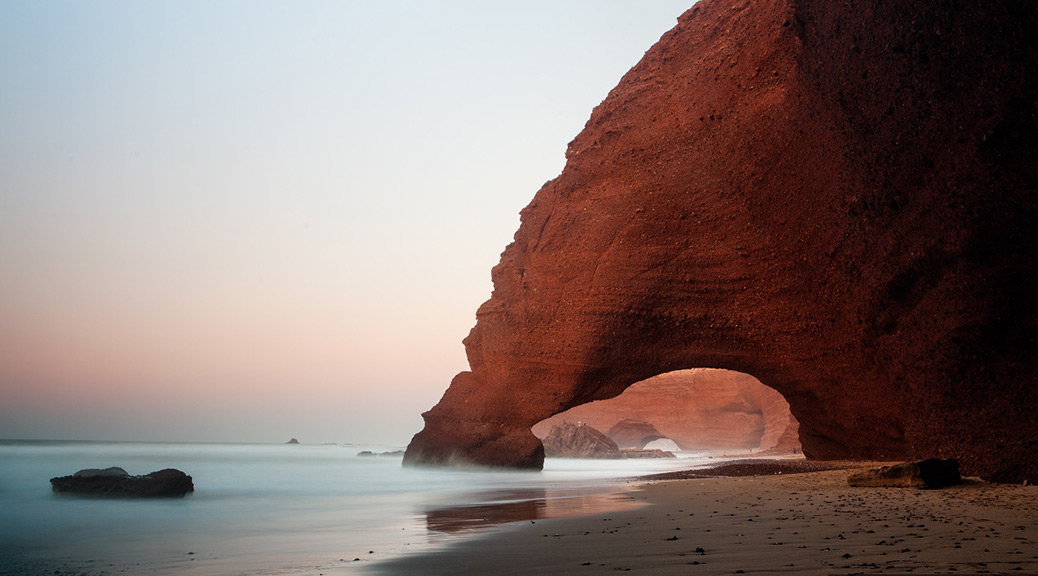
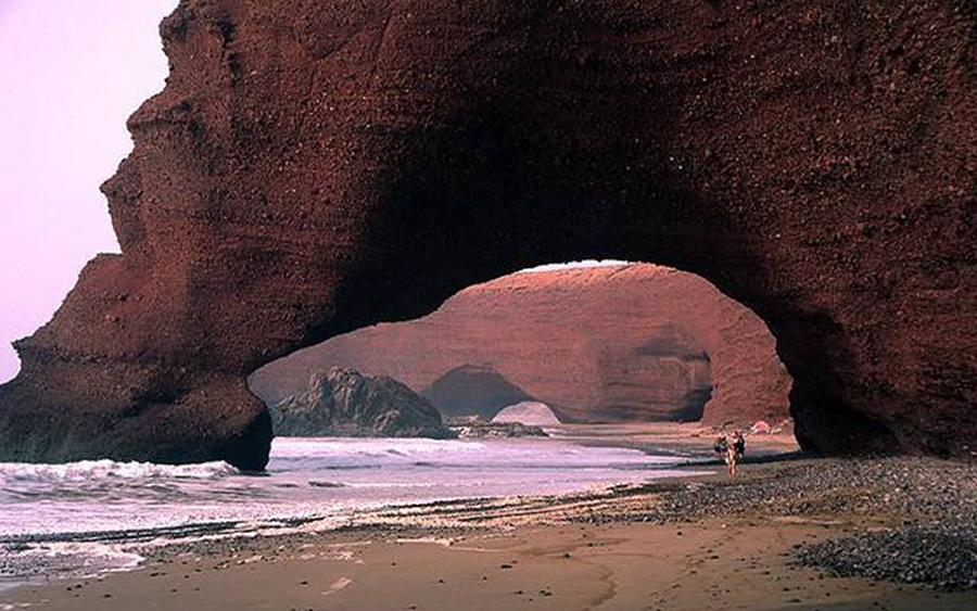
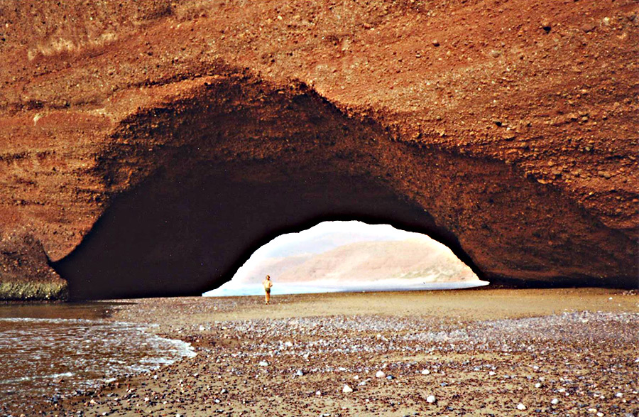
The photo below shows two large natural arches at Legzira Beach, Morocco, in the Province D’Agadir about 10 kilometers north of Sidi Infi.
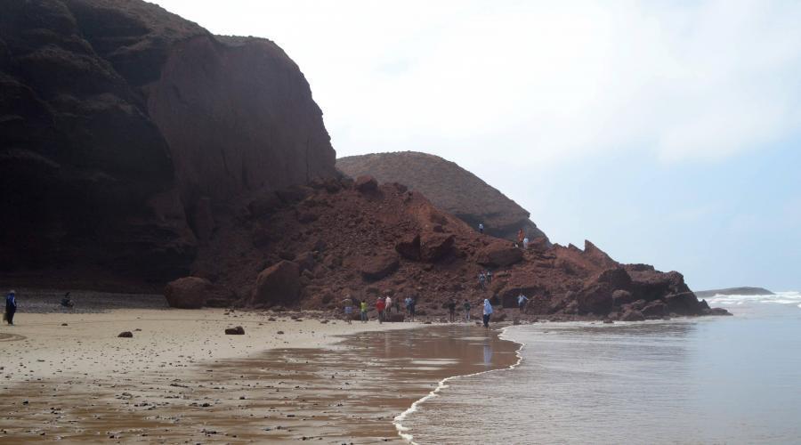
The arch in the foreground, NABSQNO 29R 391178 3257234 with an estimated span of 60 feet, collapsed on September 23, 2016. The remains are shown in the photo below.
The remaining arch, with an estimated span of 90 feet, still stands. Our own Guilain Debossens stands by the arch in the photo below.
A special thanks to Josh Summers of Far West China for providing this update and photos.
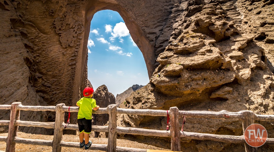
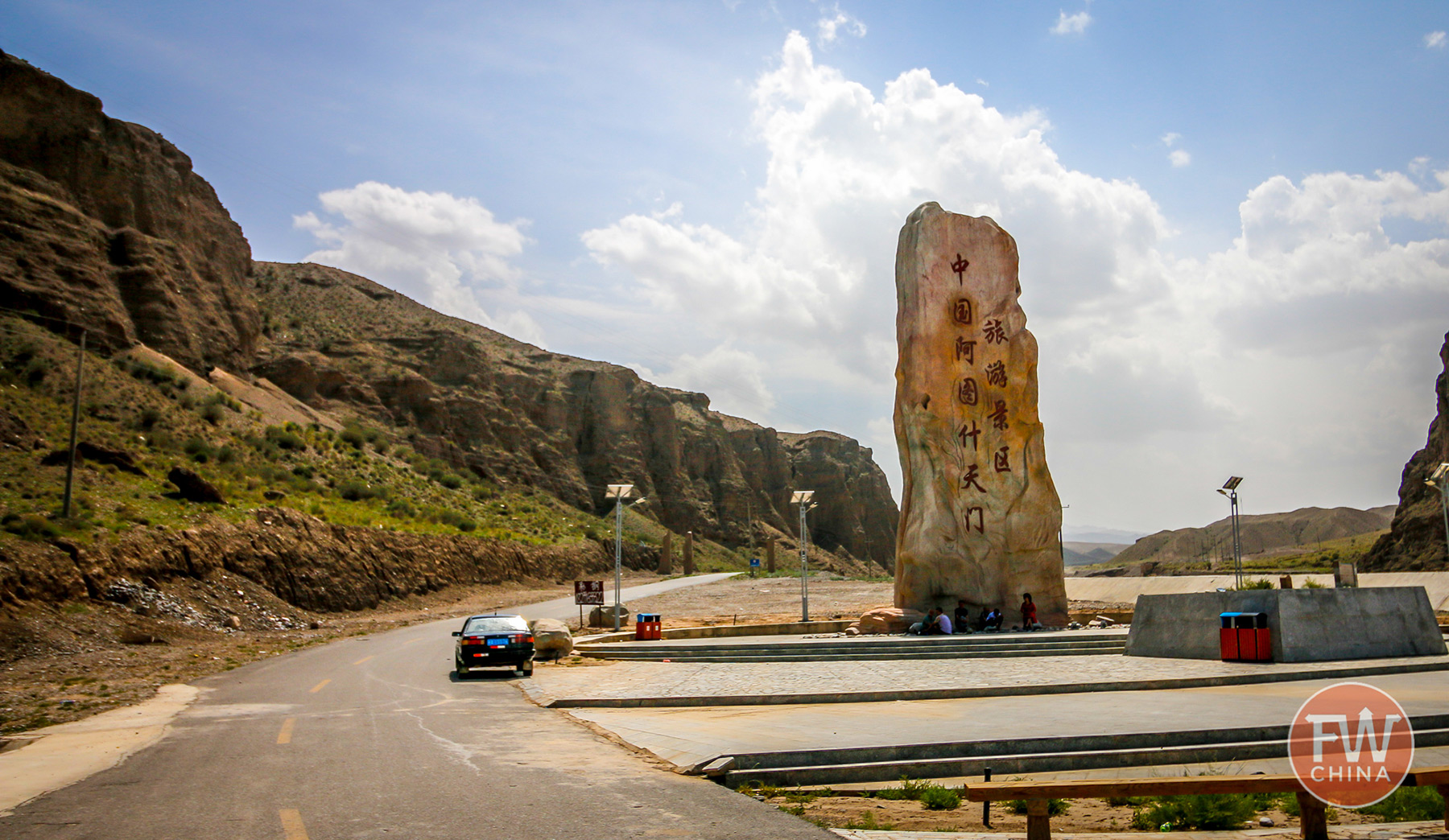
Shipton’s Arch in China is one of the world’s giant arches and is already described in some detail on the NABS website. What’s new is that a wooden walkway has been built to provide easy access to view the arch. The 3-minute video below shows the new access (note that when the video states the height of the arch is 1500 feet, that does not refer to the opening itself, which is 1200 feet high).
Shipton’s Arch is located in the mountains northwest of the city of Kashgar, part of China’s far west province of Xinjiang. For the first decade following the 2000 National Geographic expedition that re-discovered the arch, foreign travelers began to request a visit to the arch with local travel agencies. Special arrangements had to be made and at first many of the agencies had no idea what the foreigners were talking about—a proper name in Chinese wasn’t given to the arch until the late 2000s (the name is variously transliterated as “Toshuk Tagh“ or “Tushuk Tash“ in the Uyghur language or Ātúshi tiānmén in Chinese).
These pioneering travelers, including Ray Millar of NABS, talk about an arduous climb that included a 4-wheel drive vehicle, a local guide and a number of rickety ladders.
All of that—for better or worse—has changed.
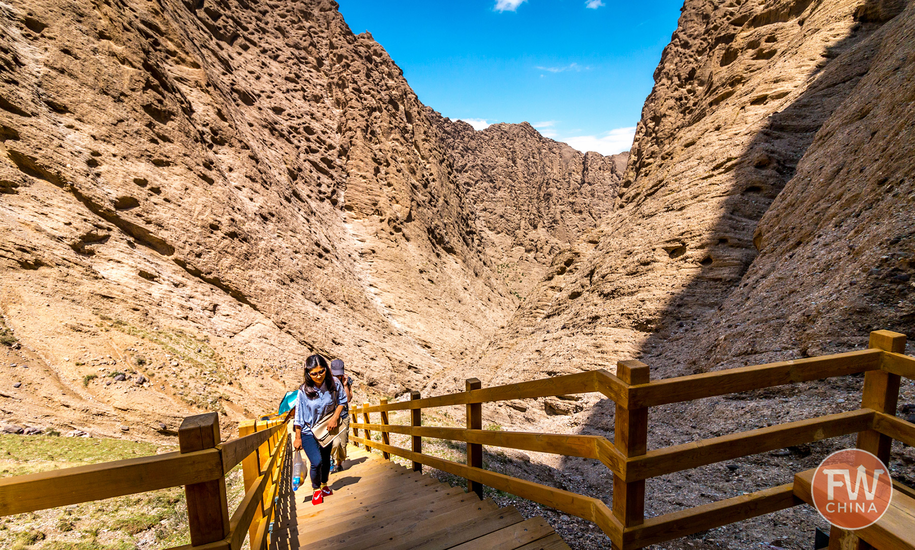
A new road leads from the highway to a new visitor’s center right next to the trail head. Guides are no longer necessary and the ladders have been replaced by strong staircases. The 1.8-mile trail to the arch is still a tiring climb that requires a certain level of fitness from those that visit. However, it’s no longer the dangerous expedition it once was.
The new paved entrance to Shipton’s Arch
Climbing the stairs up the valley to Shipton’s Arch
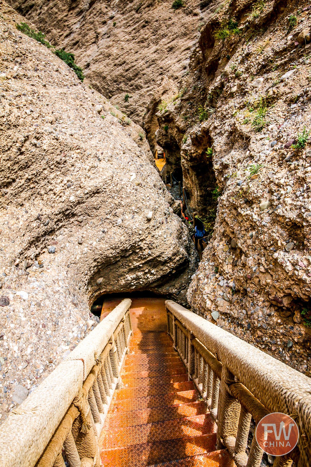
The first glimpse of the arch during the hike.
To make your own visit to Shipton’s Arch, all you need to do is arrange transportation from Kashgar for the day. This can be done either through a travel agency or by hiring a taxi off the street. For the latter, you can use the local Uyghur or Chinese (Mandarin) name, or bring a photo so you can point to it.
Hired transportation, depending on the type of car and season, can cost anywhere from 500-800 Yuan per day ($75-$120), so it’s best to get a group together if possible.
Once you reach the visitors center, which can take 1-2 hours of driving, you will be required to purchase an entrance ticket. They point you on your way and off you go!
Josh recommends bringing water and snacks since there is no place to stop and buy this during your trip. He also suggests that many tour companies offer the option to either arrive super early or stay late to see the sunrise/sunset and says it’s gorgeous. The only problem is hiking in the dark, so bring good flashlights.
NABS member Josh Summers is a writer, musician and entrepreneur who currently resides in Urumqi, capital of China’s western province of Xinjiang. He has been traveling and writing about this region since 2006 and has no plans to stop in the near future. You can find his original blog on this subject here.
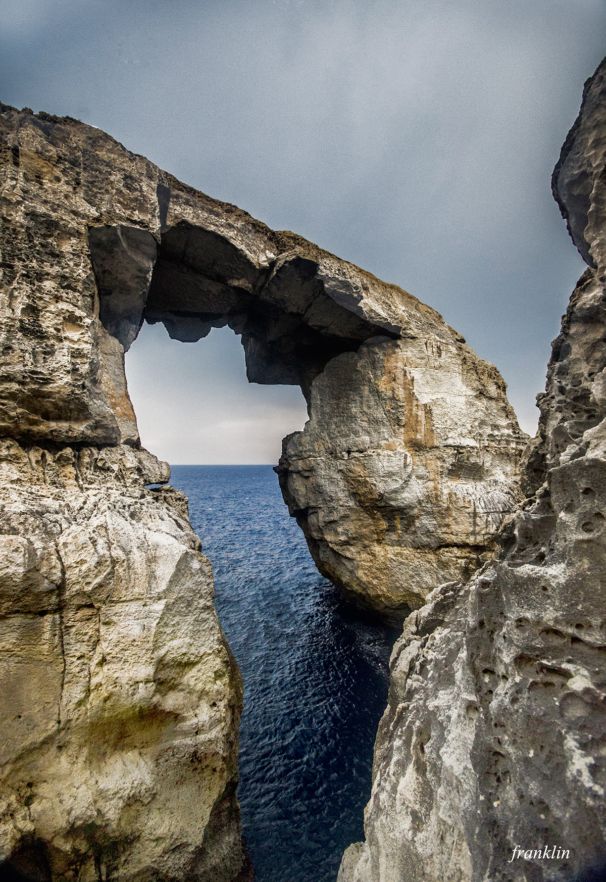
One of the most famous arches in Malta is Azure Window, which has been featured in several movies and in Game of Thrones. A lesser known but quite similar arch can be found nearby, however, known as the Arch of Wied il Mielah (NABSQNO 33S-429115-3993060). Both are near the town of Gharb. Azure window is due west, and Wied il Mielah is the same distance due north. The photo below is by Franklin Camilleri.
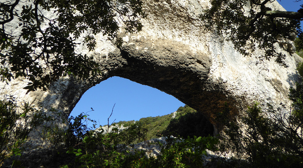
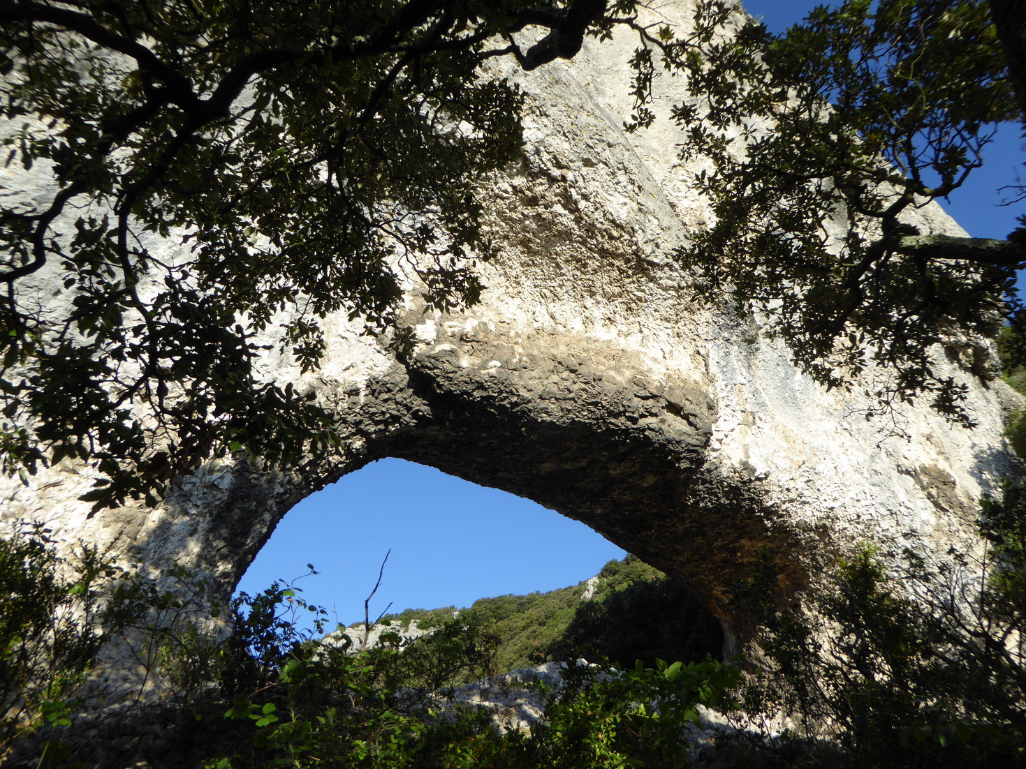
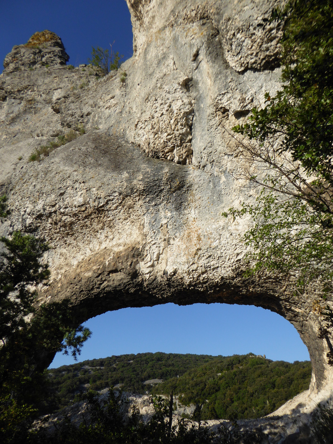
Our intrepid arch hunter Guilain Debossens reports the 900th arch that he has documented in France: Barri Troué.
This natural arch is located on the lower section of the canyon of Rimouren near the village of Saint-Montant in the Ardèche department of France. The opening has a measured span of 18 feet. Barri is an old Provençal name for a rocky ledge. Barri Troué is named (but not precisely located) on the IGN topographic map Top 25 number 2939 West Gorges de l’Ardèche (pleat B9).
Below are three photos of Barri Troué. About 95% of the arches Guilain has documented in France are on his website.
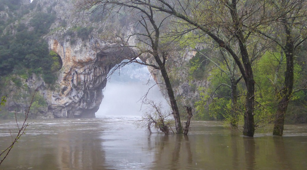
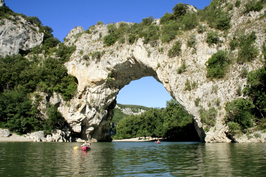
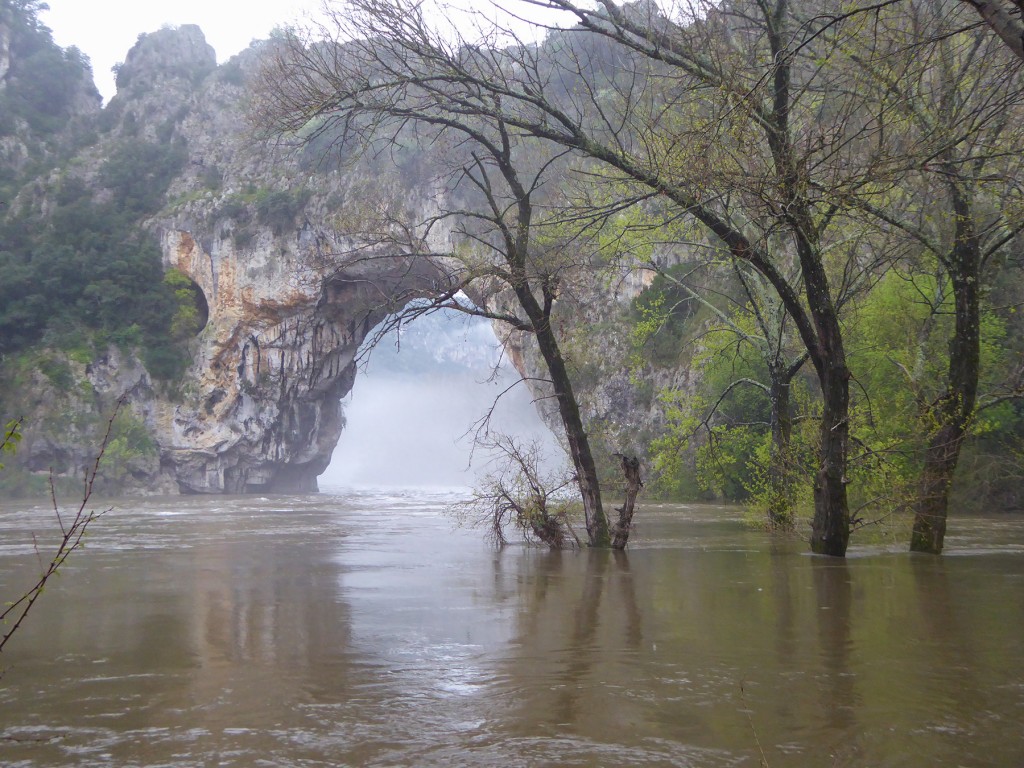
Pont d’Arc in France experienced flooding on April 4, 2016, as can be seen in the two photos below showing the Ardeche River at normal flow followed by a photo on April 4.
Pont d’Arc at normal flow.
Pont d’Arc on April 4, 2016. Photo courtesy Guilain Debossens.
A much larger flood occurred on September 19, 2014, as can be seen in the first 30 seconds of the video below.
Guilain Debossens reports that there is an historic plaque fixed on the cliff two meters above the road at the entrance of the Gorges de l’Ardèche. The plaque indicates that the Ardèche River reached the level of the plaque, 55 feet above normal flow, during the historic flood of September 22, 1890. It was the most severe flood since man developed photography, but not of all time of course.
Guilain found the photo below taken during this historic flood. The text written on the back said the flood was so huge that the Ardeche River retook the abandoned meander during this event.