Story and photos by Adam Elliott.
Red Butte Wilderness is adjacent to and south of the Kolob Section of Zion National Park. Red Butte Wilderness was created in 2009, contains 1,537 acres, and gets little visitation. There are no trails in the area and it’s very brushy.
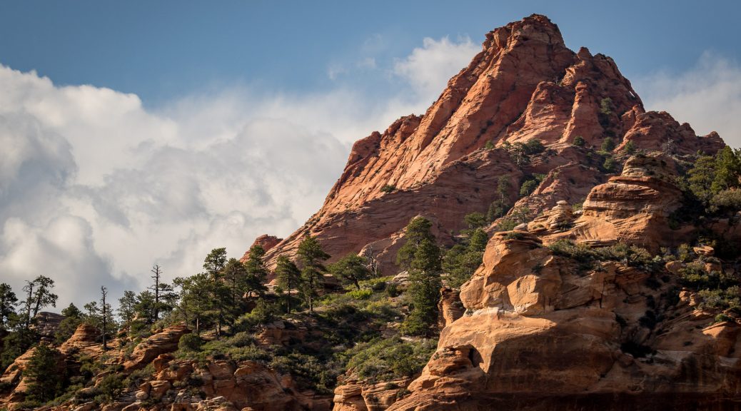
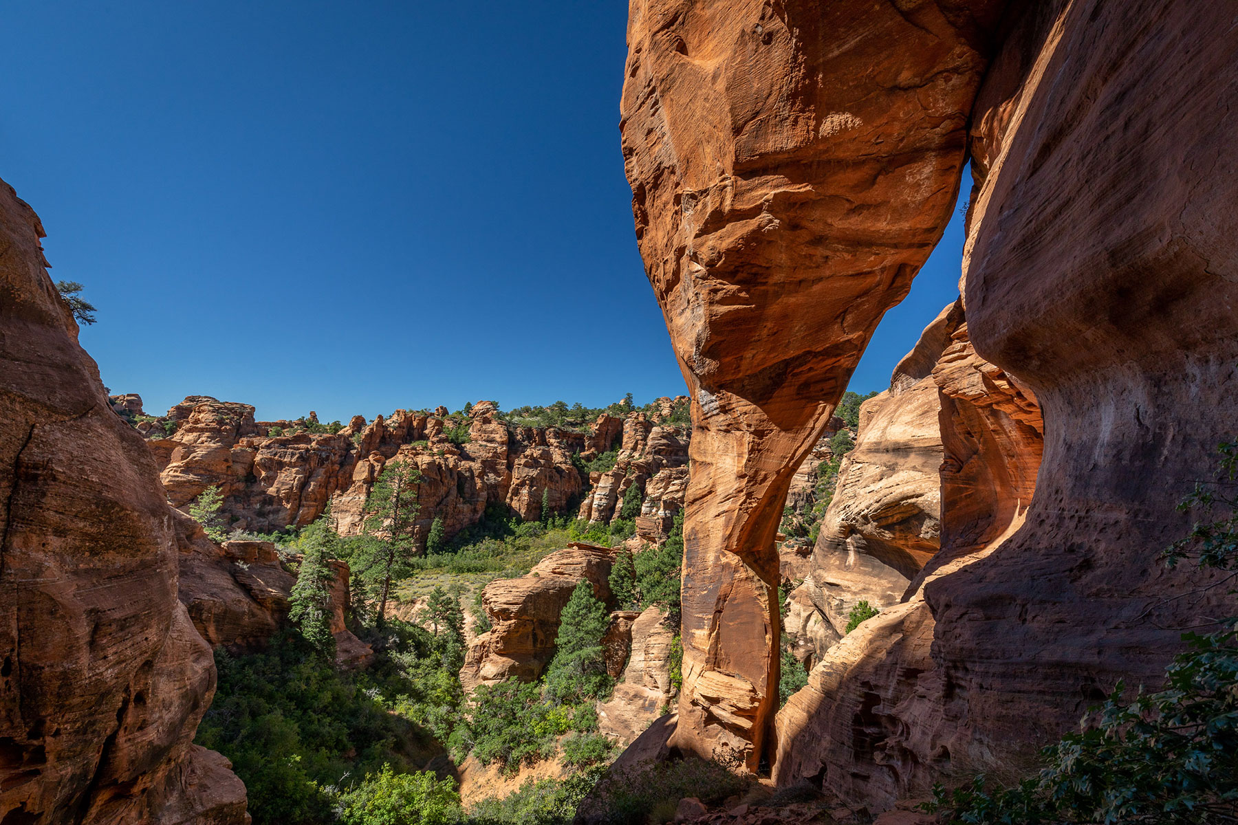
Red Butte itself contains an arch (top and next two photos). The Butte has an elevation of 7,420 feet and rises 1,800 feet above the Kolob Reservoir road about 10 miles north of the Virgin River. The coordinates for the Butte are 12S-309870-4137310. It’s a technical climb to actually attain the arch.


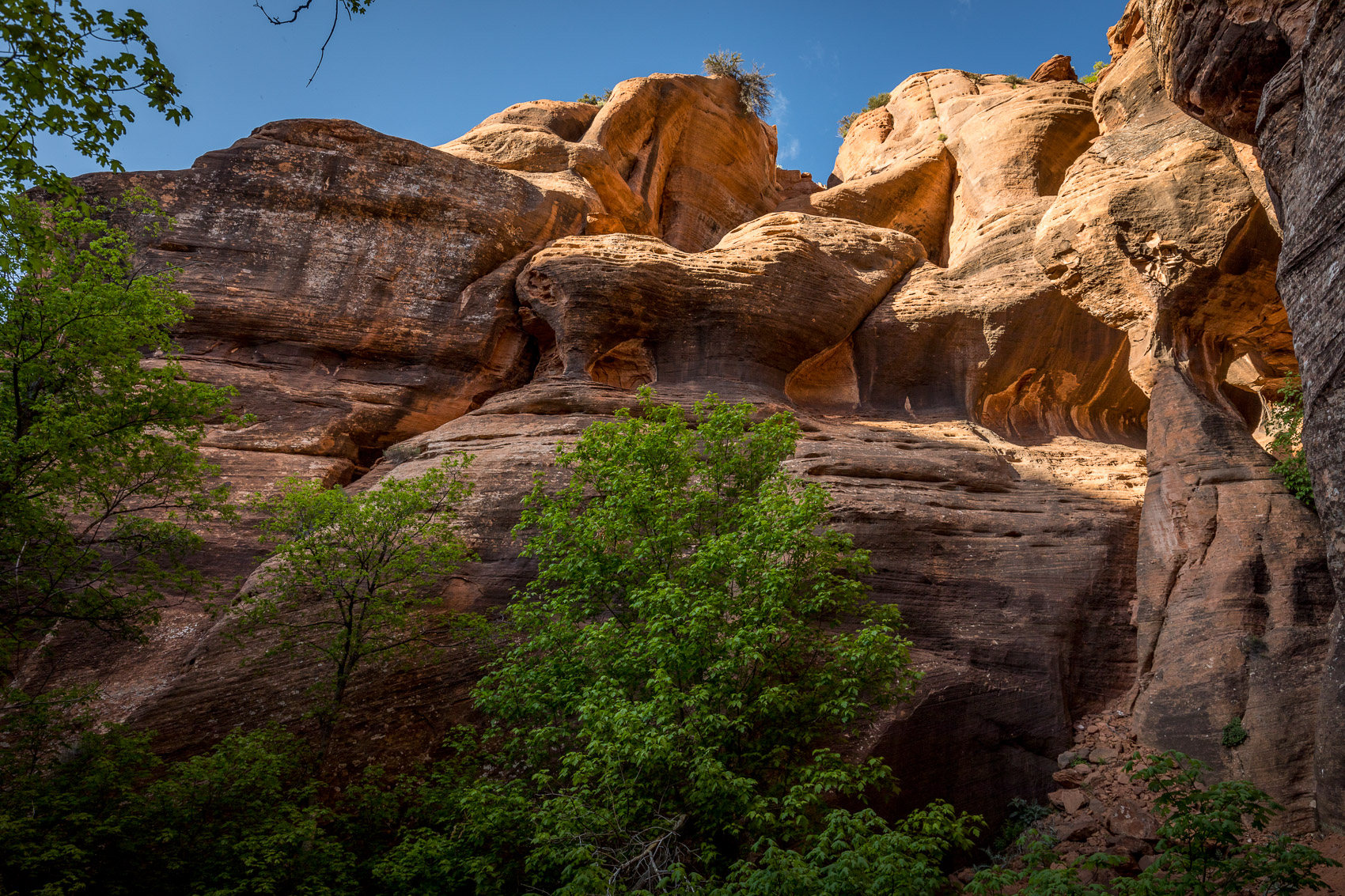
I have (so far) found three other arches in Red Butte Wilderness. The first arch, which I’m referring to as Fisher Arch, is high above the canyon floor and is situated in a position where it doesn’t get sunlight for much of the day. Despite being a very large arch it blends in with the background and as a result is not easily noticed. The first time I saw it I was far away and only had a wide angle lens. Even looking at the pictures later, zoomed up on my computer, I could not tell for sure if it was an arch. So it nagged at me for almost a year before I went back to check it out and take the photos below.
Approaching Fisher Arch.
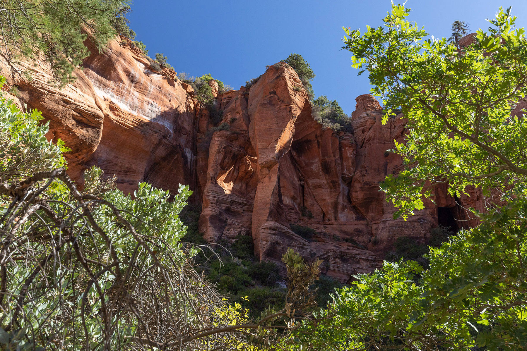
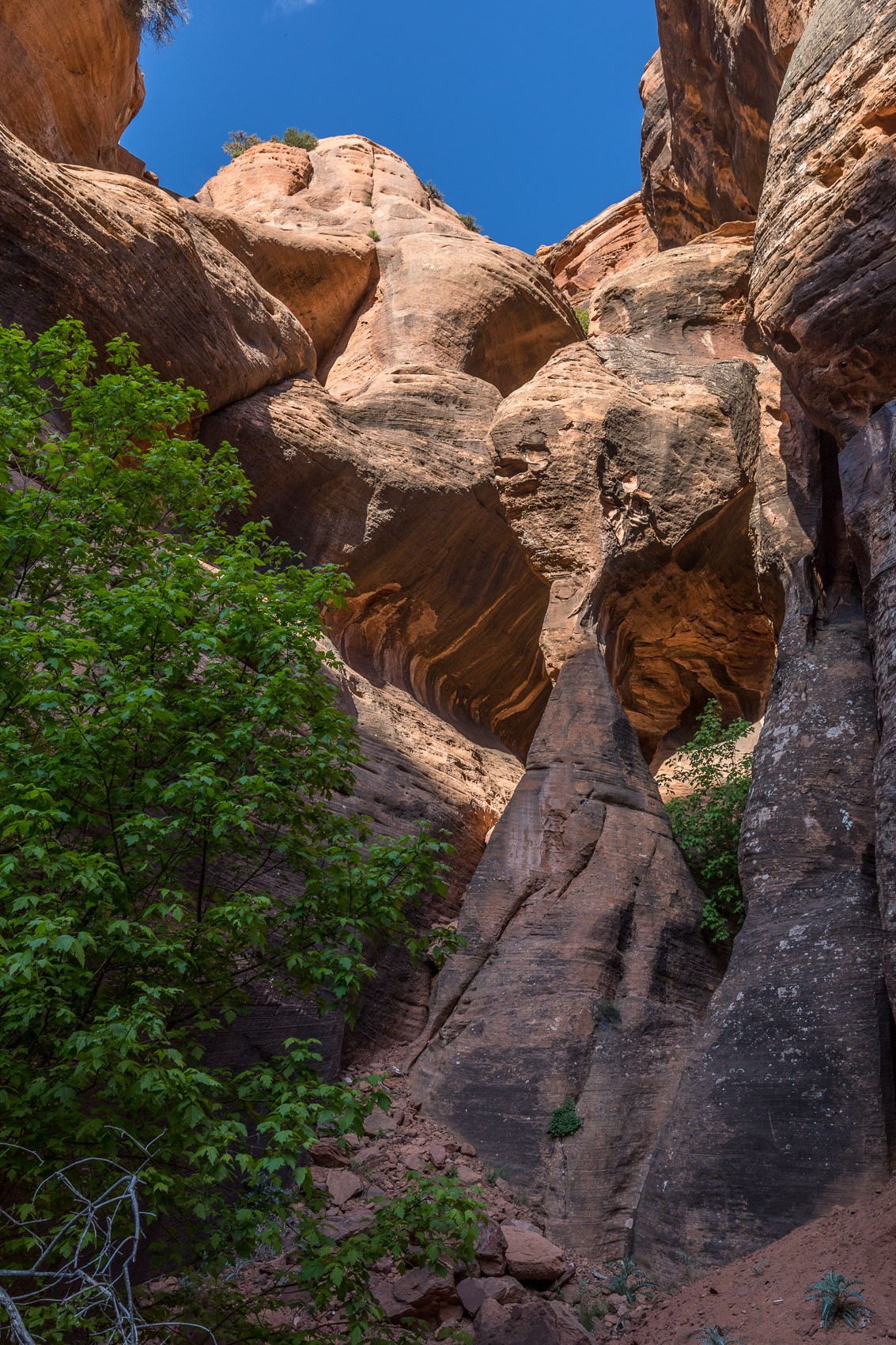
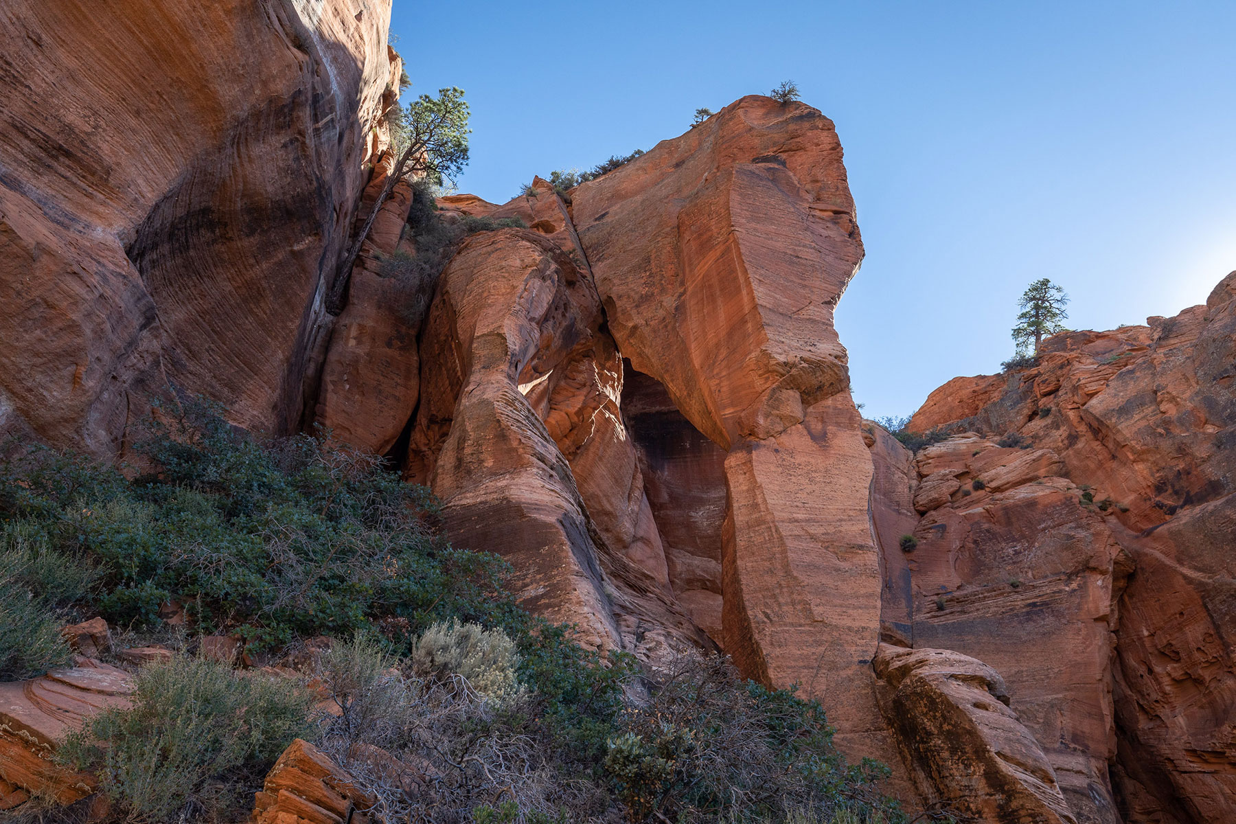 Closer view of Fisher Arch.
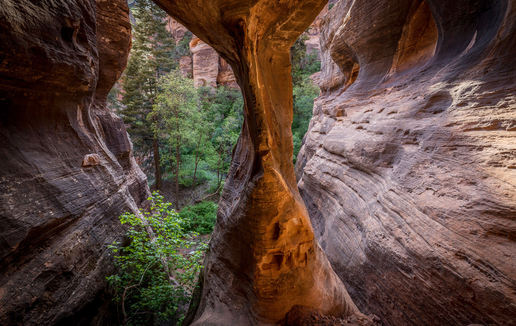
I recorded the coordinates with Gaia GPS on my phone (12S-309643-4136684) and took measurements as best I could with a laser meter (it’s approximately 65 feet high and around 30 feet at it’s widest). It’s not easy to move around the arch but it can be reached with a bit of a class 3+ scramble. The view from behind is shown below.
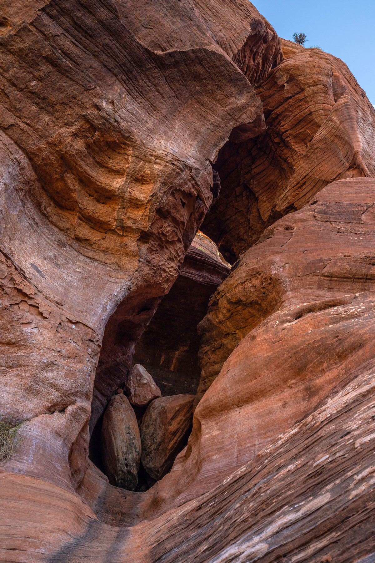
The second arch I thought this was just an interesting hole in the cliff until I got close and noticed it was separated from the wall behind it. I call it Pietila Arch and the coordinates are 12S 309935 4136444. the height is about 44 feet from below the boulders, and the span is about 20 feet. I tried to climb up the front entrance but the boulders in the photo below are about 10 feet high and I wasn’t able to get up them.
But the back side can be reached via some steep scrambling through brush and sand. Behind is is a nice little slot canyon shaped like a combination of a “V” vertically and a footprint like an “L” so water flows through here in storms. The photo below is looking through the arch from the back side.
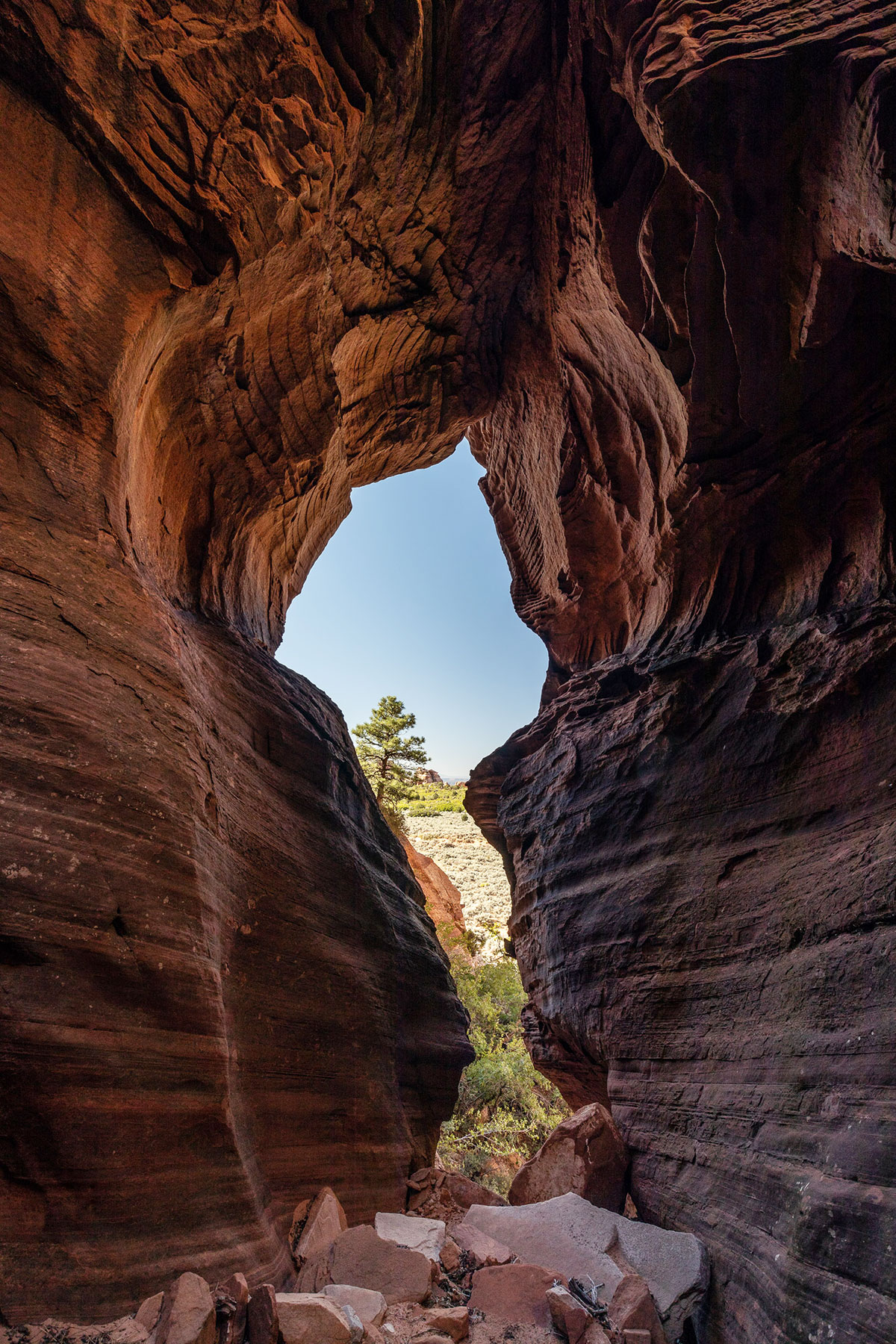
In the photo above, you can see the arch in the center going through the rock to the left. The slot canyon goes off to the right. Another view of the arch can be seen below.

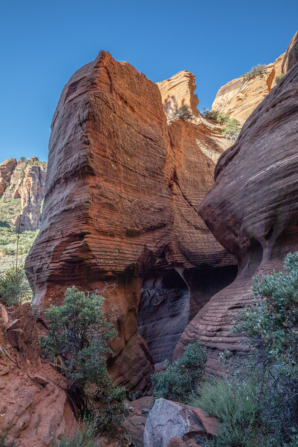
The third arch I call Adams Arch. It is a small one (about 8 feet by 8 feet) but is quite pretty once you are up inside it. It’s up on a wall, again, on the east side of the hidden canyon behind Red Butte. The coordinates are 12S-309584-4136809. In the approach photo below it is on the very far right.
Here is a better view:
And the view from inside:
Impressive structure and lovely lines in those rock formations. A really interest place to roam around and visit (whenever I get State side).
Thank you for sharing always looking for places off the beaten track.
Thanks! It’s a very interesting and complex area. On subsequent trips i found two more arches in another area but i have not been able to reach them (one would be impossible without ropes).
Is there a website posted with the measurements (width and height) of the arches in Utah? I am mainly interested in the “Little Arch” in Moab on the Poison Spider trail. Thanks for your help.
Utaharches.com has a photo and coordinates but not the size:
http://www.utaharches.com/MA/littlearch.html
Vreeland’s Nature’s Bridges and Arches lists the arch as 5-4 and gives an approximate span of 40 feet and height of 20 feet. Chris Moore’s Arch Hunter Books lists a span of 40 feet and height of 15 feet. Both references are available in the members-only section of our website.