Category Archives: Fallen Arches

Arch Collapse in Arches National Park (Rainbow Arch)

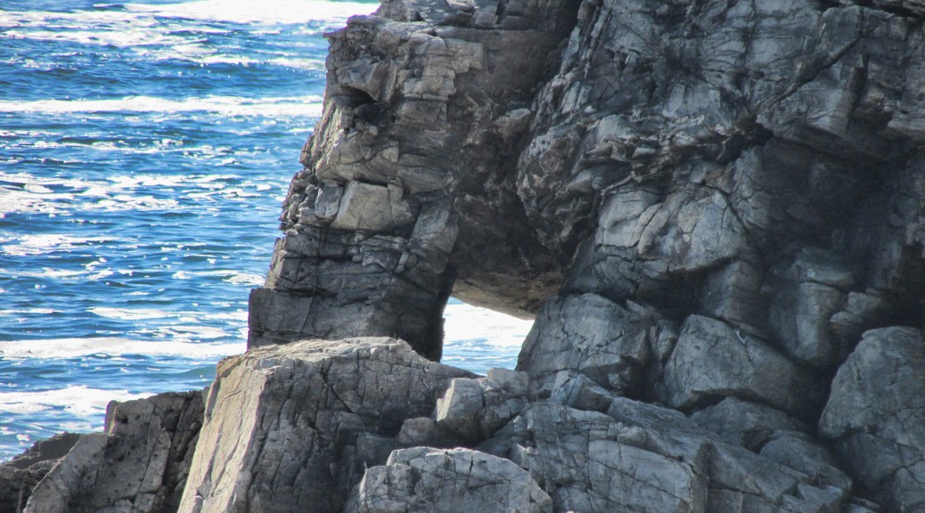
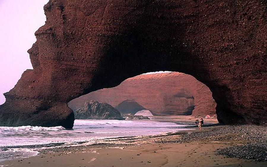
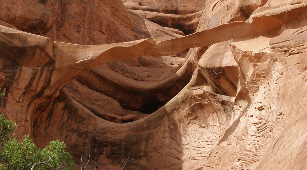
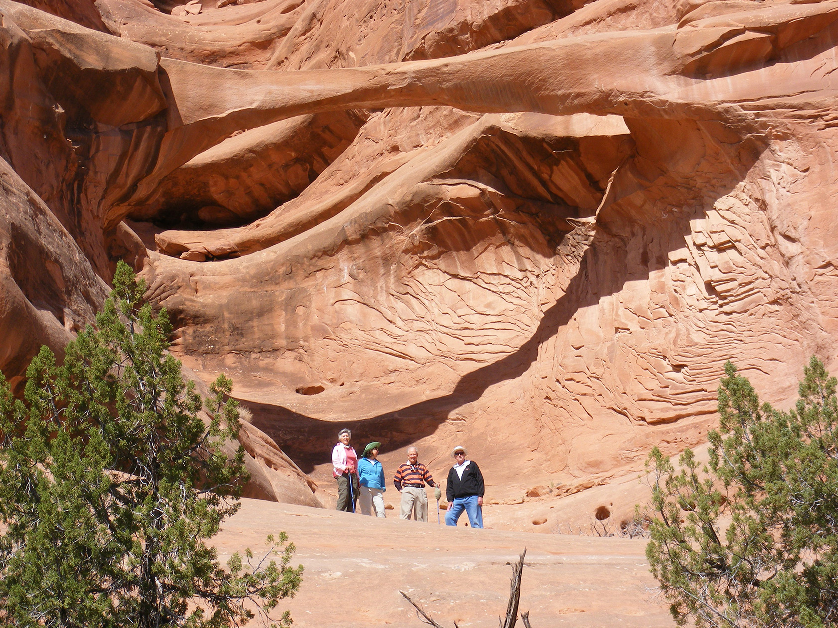
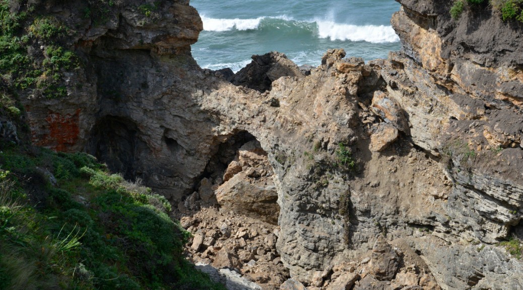
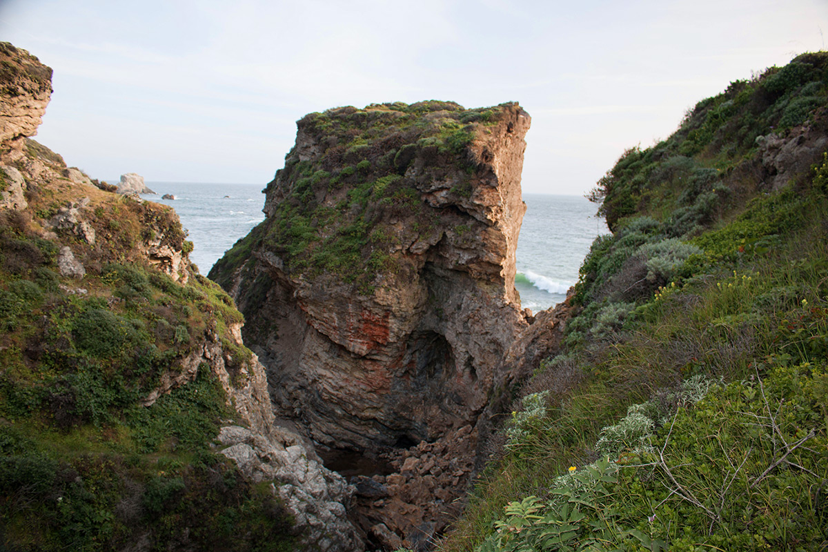
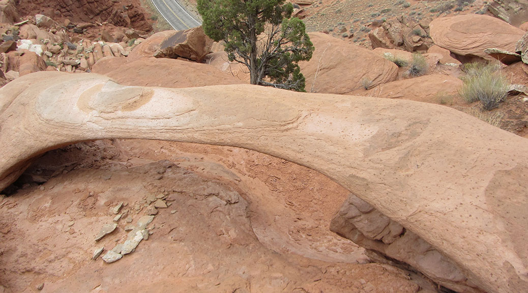
Rainbow Arch, located just above the visitor center in Arches National Park, collapsed sometime this winter. A park ranger noticed it was no longer standing during a hike in February. The arch was cataloged by Stevens and McCarrick as SA-137 and had a reported span of 11.7 feet.

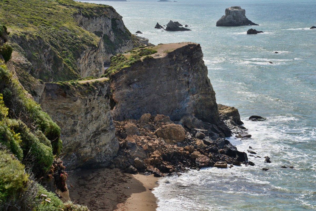
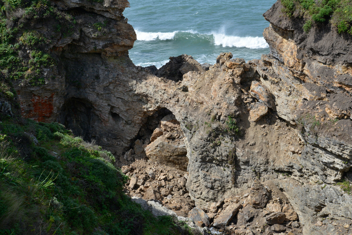
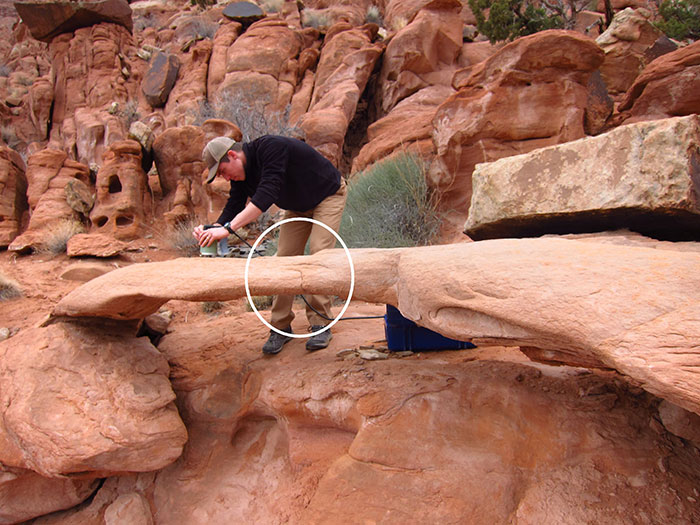
A research team from the University of Utah, including Jeff Moore and Paul Geimer, had actually been studying this arch not long before the collapse. The “before collapse” photos here were taken by Jeff Moore, and the “after collapse” photos were taken by Paul Geimer. The “before-after” comparison below was assembled by Holly Walker.

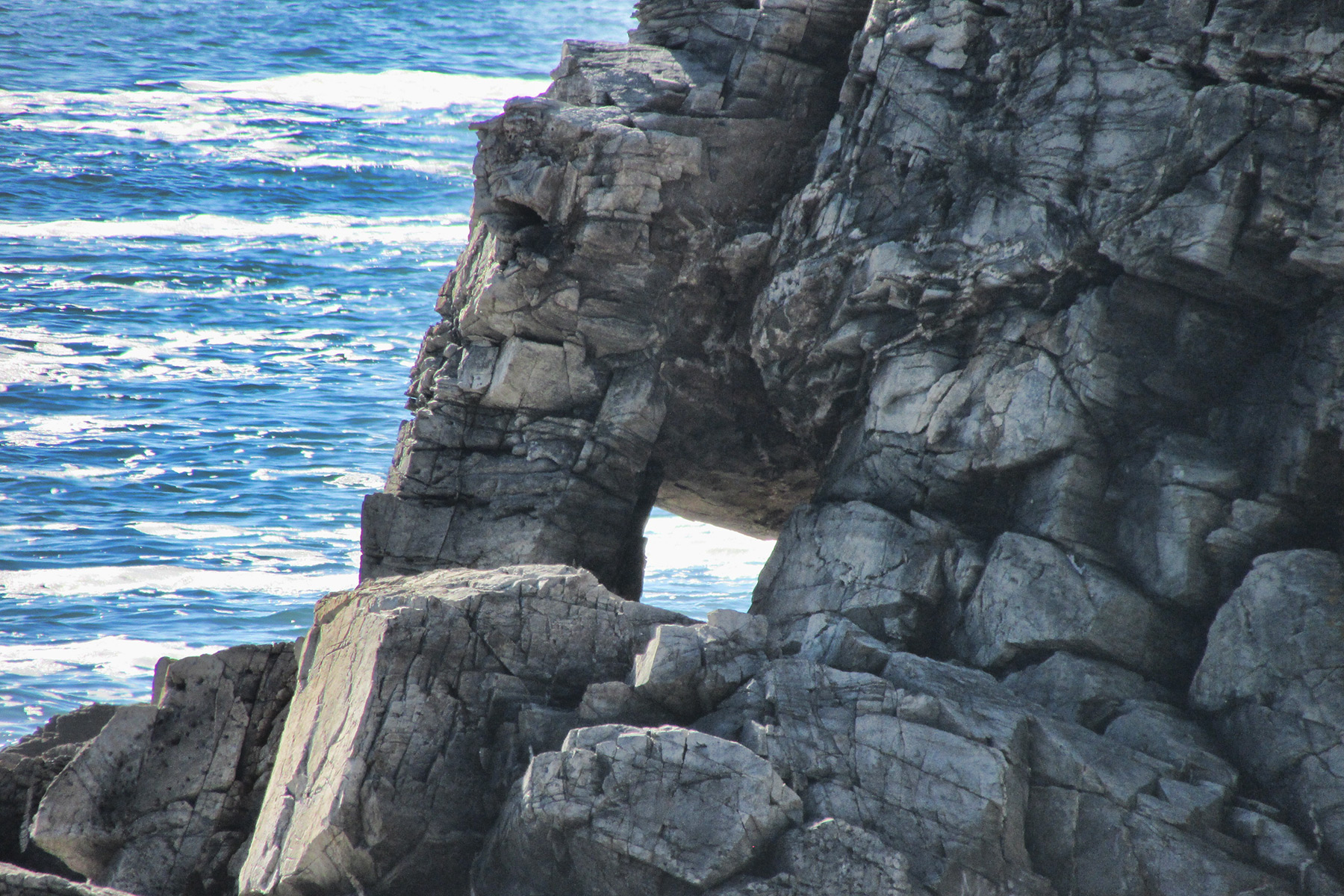
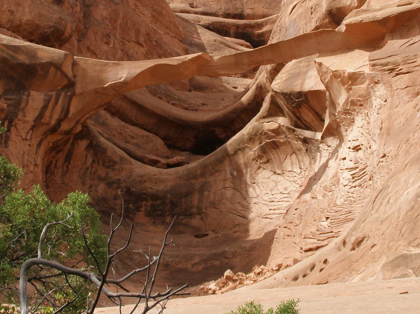
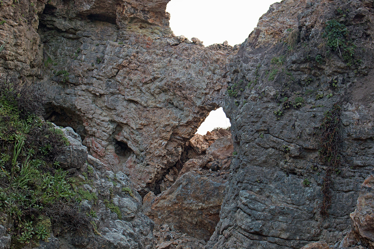
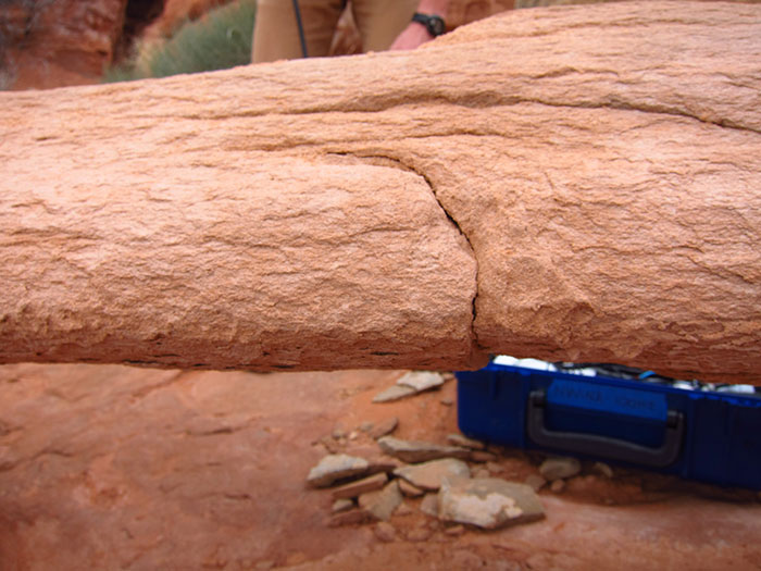
The team made vibration measurements four times at the site in 2017, focusing on a prominent crack working through the center of the span that appeared to be putting the structure in jeopardy. The crack is circled in the photo below.

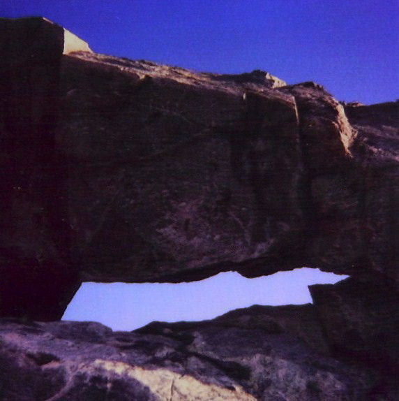
Close-up photo of the crack before collapse:

However, the team observed no changes in the crack or vibration characteristics over 12 months, and backed off on their monitoring program, believing the arch to be more stable that it appeared.

The collapse is bittersweet for the team, as it highlights and validates the fragility of these features, but unfortunately they were unable to record its last few weeks and months and identify accumulating damage.

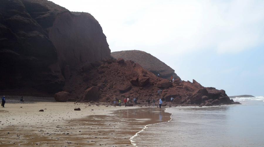
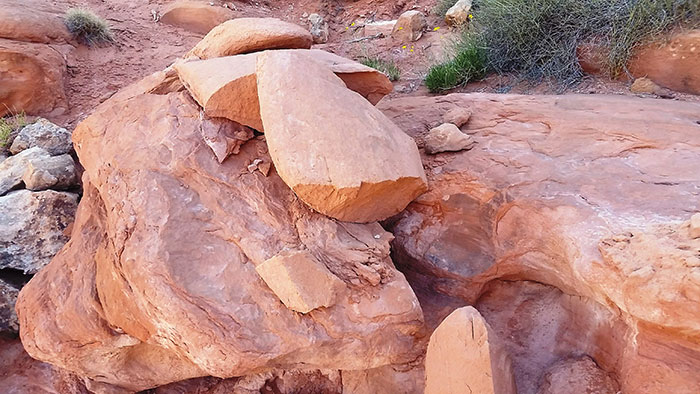
Below is a photo after collapse.

While they can’t say for certain what caused the collapse, they believe the most likely explanation is that fatigue caused by daily and annual heating cycles finally stressed the tip of the crack enough to cause a runaway failure sometime this past winter.

Rainbow Arch lives on in the virtual world as an interactive 3D model made by the research team that can be found at https://skfb.ly/VMvB.


Azure Window Collapses

Famous Azure Window in Malta collapsed during a storm on March 8, 2017. Not only did the lintel itself collapse, but the entire outer column fell into the sea.

The arch was considered at risk of collapse and walking across the arch was prohibited only last December. And in January, a slab of rock fell off a lateral face of the outer column during high seas.

The spectacular arch was featured in many movies, including Game of Thrones. Some history of partial collapse can be seen in these movies. In the scene below from the 1981 movie Clash of the Titans, the underside of the arch is flat.

In the scene below from the 2002 movie The Count of Monte Christo, it can be seen that the underside of the lintel has fallen to create a more arced shape.

Portland Head Lighthouse Arch, Maine

By Nick Terzakis

Maine is not known for natural arches but there were four small ones reported in the Journal of Natural Arch Discoveries.

This October, Pat and I  drove up the Maine coast stopping at some nice lighthouses. At the Portland Head Lighthouse in South Portland, ME you can see Portland Head Lighthouse Arch (ME-4), which is just south of the lighthouse.

me-portland-head-lighthouse

me-4-portland-head-lighthouse-arch

Directions: In Portland, drive State Street south across the bridge into South Portland and turn left onto Cottage Road. Turn left into Ft. Williams State park and head to the lighthouse parking lot. You can see the arch to the south. Walk the trail south along the fence then go uphill to the top of the cliffs. Go left on a faint trail which goes on a pebble beach, and go right around the rocks to see the arch (only if it is low tide). The arch has a span of three feet.

Unfortunately nearby Portland Head Arch (ME-2) has fallen. It had a span of four feet. A scan of my old Polaroid photo is below.

me-2-portland-head-arch-fallen


Arch collapse at Legzira Beach, Morocco

The photo below shows two large natural arches at Legzira Beach, Morocco, in the Province D’Agadir about 10 kilometers north of Sidi Infi.

Legzira Beach - Victor Kaposi

The arch in the foreground, NABSQNO 29R 391178 3257234 with an estimated span of 60 feet, collapsed on September 23, 2016. The remains are shown in the photo below.

Legzira collapse

The remaining arch, with an estimated span of 90 feet, still stands. Our own Guilain Debossens stands by the arch in the photo below.

Legzira 2 - Guilain

Partial Collapse of Ring Arch in Arches National Park

By Terry Miraglia

These photos show a dramatic change in the appearance of Ring Arch in Courthouse Wash in Arches National Park. Sometime between April 29 and October 7, 2014, a significant portion of the arch collapsed, leaving the arch very much thinner and looking quite delicate.

Ring Arch 2014 Spring
Ring Arch Spring 2014. From left to right: Sandra Scott, Susan McDowell, Gus Scott, and John Slivka. Photo by Larry Beck taken during NABS Spring Arch Rally.
Ring Arch 2014 Fall
Ring Arch Fall 2014. Photo by Susan McDowell taken during NABS Fall Arch Rally.

As the photos show, the left abutment remains intact, but shortly beyond, a large amount of rock including a portion of the right abutment has fallen. The arc of rock that remains shows no fractures in the photos, but it showed no fractures in the earlier photos either. Standing under the arch, it appears as though much of the lower right front of the span has fallen.

Ring Arch may be seen almost directly west from the park road from a long pullout on the west side of the road (NABSQNO 12S-621729-4278463) about 0.15 miles southwest of the center of the Courthouse Wash Bridge. Binoculars will help, as the arch is about 1.3 miles from the road and the arch location is not obvious.

There is no established trail to Ring Arch. Walking directly to it from the park road view is not recommended since it is difficult to avoid disturbing sensitive desert soils. It’s also unpleasant to deal with the stickers in dense patches of Russian thistle and several tumbleweed-filled drainages. A better route starts on a use trail at the parking area on the northwest side of Courthouse Wash (12-622006- 4278791).

Ring Arch is tucked in a northeastward facing alcove and has morning sun. Courthouse Wash can have standing water, serious mud, and voracious seasonal biting insects. Walks taken after a dry spell and when insect populations are low are recommended. If you are good at finding use trails and return the way you came, your round-trip walk will be about 4.0 miles. This is a wonderfully pristine area, so stay in drainages when possible and do your best to insure there is only one narrow footpath leading to the arch.

Ring Arch is a very old pothole type natural arch, which has formed in the Slick Rock Member of Entrada Sandstone. The Slick Rock Member was deposited in tidal mudflats, beaches, and sand dunes during the Middle Jurassic period between 180 and 140 million years ago.

Sources agree that Harry Reed, a Moab photographer and custodian of what was then Arches National Monument, first reported Ring Arch in 1940. Slim Mabery, a former district ranger at the monument, named the arch in 1961. The name comes from the shape of the arch. According to the World Arch Database, Ring Arch’s span is 45’ with a height of 39’. After the recent rockfall, the arch may be marginally taller.

Arch Collapse at Point Reyes Kills One

Arch Rock at Point Reyes before collapse
Arch Rock before collapse. Photo by Robert Robinson.

One person died and another was critically injured just before 6 p.m. on Saturday, March 21 when the bluff above Arch Rock (V21-12, NABSQNO 10S-516381-4204424) collapsed when the two hikers were standing on it. The arch is at the end of the Bear Valley Trail in Point Reyes National Seashore, California. The pair fell about 70 feet and were covered by the falling rocks and debris. The collapse of the bluff came about two days after the National Park Service had posted warning signs about the cliff becoming weak from cracks and partial collapses.

Arch rock is a meander type natural bridge where Clear Creek had cut through the narrow peninsula which had connected Miller Point to the mainland as shown in the photo below, looking back from Miller Point across the top of the arch before the collapse.

Top of Arch Rock from Miller Point
Trail across the top of Arch Rock looking back from Miller Point before the collapse. Photo by Robert Robinson.

The photo below taken after the collapse shows that Miller Point is now an isolated butte no longer accessible by the trail that used to go across the top of the arch.

Arch Rock post collapse
After the collapse, Miller Point is now an isolated butte no longer accessible by trail. Photo by Robert Robinson.

The photo below shows the large pile of rubble after the collapse.

Arch Rock after collapse
Large pile of rubble after collapse of the bluff above Arch Rock. National Park Service photo.

The post-collapse photo below shows that the arch actually survived the collapse of the bluff above it, a testament to the structural strength that the arch form provides.

Arch Rock after collapse
This photo shows that the arch itself actually survived the collapse of the bluff above it. National Park Service photo.

The photo below shows more clearly that the arch survived the collapse but changed it shape and now the opening has a greater height. Clear Creek still flows under the arch but disappears under the new rubble pile.

Arch Rock after collapse
Arch Rock itself survived the collapse, but changed its shape. Photo by Robert Robinson.

The Park Service considers the formation to still be unstable and dangerous and has closed the trail to Arch Rock.

The three very short videos below by Robert Robinson were taken on April 23. The first video shows the approach on the trail that formerly went across the top of the arch. You can see fissures in the ground indicating the possibility of another collapse. The second video shows views of the collapse from the Coast Trail above the opposite side of the creek. The third video shows the still-existing arch from Coast Creek itself.

A special thanks to Robert Robertson and Jeff Moore for supplying material for this article.

Rapid Evolution of an Arch

Arch evolution can occur over thousands of years, but La Dame Blanche (The White Lady) in France consisted of a crumbly clay-like rock and evolved from youth to maturity to collapse in the course of just a few years.

The photo below taken by Albert Zwinkels in 2009 shows a small, young opening.

The White Lady
The photo below by NABS member Guilain Debossens taken in June 2014 shows a mature span of 20 feet.

The White Lady
The photo below by Raphael Rodon was taken in April 2015, showing that the arch had collapsed.

The White Lady
La Dame Blanche (NABSQNO 31T-663186-4933509) was located in the vicinity of Dieulefit village in the Drôme department of France, about 100 miles south of Lyon and 120 miles north of Marseille.