|
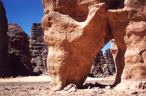
ALG-10, Shelter Arch, Tin Itinen Area. 2.5 meter span, 3.5 meter height (estimated). From
Tamrit hikers bivouac area, take the same route as for ALG-8 to the
flat area. Choice of trails can be very confusing in this gravel area so check with your guide.
There are four different trails from there. One goes to Tan-Zoumaitek and the Big Horn Fresco
rock art location via ALG-9 near the Great Canyon of Tamrit. Another
trail goes to Tin-Aboteka via ALG-146 and
ALG-147 (see Map 1). Two
alternative trails go to the Tin-Itinen and Titeras-n-Elias areas. The shortest trail is used by
hikers only. If you travel alone you take the donkey trail following the guide, the donkey
driver, and the donkey caravan. Described here is the donkey trail to Tin Itinen: Once on the
flat area bear east on the animal tracks along some isolated rock masses containing some light
rock art. After about 3 km the trail enters a low canyon. Go through this canyon and after about
30 minutes the trail emerges into the fabulous rock spire forest of Tin-Itinen. Cross it
following the primitive trail east and then NE until you reach a long corridor of rock. The arch
is located on the side of the trail in the middle of this corridor. There is a similar arch
behind this one.
|
|
|

|
Next Arch ALG-77
|
|