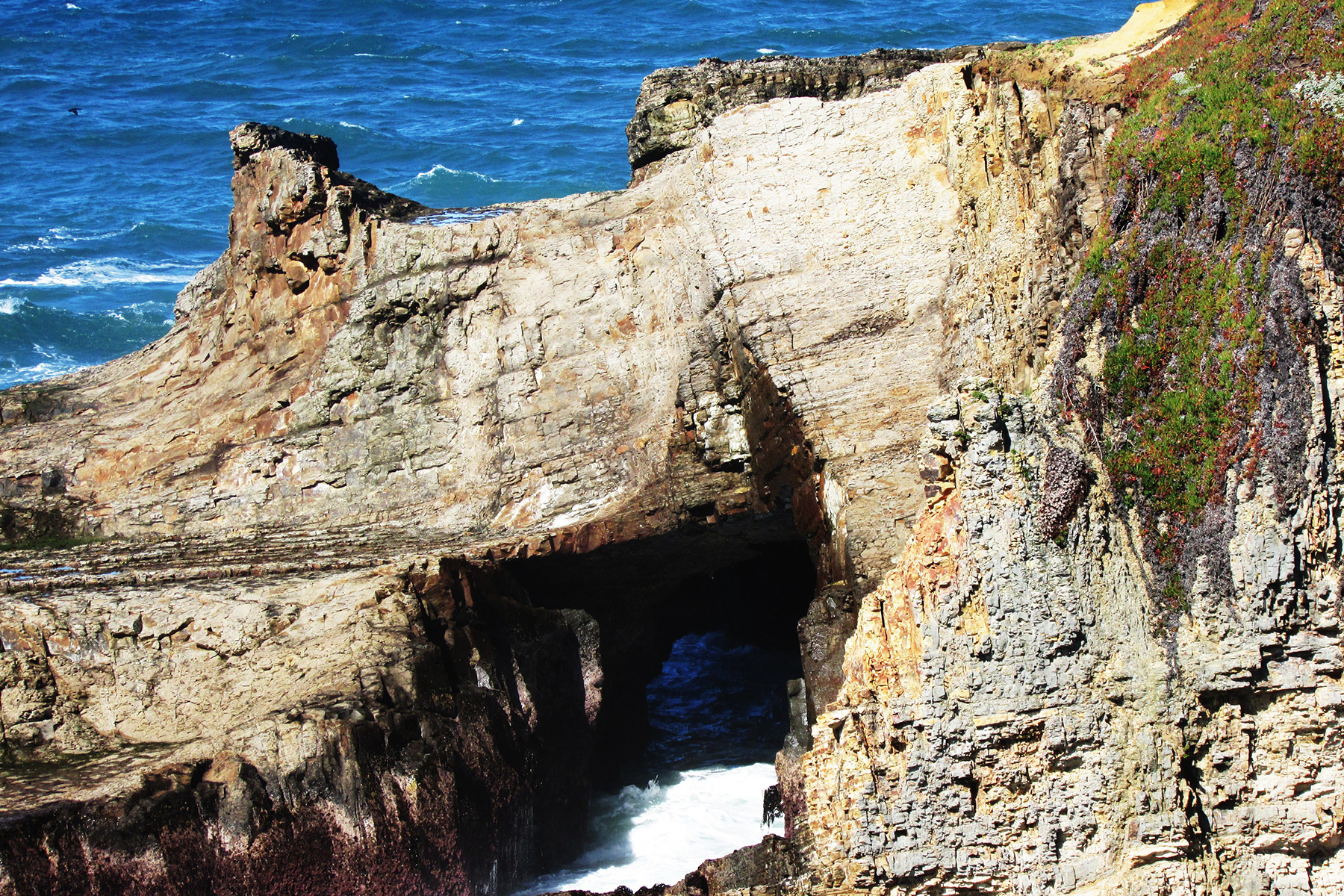
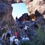
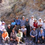
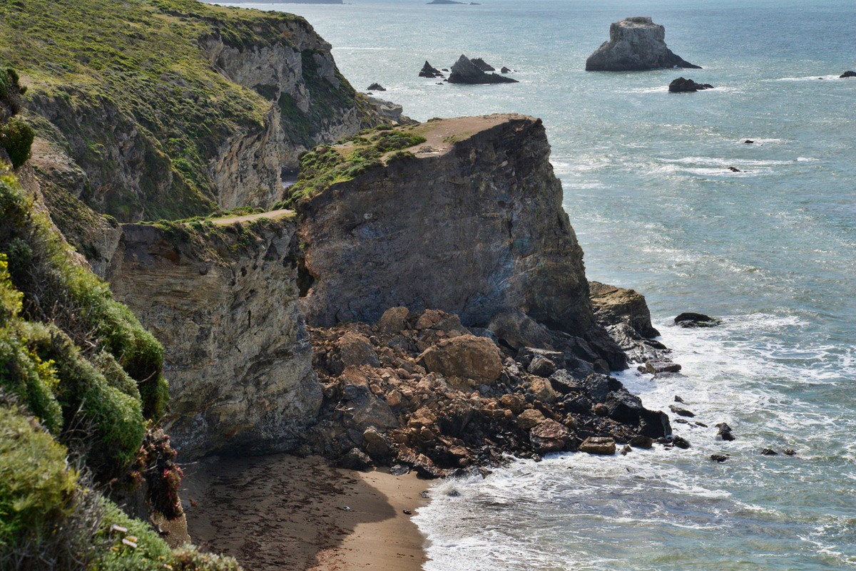
SPAN Editor Dave Kennedy gave me a tip about an area up the Northern California Coast called Storenetta Public Lands that has some sea arches. This area was once a dairy farm owned by Clover Creames based in Petaluma, CA. So I drove up to the area near the Pt. Arena lighthouse, parked at the Stornetta Public Lands trailhead, and walked the trail along the bluffs. It was quite windy. Coordinates given are from Jay Wilbur’s GIS section of the NABS website; sizes are estimates.
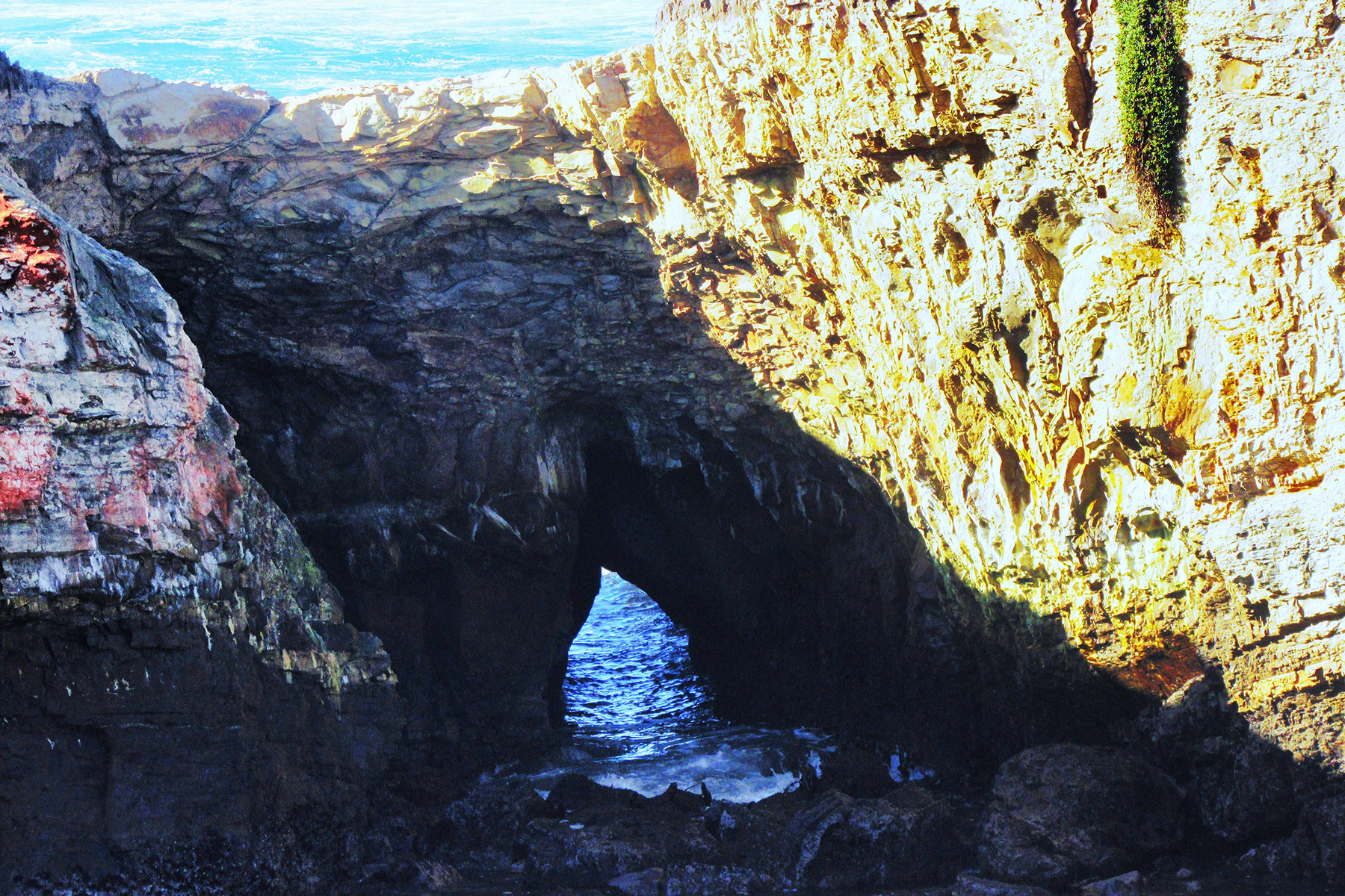
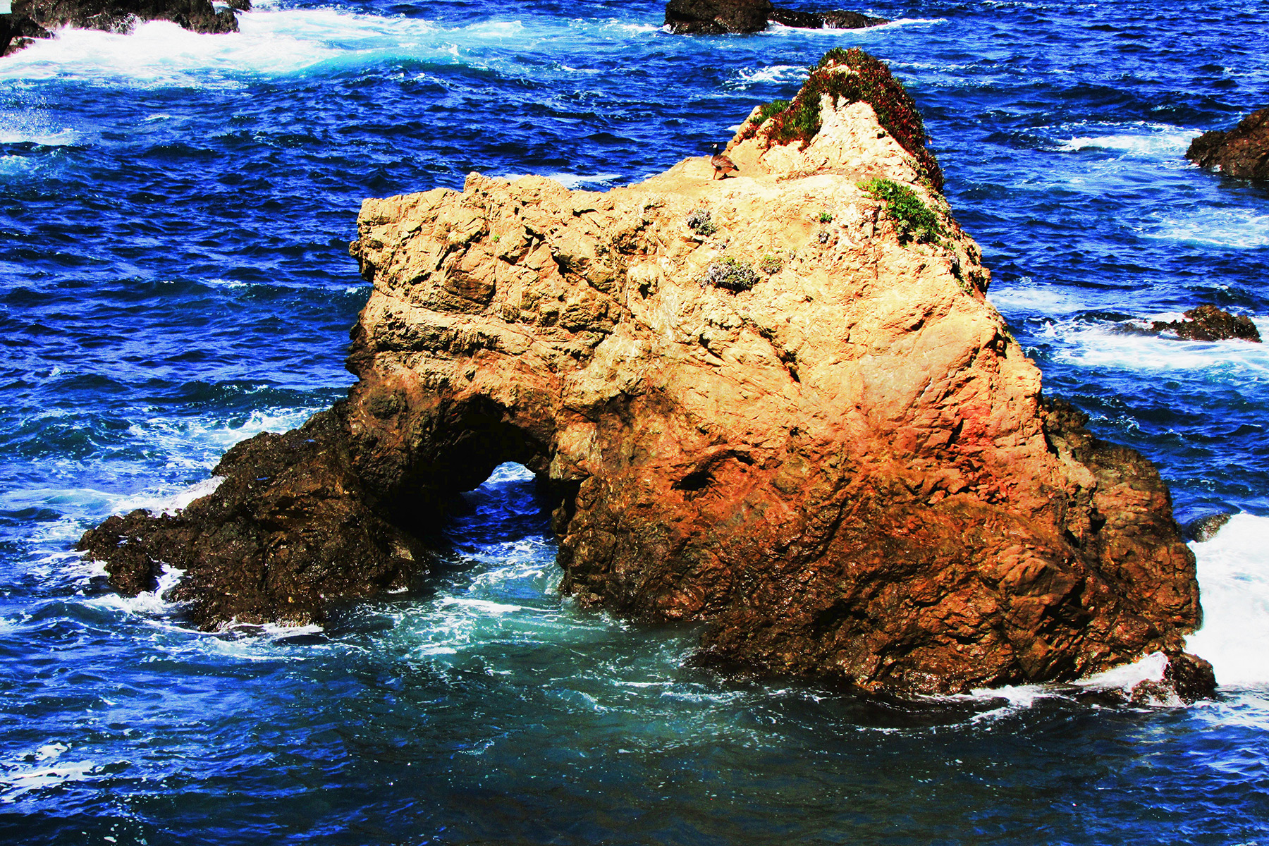
Off shore on a island is CA-85, Pt. Arena Arch, at 10S-43670-4310290, 30×35 feet, Photo 1:

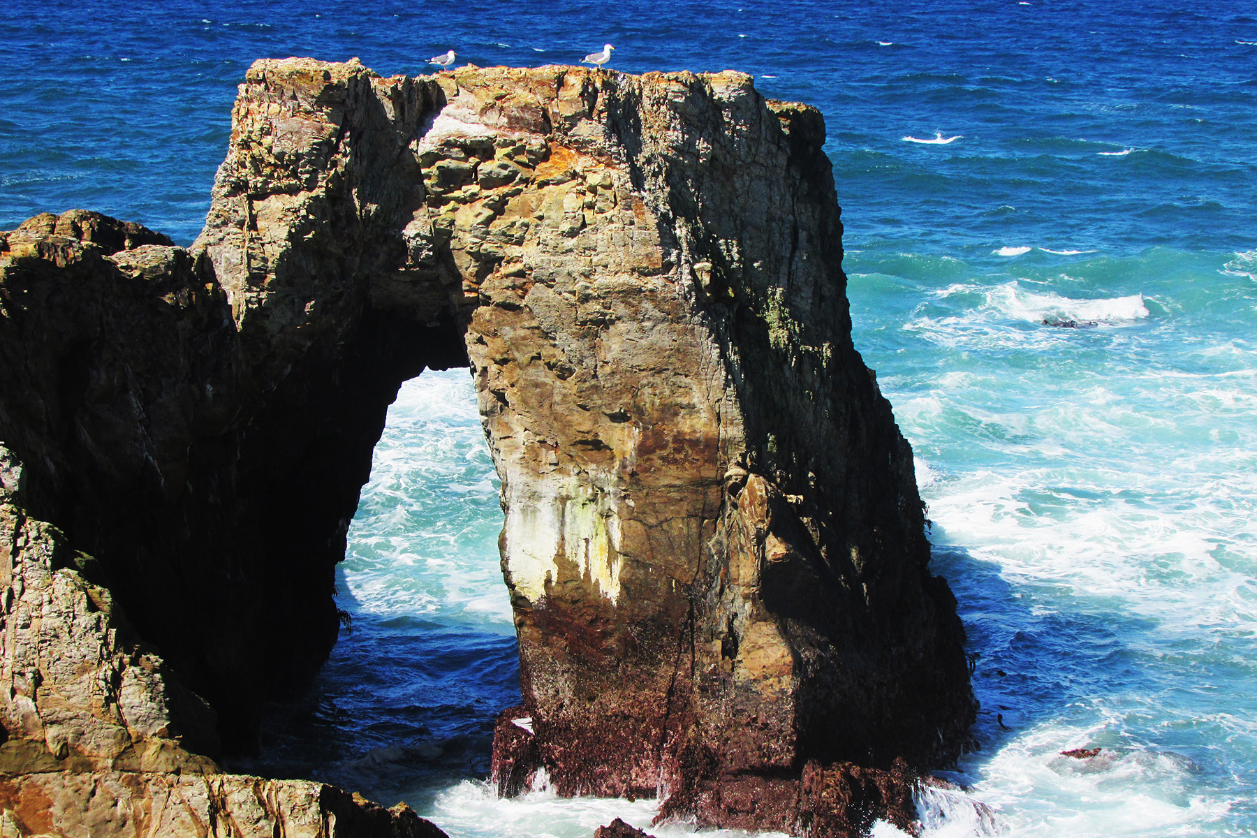
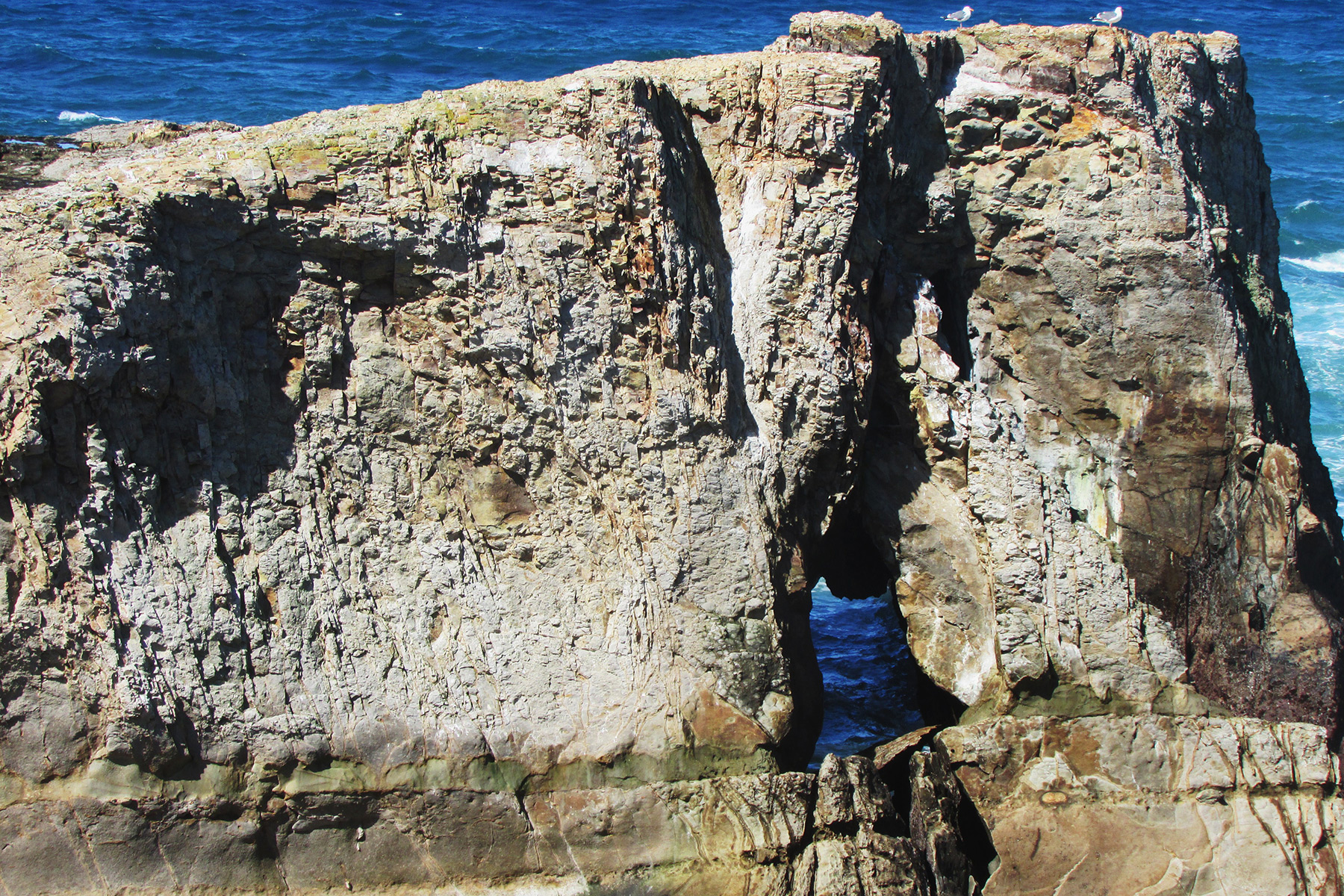
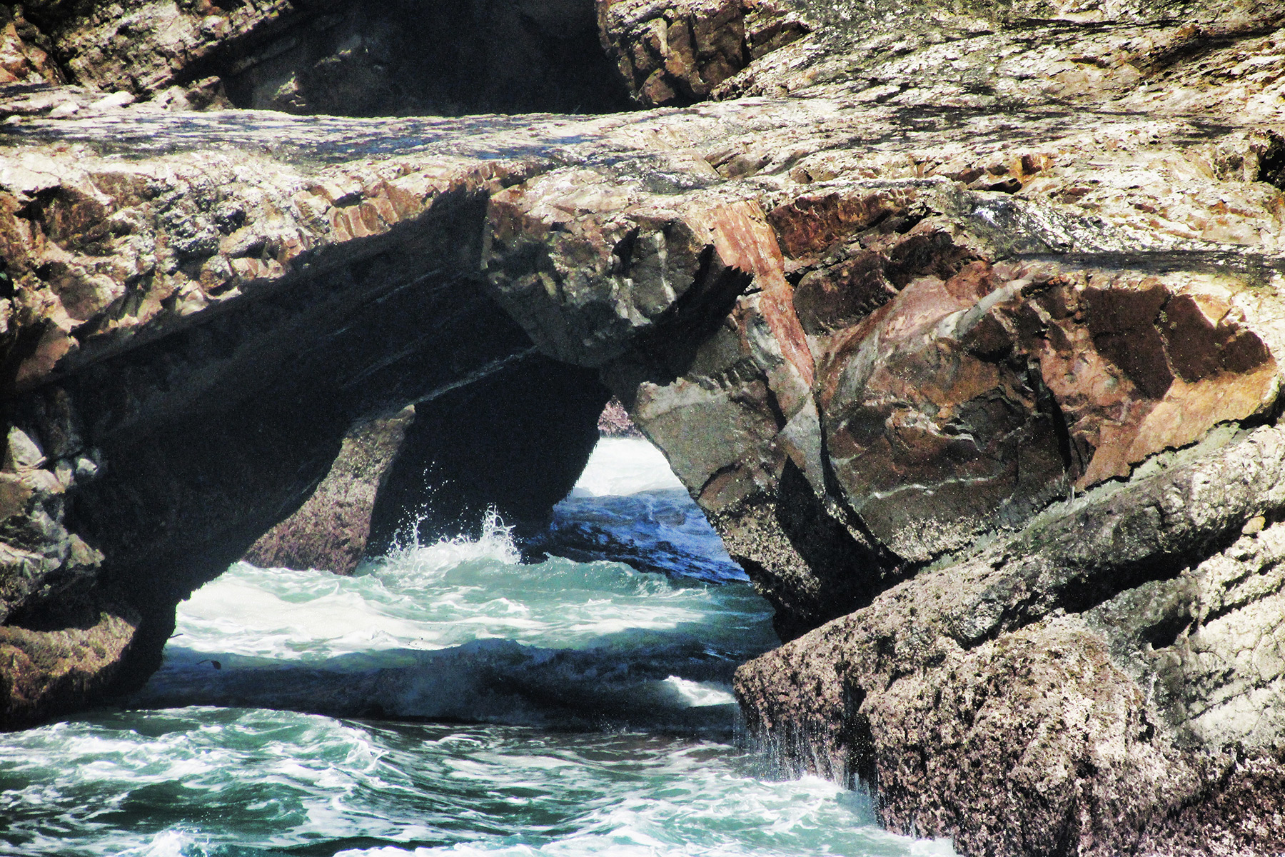
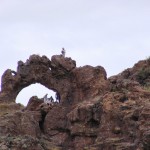
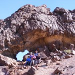
Just east of CA-85 are two other sea arches, 10×8 and 20×15 feet, Photos 2 and 3:
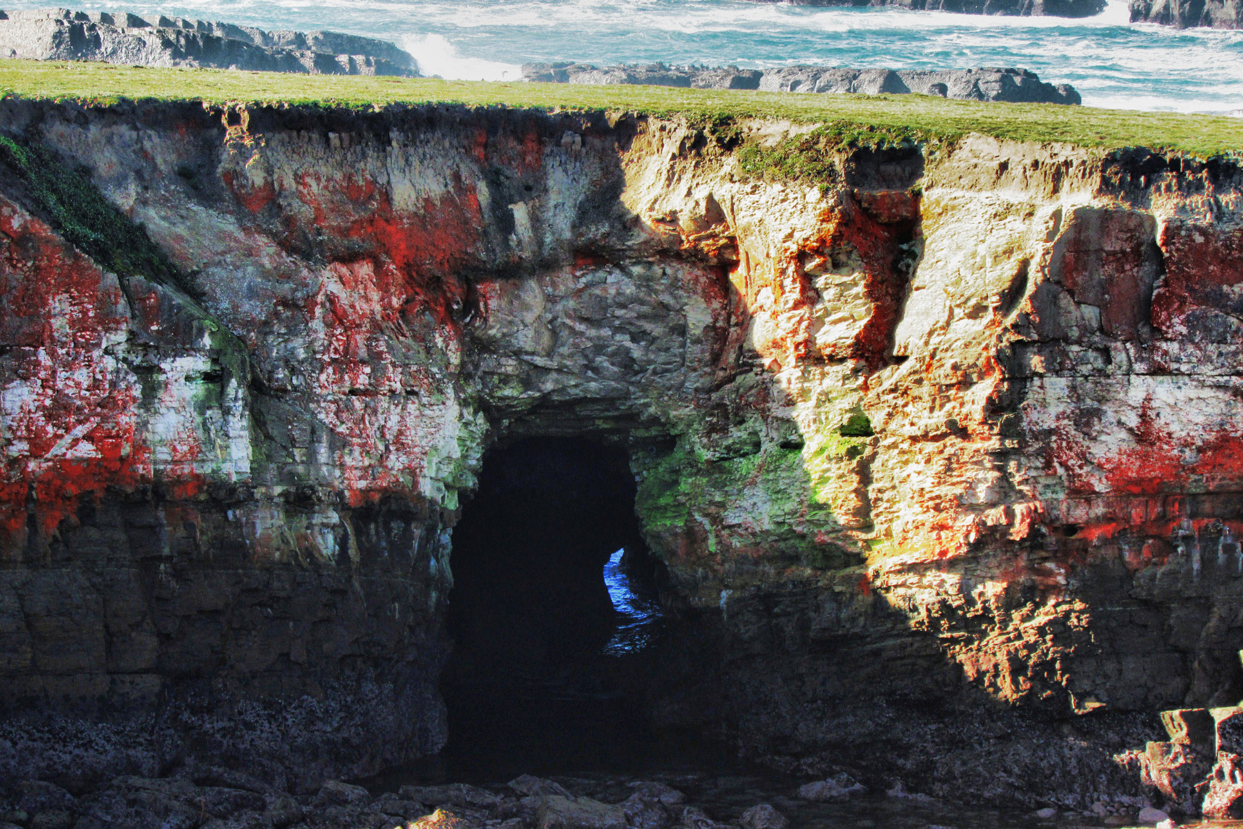
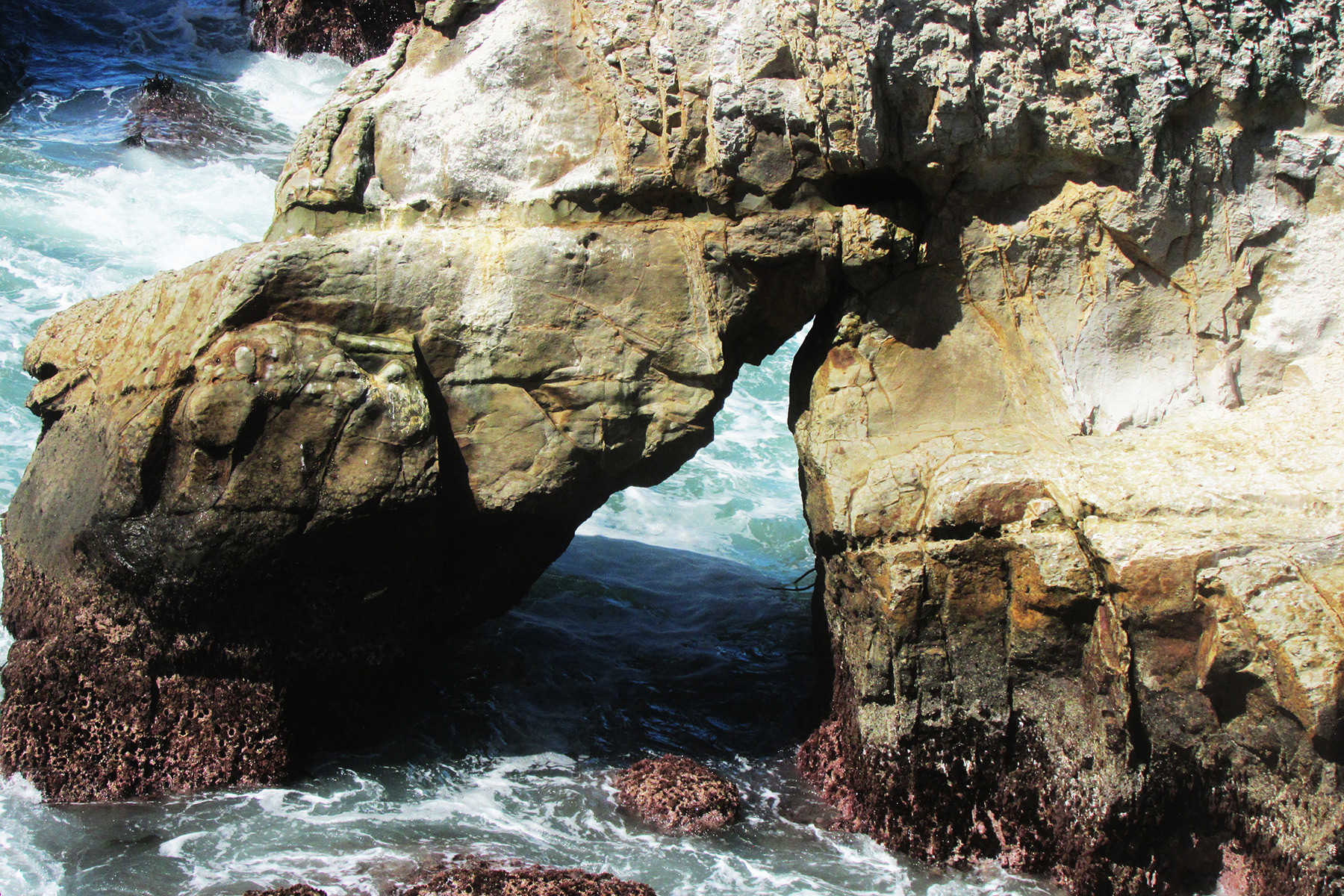
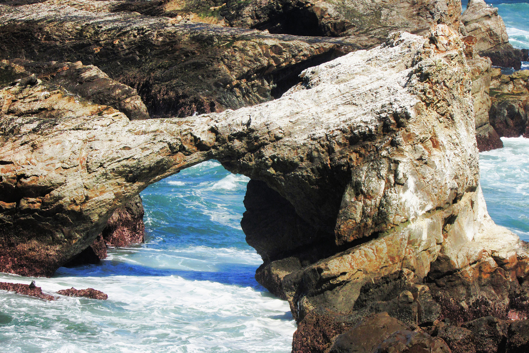
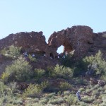
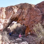
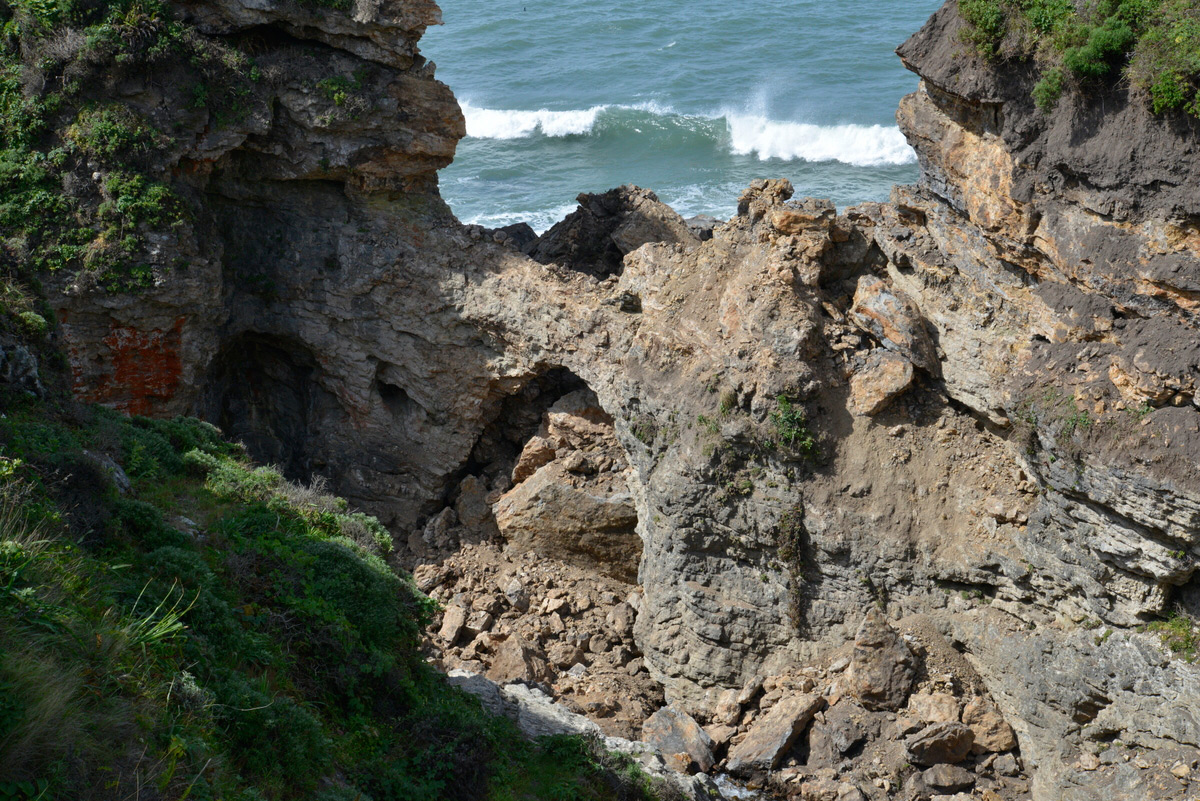
South on the trail can be seen an island called “Sea Lion Rock” which contains two arches, 10S-436670-4310055, 30×20 feet, and 10S-436730-4309980, 20×5 feet, Photos 4 and 5:

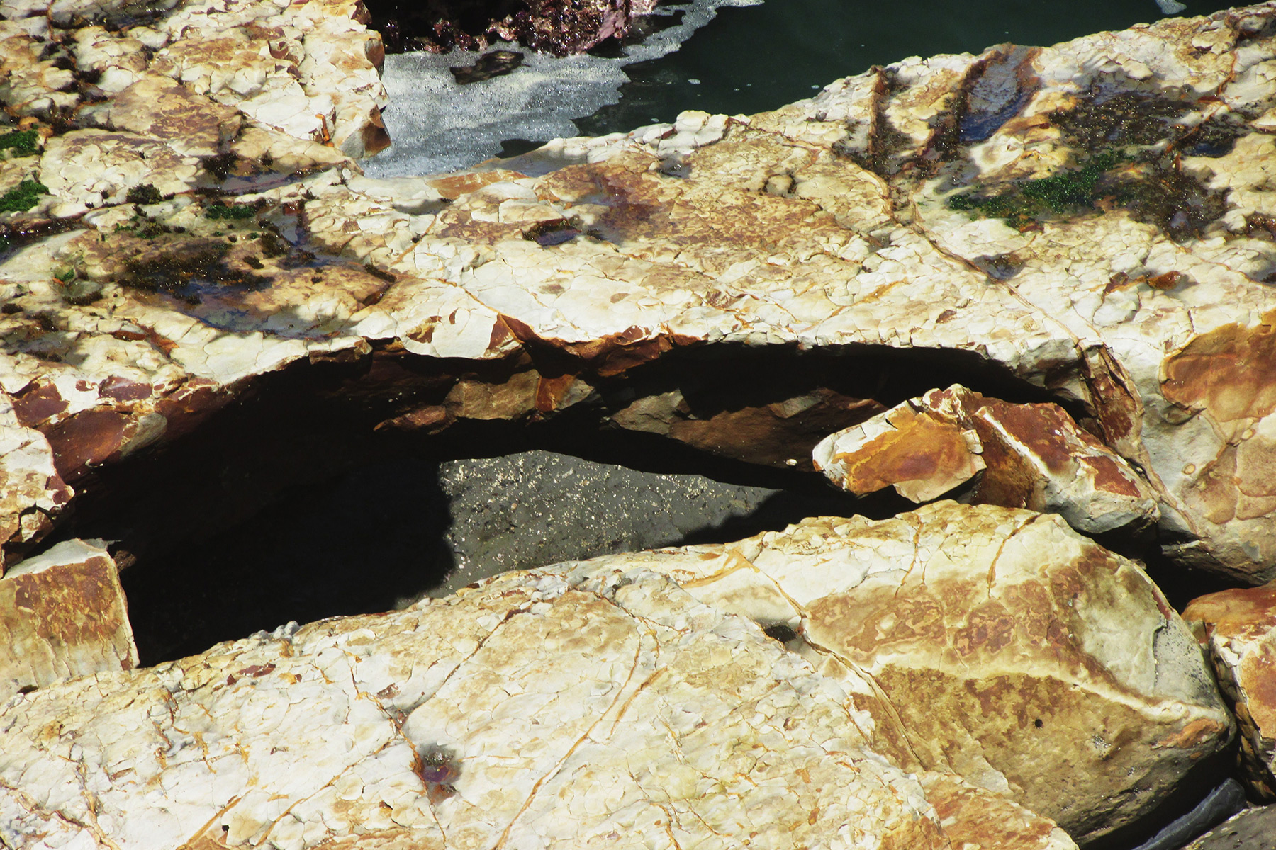
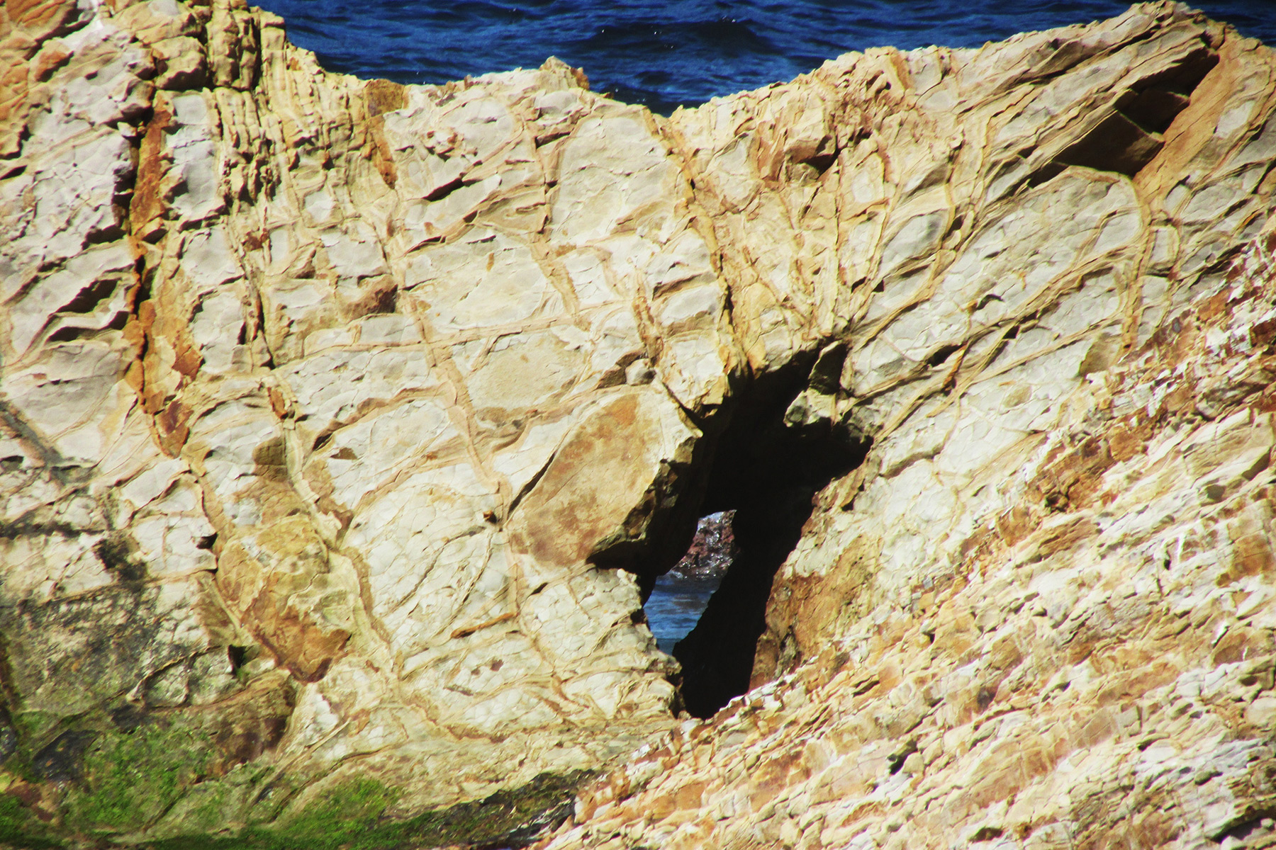
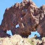
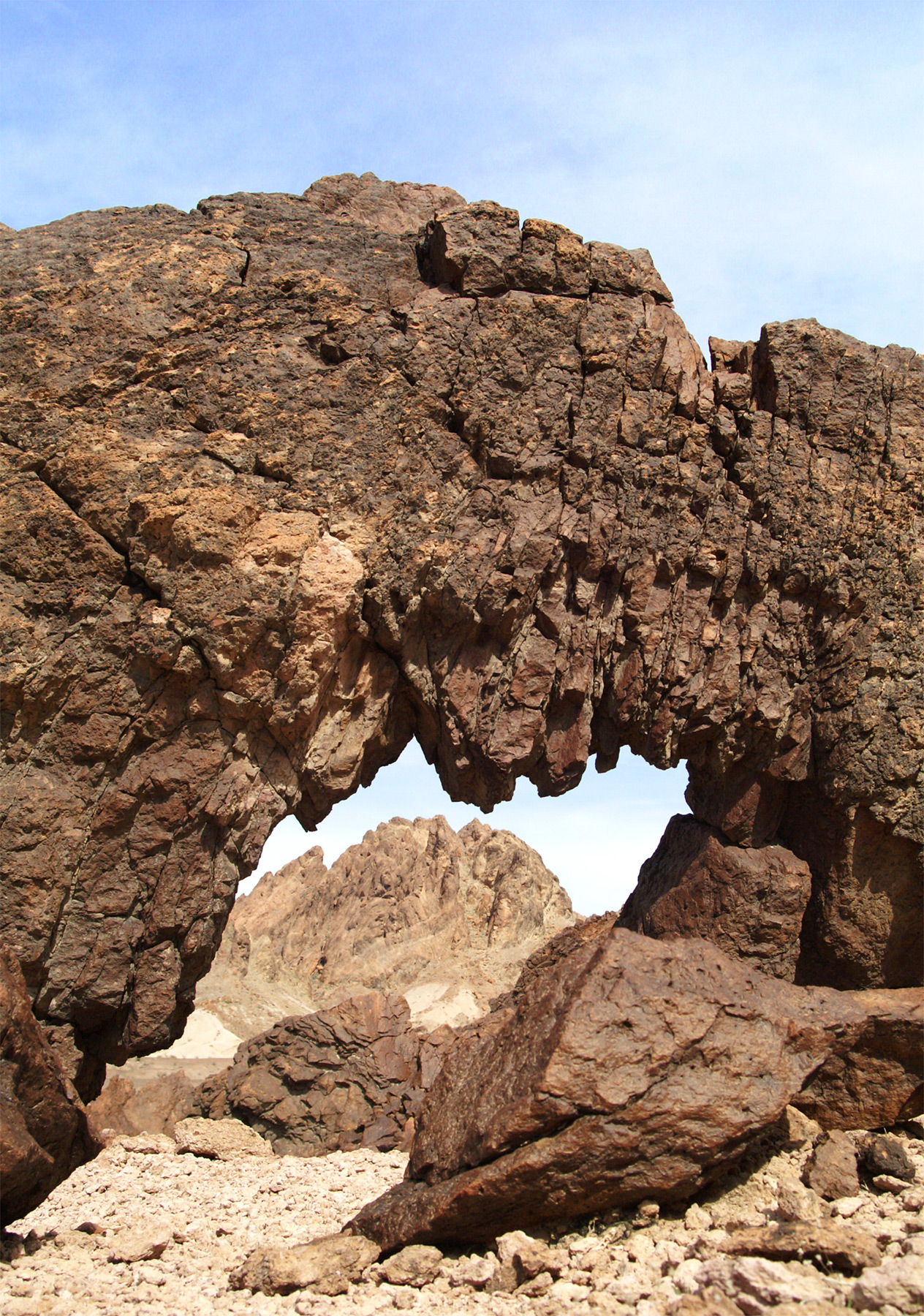
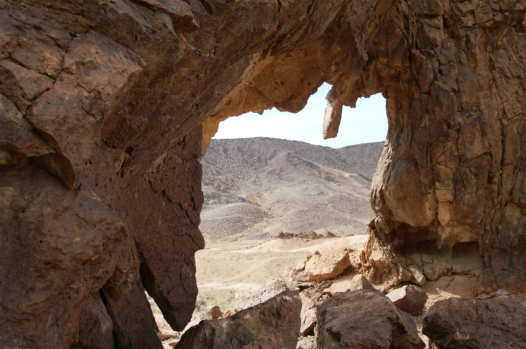
Further south along the trail near some trees is a sinkhole that has a sea arch with a pillar inside it, 10S-437040-4309680, 15×8 feet, Photo 6:
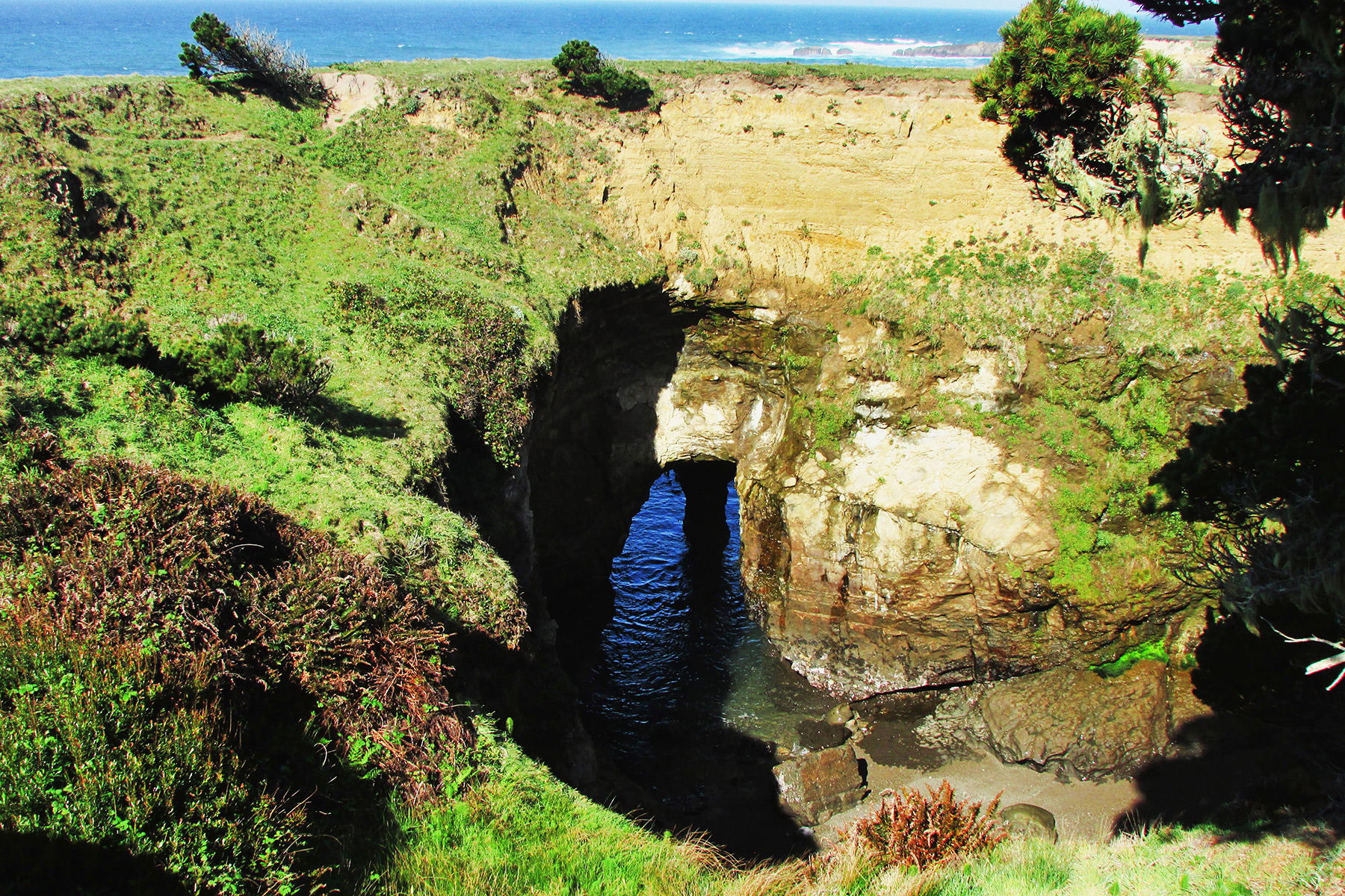
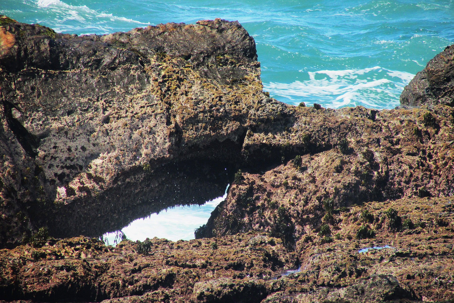
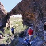
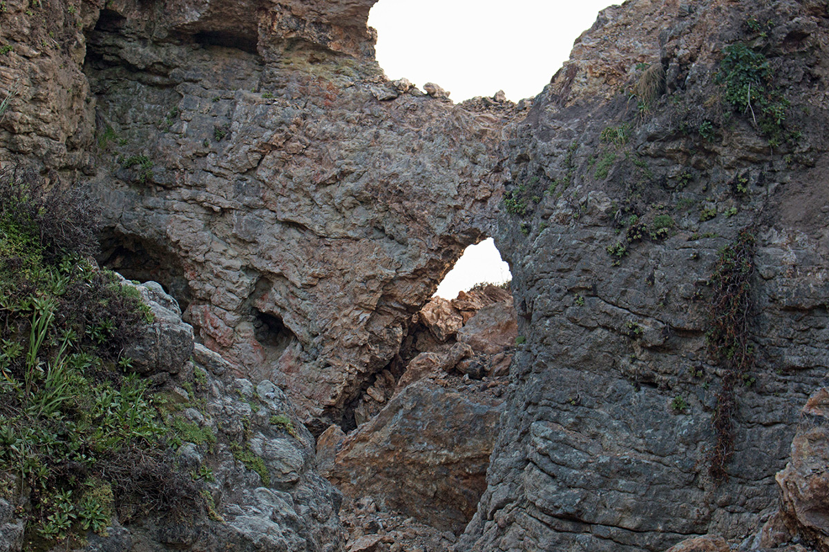
The trail soon crosses a creek, then goes up hill, and then goes around an agricultural conservation easement which is private property. The trail turns left onto a road and then goes right through a gated fence and follows the fence to the bluffs. On the bluffs on the private property side you can see an arch, 10S-436795-4309005, 10×8 feet, Photo 7:
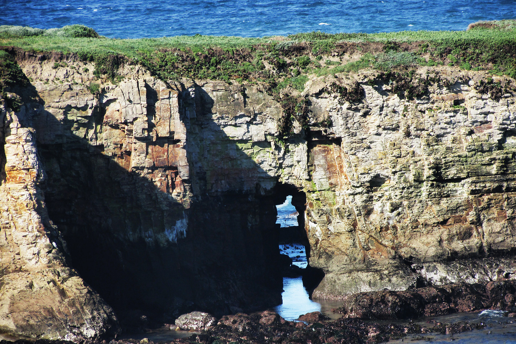
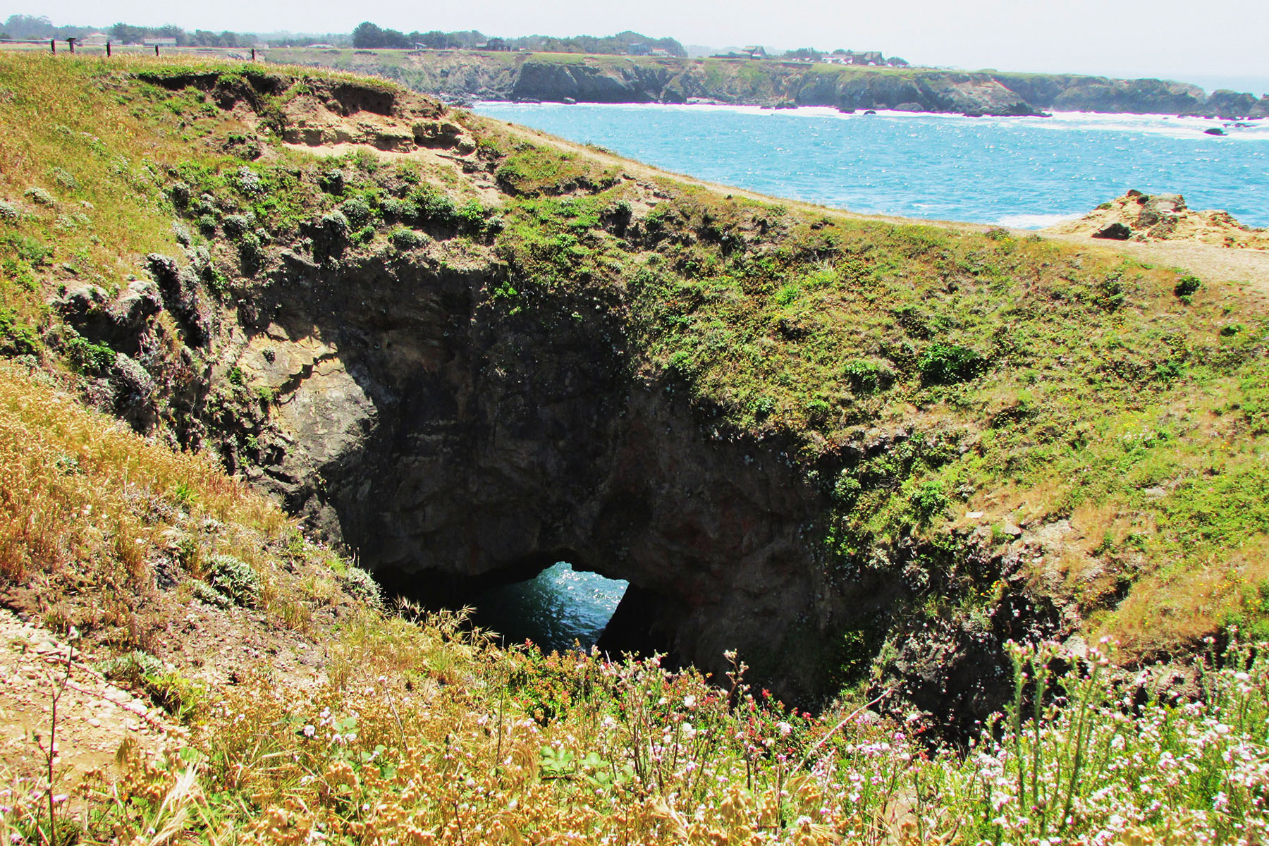
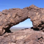
Go south along the bluffs to the first rock outcropping to find a nice arch, 10S-436805-4308560, 30×15 feet, Photo 8:
To the left is another sea arch, 10×5 feet, Photo 9:
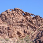
The second rock outcropping has 3 sea arches, one of which is a double, 30×15, 15×25, 25×40/30×20 feet, Photos 10-12:

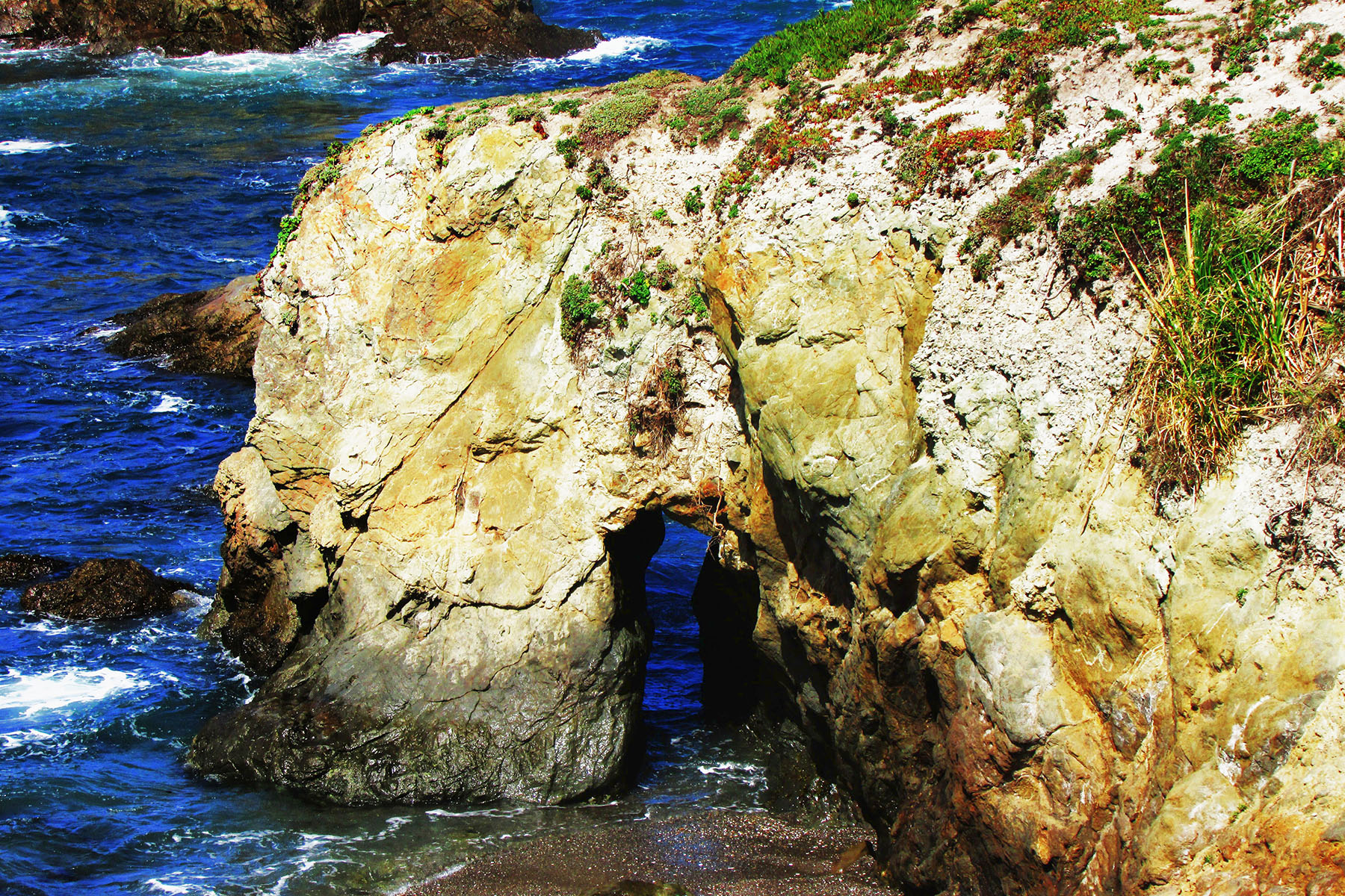
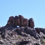
The next rock outcropping is The Hitch’n Post, 10S-436855-4308455, 20×40 feet, Photo 13:
Below the view point of The Hitch’n Post is another sea arch, 10×40 feet, Photo 14:
South along the bluffs is a sea arch with seaweed growing inside it, 10×30 feet, Photo 15:
Further south in a cove is sea arch which was the last one I saw, 10×8 feet, Photo 16:
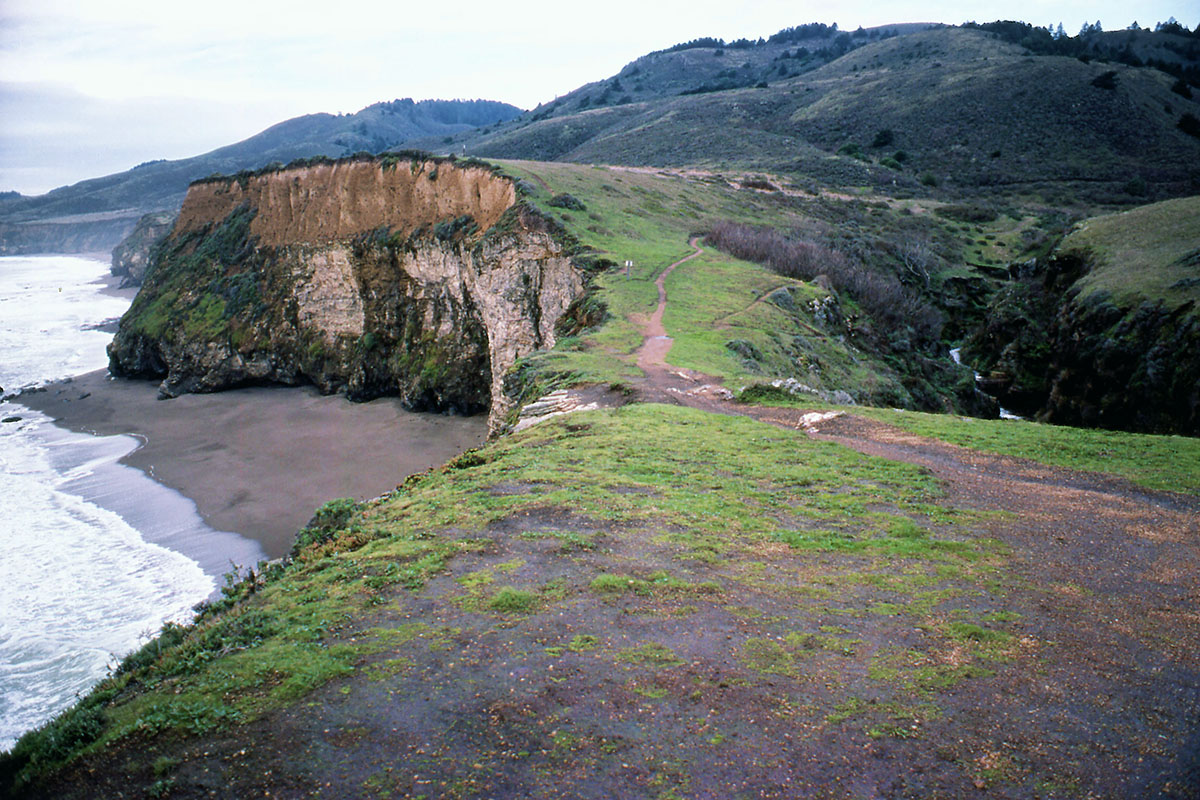
This past Memorial Day, Pat and I drove up to Fort Bragg, CA and stopped at Noyo Headlands Park which is a newly opened park. The city bought the land that used to be the the old Georgia Pacific Lumber Company and made some walking trails along the bluffs with some beautiful overlooks. The first area we visited was the southern entrance to the park which can be reached from State Hwy 1.
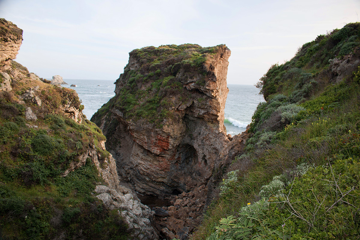
We turned west onto Cypress St. in Fort Bragg and parked at the end of the road. We walked the trail west then north to Johnson Rock. On the way is CA-209, Skip’s Punchbowl (10S-429814-4364940, span 15′ x height 20′):
The last area we visited was the northern entrance to the park which can be reached from State Hwy 1. We turned west onto Elm St. in Fort Bragg and parked at Glass Beach. We walked the trail west then south to Otsuchi Point. Just before reaching Otsuchi Point there are some steps made from logs that go down to a beach.
At the left side of the beach is CA-208, Glass Beach Arch (span 3′ x height 3′):

Back on the trail to Otsuchi Point are 4 more sea arches as follows.
Skeleton Key Arch (span 3′ x height 6′):
Island Arch (span 2′ x height 4′):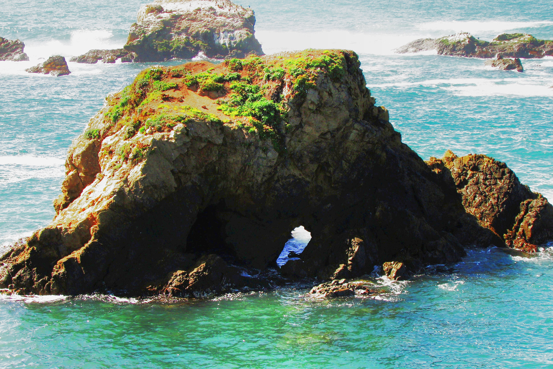
Cavity Arch (left opening span 10′ x height 14″ and right opening span 2′ x height 14′):

Otsuchi Point Arch (span 3′ x height 3′):

 ]]>
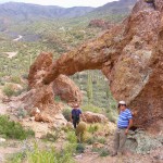
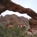
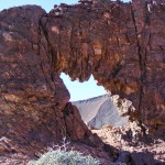
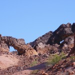
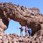
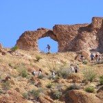
]]>The three arches located there have been unofficially referred to as Hag’s Tooth (CA-146), Gavilan Wash Arch (CA-145), and Eye of the Hawk (CA-144). “Hag’s Tooth” was aptly used for obvious reasons, and Gavilan Wash Arch was too small (5-foot span), so we chose Eye of the Hawk to honor Norm. Therefore, California arch NABSQNO 11S-707583-3657511 will hereafter be referred to by NABS as Norm’s Stargazer Arch (“Stargazer” was Norm’s old CB handle). Eye of the Hawk (“Gavilan” is Spanish for “hawk”) will be retained as an alternate designation. Of the three arches, Norm’s Stargazer Arch is the largest, northernmost, and highest elevation. It has a span of 20 feet and a height of 7 feet. NABS is planning a visit to these arches at the end of our next Rally.
Here are photos of the three arches by Dave Kennedy:
Norm’s Stargazer Arch:

Gavilan Wash Arch:
Hag’s Tooth Arch:
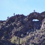
One person died and another was critically injured just before 6 p.m. on Saturday, March 21 when the bluff above Arch Rock (V21-12, NABSQNO 10S-516381-4204424) collapsed when the two hikers were standing on it. The arch is at the end of the Bear Valley Trail in Point Reyes National Seashore, California. The pair fell about 70 feet and were covered by the falling rocks and debris. The collapse of the bluff came about two days after the National Park Service had posted warning signs about the cliff becoming weak from cracks and partial collapses.
Arch rock is a meander type natural bridge where Clear Creek had cut through the narrow peninsula which had connected Miller Point to the mainland as shown in the photo below, looking back from Miller Point across the top of the arch before the collapse.
The photo below taken after the collapse shows that Miller Point is now an isolated butte no longer accessible by the trail that used to go across the top of the arch.
The photo below shows the large pile of rubble after the collapse.
The post-collapse photo below shows that the arch actually survived the collapse of the bluff above it, a testament to the structural strength that the arch form provides.
The photo below shows more clearly that the arch survived the collapse but changed it shape and now the opening has a greater height. Clear Creek still flows under the arch but disappears under the new rubble pile.
The Park Service considers the formation to still be unstable and dangerous and has closed the trail to Arch Rock.
The three very short videos below by Robert Robinson were taken on April 23. The first video shows the approach on the trail that formerly went across the top of the arch. You can see fissures in the ground indicating the possibility of another collapse. The second video shows views of the collapse from the Coast Trail above the opposite side of the creek. The third video shows the still-existing arch from Coast Creek itself.
A special thanks to Robert Robertson and Jeff Moore for supplying material for this article.
]]>