NABSQNO 32R 551117 2755963 Algeria
|
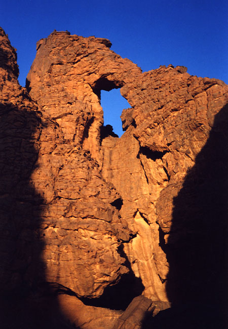
ALG-223, Amezzagh Arch, Tissoukai Area Islet Two. 5 meter height
(estimated). GPS 32R 551117 2755963. From ALG-207 (Base Camp Arch),
walk northeast some distance to reach the trail. Follow the trail along Oued Idou, which starts
in the needles of Idou. The trail goes northeast overhanging a big dryfall and follows the rim
of the following deep canyon. Then climb down the trail to reach the canyon exit and the oued in
the plain. Follow Idou wash and the trail downstream for 2.5 hours to the site of Tissoukai. The
trail sometimes goes along the bank and sometimes in the sandy wash, and crosses two major
hollows. At half way the trail passes close to the side of a maze on the left and some fin rocks
on the right. The camping spot and the arch are located at the GPS point given above. The camp
spot is 150 meters northwest off the wash and opposite a small islet of rock (islet 3 on
Map 10). The arch is up on the rock and inaccessible.
However, you can climb to a terrace above the camp spot via an easy chimney and get a close view
(as in photo, which was taken at sunset). Amezzagh means "camp" in the Tamahaq
dialect.
|
|
|

|
Next Arch ALG-221
|
|