NABSQNO 12S-644485-4297965 (f)
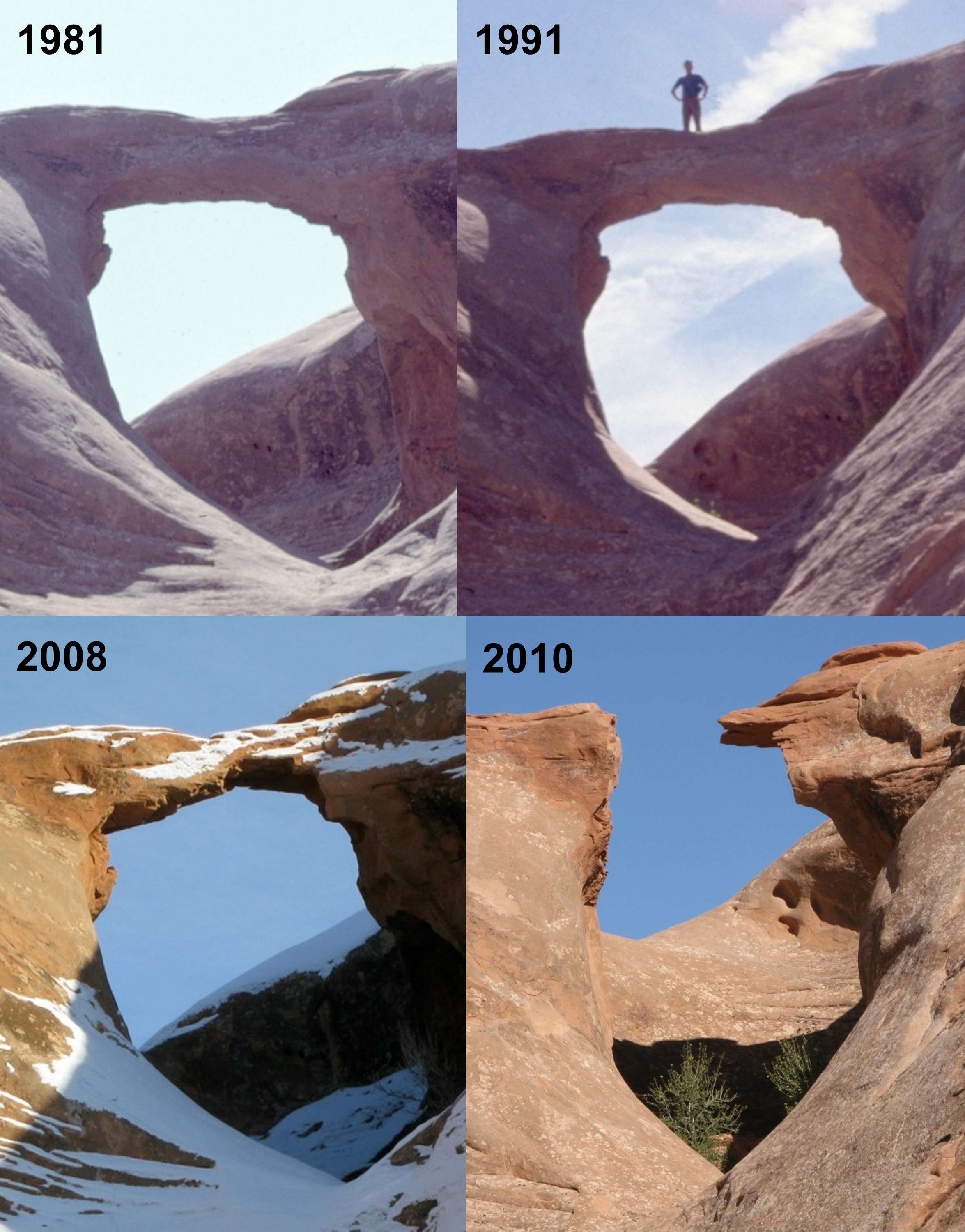
Arrowhead Arch, Grand County, Utah
Photos by Bob Vreeland (1981), Jay Wilbur (1991), and Terry Miraglia (2008, 2010)
NABSQNO 12S-644485-4297965 (f). Arrowhead Arch was a pothole natural arch eroded through Entrada sandstone. It was usually accessed by 4WD roads north of Dewey Bridge in Grand County, Utah. The specific date of collapse is unknown, but must have been during the first 8 months of 2010. The series of photos above shows an interesting progression of erosion on the underside of the lintel prior to collapse. Arrowhead Arch was listed by Vreeland as number 5-43 in his catalog. It had a span of about 15 feet.
| Topo Map | Google Map | Return to State Index |