NABSQNO 15S-567170-4234600
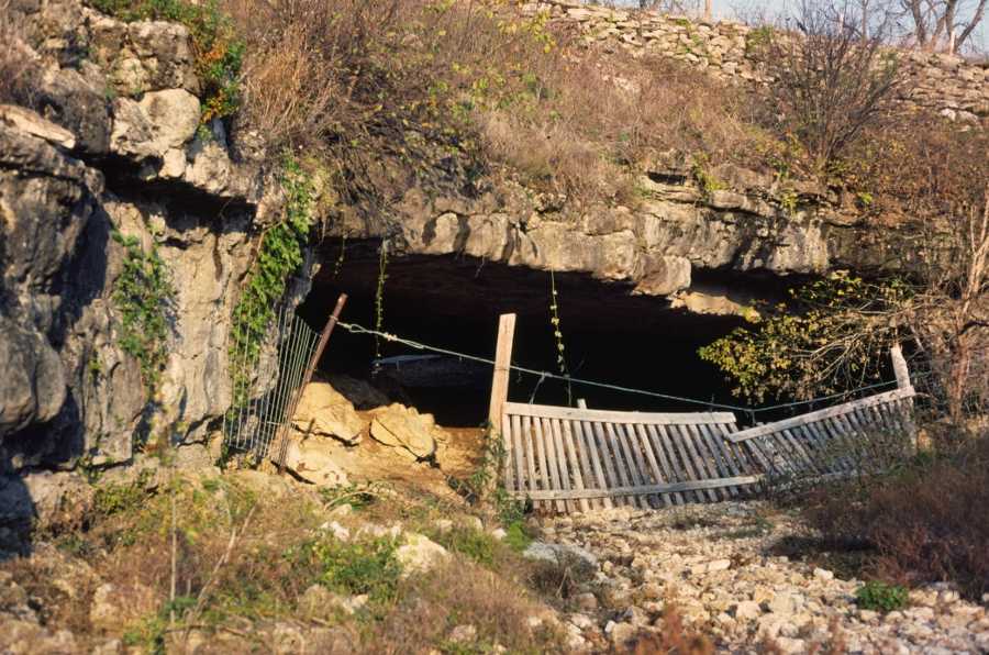
Arch Cave, Miller County, Missouri
Photo by Danny Horowitz
NABSQNO 15S-567170-4234600. Arch Cave is a waterfall natural bridge eroded through Gasconade dolomite by a subterranean tributary of Tavern Creek. It is located about 2 miles east of St. Elizabeth, Missouri. The arch is on private land so access requires permission of the landowner. Arch Cave, also known as Jurggenmeyer Natural Tunnel, appears in the second edition of the Beveridge catalog as number 309. David Brandt-Erichsen measured the span of this arch as 60 feet.
| Topo Map | Google Map | Return to State Index |