NABSQNO 15S-743160-4282380 (f)
Namesake Natural Bridge (fallen), St. Louis, Missouri
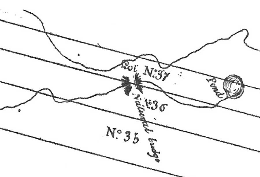
Plat map detail from Dupre's 1838 Atlas of St. Louis (public domain)
NABSQNO 15S-743160-4282380 (f). Namesake Natural Bridge was a waterfall natural bridge eroded through limestone by Rocky Branch Creek. It was located near what is now the corner of 23rd and Palm Streets in St. Louis, Missouri. Natural Bridge Road, which begins near this intersection, derives its name from this historic feature.
In the early 19th century, Natural Bridge Road ran over the top of this natural bridge. During the Civil War, cholera outbreaks caused by drainage problems and rapid population growth led the St. Louis city administration to undertake several sewer projects. One of these included re-engineering Rocky Branch Creek as a major underground sewer channel. In the process, the natural bridge was destroyed.
Namesake Natural Bridge appears in the Vreeland catalog as number 14-112, and in the second edition of the Beveridge catalog as number 279. Although its dimensions are probably lost to history, its opening almost certainly had a tunnel-like shape and a relatively small span.
| Topo Map | Google Map | Return to State Index |