NABSQNO 16S-373615-4135361
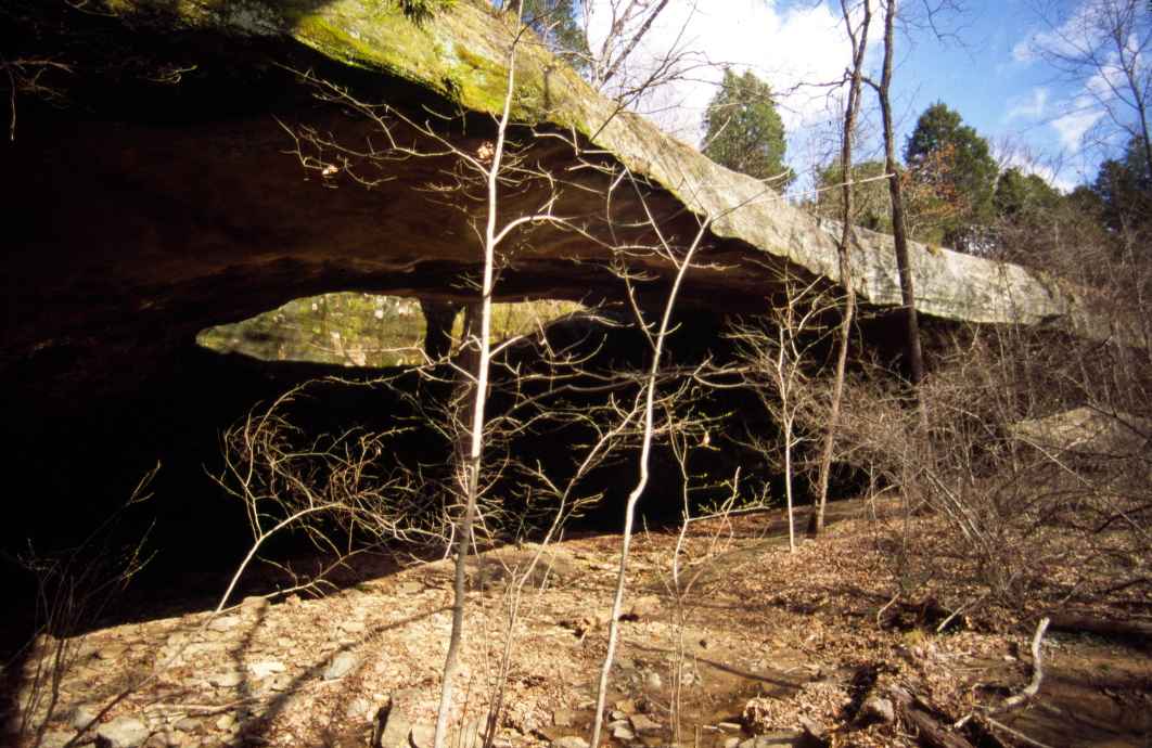
Mantle Rock in Livingston County, Kentucky
Photo by Jay Wilbur
NABSQNO 16S-373615-4135361. Mantle Rock is a young alcove natural arch eroded through Pounds Sandstone, which is Pennsylvanian in age. It is located on land owned and opened to the public by the Nature Conservancy. This organization asks that visitors stay on the short, well-marked trail to the arch because of rare and fragile plant communities in the area.
During the winter of 1838-39, several thousand Cherokees camped under Mantle Rock and other nearby rockshelters. Many died here as they waited for the icy Ohio River to thaw so that it would be safe to cross. It was one of many tragic stops along the infamous "Trail of Tears."
Mantle Rock has a span of 167 feet, a height of 21.5 feet, a separation of 12 feet, a width of 17 feet, and a thickness of 9 feet. These dimensions were measured on 16 March 2006, with the aid of laser ranging. They should be considered quite accurate. Mantle Rock has the largest span of any documented natural arch in the US east of the Mississippi River.
| Topo Map | Google Map | Return to State Index |