NABSQNO 11S-719651-3647182
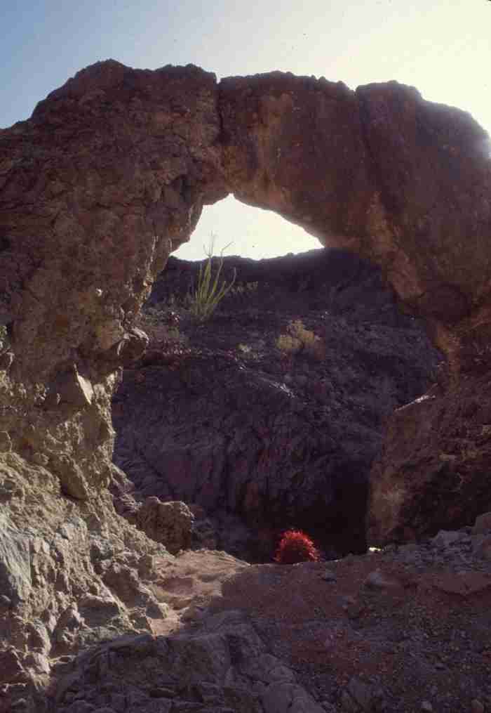
Arturo's Bridge, Imperial County, California
Photo by Jay Wilbur
NABSQNO 11S-719651-3647182. Arturo's Bridge is a waterfall natural bridge located in the Chocolate Mountains not far from the Colorado River and the Picacho State Recreation Area. It has eroded through a ridge of basalt. Access requires an easy, two-mile round-trip hike up a desert wash from Picacho Road, a good gravel road that connects back to Interstate 8 at Winterhaven, California. When planning a hike in this area, please avoid the extreme heat of summer and carry more water than you think you will need.
Arturo's Bridge has a span of 12 feet, a height of 11 feet, a thickness of 4 feet, and a width of 2 feet. The obvious signs of hand excavation at the base of the arch suggest that someone in the recent past suspected that this might be the site of the Lost Arch Mine. Any gold they found is now long gone.
| Topo Map | Google Map | Return to State Index |