NABSQNO 15S-487938-3943502
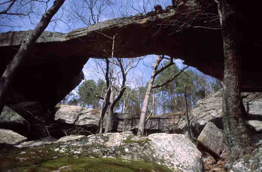
Buzzard Roost Rocks Natural Arch, Pope County, Arkansas
Photo by Jay Wilbur
NABSQNO 15S-487938-3943502. Buzzard Roost Rocks Natural Arch is an old alcove natural arch eroded through the Middle Bloyd sandstone member of the Bloyd formation. The Bloyd formation is early Pennsylvanian, or about 315 million years old. A good summary description of the Middle Bloyd sandstone member is found in an abstract paper by Teas and Zachry who refer to it as Gaither Mountain sandstone.
Buzzard Roost Rocks Natural Arch is located within the Ozark National Forest, northeast of the small community of Treat in Pope County, Arkansas. It is located about 200 yards north of a rock formation known as Buzzards Roost and is within a USFS Special Interest Area with that same name. As a result, its official name has become Buzzard Roost Rocks Natural Arch. However, the name "Rainbow Rock" is used by the local population. It has a span of 87 feet, a height of 31 feet, and a separation of 30 feet. It has the second greatest span of the documented natural arches in Arkansas.
Access requires a lengthy drive on a high-clearance Forest Service road, followed by an easy hike of just under 2 miles along a path used frequently by ATVs. Many would consider Buzzard Roost Rocks Natural Arch the best example of a natural arch in Arkansas. It is certainly one of the premier natural arches in the US.
| Topo Map | Google Map | Return to State Index |