The Natural Arches of Southern Arizona
A portfolio by David Brandt-Erichsen
Each arch on this page can be reached in a day trip from Tucson
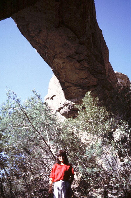
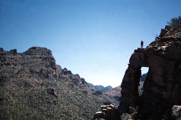
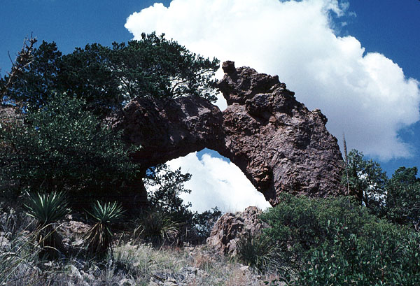
Chiricahua Natural Bridge
Chiricahua National Monument
NABSQNO 12S-655318-3543960 MAP
This is a very unusual feature. First, it is not a natural bridge. A natural bridge is an arch which was formed over a watercourse, and this was not formed in that manner. Second, this may not even be a "true" natural arch! A natural arch is a hole eroded in solid rock, but this was formed when a block of rock fell off a cliff face and became wedged into place. Subsequent weathering cemented it to the surrounding rock, so it currently forms a continuous rock span just like any "normal" natural arch. It has a span of 37 feet. It is one of the many interesting rock formations in Chiricahua National Monument. A round-trip hike of 5 miles on a trail takes you to a viewpoint for the arch. To actually access it requires some bushwhacking. The trailhead is on Bonita Canyon Road, 1.3 miles past the Visitor Center.
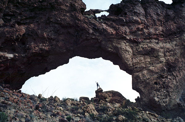
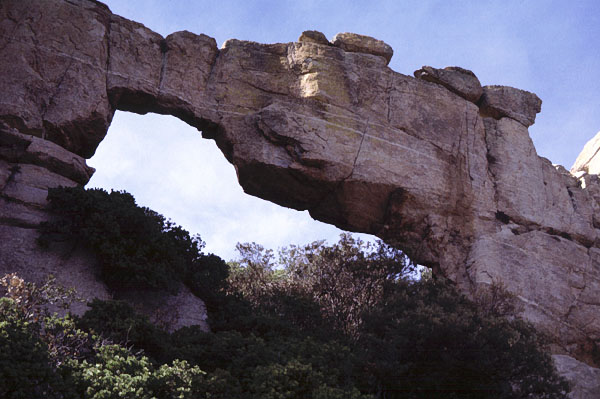
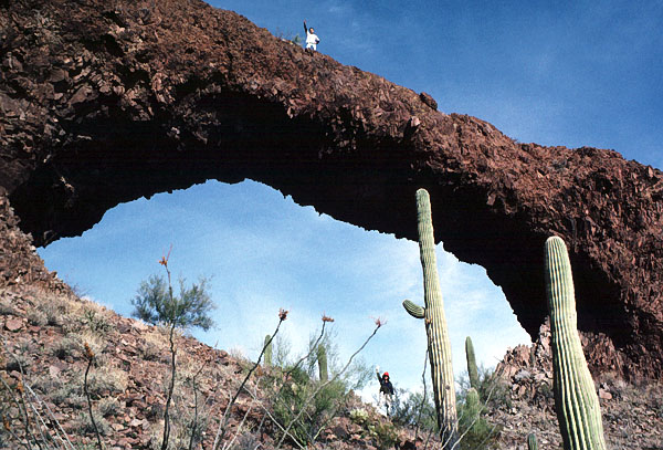
Arch Canyon
Organ Pipe National Monument
NABSQNO 12S-338726-3546077 MAP
With a span of 90 feet, this arch is the largest in Southern Arizona. It is located in Arch Canyon off Ajo Mountain Drive in the eastern part of Organ Pipe National Monument. It can be seen from the road and approached by a short hike up Arch Canyon. A steep primitive use trail goes up behind it and allows access to the opening.
Black Hills Arch
NABSQNO 12S-599610-3660765 MAP
This delicate span has been eroded in volcanic basalt and is located in Box Canyon just north of Ft. Thomas (which itself is located on Highway 70 about half way between Globe and Safford). It takes about a 5-mile round trip hike up the wash to reach the arch.
Natural Bridge in Brown Canyon
Buenos Aires National Wildlife Refuge
NABSQNO 12S-445420-3515675 MAP
This is one of the very few natural bridges in Arizona, and the only one in Southern Arizona. It has a span of 47 feet. A creek runs under the bridge about 6 months out of the year, and there is almost always a pool of water under the bridge. It can be reached by fairly level trail of about 5 miles round trip, but access is limited to guided tours within the Wildlife Refuge. Brown Canyon is located in the eastern foothills of Baboquivari Mountain about 50 miles southwest of Tucson. For information on access to the natural bridge, contact the Buenos Aires National Wildlife Refuge at (520) 823-4251.
Elephant Trunk
Sabino Canyon Recreation Area
NABSQNO 12S-519460-3575115 MAP
This rather crumbly arch is located near the entrance to Bear Canyon on the canyon's eastern ridge and can be seen from portions of the trail to Seven Falls.
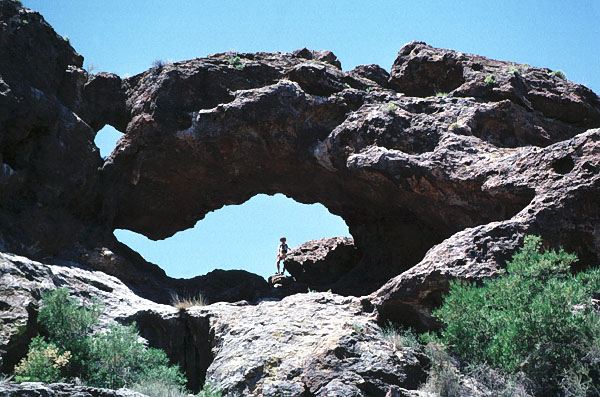
Rocky Arch
NABSQNO 12S-528092-3582296 MAP
This is the most easily visited of all the arches in this portfolio. It is located immediately adjacent to the Mt. Lemmon Highway about 1/2 mile north of Geology Vista, yet is seldom noticed by motorists. It is on the west (uphill) side of the highway.
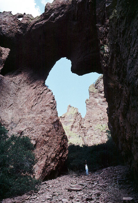
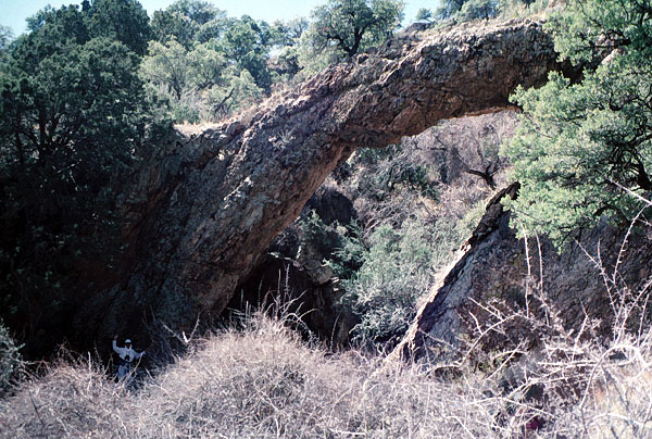
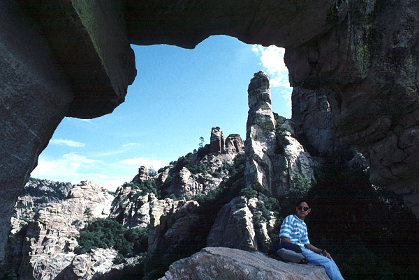
The Portal
NABSQNO 12S-672846-3528470 MAP
This is located on the eastern side of the Chiricahua Mountains, near Portal, in the canyon of the South Fork of Cave Creek. To view the arch, drive west from Portal on the paved road for 3.2 miles and turn left onto the dirt road into South Fork. After 0.4 miles stop and look up in the cliffs to the left for the arch, which can be seen from the road. To access the opening requires a very steep and difficult bushwhack and scramble. The span is 25 feet and the height is estimated at 75 feet. There are numerous other openings in the rugged crags of the eastern Chiricahua's, but this is probably the largest.
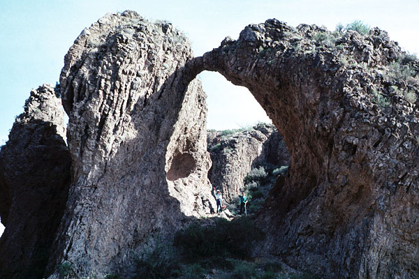
Little Portal
NABSQNO 12S-672836-3528470 (see previous map)
Immediately adjacent to The Portal at its base is another opening which measures a span of 15 feet and a height of 15 feet. This opening is not visible until you reach The Portal. The two form a double arch.
Whitetail Arch
NABSQNO 12S-663016-3542279 MAP
This is a small but attractive free-standing arch located on private property in East Whitetail Canyon in the eastern Chiricahuas near Paradise.
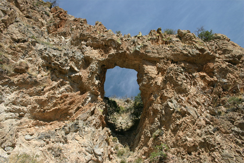
The Window
NABSQNO 12S-513395-3582043 MAP
A long, steep, strenuous hike is required to reach this landmark in the Catalina Mountains. A trail from the Ventana Canyon trailhead goes to the arch, requiring a round trip distance of 13 miles and an elevation gain of 4500 feet. The span of the opening is 32 feet.
Nachi Kulik
NABSQNO 12R-432857-3496360 MAP
Eroded in volcanic rock, this arch is located in a rock outcrop called Nachi Kulik, which is shown on the topographic map for Caponera Peak. It has a span of 22 feet and is located in the Tohono O'odham Nation about three miles east of San Miguel. Visitation is not recommended without permission.
Window Mountain
NABSQNO 12S-383350-3579420 MAP
Window Mountain boasts this fine natural arch which has an estimated span of 40 feet. It is located about 100 miles west of Tucson in the Tohono O'odham Nation and visitation is not recommended without permission. It is, however, clearly visible from a paved highway from about four miles away. Take Highway 34 about nine miles west of Santa Rosa to view the arch.
Ramanote Canyon Natural Arch
NABSQNO 12S-486930-3478540 MAP
John Montgomery of the Southern Arizona Hiking Club notified NABS of this obscure arch located in Ramanote Canyon west of Rio Rico, Arizona. It has a span of about 20 feet and a height of about 30 feet. John has posted directions and photos at HikeArizona.com. Care should be taken in visiting this area due to potential drug smuggling activites from the nearby Mexican border. Photo by John Montgomery.
Go to next Gallery feature - unnamed arch near Many Farms