NABSQNO 12S-703843-4323189
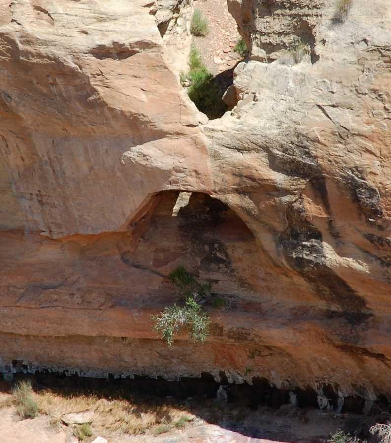
Culvert Arch, Mesa County, Colorado
Photo by Jay Wilbur
NABSQNO 12S-703843-4323189. Culvert Arch is a cave natural arch eroded through Wingate sandstone. It is located near the upper trailhead and carpark for the Serpents Trail in Colorado National Monument, Mesa County, Colorado, and is easily visible from that trail.
The appearance of Culvert Arch not only gives the arch its name, it also suggests to many that the arch is a waterfall natural bridge. However, there is no evidence of a streambed beneath the arch. Furthermore, the channel above the arch was created when Rim Rock Drive, the main paved road through the Monument, was engineered. It is not a natural channel. Indeed, during a heavy rain that created many fleeting waterfalls along rims of rock nearby, no water was seen to flow through the arch. Finally, because the opening is much smaller at the top entrance than the bottom entrance, it is more likely that roof collapse above a cave was the primary erosion process that formed the arch rather than the collapse of a wall below a pothole. Thus, the arch is best classified as a cave natural arch rather than a pothole natural arch.
Culvert Arch has a span of about 3 feet.
| Topo Map | Google Map | Return to State Index |