 This arch is located in Organ Pipe Cactus National
Monument. See Ajo Frog Eye Arch. Drive the Loop Road for
about 11miles and park at the Bull Pasture/Estes Park trailhead.
Hike up the trail to where the official trail ends overlooking Bull
Pasture. This is about 1.5 miles from the trailhead. Continue on
the well-marked unofficial trail around the pasture. As you
approach where the trail turns up toward the ridge, you will see
Ajo Mountain Arch off the right side of the route in a lava dome
not far from the trail . You have hiked about three miles from the
trailhead at this point. UTM coordinates for the arch are
12S 340708E 3543310N; WGS84 at about 3650 ft, elev.
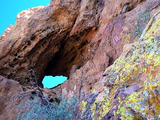
This arch is located in Organ Pipe Cactus National
Monument. See Ajo Frog Eye Arch. Drive the Loop Road for
about 11miles and park at the Bull Pasture/Estes Park trailhead.
Hike up the trail to where the official trail ends overlooking Bull
Pasture. This is about 1.5 miles from the trailhead. Continue on
the well-marked unofficial trail around the pasture. As you
approach where the trail turns up toward the ridge, you will see
Ajo Mountain Arch off the right side of the route in a lava dome
not far from the trail . You have hiked about three miles from the
trailhead at this point. UTM coordinates for the arch are
12S 340708E 3543310N; WGS84 at about 3650 ft, elev.
|
| Photo and Directions by Rob Jones Trip Report |

|
Natural Arch and Bridge Society Home Page |
|
About Bob |
|
Return to Bob's Arches Home Page |
|
Return to Arizona Arches |