NABSQNO 12S-617910-4027860 MAP
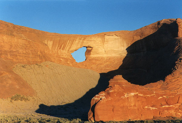
There are several arches marked as "Window Rock" on the topo maps. This particular "Window Rock" is an inaccessible opening which can be seen from Highway 59 in the cliffs to the north of the highway just four miles west of Many Farms, Arizona. It has a span of about 40 feet. Early morning photo by John Remakel.
Go to next Gallery feature - Wrather Arch