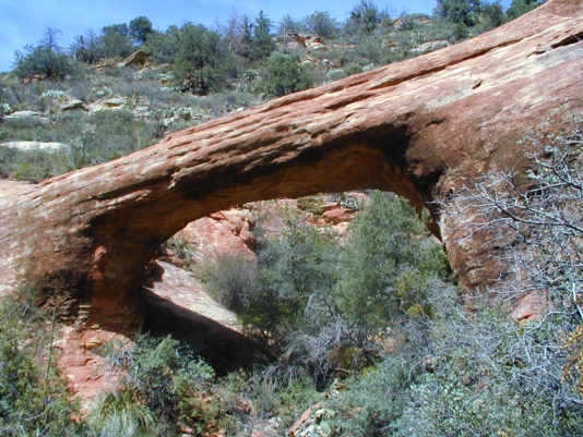
 From the “Y” (junction of highways 89A and 179) in Sedona, Arizona, drive 3.1 miles SW on 89A (toward the town of Cottonwood) to Dry Creek Road. Turn right onto Dry Creek Road and drive 2 miles, then turn right onto the dirt FR 152, signed for Vultee Arch. After about 1.3 miles, you will see a sign for the Devil’s Natural Bridge parking area just off to the right of this FR road. Keep driving on the main dirt road for another 3 and a half miles to the end of the road. Start hiking on the trail to the right of the parking loop. It is 1.75 miles hiking (one way) to the arch. About 1.5 miles up the trail, take the left (signed) fork of the trail. Follow the trail, then the route briefly up on the red sandstone where you will find a plaque about the naming of the arch and a viewpoint. A bushwhack route takes you beneath or behind the arch. It is reportedly 40 feet high and has a 50 foot span. The UTM coordinates for the arch are approximately 12S 429804E 3866829N WGS84.
|

|
Natural Arch and Bridge Society Home Page |
|
About Bob |
|
Return to Bob's Arches Home Page |
|
Return to Arizona Arches |