|
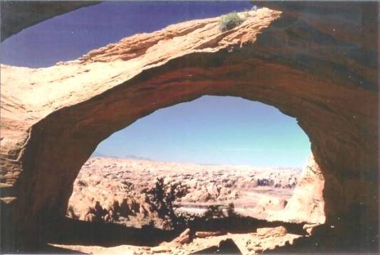
This arch is named for the well-known explorer of Lake Powell and environs.
He has published many maps and articles on the area and has his own Gallery
on the Natural Arch & Bridge Society website.
The arch overlooks the San Juan River Arm of Lake Powell just west of Trail
Canyon. The arch is located on the"Wilson Creek, Utah 7.5' Map". It is
approximately 200 ft. north of and below highpoint 4994T at 37deg.09' 01"N
and 110deg.46' 45"W. It is in the same mass of sandstone as Flying Eagle,
qv, and easily could be combined with that arch on the same trip.
Follow the directions to Flying Eagle, and after passing it, climb a crevasse
to the lowpoint of the ridge between 4994T and 4883T. Descend the dome to
the west and locate a shelf to follow around toward the north again. Pass several
deep waterpockets and a basin that measures about 200 ft. x 80 ft. After arriving
at an overlook of the Lake, look for an alcove about 200 ft. to the south. The
arch is located in this alcove. Climb the dome to the west of the alcove to the
arch.
Photo by Ray Millar |
