|
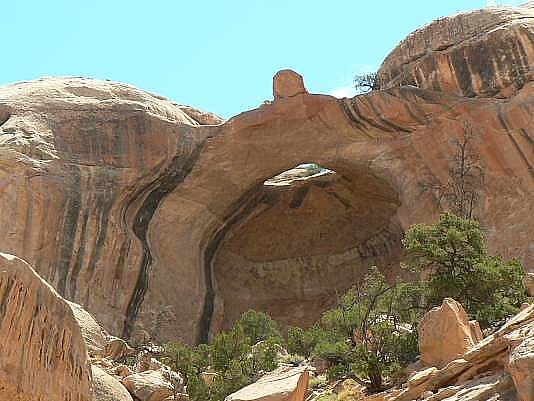
Rob prefers the name “Solitaire”–more appropriate when you look at the arch. It is also apparent how the name “Perched Boulder” originated. This high pothole arch is in the same canyon system as Tibbett Arch. From where the Ernie’s Country route crosses the wash, hike up-canyon for about 2.5 miles. At about 1.5 miles up the canyon, take the right fork (the left fork leads to Wall Runner). You will see an open canyon area on your right (east). Check your GPS, then walk into this open area for about 0.4 miles, looking for the distinctive ring-shaped stain of desert varnish on the white Cedar Mesa SS. The gem part of the solitaire ring is also a guide. Be careful to walk in the drainage to avoid crushing the prevalent cryptobiotic crust. Approximate coordinates for this arch are UTM 12S 587357E, 4223243N WGS 84. Photo and directions by Rob Jones |
