|
Several years ago, the name "Seal Castle Window" appeared
in an 02 picture book which Ted found and inspired him to locate the
flat woody area bearing the name. The place name also appears
on USGS Topo Map Bryce Canyon Nationl Park, Utah (1939)
as well as USGS 7.5' Topo Map Bryce Canyon, Utah (1966),
but not on the park folder. The area is about a mile north of the
Tropic Trail and up against a cliff line about a half mile east of the
Horse Trail. The easiest route is to go along the main Bryce Wash
parallel to the trail and along the the cliff wall. Head north through
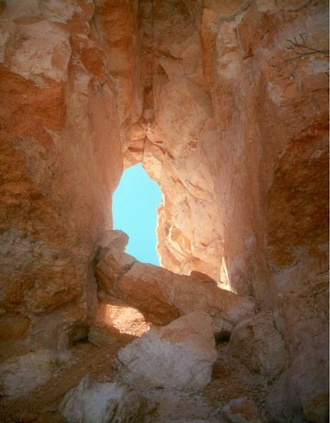
the woods to get to Seal Castle Wash. This arch is about 1/4 mile
north of "Deceiving Arch" which is located
at latitude 37 deg. 37.398' and longitude 112 deg. 8.822' Its
estimated height is 25 ft. with a span of 10 ft.
Photo and directions by
Ted Dahlmann |
