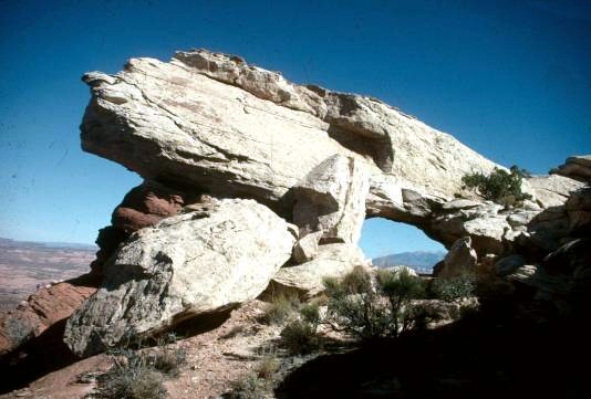
 This arch is at the very top of what has been called
Culvert Canyon because it starts well off State Hwy 279
NW of Moab through the railroad culvert.
This arch is at the very top of what has been called
Culvert Canyon because it starts well off State Hwy 279
NW of Moab through the railroad culvert.
The easiest route to take is the bench route just above the stream bed on the left and follow it E and then N up to the large arch with the 3 names - Gold Bar (old name on topo map), Jeep Arch, and Echo Arch. Poison Spider Arch is 1 1/4 miles ENE of of this arch across a very large "bowl" of slickrock that is very difficult to hike and route-find. I went slightly above Jeep Arch to the summit of the "bowl" and hiked the rim toward the east and then south until I reached the arch which, incidentally, is visible from Hwy 191 way below it. It is a 9 ft. X 5 ft. arch and an afternoon picture.
NOTE: For alternate directions to Jeep Arch, see the directions accompanying Stan Wagon's photo.
Photo and directions by Ted Dahlmann
