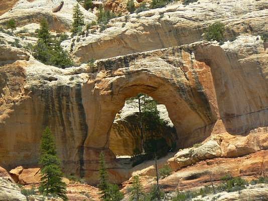
 This lovely arch is located in the Dark Canyon Wilderness,
one of the precious few officially-designated wildernesses in
Utah. It is in the Manti-LaSal National Forest.
To hike what Rob calls the "Preferred Trail", take the
Bi-Centennial Highway Utah 95 to the turn-off to Natural Bridges
N.M. (Utah 275). Drive about 0.6 miles and turn right onto Forest
Service Rd. 88 (FS88). This is the road to follow most of the
way to the Horse Pasture Trailhead (Trail 025). However ,
there are many places where a wrong turn can be taken; so a
good trail map such as National Geographic 703 and a good
GPS are vital. Continue on FS88 to Duck Lake and turn left
onto Rd. 154 for 1.6 miles to the Horse Pasture Trailhead. Hike
the trail for 4 miles to its intersection with Dark Canyon. Hike
down-canyon 2.5 miles to its junction with Peavine Canyon. Look
NE to view the arch. This drive and hike should be taken only
in dry weather.
This lovely arch is located in the Dark Canyon Wilderness,
one of the precious few officially-designated wildernesses in
Utah. It is in the Manti-LaSal National Forest.
To hike what Rob calls the "Preferred Trail", take the
Bi-Centennial Highway Utah 95 to the turn-off to Natural Bridges
N.M. (Utah 275). Drive about 0.6 miles and turn right onto Forest
Service Rd. 88 (FS88). This is the road to follow most of the
way to the Horse Pasture Trailhead (Trail 025). However ,
there are many places where a wrong turn can be taken; so a
good trail map such as National Geographic 703 and a good
GPS are vital. Continue on FS88 to Duck Lake and turn left
onto Rd. 154 for 1.6 miles to the Horse Pasture Trailhead. Hike
the trail for 4 miles to its intersection with Dark Canyon. Hike
down-canyon 2.5 miles to its junction with Peavine Canyon. Look
NE to view the arch. This drive and hike should be taken only
in dry weather.
The coordinates for the Peavine Canyon/Dark Canyon junction are approximately UTM 12S 600615N 4182517W (WGS 84) and those for the arch are estimated to be about UTM 12S 601144N 4183171W (WGS 84). Photo and directions
|
