|
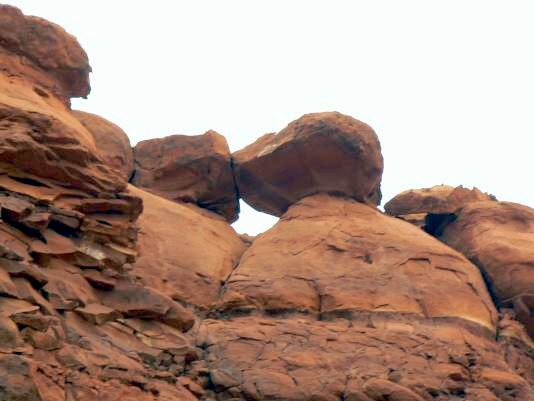
Maze 633-1 Arch
Driving north on the Bi-Centennial Highway 95, cross the Colorado River
and at MP 46.4 turn right onto Rec. Rt. 633. (Mile Point 0 for Rt. 95 is at Hanksville). If you find yourself at the Dirty Devil River bridge, you have missed the turn onto Rec. Rt. 633. Rec Rt 633 eventually becomes 4wd. Drive north on Rec 633, which travels to the Orange cliffs area of the Maze District. Set your trip odometer at zero when you leave Rt. 95. At 13.6 miles, view 633-1Arch on your right. Approximate GPS coordinates are UTM 12S 561441E, 4197395N, WGS 84
Photo and directions by Rob Jones |
