|
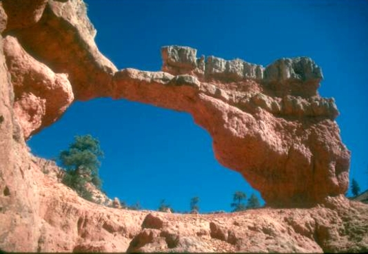
On Rt. 89, seven miles south of Panguitch, turn east onto Rt.12. This route ascends Red Canyon to the top of the Paunsagunt Plateau. About 6 miles from the Rt. 89-Rt. 12 intersection , turn left at a sign, “Losee Canyon 2, Casto Canyon 3”. Drive 2 miles and
turn into a parking area on the right and look for a sign saying “Arches Trail”. Cross a dry wash and head slightly up-hill for a short distance to the start of the half–mile loop, staying to the right. A 6 ft. span arch appears on the left followed shortly by Losee Arch, a free-standing arch with a 27 ft. span. Further up the trail is a wall with several small arches. The photo was taken in the early afternoon.
Photo by
|
