|
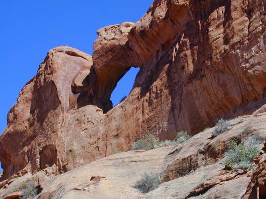
This Arch is located in the huge "Escalante/Grand Staircase NM.
Drive 28.8 miles east of Boulder on the Burr Trail (now labeled
"Boulder-Bull Frog Scenic Road"). Turn right (south) onto the
Wolverine Loop Road (high clearance or 4wd) for about 13 miles
to the parking area for "Little Death Hollow" (although on the
Pioneer Mesa Quadrangle it is simply called "Death Hollow"). From
the trailhead, enter the Wilderness Study Area and hike SW down
the broad Canyon. As the Canyon walls constrict, watch for the
arch high on the left wall. It is one-eighth of a mile NE of elevation
5464T printed on the Pioneer Mesa Quadrangle map. If you have
entered the narrow part of the canyon without spotting the arch,
retrace your steps and look again. Rob suggests taking a detailed
map (preferably the "Pioneer Mesa Quadrangle") , a shovel, and extra
water and food. Rob also recommends Steve Allen's "Canyoneering
3, Loop Hikes in Utah's Escalante" for exact road descriptions.
Photo and Directions by Rob Jones |
