 Go south from I/S 70 at Exit 108. A quarter mile past the
bridge at 12S 0494831E 4298931N , keep right. Again keep
right at 0493348E 4298046N and then left at 0491531E
4293014N into Kimball Draw. About 1.5 miles into Kimball Draw,
leave the wash at 0493395E 4292670N to the right into a minor
wash. Turn right at 0494275E 4291400N and then left at
0496450E 4288450N (approx.) driving to the end. There is a
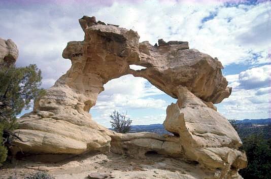
last “Y” shortly before reaching the trails end. The right spur
leads to a breathtaking viewpoint at the rim of Poor Canyon, the
left spur ends at a “camping area”. There, a short trail to the arch
begins. You can’t go wrong (Rolf’s words, not the author’s).
Trails Illustrated/National Geographic Map No.712 Revised ’05
could be of some help.
Go south from I/S 70 at Exit 108. A quarter mile past the
bridge at 12S 0494831E 4298931N , keep right. Again keep
right at 0493348E 4298046N and then left at 0491531E
4293014N into Kimball Draw. About 1.5 miles into Kimball Draw,
leave the wash at 0493395E 4292670N to the right into a minor
wash. Turn right at 0494275E 4291400N and then left at
0496450E 4288450N (approx.) driving to the end. There is a
last “Y” shortly before reaching the trails end. The right spur
leads to a breathtaking viewpoint at the rim of Poor Canyon, the
left spur ends at a “camping area”. There, a short trail to the arch
begins. You can’t go wrong (Rolf’s words, not the author’s).
Trails Illustrated/National Geographic Map No.712 Revised ’05
could be of some help.
Directions and photo |
