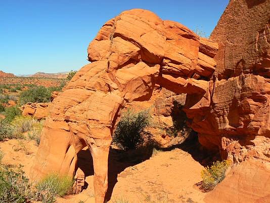
 This arch is in a BLM Special Management Area, which
requires a permit to hike the Coyote Buttes North Section. From
Hwy 89 in southern Utah, turn south on FR1065 (House Rock
Valley Rd.) for about 10 miles and park at the trailhead for Wire
Pass (which leads to Buckskin Gulch). Pay your parking fee,
make certain you have your permit, and hike west down the
canyon. After 1.1 miles from the trailhead, look south for a short
canyon with a sand dune on its west flank. This short canyon is
just before the first set of narrows. Walk up this flank, observe
the rounded ridge to the south, and hike south for another mile to
the arch. Total hiking distance is approximately 2 miles one way.
UTM 12S 40956E 4096509N WGS 84. For reference, the car
Park UTM is about 12S 408723E 4097394N.
This arch is in a BLM Special Management Area, which
requires a permit to hike the Coyote Buttes North Section. From
Hwy 89 in southern Utah, turn south on FR1065 (House Rock
Valley Rd.) for about 10 miles and park at the trailhead for Wire
Pass (which leads to Buckskin Gulch). Pay your parking fee,
make certain you have your permit, and hike west down the
canyon. After 1.1 miles from the trailhead, look south for a short
canyon with a sand dune on its west flank. This short canyon is
just before the first set of narrows. Walk up this flank, observe
the rounded ridge to the south, and hike south for another mile to
the arch. Total hiking distance is approximately 2 miles one way.
UTM 12S 40956E 4096509N WGS 84. For reference, the car
Park UTM is about 12S 408723E 4097394N.
|
| Photo and Directions by Rob Jones Trip Report |

|
Natural Arch and Bridge Society Home Page |
|
About Bob |
|
Return to Bob's Arches Home Page |
|
Return to Elsewhere in Utah. |