|
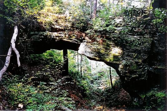
Go to the Kentucky Landforms website and click on "Coal Branch Arch". Then go to
the Google map showing the Arch location. This location is about 5 miles (as the
crow flies) west of Stearns, Kentucky. There is a Visitor's Center for the Big South
Fork National River and Recreation Area in Stearns which might have directions to
the Arch. Taking Rt. 92 NE of Stearns for about 5 miles and then turning left onto
Rt. 1363 for about 3 miles, and then turning left onto Devil's Creek Rd. (FR 562) will
get the arch hunter to the area shown on the Google Map. The Map shows the
location of Coal Branch Arch as well as several others which could be visited on the
same trip. The UTM coordinates for Coal Branch are 16S 718405E 4062747N.
Photo by Ray Millar |
