|
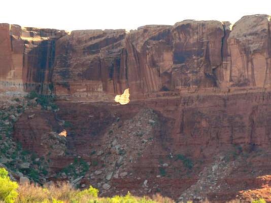
The arch is in the upper face of a cliff on the east bank of the
Green River near the rock formation known as "The Sphinx",qv,
at approximately River Mile 26.3 (the distance above the
confluence of the Green and Colorado Rivers), or 25.5 miles
from the Mineral Bottom launch ramp. When you see the easily
identifiable Sphinx, you will know you are near Ra's Window.
UTM coordinates approximately 12S 589455E, 4246943N;
(NAD 83/WGS84 datum). The arch can also be vewed from
the White RimTrail access. See Rob's Trip Report Photo and directions by Rob Jones |
