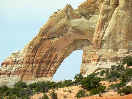
 Drive east of tuba city on Hwy 160 to milepost 349.8. Here, you will see an elevated railway over an arroyo and a vehicle tunnel to the north. Drive through this tunnel and continue on Indian Road 16 for 3.6 miles. Turn left and stay on this main road for 6.2 miles. About here you will see the large arch on the southern end of the mesa. You are on your own here because roaming on the Navajo Nation without permission is not an approved activity. The approximate UTM coordinates for the arch are as follows: 12S 502228E 4036516N (WGS84). The arch has a vertical opening height of 85 ft. and a span of 55 ft.
Photo taken with a 430mm lens Directions and Photo by Rob Jones The Wilderness Vagabond |
